Aug 31, 2012
Dust Mite helps the best prepare lesson plans for the upcoming school year.
—orc Fri Aug 31 23:56:28 2012
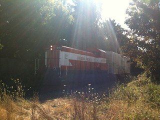
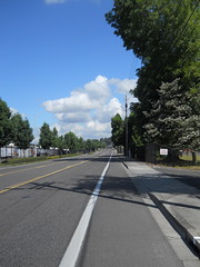
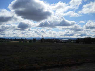
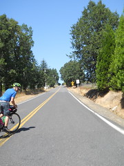
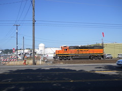
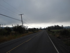
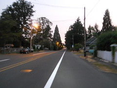
A short Portland Traction freight interrupts my trip to the store.
—orc Fri Aug 31 18:36:07 2012
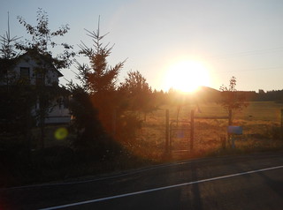
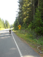
Summer has started to run abruptly down, and my summer routine of riding two permanents a week is starting to be severely crimped by the increasingly complex schedules of everybody else in the family.
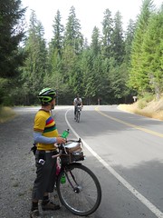
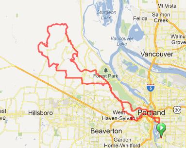
This week, for instance, saw my plan of riding a wednesday permanent downgraded to riding a wednesday populaire because I couldn’t get out of the house until 10am and needed to be back home by 5pm (it is theoretically possible to ride a <7hr 200k, but at this point in my life it’s not theoretically possible for me to ride a <7hr 200k – I’m trying to clean up my climbing speed so I can get a <8hr solo 200k, but that’s a loooong ways away from 7 hours.) I don’t have any traditionally populaire-length (100k) popularizes, so instead I arranged with Kevin Brightbill to ride his Luna Lovegood 105k loop from Brooklyn up to La Center and back. Tony Wittinger had arranged to come along as well, but at the last minute Kevin realized that he had a huge stack of errands to do, so he couldn’t come along, so it was just Tony and me on the ride.
I tend to ride south and east of Portland, because Oregon cities are generally compact enough so you can get through the city and the suburbs into the country in finite time. But that’s an artifact of having an urban growth boundary (not putting subdivisions over farmland is a radical socialist idea for the United States and as far as I know Oregon is the only state that put meaningful restrictions on sprawl in before every large urban area became riddled with incurable metastatic suburbian growth.)
Washington, alas, does not have any sort of anti-sprawl restrictions, and the area around Vancouver is gradually being built over with freeways and expensive tract houses.
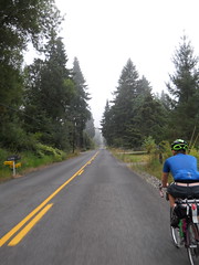
And that’s where we went. First 11 miles through Portland to get up to the Columbia River and the Interstate Bridge(s), which are pretty grim because they’ve got teeny little sidewalks along the roadway that are expected to carry bicycles and pedestrians. There aren’t many pedestrians and bicycles along here, but there are some (both Portland and Vancouver spend a considerable amount of energy setting up bike infrastructure, which is probably a horrible shock to out of town riders who follow the good bike routes up to the Interstate Bridge and are then dumped into what is obviously a contemptuous scrap thrown to those Communists who don’t drive SUVs like G-d Himself Intended) and we had to squeeze our way past a couple of people walking from Hayden Island over to Vancouver before we worked our way through the last hazardous pinchpoint and were spat out onto the bike routes through Vancouver.
The outbound route more or less follows the BN mainline (and, ugh, I-5) up towards La Center; Columbia to Fourth Plain, Fourth Plain to Fruit Valley (which goes through a baffling number of name changes in the 12 miles we were on it) and then a collection of shorter segments (including some that were in the throes of being rebuilt to accomodate more suburban sprawl between Ridgefield and La Center; this, combined with an attitude towards signage that makes Portland look anal about it, gave us a couple of bonus miles when we made wrong turns and were only saved by Tony knowing which way various towns were) that eventually popped us out into undeveloped countryside for the last 5-8 miles into La Center.
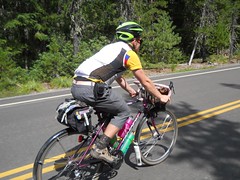
The suburban areas were colourless enough so I put my head down and put on the gas for much of the outbound ride, only slackening when we got into the really hilly area around La Center. And there are a lot of deceptive hills up around La Center, too – you’d not think that there’d be false summits on a 100 ramp, but Royle Road has them and I found myself, more than once, accelerating up what I thought was a short ramp, curving around a screen of trees, and seeing twice as much elevation ahead of me just as I exceeded my 30 second horsepower rating.
But after a bunch of these hills (sprinkled with flat sections that were undeveloped enough to be pretty, and the occasional construction zone where the paved road had been replaced with washboarded gravel) we finally reached La Center Highway, and sailed past the casinos into downtown La Center for our first control.
We’d taken about 2h20 to get here, which wasn’t bad considering some of the slow speed zones we had to transit (the Interstate Bridge, yes, but we were also batting about 950 on reaching stoplights just as they went red.) and decided that this would be a good day for a nice sit-down lunch.
A nice long sit-down lunch; by the time we finished and paid, we’d gone past the closing time for the control (the control closed 3h44 after the start of the ride, and our receipts were dated exactly 3h44 after the start of the ride) so we had to move pretty smartly to get back to Brooklyn before the timer ran out.
It didn’t help that we’d just had a nice long lunch that was happily metabolising away in our stomaches. I’d been trying to run quickly up hills, but the first few ramps (and, boy, there are a lot of hills around La Center) saw me wallowing up them as if I was riding my trek with a full load of groceries, but by the time we transited a routing control a few miles east of La Center enough food had digested so my body was more willing to put effort into forward motion. Which was good, because we were about to reach 72nd for a 7 mile run down a busy suburban avenue, and I didn’t want to spend more time than I needed there.
I took the lead coming up a ramp on 259th St (which becomes 72nd Ave when it curves left at the head of the ramp) and then put on the gas when we hit the long tangent running south into Vancouver and did that segment at a somewhat more than 20mph average (slowed down a bit by, you guessed it, a bunch of stoplights that we reached just as they turned red.) And then left onto St Johns (which becomes St James, then St Johns; the cuesheet actually had turns for those renamings, but in reality there were no turns but instead the road would curve, then rename itself) which we used to cross into Vancouver proper at a much more sedate 18-19mph.
St {Johns/James/Johns} dead-ends into Fourth Plain Blvd, but on the other side of I-5 than the Fruit Valley intersection. The Fruit Valley side of Fourth Plain has bicycle lanes, but not this side; it’s only a mile back to Columbia St (how we got through downtown Vancouver, and also how we get back to the bridge) but it’s a mile that starts as a narrow 4 lane road w/o bike lanes, and then says “I hate you” by dropping you onto a junction with I-5 where lanes magically become on and off ramps, and the offramps are nice wide banked curves w/o stop or yield signs for better bicycle splatting when someone comes off the freeway at 70mph and doesn’t get down under 50 until they’re at the first stoplight on Fourth Plain. Getting back to all of the red lights on Columbia was a bit of a relief compared to this part of Fourth Plain.

And then back to Brooklyn via the Interstate Bridge, a longer-feeling-than-it-actually-is crawl through the industrial district in the Columbia river bottoms, and a long ride south on Vancouver (which, now that N Portland is being gentrified, has nice wide bike lanes) followed by the traditional maze of twisty passages to get into SE Portland.
6h04 trip time (2h20 up, 2h20 back, with, ahem, a nice long lunch in the middle :-) We could probably have carved half a hour off if the lights were green, and 1h20 off if we’d not stopped for lunch, but we’re both fast enough so that we can actually sit down for a nice lunch and still go faster than brevet minimums.
I didn’t take very many photos, but the ones I took are on flickr.
(And now I have to decide whether I can do the Zigzag 160 with a 14:30 start time. I’m hoping that my grandparents will want to pick up the bears today so I can get myself up to ~6500 RUSA miles before August is over, but I don’t have any short populares and the Zigzag 160 is the only one I think I can safely do in < 8 hr these days.
—orc Fri Aug 31 13:33:54 2012
Aug 29, 2012
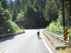
Last weekend was the date for the last ride in the Portland series that we (me and some of my friends who live in the Portland area) organized for this year. I’d organized the 200, helped with the 300, volunteered on the 400, but ended up not doing anything for the 600 because it ended up being a self-supported ride which didn’t need volunteers. So instead of volunteering, I decided to ride the thing. It was quite nice – the route wandered down the Willamette Valley past Salem, went west and southwest almost to the coast, then turned around and shot back to the mountains east of Sweet Home, at which point it climbed to the top of one of them, dropped down into a valley, climbed to another mountain pass, then returned to Portland via the old familiar route from Ripplebrook to home.
I tried to ride the spring 600 by myself (I’d been trying to arrange to ride it with a couple of other people, but that fell apart a month and change before the ride) but that failed because I just wasn’t having any fun after riding by myself from Portland to Newberg (on a cold foggy morning,) arriving late to the start, then riding, also by myself, into a headwind all the way from Newberg down to the Blodgett Store, where even the hand-scooped ice cream was not enough to keep me from abandoning and going back home. So this time I’d decided that if I couldn’t find anyone to ride with I’d just not do it at all; I asked around and my friend Kevin said that he thought it would be a good plan, so the ride was on.
At 5am on Saturday morning. Ugh. That meant I’d need to wake up at 3:45 to be able to get myself moving before rolling across to Woodstock Park at 4:20 (it’s about 4 miles from here to there, and I wasn’t expecting that I’d be breaking any land-speed records on the way there.) And a 3:45am wakeup meant I needed to get to bed at 8pm on Friday.
So when did I start getting ready for this brevet? How about 2:45pm on Friday? It’s not as if I needed to do anything new – I hose clamped a third bottle cage onto the mlcm, dug out my saddlebag and installed it, then filled the saddlebag with clothing, a spare tube, and a space blanket (Kevin and I were planning on riding through instead of stopping at a hotel, and the space blanket was a required piece of gear for doing that) and my big rando bag with food and a single extra baselayer, because it was supposed to be moderately cold on Friday and Saturday nights, set out my geeky bike clothing and got to sleep somewhere around 8am.
On Saturday morning, I woke up about 2 minutes before the alarm was ready to go off, and I puttered around slowly getting ready for 40 minutes before rolling out the door to ride up to Woodstock Park.
It was not just moderately cold. It was cold, and I found myself putting on my windbreaker to trap some heat before I rode over there. I looped around Woodstock park a couple of times before seeing a couple of rando-looking bicycles scooting by, and followed them to the park bench that was serving as the opening control for the ride.
At 5am, after waiving myself and getting a brevet card+cuesheet, we were released to wander off into the predawn gloom, and headed south towards the traditional River Road route down to Oregon City.
From Oregon City, there are several ways to get up to the Boring Lava, some steeper than others. 7th Ave is one of the steep ones, so we took that (it’s pretty steep. It’s not as bad as some of the more horrific ramps on the Eden’s Gate 400k, but I was down in my dump gear and working hard to wind my way up that ramp within about half a block of the bottom) up to the top, then worked our way over to Beavercreek Road, which we used to get down to Molalla.
The fun thing about Beavercreek Road is that it climbs Highland volcano, passes within 4 miles of Highland Butte, then plunges down to Molalla. But first you climb and climb, mainly gradually, past suburban sprawl, then through a region of small ranches and vanity farms, then into farmland and woodlots before you reach Beavercreek and start heading down.
It was pretty cold climbing upgrade, but whenever we dropped into stream valleys and went past ponds we’d pass through pools of freezing cold air, and I was forced to put my windbreaker on even though we were climbing fairly quickly. And then we topped out, rolled downgrade for a while, and then I was very happy that I had the windbreaker because Beavercreek falls off the edge of Highland volcano on a mile-or-so 10% ramp. We screamed down into the valley, reaching speeds of either the high 40s or low 60s (depending on whether you trust my GPS,) quickly worked our way into Molalla, then headed out the other side to climb up to Wildcat Road.
Wildcat Road isn’t that bad climbing up from the north – I’ve transited it from the north and from the south this year, and it’s much nicer from the north – but as we rollercoasted our way down from the Wildcat Road summit I began to have a nasty suspicion that we’d not be seeing very much of the notoriously flat parts of the Willamette Valley here.
And we didn’t – from Wildcat Road we turned onto highway 213 just as it went across a spur of the mountains, crossed into Silverton to take it up onto the highlands that separate Silverton from Stayton,
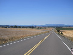
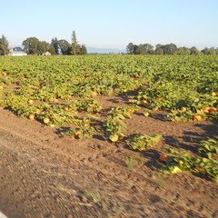
turned west onto Waldo Hills Drive just in time to claw our way into and out of several river valleys, then finally south across highway 22 to go into Aumsville, where we finally encountered several miles of flat farmland (including a stretch about halfway between Aumsville and Turner that looked for all the world as if it had been sliced out of central Oregon and plunked down in the Willamette Valley) before running headlong into the steep hills that sit just south of Salem.
There are some seriously annoying ramps there, including a roller coaster-style ride along Hylo Road (five rolling hills; I had to winch myself up the first two before successfully making a run on the third and bouncing the last three rollers) and a twisty descent down the west side of the hills that, when we were almost to the Willamette, becomes a terrifyingly steep and twisty ramp.
The Willamette river bottoms were, for a change, almost optically flat for a couple miles before we went over the river into Independence, where the road started undulating gently all the way over to Kings Valley Highway, which we reached just before it climbed up and over a spur of the Coast Range to highway 20, which climbed over another spur before depositing us onto the road to Alsea.
Highway 34 (which is the main road to Alsea) is, for quite a while, a nice slowly climbing road that, without fuss, muss, or bother, runs along a river. And then, all of a sudden, it isn’t a slowly climbing road, because it runs headon into Alsea Mountain, which it goes over with all haste.
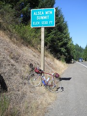
When we reached the Alsea Mountain ramp, a funny thing happened. Kevin was climbing just a little bit slower than I was, so I had to choose between climbing really slow to keep from overrunning him or just overrunning him at my natural pace. For a while I climbed really slowly, but then I found myself falling behind and tried to transition back to my slightly faster pace to catch up and discovered that the faster climbing I’d discovered on my last run of One Big Hill was not a fluke – I accelerated up to ~9mph, sailed past Kevin, and punched my way the next 800 feet up to the top of Alsea Mountain as if it was a railroad grade instead of a mountain road. This bizarre behavior persisted for the rest of the ride (with one notable exception), and I’d find myself, unless I was careful, dropping whoever I was with as I flew up one ramp or another.
But anyway, after climbing Alsea Mountain we dropped down to Alsea, where, for the first time, we encountered some of the other riders (Shun & Jim Poppy,) who’d gotten into Alsea about 40 minutes before we did.
Unfortunately, Jim was exhausted and planning on abandoning and going back up 34 to the town of Philomath to find a hotel room, and couldn’t be convinced to follow the route forward past Alsea Falls (which would put him in the Willamette Valley about 15 miles south of Corvallis, which has somewhat better hotel accommodations and which is that much closer to the end of the ride. They told us that they’d seen Theo & Joshua leaving when they’d rolled in, so despite our relatively lazy riding we’d not fallen too far behind the fast boys (well, with the notable exception of Michael Wolfe, who was about 55 miles ahead by this time.)
We weren’t in much of a hurry, so we ate a leisurely lunch (well, “leisurely” in rando terms; we actually tasted the food instead of just wedging it into our mouths as fast as we could eat) then headed out to climb back over the mountains into the Willamette Valley.

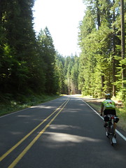
Highway 34 is an awfully nice road for the amount of traffic it has, but it doesn’t hold a candle to the Forest Service road (East Fork Road) that works its way up to Alsea Falls, then down to Alpine. Nice twisting roads climbing gradually through second-growth forest up to the summit, then dropping quickly down into the Willamette Valley, and with basically no traffic on a Saturday afternoon.
And, finally, when we reached the valley floor, we finally got the optically flat Willamette Valley I’d been looking for – miles and miles of flat riverbottom land, punctuated with the occasional town.
We stopped in Harrisburg for a snack and more water, but the only elevation we had for the 15 miles or so across the valley was the overpass we took to get over interstate 5.

And then, just at dusk, we ran up against the eastern edge of the valley and said goodbye to level ground for the next 170 miles. The road turned north, ran up and through a small pass in the foothills, then deposited us in Brownsville in time for us to get a late evening dinner (at the Dari Mart.)
And then it was night. There was a new road going east to Crawfordsville, but then we were routed onto the route that the Eden’s Gate 400 uses to get from Sweet Home south to Crawfordsville. Sure, we were doing it in reverse, but it’s a pretty familiar route and it was no trouble to get up to Sweet Home from there.
We’d made it to Sweet Home just a little after 11pm, which is when almost everything closed, and had to search around for a while before finding a Texaco station that was still open for receipts, food, and water. And after stocking up, we headed out into the night for what would prove to be the most difficult part of the loop.
From Sweet Home, you got to Quartzville Road. From Quartzville Road, you go to NF 11. From NF 11, you go to Highway 22. This simple set of cues hides the teeny detail of a getting to the top of a 4000 foot pass. It was good that it was dark, because if we’d seen the mountains closing in around us it would have been fairly disillusioning.
As it was, we were pretty tired by now, and we’d given up any hope of riding through without sleep. We started looking around as we went for places where we could get off the road and take a nap, and finally found one by the Green Peter dam – there was some sort of informational kiosk set up on a concrete slab which we commandeered as a sleeping platform for a half-hour nap, and then headed east again.
East of Green Peter dam is, of course, Green Peter Reservoir, which is a hideously popular camping site, and we didn’t get very far east of the dam before we started to see dozens, if not hundreds, of campers and tents set up on every available open spot alongside the road. This went on for a dozen miles or so before we reached Yellowbottom park, where there was an info control and water. We refilled our water, wrote down the info answers, then headed east again, and soon reached the turn onto NF-11, where the road narrowed and started pointing steeply upwards.
Way back at the start of this brevet I’d dropped to my alpine ring to get up 7th Ave in Oregon City, then shifted back to the 50t ring at the top of the ramp. I’d not gotten out of the 50t ring since then, but I did it now, and left it there for the next 20 miles or so as we climbed and climbed and climbed.
But before we did much climbing we were riding along a windy not-so-steep section when all of a sudden I was falling-over exhausted, and said I had to stop for another nap. This time there was no convenient concrete pad, but the masses of campers had dropped right off when the road curved away from Green Peter and we found a suitably wide uncamped-upon grassy verge by a bridge where we could park the bicycles, lay out the space blankets, and lie down for a 45 minute nap.
That 45 minutes was basically just what we needed; the space blankets were nice and warm, 45 minutes was about a sleep cycle, and I actually managed to sleep deeply enough to dream before the phone started squawking to wake us up. And then we got back on the bicycles and went back to grinding our way up this very very long ramp in the middle of the night.
Some time later (I’m not sure just how long it was) Kevin was grinding along ahead of me when he saw something and stopped; he’d seen a bicycle, and then another space-blanket wrapped form. It was Theo, who we’d last seen about half a mile past the start of the ride, now riding by himself because Joshua had abandoned somewhere in the Willamette Valley. We swept him up and then it was the three of us creeping slowly up the ramp.
We weren’t moving all that fast, so the sun came up while we were still grinding our way up, and by the time we reached the flatter section where the road levelled off just before the summit it was dawn and rays of sunlight were illuminating the tops of the trees around us.
The scenery up here is gorgeous – it’s all been logged off once or twice, of course (those forest roads aren’t there for their scenic beauty) – but despite that it’s a wonderful world of second/third growth timber, deep rocky ravines, and spectacular vistas as the road wound around mountaintops.
But then, of course, the road dropped off sharply towards highway 22. Theo and Kevin zoomed on ahead, and I proceeded as recklessly as I felt safe doing (which is not very fast compared to basically every other randonneur in Oregon) and eventually caught up to them down at the junction with the highway. And then we rolled north towards Detroit, down a bit (but not particularly steeply; we’d done all that coming down from the summit of NF 11) but mainly levelly.
We weren’t moving particularly quickly (Theo was exhausted and not able to move quickly here; the three of us were planning on stopping in Detroit for some sit down food in a restaurant, but until then Theo, and to a lesser part me, were riding on fumes) so I had a chance to sightsee as we rolled along. What I was looking for was signs of the old Oregon Pacific, and I was rewarded for my efforrts when we rolled through Idanha by spotting a lonely railroad siding in front of an old sawmill. It’s not much of a reward, but it has been about 50 years since Detroit Lake was created, so any signs of actual railroad were an unexpected surprise.
After Idanha we rolled along the shores of Detroit Lake for a while until we reached Detroit proper, where we stopped, had a leisurely breakfast, then headed towards NF 46 and one last mountain pass before dropping towards home.
I was considerably revitalized by this breakfast, so I shot ahead by a long ways on the more gradual climb up to Breitenbush, and then we rode along together for a while until first Theo, then I, realized that we really needed to get to a bathroom, and the nearest one was about 30 miles ahead of us. Theo put on the gas and pulled ahead, then I put on the gas and caught up with him, negotiated briefly about who had priority, then dropped back to let him gap me so he’d have first dibs. And then, after he’d forged ahead out of sight, I tried to see if I could deliberately get into a higher speed climb, but, alas, I did this just as I reached the steep twisty section that went up to the pass, so all that happened was that I sweated all the way through my baselayer and had to stop to take off the sodden mass before going up that last mile of 6% grade to the summit.
Which I did successfully without stopping, even though I was moving at somewhat less than walking speed when I topped the grade. I stopped, rearranged my water supplies (I was carrying six bottles of water at this time – three ~22 oz bottles in cages and three small soda bottles that I’d refilled with water; two of the 22 oz bottles were empty, so I dumped the soda bottle water into them, crunched the soda bottles flat, and repacked things. While I was doing this Kevin caught up and we headed out together for a while.
Unfortunately, I still needed to use the bathroom, so I was moving with somewhat more urgency than usual. We stayed more or less together over the false summits, but when we came over the real summit and hit the steep downhill to the end of the first false descent I started putting on the gas and shot on ahead. And then I sprinted, about as fast as I could go, the remaining 20 miles down to the next bathroom at Ripplebrook Guard Station, almost overrunning Theo in the last couple of miles (I saw him in the distance at the start of a section where NF 46 swerved away from the Clackamas River and went over a series of short ramps, pushed up my speed a bit, and closed to within about 500 feet of him before he noticed and pushed up his speed to get to the bathrooms before I could. So 500 feet was about as close as I got :-)
At Ripplebrook, we regrouped (Kevin was about 4(?) minutes behind me,) used the bathrooms, got a snack, then headed out. Theo’s breakfast had obviously started to metabolize, because he was getting very ancy about staying in one place, and we sped up and got out of the Guard Station in much more of a hurry than our activities there would have seemed to have indicated.
And then the headwind started. I’ve ridden up to Ripplebrook a lot over the last few years, but this was possibly the worst headwind I’ve encountered returning. It was blowing hard enough to stop me at the top of the steep ramp, and by the time I’d managed to restart and get up to a unridiculous speed on the downhill Theo had reached the bottom and Kevin was about halfway down.
This was the last we saw of Theo; Kevin was having much more trouble with the headwind, so we regrouped and tried to form a paceline to get down to the bottom of the gorge.
But as we ground our way north against the wind, the oddest thing happened; the both of us started to feel like we were about to fall asleep. Perhaps it was the familiarity of this route segment – there are no surprises between Ripplebrook and Estacada anymore (except, possibly, “are there any new landslides we need to dodge?”) so it’s just a matter of pushing the pedals around while sailing through gorgeous scenery – or perhaps we were just tired enough so that the caffeine wasn’t working quite as well as usual, but in any case we had to stop to clear our heads on Faraday Road, and then we needed to sit for quite a while in Estacada to eat twinkies and sip convenience store “coffee” before going out onto the wider river valley between Estacada and Amisigger Road, where there was enough traffic to keep us from falling asleep (from the sheer terror of thinking that if we fell asleep we’d swerve out into traffic and *bang* the SUV that ran us down wouldn’t even stop until it got home.)
It was pretty hot on this part of 224, too; even though it was late afternoon and only in the mid eighties I could feel the sun slowly cooking the left side of my body as we scooted along. It’s been more than a year since I came back from Ripplebrook on a really hot day, so my memories of that trip are nothing more than the many stops I made at various convenience stores to get bottles of nasty sports drink, but I’m very happy that we weren’t transiting this road one one of the 100°F days we had the weekend of the summer 400k.
Turning off 224 to get over to Boring to hop onto the Springwater Trail brought us to the last notable climb on the loop – Amisigger Road climbs, with only one flat(tish) section, steeply up to the top of the bluff that Boring sits on. It’s shaded, which is good, but the margin at the side of the road is approximately an eighth of an inch wide, so we had to turtle our way up the ramp with traffic whizzing by right next to us. When we reached the top of this nasty ramp, we stopped in a tiny spot of shade and spent about 5 minutes catching our breath before going into Boring and dodging over to Telford Road to finish our transit to the Springwater Trail.
And then we “zoomed” into town, stopping once at Linneman Junction to use the bathroom there (open, miraculously, for once) and proceeding on city streets to where we thought the closing control would be. Nobody was there, so we called the organizer (Joshua Bryant, who’d DNFed Saturday afternoon and returned home) and discovered that the closing control had been relocated to his house (about a mile away from Woodstock Park.)
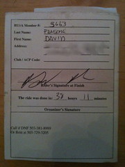
We’d reached Woodstock Park 37h58 after we left it on Saturday morning, called Joshua basically on the dot of 38h after we left, but reached his house and had our cards signed off 38h11 after we left.
So not a particularly world-shattering speed record (slower than the 600 last year, where Theo, Asta, and I rode through without, as far as I know, any sleep) but it was a loop time that only had us in the dark for about 45 mainly-up miles and got us to the summit of NF 11 at dawn so we could appreciate the whole thing. If I want a speed record, I’ll have to build a flatland 600k, improve my 200k speed to < 8h, then ride the f_ck out of that 600k until I go a <24h loop time. But not this year – I couldn’t be realistically happier about how the 600k went; beautiful scenery, interesting roads (who would have though that you could put so many hills on a route that directly transits the northern Willamette Valley,) mountain passes, intriguing night segment, and good company.
I used to think that 400k was definitely my favorite distance, because it was long enough (to someone who’s my speed) to ride morning, evening, and night, but the two 600s I’ve finished (with company; the longest I’ve ridden by myself has been 400k and that was not a very pleasant way to get a sub-20 hour 400k) have much more pleasant memories than any of the 400s I’ve ridden except for my Hot Springs-Covered Bridges 400k.
Did anything not work on this loop? No, not a thing; the chain on the mlcm started out grimy and got worse to the point where I had to coax downshifts, but it worked despite that. The hose-clamped third water bottle cage stayed in place for the entire loop, and the bottle stayed in it too (helped by a piece of rando crap I found; I found a toe strap lying on the side of the road on Beavercreek Road, grabbed it, then used it to tie the third water bottle to the frame,) the Atac pedals + cleats worked quite well and I only got a couple of cramps in my right foot after particularly long sprints, and I actually managed to pack exactly enough clothing for the loop.
About the only thing that went “wrong” was that I was drinking water like a hose during the first day, and only reduced my consumption when we reached Ripplebrook and I ran out of my nasty sports drink tablets.
Oh, yeah, and the Amisigger Road ramp sucked dead bunnies through a straw. If I had been feeling really tired, I would have been sorely tempted to take 224 to Barton, then Baker’s Ferry/Springwater/Clackamas River Road into Oregon City, then River Road and the Trolley Trail up into Portland instead of wnching myself up that ramp.
But other than that quibble it was a spectacular long day out.
Pictures are on flickr, my sanity is safely stored away in a box in the attic, and I’m more than ready to do another 600k. Too bad there are none within reachable distance for the rest of this year :-(
—orc Wed Aug 29 01:18:42 2012
Aug 28, 2012
| Cert No. |
Type |
Km |
Date |
Organizing Club or Permanent Route |
Time |
| RUSA-T20758 |
RUSAT |
207 |
2012/01/07 |
OR: Volcanoes vs Farmland / 1301 |
10:55 |
| RUSA-T21333 |
RUSAT |
206 |
2012/02/04 |
OR: Portland-Ripplebrook-Portland / 1302 |
10:59 |
| RUSA-T21735 |
RUSAT |
206 |
2012/02/25 |
OR: Portland-Ripplebrook-Portland / 1302 |
11:35 |
| RUSA-P05905 |
RUSAP |
100 |
2012/03/17 |
Oregon Randonneurs / 937020 |
04:36 |
| RUSA-T22400 |
RUSAT |
230 |
2012/03/24 |
OR: Sellwood-Birkenfeld-Sellwood / 1278 |
12:24 |
| 352540 |
ACPB |
200 |
2012/03/31 |
Oregon Randonneurs / 937020 |
11:50 |
| pending |
ACPF |
360 |
2012/04/06 |
Seattle International Randonneurs / 947018 |
24:00 |
| RUSA-T22793 |
RUSAT |
206 |
2012/04/14 |
OR: Portland-Ripplebrook-Portland / 1302 |
09:51 |
| 127213 |
ACPB |
300 |
2012/04/21 |
Oregon Randonneurs / 937020 |
13:19 |
| RUSA-P06398 |
RUSAP |
100 |
2012/05/12 |
Oregon Randonneurs / 937020 |
05:38 |
| 88356 |
ACPB |
400 |
2012/05/19 |
Oregon Randonneurs / 937020 |
19:48 |
| RUSA-P06534 |
RUSAP |
110 |
2012/05/26 |
Oregon Randonneurs / 937020 |
04:57 |
| RUSA-T23875 |
RUSAT |
206 |
2012/06/02 |
OR: Portland-Ripplebrook-Portland / 1302 |
08:59 |
| RUSA-T24226 |
RUSAT |
200 |
2012/06/15 |
OR: One Big Hill & Silver Falls / 1566 |
10:28 |
| RUSA-T24255 |
RUSAT |
203 |
2012/06/16 |
OR: Portland-Ripplebrook-Portland / 1302 |
11:03 |
| RUSA-T24434 |
RUSAT |
167 |
2012/06/24 |
OR: Zigzag 160 / 1565 |
08:44 |
| 356871 |
ACPB |
200 |
2012/06/30 |
Oregon Randonneurs / 937020 |
12:04 |
| RUSA-T24629 |
RUSAT |
200 |
2012/07/04 |
OR: One Big Hill & Silver Falls / 1566 |
09:24 |
| RUSA-T25060 |
RUSAT |
201 |
2012/07/18 |
OR: Hills to the Yeah / 1134 |
10:45 |
| RUSA-T25226 |
RUSAT |
101 |
2012/07/25 |
OR: Pomona Sprout / 1595 |
05:38 |
| RUSA-T25364 |
RUSAT |
161 |
2012/07/30 |
OR: Portland/Pacific City 160 / 1601 |
09:17 |
| pending |
ACPB |
400 |
2012/08/04 |
Oregon Randonneurs / 937020 |
25:11 |
| RUSA-T25595 |
RUSAT |
114 |
2012/08/09 |
OR: Dixie Mountain 100 / 1303 |
06:09 |
| RUSA-T25650 |
RUSAT |
408 |
2012/08/11 |
OR: Hot Springs - Covered Bridges 400 / 1616 |
23:09 |
| RUSA-T25815 |
RUSAT |
205 |
2012/08/15 |
OR: Volcanoes vs Farmland / 1301 |
10:25 |
| RUSA-T26154 |
RUSAT |
103 |
2012/08/16 |
OR: Nicolas Flamel Populaire / 1612 |
04:57 |
| RUSA-T26039 |
RUSAT |
200 |
2012/08/23 |
OR: One Big Hill & Silver Falls / 1566 |
11:43 |
(not counted: 1200km of check rides, 400k of DNFs, orrando’s summer 600k – in total, I’m at about 8000km’s worth of brevets/permanents/flèche so far this year. This may explain why my climbing speed has dramatically increased in the last few weeks)
I guess I’m trying to pack as much riding in as I can before I go under the knife this winter to have my shattered shoulder kludged back together.
—orc Tue Aug 28 02:41:58 2012
Aug 26, 2012
… but I’ve finally finished (on what will be my last brevet of the year, unless more are magically organized in Portland) a series of 200-300-400-600km brevets. Normally they’re done in a series starting at 200k, then working up to 600k, but in my case I started with 200k, did 300k and 400k, then did another 200k, then another 400k, and finally convinced a friend to ride with me on this 600k.
So, a series. This is mixed in with the ~25 permanents I’ve ridden so far (distances from 100km to 400km) to make up a bucketload of rando miles (something on the order of 7000km so far, but 1200km of that is various checkrides that I did before the offending route was approved.) In some ways it was harder than last year’s series, but in other ways it was easier. And I finally discovered that when you’re tired, wrapping yourself in a space blanket and getting 45 minutes of nap can be as comfortable and refreshing (I could have spent $130 on a hotel room that I might not get any use out of – a 38 hour 400 is slow enough so that I’d be spending $60/hour for sleep in a hotel) as sleeping in a hotel room, and, of course, it’s a bucketload cheaper.
Next year I may not do an “official” 2346 series, because there’s a chance that there won’t be a Portland-based series offered and I’ve gotten fairly tired of travelling long distances at 0dark:30 in the morning just so I can ride my bike in a large circle, but there are now enough Portland-based permanents so I can do that series all with permanents and not be forced to get up at 0dark:30 to ride them, and do it several times without spending a small fortune travelling to adjacent states to fill a dance card.
—orc Sun Aug 26 23:57:35 2012
Aug 24, 2012
600 tomorrow, so no time to practice brazing bottle cage bosses onto a frame. The solution to this problem (the problem being two 40+ mile mountain segments w/o services and only two sets of water bottle bosses on the mlcm)? Hose clamps.
Oy, that’s pretty special.
—orc Fri Aug 24 18:25:44 2012

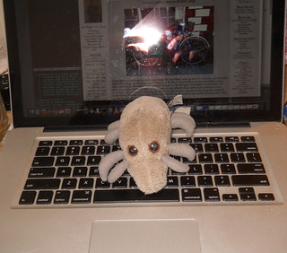
Flying Santa Cruz Dust Mite, as captured by the personal camera in a macbook pro.
—orc Fri Aug 24 16:03:57 2012
In the category of “lets do things at the absolute last minute” I think I’ve got a new winner.
Tomorrow morning, at ~4:20am, I need to get on my bicycle and ride over to Woodstock Park so I can pay $10, pick up a brevet card and cuesheet, then ride a 600km loop before staggering back home from Woodstock Park on Sunday evening (afternoon if I’m really fast and don’t founder on the steep southside ramp of NFD 46).)
So when did I start getting ready for this ride?
Last week (since I had to go down to California from Sunday to Wednesday)…? no.
Wednesday afternoon after returning from the railroad station…? Nope.
Thursday evening, perhaps…? Um, no.
How about Friday afternoon. It’s 2:30, so I’ve got ~5 hours before I have to go to sleep so I can get in the ballpark of 8 hours of sleep before I stagger out the door. I’ll start getting ready now!
Oy. This is flakey even for me. Time to make a map showing all the coffeeshops along the route.
—orc Fri Aug 24 14:26:57 2012
Aug 23, 2012
When I was on the train Sunday night, my friend Ed messaged me and asked if I wanted to do a ride on Monday. Well, I was on the train to That Paradise That Is California™ (I was going down to meet with the rest of the autonomous collective that I’m doing the user interface for an iPad app for) so that was out, but I suggested that Thursday might work because I wanted to get some miles out of me to warm up for the summer 600k this weekend. And I suggested One Big Hill & Silver Falls because it’d been a couple of months since I last did it and I wanted to see how it looked like after riding about 3000 miles in the last two months (I’m dealing with the catastrophic last year by riding the f*ck out of my bicycle this summer; I can ride up to about 150km before thinking about things becomes unendurable, and I can at least double that if I plug earphones into my cellphone and play music while I’m riding. So I’ve been riding, on average, 2 permanents a week since the beginning of July (I’d ride more except my family objects when I’m spending too much time out on the bike. Oh well.)
So, at 7:15 this morning Ed and I set out to the south. It had been 3.5 days since I’d been on a bike, and about 40 hours of that was on one train or another (but all of it was in the same coach; it takes two days to run a Coast Starlight trainset from San Jose, CA down to Los Angeles, service it, and run it back up to San Jose. where most of the Portland-bound passengers were then deposited) so it took approximately 15 (fast) miles to warm up – those first miles saw my traditional slothlike climbing, but the last five miles saw me starting to get to the top of the rollers faster than Ed was doing.
It took us about 1h25 to make it the 20 miles from Portland to Canby, which was pretty screamingly fast considering the slow climb up South End Road to the top of the Boring Lava, but when we reached the first control (at Cutforth’s Thriftway we stopped and took a leisurely break, not leaving until 9am. This was the start of a theme; we’d sail along at a fairly good rate for a while, and then we’d stop for a little something and burn off a bunch of the time margin we’d gathered up.
It was also the start of another, and completely unexpected theme; from Canby south I was riding faster than Ed, and climbing considerably faster than he was. So we’d ride along together for a while, then reach a series of rollers or a ramp and I’d evaporate with an implosion of air, only to have to slow down or stop later on so we could regroup. This unusual behavior even continued on the climb from Silverton up to Silver Falls, where I was easily maintaining 10-12 mph on the lower ramp, and 9-10mph on the upper ramp on highway 214 (compare this to the first time I rode this loop, where I chased (if you can call it a chase when I was going so slowly) Asta up the ramp at a majestic 5-6mph.)
But, despite all this, it still took us about 5 hours to reach the lodge at South Falls, so I burned off some more time by eating a gardenburger before we continued up to North Falls, then back to Silverton. Once again, I got a long ways ahead every time we hit a ramp, but Ed was getting into a better aero tuck than I was doing (he’d flipped his cap around backwards, so could get really low and still see, while the bill of my cap would get into my eyes unless I contorted my body in an unaerodynamic fashion) and pulled quite a ways ahead on the steeper and curvier parts of the wonderful descent back down into Silverton.
I led part of the way through Silverton, but we started switching the lead by the time we reached C Street, and kept this up for the 4 or so miles up to the control at Mount Angel, where I foolishly didn’t get any water. Foolishly, because on the other side of Mount Angel the road became a little more hilly (hillier because I wanted to check out Needy Road as a possible route up into town for the Buena Vista Commuter route I’m working on now, and Needy Road is not very heavily graded) and I went back to zooming up ramps and getting a long ways ahead.
By the time we reached Lone Elder Road my water bottles were down to the dregs, so I refilled them at the Lone Elder Store, and, thus refreshed, we headed north again.
But the road gets really hilly north of Canby, and I opened up a huge lead between our turn onto Central Point Road and Criteser Road. On Criteser Road, I found a shady spot, stopped, and waited for Ed to appear.
And waited.
And waited.
For about 20 minutes.
Okay, this is not good. I pulled out the phone, but discovered that I was in one of the metropolitan dead zones for T-Mobile, so I couldn’t call to see what was going on. So instead I turned around and slowly rode back south along Central Point Road to the last place where I saw Ed.
And that was 4 miles down a hilly road. I wasn’t going very quickly up hills because I hoped that he’d pop over the top of them before I had to go down into a valley that I’d have to reclimb later. But no such luck; I went all the way back to where we’d turned onto Central Point Road without any signs of Ed, his bicycle, or an accident.
I’d called Julie about halfway back down the road to tell her that I was not going to make it home even close to when I wanted to because I’d lost Ed, then called her a couple more times after trying to call Ed and getting no answer from his cellphone. On the last call, I told her she should go out to dinner with the bears and my parents and not wait for me, because I would start calling around to see if I could get Ed’s home phone, then call that (but I was on Leland Road by this time, and I didn’t want to call until I got to the Gladstone end of Oregon City.) On this call, I said that I was about 55 minutes away from home, and it was about 10 minutes later (after screaming down Linn Ave into midtown Oregon City; normally I use my brakes on the 25mph corners, but, no, I was in a hurry) that I reached the Clackamas River bridge, where I was planning on starting to make calls.
But before I was able to do that, the phone rang. It was the best, calling to tell me that Ed had just showed up at the front door. He’d apparently missed the turn onto Criteser and took Central Point Road all the way up into Oregon City while I was cooling my heels waiting for him.
*sigh*
So I didn’t need to sprint in case I had to call out the cavalry.
But I did need to sprint if there was any chance that I could make it home in less than 12 hours. So I bolted north as if someone had lit the mlcm on fire and the only fire extinguisher in the world was sitting in my living room.
40 minutes later I staggered in the front door, turned off my GPS, then bolted for the bathroom.
Oy. What a day.
132 miles (124 + 8 bonus miles) in 11h43. Oh well, that <9 hour Silver Falls loop will have to wait for another day.
This loop brings my yearly milage to 7200 miles (I’ll be comfortably over 7500 miles at the end of August) with about 3300 of those miles being finished-for-credit RUSA permanents/brevets (and another 700 or so being unfinished/checkridden RUSA permanents.))
Pictures are on flickr, of course.
And I see that the weather forecast claims a chance of rain on Sunday, so I’m going to have to put fenders onto the mlcm tomorrow morning (as well as a couple of pipe clamps to hold a third water bottle cage. It wouldn’t be a proper random bike without an assortment of random fasteners holding things onto it) before I arrange everything for what will hopefully be my last brevet for the year (if I DNF this one, I’ve got to go either to Seattle or California to do a cleanup 600, and I really don’t want to do that. Next year I’ll have a 600k permanent or two and I’ll be able to ride those instead, but I don’t have them now and I want to ride at least one 600 this year.)
—orc Thu Aug 23 23:51:32 2012
Aug 22, 2012
A set of standard sized stamped lugs, just waiting for me to either find a shattered frame or cut apart the gaspipe frame so I can play around with trying to braze larger chunks of metal together.
And if it works, I’ll build an xtracycle around them.
—orc Wed Aug 22 20:12:07 2012
Aug 20, 2012
I was trying to set up a friend’s macbook so he could build iPad apps and test them on his iPad, but every time we tried to actually do it the process would come to an abrupt halt with one of a dozen error messages.
After several hours, I finally examined some of the allegedly unsigned certificates on his system (I say “allegedly” because some of these certificates – the Apple certificates that all the developer certificates rely on for a chain of trust – were copied over from my machine where they were happy) and realized that even the highest-level developer certs were saying they weren’t issued by a trusted authority.
“Wait a minute,” thought I, and went to take a look at the top-level Apple CA certificates.
Which weren’t there.
Oh. I’m not exactly sure just how they disappeared, but after I copied them over from my machine all of these previously invalid developer certificates were magically valid.
Sigh
Needless to say, the error messages that MacOS issued didn’t say jack.
I’m glad I wasn’t so tired that I couldn’t bull through and figure this stupid thing out, though this screams “Hi! I’m a huge security risk! Have a nice day!”
—orc Mon Aug 20 23:05:39 2012
Aug 19, 2012
A few months ago (just before the Saltzman Road episode of the disaster of the week club) I decided that I’d try out clipless pedals just to see if they were substantially different from clips & straps. After a little bit of half-hearted research, I decided I’d try out Crank Brothers eggbeaters, which initially were absolutely marvelous – easy to fasten my feet to, easy to unfasten my feet from, secure when my feet were in them, and with a little bit of play so I could adjust my feet left/right on the pedals.
I wanted to see how clipless would work for everything, so I rolled all of my bicycles over to them, and was happier than a clam in batter.
Now fast forward about two months, and a few defects had become apparent with this pedal/cleat design.
- first, the brass cleats were wearing at a ridiculously fast rate; in two months, I’d worn down one set to the point where they’d started to spontaneously unclip if I twisted my feet at all, and the second set had started to look dangerously worn. Now, it is true that I do ride a lot, but I’d only ridden about 1800 miles in that time (the Saltzman Road disaster stopped me from riding for about a week, and then I took a while to get back to my normal riding habits, but still the idea of going through another $18 consumable every two months (the chain being the other one; no matter how I maintain a chain, it’s toast after 3k miles and if I try to keep using it longer than that, I kill my cassette as well.
- secondly, and much more annoyingly, the pedals had started to make little annoying *click*s whenever I pedaled. And after my trip to Newport and back it had become a loud annoying *click*, which, upon investigation, turned out to be because the “bearings” (for lack of a better word; the cheapest eggbeaters just have axle holes punched through the retaining clips without, as far as I can tell, any sort of hardening) had worn oval and the clips were sliding back and forth and clicking against the pedal axles.
I might have been able to tolerate one of these defects (might have) but the combination of the two rendered the pedals unsuitable for my purposes (it’s harder to enjoy the country scenery when you’ve got a clicky soundtrack, and having to buy 5-6 sets of cleats a year would get old really fast) so I pulled the eggbeaters (fortunately they’re from REI, so I can actually return them) and replaced them with a set of Shimano M520s.
Unlike the eggbeaters, the Shimano cleats don’t have any play; there’s only one place where your feet can go and by G-d that’s where your feet will be when you’re clipped in. It makes them a lot harder to adjust – on hot days, I’d periodically get cramps in my feet when climbing steep ramps – and I never got them to be completely comfortable. And, also unlike the eggbeaters, I couldn’t half-unlatch my feet when approaching a stop, then completely unlatch them at the stop – the Shimano cleats are either latched or unlatched and if I tried to half unlatch they’d forceably rematch themselves again.
This was not a problem; I just had to train myself to be a little more deliberate when detaching myself from the bicycle.
But what was the problem was that after 2000 miles the pedals had started to click on me. In this case, it wasn’t that the bearings had ovalized, but some play had developed in the springs and they were either sliding or bumping up against the tension adjusters and clicking (A friend had recommended that I take the tension out as far as possible to make it easy to clip in/out, and I suppose I could increase the tension to see if that would make the pedals less clicky) so I pulled them to try a third alternative that another friend suggested.(I may go back to the Shimano pedals later if I can figure a good solution to the clicking, because Shimano uses steel cleats instead of brass, so after that 2000 miles the only signs of wear were that the bluing had been worn off their bottoms) in the form of Time ATAC pedals.
These pedals have only been on the mlcm for a couple of days, so I don’t know how they will wear (they use brass cleats, so I’m not particularly confident of their durability unless I can get steel replacement cleats) but I do know that they’re amazingly stiff. When Time says it’s a 15° rotation to unlatch, they mean it, and more than that I can feel my left shoe attempting to twist off my foot when I rotate it off the pedal.
If there’s any pedal that’s going to have me do the traditional clipless “fall over sideways while trying to detach my foot” dance, these are them.
You might think “why doesn’t he go back to clips and straps?”
Well, sadly, I find I prefer clipless pedals because they’re more adjustable than clips and straps (it’s really easy to loosen and slide a cleat around. It’s not so easy to unbolt toeclips and add spacers to move the toe forward, or to replace the toeclips with shorter/longer ones.) When I de-eggbeatered my pile of bikes, I put clips and straps back on the trek and they are noticably less comfortable that the more bike-geeky solution (sadly, I’ve found that a lot of the more bike-geeky things out there, from jerseys with back pockets to tights to clipless pedals, work noticably better than my traditional approaches. Sigh) and I’m going to have to recliplessize it as soon as I work out which pedal type I prefer.
Hopefully “which pedal type I prefer” will also be a pedal that lasts more than 2 months.
—orc Sun Aug 19 10:52:25 2012
Aug 17, 2012
Dust Mite is back from a vacation in Mississippi, and just in time for friday dust mite blogging!
—orc Fri Aug 17 23:31:22 2012
It had been a distressingly long time since the last time I was up at Joe’s Donuts, so I decided that I should go up there and get a dozen so the bears would have donuts available when they came back from their grandparent’s house in Mississippi. Normally it would be a 52 mile roundtrip (Springwater->212->Orient->Kelso->Bluff->26 et retour), but there’s a new populaire that makes it a nice round 103km by the simple expedient of taking the scenic(?) route along Marine Drive, then 257th/Orient->Bluff->26 (returning via the Springwater Trail, so the donuts don’t get rattled around quite as much.)
The front rack on the mlcm is a little too narrow to balance a box of donuts without using a sheet of coroplast as a shelf (I had one, but I cut it up to make baseplates for rando bags) and I wanted to make certain that the squeaking in the new(ish) Shimano M520 pedals were indeed the pedals and not something else on the bike (executive summary; Now, I am become death, the destroyer of clipless pedals) so I dragged the project bike out, moved the pedals over to it, and rode it up to Sandy and back.
An interesting thing about the project bike is that it feels slow, even when it’s moving pretty fast. So even though I thought I was just poking along I managed to do this loop in 4h57 (66 miles, because I thought I’d missed an info control and looped back a couple of miles to (not) find it) with over a hour of either sitting around at Joe’s or stopping at the side of the road to eat blackberries. The total time is no speed record (I think the fastest I’ve done a Joe’s loop is 3h45, and that was late in the year a couple of years ago when I was at the top of my form and had a tailwind going up the hill which died when I turned around and came home) but in the context of I’m never going to get a speed PR on a loop that includes Joe’s Donuts it’s pretty fast.
Sadly, I also discovered that even though the Cowbell bars on the project bike don’t foul a donut box, the brifters do – sure, I can fit the box between the brifters, but then I can’t move the downshift levers in far enough to actually downshift. So I had to tie the donut box on long ways forward, which hung it a long ways out in front of the front wheel and disturbed the handling just enough so I couldn’t ride no-handed for more than about 50 feet :-(
This makes about 800km that I’ve ridden in the last 7 days, of which 716 were for RUSA credit.
Since I didn’t have my rando bag along, that means I also didn’t have my camera, but just the birthday iPhone, which I’m not going to take out when I’m moving, because I would hate to drop and shatter it before it’s even a month old. So there are just three pictures on the loop, sorry!
—orc Fri Aug 17 17:33:18 2012
Aug 15, 2012
The last time I rode Volcanoes vs Farmland was a catastrophe that kicked off a rolling series of disasters that continue to this day (say hello to my shattered shoulder; it hurts basically all the time, partially because my now-disconnected clavicle rubs against my scapula and the muscles that drive my upper arm, partially because the stupid thing is only kept from popping out by the skin on my shoulder, which is probably developing one hell of a callus on the inside. I might be able to get it kludged back together, but that will require not using my right arm at all for four freaking months so I’m trying to do as much riding (and programming, and sewing, and brazing, and rack fabrication, and bicycle construction, and basically anything else I can think of other than sitting around and collapsing into what would be a suicidal depression if not for antidepressants) in before I finally snap and have the surgery (the surgeon I talked to basically said “you’re old, you don’t have enough years left to want to take 4 months off from life.” Um, thanks, I’ll remember that if I crash and the clavicle tears its way, Alien-like, out from the inside.) And that’s just one of the disasters) so when my friend Kevin suggested it as a ride option for the midweek permanent, I figured that my only goal for it would be to finish the day without it being another catastrophe.
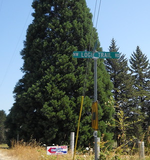
I’m not sure what Logie Trail Road has to do with not being another catastrophe.
You might ask “What does Logie Trail Road have to do with this permanent, which when I look at the cuesheet I see it goes past Logie Trail and climbs Skyline via the much more moderate ramp on Old Cornelius Pass Road?” Well, it’s like this; Old Cornelius Pass Road is closed for a bridge replacement and I needed to find an alternate route. The official alternate route (New Cornelius Pass Road) is too urban for the theme I’m trying to do, the unofficial alternate route (Germantown Road) is being chipsealed and is now a mass of drifted gravel, and any other routes over the Tualatin Mountains are too far into the UGB to give me the slow wrapping yourself in the city as you come down Skyline, Germantown, and US 30 into the center of Portland.
But Logie Trail Road isn’t urban. And it’s supposedly a nice, if kind of steep, climb, which would make it a nice bookend to a route that starts off with another nice, if steep, climb. And that would make this loop a nice successor to last Saturday’s Hot Springs-Covered Bridges 400, which turned out to be a little more insanely climby than I’d originally thought.
I looked at the weather, which was going to be nasty – it would start out the morning in the low 60s, then slowly work its way up to a high of about 95°F at between 4 and 5 pm – and suggested that we start at 6am and move around the loop smartly so we could finish in the ballpark of 4pm. Kevin thought this was a fine plan, so we met up near Marsee at ~6am, did the paperwork, and headed off to the south, via the traditional route (with one variation; When Tri-Met finishes the section of the trolley trail they’re supposed to be building I’m going to reroute all of my relevant permanents to use it, but for now I reroute the permanents I ride up 99E to Park and then onto the Trolley Trail) out to Barton, where we’d turn back to climb Highland Butte.
As we rode along Baker’s Ferry Road towards Barton, I couldn’t help but notice that the lower bluffs were obscured by a layer of extremely low clouds, which didn’t seem to show any interest in going away. After we turned around in Barton and headed back, the clouds were still there at about 300 feet ASL.
Climbing Harding Road put us into the clouds. Dropping down to Fischers Mill dropped us out of the clouds, but as soon as we climbed up the first ramp on Ridge Road we were back in the clouds, where we stayed for a good long time.
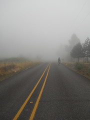
This was not a moderate overcast, either. Everything, including us after a little while, was wet and drippy from the moisture and there were long stretches where we were almost feeling our way through 50' visibility. It got lighter when we reached the summit of Ridge Road (I think we were almost poking through the top of the cloud cover here) but our descent was back into the thick damp fog.
I’d brought my vest along for paranoia’s sake, and was glad I did – the descent from Highland Butte was stupidly cold for August, and we didn’t finally get out of the clouds until after we dropped down into the Buckner Creek river valley.
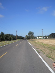
It was still overcast when we passed through Canby, but we started to see patches of blue sky around the time we passed Barlow Road, got patches of sunlight as we went across the Pudding River valley, and then by the time we reached 551 (by the Aurora Airport) the clouds had all evaporated except for one or two stray tendrils.
And then the headwinds started, and it started to get hot. We dealt with the headwinds in the traditional way of putting our heads down and sprinting into them (it does not work so well when you’re going upgrade, but it worked well enough so I could pull Kevin most of the way along North Valley Road to Flett Road before we turned sideways to the wind and I blew up) and dealt with the heat by trying to ignore it as long as possible.
Newberg (a little less than halfway with the extended route) was reached in 4h59, we reached Gaston a hour and change later, sat down for a 20 minute lunch, and started out again into a really hot sun.
We couldn’t ignore it now, but continued to punch our way into the headwinds while starting to drink like fish to keep from evaporating completely away. The Gaston water ran out about the time we reached North Plains, so, after refilling, we tried to keep from drinking for the next 5 miles so that we’d have some water for the new Really Big Climb.
And, my, Logie Trail Road is a really big climb. It starts out super-steep, then moderates to merely steep, the bounces between steep and really steep for a few hundred vertical feet, then drops into a little valley and proceeds to rain down curses on you and four generations to follow by giving you first what feels like a Cole School Road-like ramp, which then moderates to a last mile to High Rock-like ramp, and then nastily bounces between those two for a considerable period of time before you do one last crawl through a logged over pine forest and are brought up to the intersection of Johnson (Logie Trail becomes Johnson Road for a while for no apparent reason) and Beck.
And did I mention it was hot while we climbed? It was so hot that the asphalt was slowly boiling, and there wasn’t much shade. This did merry hell to our climbing speed, and equally bad things to our water supply (which was vanishing at a rate of about 8 oz/mile.
But at the intersection of Beck and Johnson/Logie Trail, Beck went downhill and through a wooded stretch, then tilted upwards only steeply and brought us up to Skyline without fuss, muss, or bother.
Then there was 4 miles of descending to Cornelius Pass, often steeply, mainly done without brakes, and a refill of our completely empty water bottles before climbing up that last steep ramp, rollering along for a few miles, then plunging down to water level on Germantown.
We reached the bottom of Germantown without incident, then bolted south as fast as we could go for the final control. I’d moved the final control a mile north to try and make up for the extra miles that Logie Trail added, but the route was still 210km with those changes. We passed 200k in about 9h55, but then had to transit NW and downtown Portland with its approximately 1,000,000 stoplights, so didn’t actually make it into the final control until 10h25 after we left in the morning.
So not a catastrophe to be seen, but instead the fastest time I’ve done on this loop, even though the other times didn’t include Logie Trail Road, 95°F heat, or a boiling asphalt road. A third waterbottle would have made the loop nicer, but I never actually ran out of water even though I was down to the dregs at the bottom of the bottles by the time we finished Logie Trail.
So, all things considered, it was a good day out.
Pictures are on flickr and I’m now up to ~5400km of permanents/brevets (with another ~1200 of prerides and checkrides that don’t count. Drat!) and ~7000 miles ridden this year (I’m about 90 miles shy of 7k now, but I’m riding a donut populaire on Friday morning and that, plus a quick run sometime in the morning tomorrow, will put me over 7k miles (and 5500km of RUSA miles) for the year.)
Sadly, I won’t be able to keep up this routine of two permanents a week after the school year starts. Maybe I need to make some non-insanely-climby Portland-area populaires and see if I can ride them during the schoolday on Wednesdays?
—orc Wed Aug 15 23:00:03 2012
Aug 12, 2012
Earlier this week, when my friend Kevin and I were discussing whether to ride a permanent this weekend in addition to what is becoming a weekly midweek permanent, I brought up the idea of riding my new 300, but after a day he had a better idea.
“ I’m up,” he wrote, “to ride your new 400 instead of a 300.”
Well, I wasn’t planning on riding that loop until next summer (my end-of-summer calendar is getting a bit crowded; I only have one more wednesday, possibly a thursday, and maybe enough of a saturday to ride a populaire before the school season starts and I’m back to scrabbling for time to ride one a week until the end of the year) but I’d be a fool not to ride if someone wants to do it with me.
So, at 7am on Saturday morning (the advantage of a permanent over a regular organized brevet is that you can set the starting hour to something more reasonable) I quickly finished my coffee, and the two of us hopped onto our bicycles and headed for points south. There’s not anything to be said about the run out into the country – I take River Road south to Oregon City, then go east on Clackamas River Road, and I do it for many of my permanents, so it’s not as if there’s anything much to describe that I haven’t already described.
The only thing new about the route out to as far as Ripplebrook is that the jughandle project has progressed far enough along so that the Clackamas River Road/Washington St underpass is finished and open. This means that my permanents through here no longer have to do the Apperson zigzag to get around the construction zone, and I’ve started redoing the cuesheets for all of my Oregon City perms to use the new underpass. It makes the start of a long loop much more satisfactory when you don’t have to cool your heels at the Abernethy/Redland Road intersection waiting for the stop light to change, then winch your way up and over highway 213 so you can drop down on the other side.
The day started cloudy, but as we headed east and away from the Willamette River we popped out into clear skies and spent the rest of the day under a hot sun. This wasn’t all bad, because there was still some residual haze at the lower elevations and our (speedy) trip up to Ripplebrook felt almost as if we were cycling through an oil painting. (And the trip was speedy; it was 4h18 by the brevet clock, but we didn’t get away from Marsee until 7:08, we stopped on Faraday for a snack, and we stopped on river road because one of my water bottles ejected when I was unable to avoid a pothole. Probably 3h50 of actual moving time, which isn’t bad for uphill.)
We made up for our speedy trip up by taking our sweet time there; I had a leisurely snack, we refilled water bottles, I connected to the wifi there and posted this update, and we didn’t get back on the road until sometime after noon.
Prior to this day, every time I came up to the end of highway 224 I’d turn left and climb NFD 57 up to either Timothy Lake (via NFD 5810 or NFD 5810/5820) or High Rock (NFD 58.) But today we turned right and proceeded onto NFD 48, which was a revelation.
“Why haven’t I ridden this road before today?”, I kept asking myself as we wound upgrade for miles and miles and miles along the Clackamas River. It is, if anything, prettier than the lower reaches of the Clackamas River between Estacada and Ripplebrook, and even though it’s the scenic route from Detroit to the Portland area there is still not much traffic along it. It climbed very slowly for many miles, then started pitching up steeply for the last 700 feet or so to the summit (~3800 feet) which slowed us right down to a crawl, but not, apparently, for very long, because we still made it from Ripplebrook to Detroit (45 miles) in 3h18.
The summit of NFD 48 is pretty nice if you’re coming from the north; you false summit a couple of times, climb over the actual summit, false descend a couple more times, come upon a steep grade warning, then fall off the edge of a cliff and plunge down 2100 feet or so in the next 10 miles. Six miles down from the summit is where the turnaround point for the spring 300k was, and, yup, the “twisty road next 6 miles” sign still doesn’t say “… and 1500 feet of climbing. Hello, bicyclists!”
And then it’s familiar territory for me (I was acutely aware of the scenery as I went up and down that part of the road this spring.) My water finally ran out about 5 miles west of Detroit, and it was hot enough so that the 15 minutes it took to cover that distance completely dried me out (I drank a lot of water on this ride; almost 16 bottles worth, and much of the last 2/3rds of the ride was a race against my water running out, which only happened twice after Detroit.)
And, just for that additional touch of familiarity, we left Detroit and went directly into the teeth of a strong headwind. It was 20 miles down to our exit at Mill City, and for the first 12 miles I sprinted as fast as I could go into the headwind, and then when I blew up Kevin dragged me the rest of the way to Mill City at close to the same speed.
One annoying thing happened on the way to Mill City, though. The third bottle cage holder that I put onto the mlcm has the problem that it’s all made of plastic and that it uses the bottle cage to keep the toothed belt in place. This makes the bottle cage mount into a lever, so if the bottle cage is on the bottom of the frame and loaded with a bottle of water it will twist the plastic bottle cage bolt mount up and down. Get a big enough bump and it will twist far enough to let the belt loose, with the expected results.
In my case, we were rattling down the dubious pavement on highway 20 when I heard the thump of something falling from my bike, and when I looked I saw the water bottle lying on the ground behind me. I stopped, turned around, and tried to go back and retrieve it, but it had started to roll and it rolled all the way across the highway, passing under at least one camper van and truck in the process, but not being squashed while doing so. When there was a break in traffic, I ran across and retrieved the bottle, only to realize upon returning that the bottle cage was gone – and back about 50 feet there it was, lying quietly on its side in the bike lane.
So I finished off one of the existing (and almost empty) bottles, stuffed it into my rando bag, then tied the bottle cage to my tool roll and continued on my way. With only two bottles. Grr. I’m going to buy some water bottle cage mounts and experiment with the gaspipe frame to see if I can actually braze on a bicycle with the tiny torch I own (if that works I’ll put a second set of bosses on the downtube and a set on the DS seatstay so I can carry a fourth bottle on particularly arid brevets.
But, anyway, we got off highway 20 at Mill City, proceeded along the Lyons-Mill City road, then turned south onto highway 226, which we would take most of the way into Scio. Highway 226 climbs over a point of land to get into the Thomas Creek (which has at least three covered bridges over it, all of which we crossed during this permanent) watershed, and we hopped from bridge to bridge as we headed west.
And then we headed west a little more so we could cross the North Santiam River, then head north and east back towards Stayton, which would be our first actual timed control for about 60 miles.
The sun had been getting lower and lower as we raced from bridge to bridge across the valley , and by the time we turned back west it was getting very low indeed. It was still dusk when we rolled into the control in Stayton (an open control, so we stopped at the Roths on the west side of town) but while we were taking our (leisurely) stop the dusk went away leaving us in the dark.
So then we had to finish the loop at night. There were good things about riding at night; farmers were working at night, so we passed several farms where they were plowing, baling hay, and harvesting wheat under the lights of their combines, and when we got up to about 1200 feet we could look west and see the lights of all of the cities and towns from Salem up to the southern suburbs of Portland.
The bad things were that it was dark, so our navigation was to look at the cuesheet, memorize the next half dozen cues, then try to estimate how far we had gone since the last cue. I had loaded the cuesheet on my cellphone, but didn’t want to try and juggle it at night so it spent most of its time uselessly in my jersey pocket. Worse yet, some of the roads I used were ones that the online mapping software I use claim are acceptable bike routes. One of them was a steep loosely gravelled road, another one was a country lane that was blocked off in the middle. So I had to do some route tweaking in my head as we went along. When we found the gravel road (up on the highlands between Silverton and Stayton) the detour was to go a mile further east to Drift Creek Road, which also got us into Silverton, but at the cost of 4 extra miles. To make up for that, I struck Wildcat Road from the route between Mount Angel and Molalla and used highway 213 (not very busy at midnight!) instead.
And then there were hills. Some pretty scary. The route I took out of Stayton north went up some amazingly steep hills that I had to climb in my big ring because the mlcm started throwing its chain every time I shifted from the big ring to the small. And after Canby, the route east to Redland went up and down and up and down and up and down until we were almost sobbing with frustration. Fortunately I’d managed to get the mlcm into the alpine ring, but I left it there until we got out of Redland and had reached the summit of Redland Road. My crankset is fairly narrow, and the upper 3 gears aren’t accessable (well, I can shift to them, but then the bicycle makes horrible grinding noises when I pedal) if I’m in the alpine ring, so I spent a lot of time spinning like mad to keep up with Kevin.
And it had gotten cold after we transited Silverton. First the dips in the valley were cool, then cold. And then cold fingers started reaching out from the streams. And then the cold damp fog started, and by the time we summited Redland Road it was misty all the way down to Oregon City. Like a fool, I just coasted down that hill, and I was pretty much saying “F__k, it’s cold! F__k it’s cold!” all the way down to the junction with Abernathy Road, where I stopped, waited for Kevin (he was proceeding slowly down Redland Road because he didn’t want to freeze) and shivered until the cold was shaken out of my bones.
And then to home along the traditional path. River Road, Trolley Trail, River Road (again), 17th, and home. 23h09 in total, which isn’t fast but still gave us 4 hours of breathing room (or sleeping room, if this wasn’t a 400 but the initial 400k of a 600, 1000, or 1200) as well as 4 hours of leisurely stops at various controls.
This is my third 400 of the year, and it’s the only one so far that I’ve really enjoyed. It helps that I think this might be my absolute best route so far (even with the sinuous wiggles at the end to get it over 400k) but it was nice to just have it go without fuss, muss, or anything (Well, there was the bottle cage and the shifting starting to go wonky, but that’s just mechanical things and they don’t matter.)
Pictures are, as always, on flickr and I will post a formal route description as soon as my route revisions are approved by RUSA.
—orc Sun Aug 12 22:22:15 2012
Aug 11, 2012
- 4:18 to Ripplebrook, then we waste it all by loitering:-)
- 3:18 to Detroit (45 miles, including climbing up to a 3700 foot pass on NFD 46. I appear to be getting faster at climbing :-)
- 13:40 (total from Portland) to Stayton (80 miles to go!)
- 23:09 total to Portland. Those last 80 miles were, um, more difficult than we thought they’d be.
—orc Sat Aug 11 11:34:01 2012
Aug 10, 2012

I was making up the paperwork for tomorrows run of my Hot Springs-Covered Bridges 400k when I realized that the controls needed to enforce the sinuous wiggle at the end of the loop (as well as all the info controls) managed to completely fill up the RUSA prototype brevet card and slop over onto another page.
So, until I can work out a better format for brevet cards for my permanents (I believe I have the leeway to rearrange the format of cards for my permanents, because I am the controlling authority for my rides. I’ll need to check that, though) I’m printing them out as a little book. Hopefully it will be durable enough to survive the sort of handling that brevet cards tend to get on a 400k.
—orc Fri Aug 10 21:15:11 2012
Aug 09, 2012
When I went out this morning, I was fully expecting that I’d just do a regular ride of the Dixie Mountain 100 and then stagger back in the door at 3 or 4 in the afternoon. But, alas, I didn’t realize that (a) that Leif Erikson Drive had been closed this spring for culvert/road reconstruction, nor that (b) this reconstruction was running slowly and would take all summer to finish.
The first inkling that something was going to go terribly wrong with the loop was when we were creeping up one of the countless insanely steep ramps on 53rd drive (I swear this ramp wasn’t nearly as steep this spring when I was the fastest person up it on the flèche) and a warning placard caught my eye and all I saw before I labored past was somethingsomethingLeif Eriksonnumbersomething. So I stopped for the next one I saw and read, to my annoyance, that Leif Erikson Drive was closed for somethingoranother from milepost 5 to milepost 9. It was an annoyance because guess where Saltzman Road intersects Leif Erikson Drive? Milepost ~6.5, which is almost exactly in the middle of the closed section.
And, unlike Skyline or highway 30, Leif Erikson Drive (and Saltzman) twist through Forest Park as if they were snakes with delirium tremens, so if I did the obvious reroute (Skyline/Thompson/Cornell) the route would be shortened to only 65 miles.
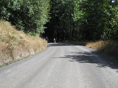
I spent a considerable amount of time considering what to do as we (I was riding the loop with Kevin Brightbill, who lives conveniently close enough to me that it’s easy for us to ride each other’s permanents) wound our way up Thompson, across Skyline, down Germantown (which is being chipsealed, so we got a little more gravel to make up for Saltzman/Leif Erikson)/Old Germantown, then along the traditional Phillips/Helvetia/Jackson Quarry/etc and, by the time we hit the climby (and gravelly) parts of Dixie Mountain Road (at which point my thoughts became wonderfully concentrated on keeping the bicycle upright and on its wheels as I slowly slithered my way upgrade through loose dusty summer gravel) I thought that the best solution would be to go on Skyline to Thompson, then drop down into the city and do a lap around Mount Tabor before finishing.
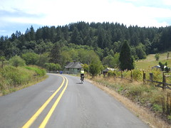
Kevin had a better idea. He pointed out that Rock Creek Road would give us another mile or so, and we could take Skyline to 26, then drop down by the zoo to make up the rest of the miles. I’d never actually been on Rock Creek Road, so that seemed like a good plan. And it was – with the notable exception of a sliver of road by the old Oregon Electric mainline from Portland to Banks, which looks like a war zone – it’s a terrifically scenic road that winds past rural houses, farms, ranches, and even a bit of open range and which adds three miles (of difficult to control, alas!) road to make up for the soon to be detoured around road closure on Leif Erikson.
So we discussed how to make up the other couple of miles. We first thought that going down Thompson/Cornell would make up the other 2 miles, but decided it probably wouldn’t after all.
Skyline to the Zoo was brought up, and we both thought it would be a couple of miles too long, but better err on the side of bonus miles than short-change the route.
It’s kind of climby getting over to highway 26 on Skyline. And it’s amazingly disorienting, even though I’ve done it before – by the time Skyline started dropping down to the little shopping center just northeast of 26, my brain was convinced we were coming from the south and needed to cross the bridge over highway 26 to get to the Zoo. But despite my confusion, we did find the correct way to the zoo and dropped down the hill to downtown Portland, then across the Hawthorne bridge and east to 12th, and then back to Sellwood, which we reached 6h09 after the brevet clock started at 9am (6h01 after we left Marsee Baking, because I was finishing my coffee.)
The gory details of the emergency rerouted loop turned out to be
- 115 km (instead of 114),
- 6600 feet of climbing (
only 3000 feet less than my 400 no, the 400 has 14,000 feet of climbing))
- at a whopping 11.8mph brevet average.
I will probably have to either withdraw the loop for the duration of the Leif Erikson roadwork or do a new application for a reroute that adds back the missing 5 miles.
But on the bright side, the amount of climbing in this last-minute reroute makes the 400 look easy (modulo the small detail of riding an additional 180 miles; We’ll see how easy it feels when I stagger back in the door on Sunday morning!)
As always, photos are on flickr.
—orc Thu Aug 9 23:24:55 2012
Aug 08, 2012
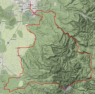
The days are starting to get shorter, and soon they will be short enough so that anything except a flat 200 will start and/or end in the dark. I didn’t think I would be able to checkride my new 400k this year, but when I was casting around to my friends to ride a 300 this week my friend Kevin said that Saturday would actually be an excellent day to check out my 400.
Can’t argue with that. 400k is a bit long to travel by myself (I’ve done it, but it was, um, unpleasant,) but the miles go by faster when I’m riding with other people. So I guess this Saturday will be my 3rd 400 for the year, and I’ll have to ride my new 300 sometime next week.
This will certainly get me ready for the summer 600, despite being on a forced rest week just before that loop (I need to go to That Paradise That Is California™) for programming related activities, and I don’t think the rest of the autonomous collective would appreciate my bringing down the mlcm and running off to gallop up and down the mountains that separate Santa Cruz from the rest of the Bay Area instead of doing those programming related activities that I went down to do) just before the 600 is supposed to happen (maybe I’ll need to, ugh, fly the gropeworld express back and forth instead of taking the train.)
But in any case that’s a couple of weeks away and Saturday is only 2 days away, with nothing inbetween but a couple of days of iPod app writing, a gravel populaire and maybe a run up to Joe’s Donuts.
—orc Wed Aug 8 22:46:59 2012
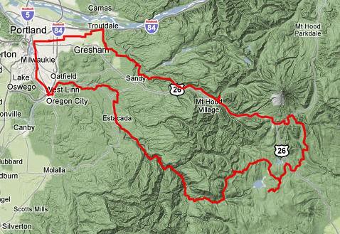
Several years ago, I rode Michael Wolfe’s Barlow 300k which, aside from the tiny details of starting inconveniently in Sandy, a hikeabike across Anvil Creek (easier done with an xtracycle than with cleats!) and freezing my butt off descending from Barlow Pass, was a spectacularly scenic wander through the wilderness that I wanted to do again. Alas, the brevet wasn’t done again (until this year – the summer 400k this year was basically the Barlow 300k with the Maupin end filed down and a start in Portland rather than Sandy) and I wanted to get up into the mountains again, and maybe get RUSA credit for doing so.
After a few iterations and revisions I came up with a slightly different route that started in Portland and still got many of the scenic high points (and added a few new ones,) though I had to leave the leg down to Maupin out to keep the trip times down under 20 hours.
As you might expect, this route starts at Milwaukie & Bybee (most services start opening at 6am, but there’s a QFC and 7/11 a few blocks north and a Plaid Pantry 1 block south on Milwaukie) and works its way south on 17th, the Trolley Trail, and River Road down to Oregon City, at which point it heads eastward on the Clackamas River Road, Springwater Road, and Baker’s Ferry Road to Barton and a junction with OR 224, which you almost take all the way up to Ripplebrook Guard Station.

The almost is that there is a quieter and more scenic way to get from just north of Barton to Estacada. Just south of Barton is the junction with Amisegger Road, which takes you east to the backroads that you’ll be taking instead of 224. But first, some climbing; on Judd Road, you need to climb 300 feet or so up the side of a bluff on a moderately steep grade, and then wind upgrade for several miles between farms and what would be subdivisions if Oregon didn’t have fairly strict land use laws, then descend back into the valley and take Eagle Creek along the edge of a lower bluff all the way up to Estacada.
But as you’re climbing up this bluff you might wonder why I didn’t route you along the slightly shorter and much noisier, busier, and glass fragment covered bike lane along 224.
Well, there’s the small matter of the descent that makes this all worthwhile. The bluffs here are fairly steep and after you’ve transited Judd Road, crossed highway 211, and zigzagged over to Van Curen Road, you come up a small rise and there’s no road visible in front of you. Keep moving forward, because the road is there – it’s just going down really steeply to get you back down to the valley floor. I’ve made 50mph dropping down this hill without tucking, and even if you can’t get this speed it’s still an immensely thrilling feeling to drop over the edge of this cliff and see the road appear before you as your bicycle plunges down the ramp.
Eventually you reach the bottom, and eventually your speed reduces to the point where everything isn’t blue shifted, and then it’s a simple ride through more farms, ranches, and eventually a cluster of massive churches, as you ride up to the first (open) control in Estacada.

If your supplies are at all low, this is the place to top everything off, because south of here the pickings get very slim for the next 90 miles and you’re going to be doing a bucketload of climbing while you’re at it.
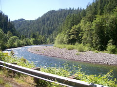
When you’re finished with this control, it’s time to head south to the next control at Ripplebrook Guard Station. Yes, you’re going to have to go back onto highway 224, but once you get south of Estacada you’re in the mountains and 224 becomes stunningly scenic. And, aside from two ramps (a long climb to get over a mountain spur adjacent to PG&E’s West Side Hydropower facility at Faraday Lake) and an almost as long climb to get up to the ledge that Ripplebrook sits on it’s all very sedately graded, with only a couple of spots where you’ll be suddenly struggling to keep up your speed until you realize that you’ve gone up a couple of hundred feet above the river and need to wait for the river to come up to meet the road again.
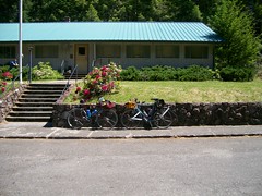
The control at Ripplebrook isn’t strictly necessary, but is more a not-particularly-gentle reminder that if you need more food and water you need to get it NOW because the real climbing is about to begin (9000 feet or so in the next 65 miles) and there are very few chances to top off your water supplies, and no chances to get more food, until all of this climbing is over. Fill your waterbottles here, and if it’s a hot day buy some bottled water to throw into your handlebar bag/trunk bag/jersey pocket, because the climbing starts almost immediately after leaving this control.
Highway 224 continues south for about half a mile past Ripplebrook, then comes to an abrupt end at a junction with NFD 46 (to Detroit) and NFD 57 (to Timothy Lake.) Turn onto NFD 57 and start climbing; you climb about 800 feet in the next 4 miles, and then give up about 400 feet in the two miles past that. The climb takes you up quite a ways onto the side of the valley of the Oak Grove fork of the Clackamas River, then drops you down next to it and hopscotches across it several times before you reach the junction of NFD 58 (and, coincidentally, the end of the paved part of NFD 57 – NFD 57 is paved up on the top of the plateau, but there’s 7 miles or so of gravel here including at least one steep loosely paved ramp.
No, your destiny is NFD 58, which climbs (and climbs, and CLIMBS) about 2000 feet up to the base of High Rock in the next 7 miles. It starts out steeply, moderates for a little while, then starts slowly pitching up again (not evenly; it pitches up, then moderates about halfway, then pitches up a little more severely until you’re climbing what feels like a 20% grade near the top) and goes on and on until you’re wondering if it will ever end.
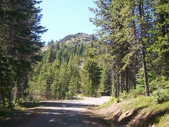
And then you curve left and there High Rock is, looming over the last insanely steep section of the ramp. NFD 58 goes off 4 directions here, but fortunately only one of those directions is to the right, because that’s they way you want to go. This ramp is not quite done (there’s still 500 feet of climbing) but the grades are nowhere near as insane as they were just before this junction and you can get some spectacular views off to the south whenever the road passes through clear cuts. If it’s a clear day, you will be able to see Mount Jefferson off to the south, and there are a couple of spots where you can see Timothy Lake looking like a photograph 1000 feet or so below you before the road curves northwards and starts to descend.
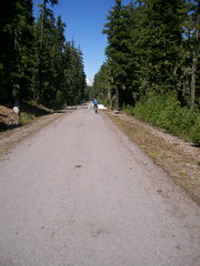
For a while you’re high enough to catch glimpses of Mount Hood peeking through the trees directly in front of you, but the road eventually turns back to the east and there’s not much to see except for miles and miles of forest with the occasional clearcut before you reach Skyline Road and a quick outandback 4 miles down to the Clackamas Lake Ranger Station, which, besides being a control, also has water (and maybe snacks; riders this year have reported that the visitor center there does have snacks for sale.)

When you’ve topped off your water, you turn around and head east again on Skyline Road, climbing past the campgrounds that circle Timothy Lake, into the territory of the Confederated Tribes of Warm Springs, and then to highway 26, which is a short but busy connection to the last and most scenic wilderness part of the loop.
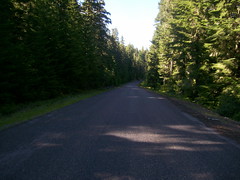
It starts with NFD 43 (Cedar Burn Road), which takes you six miles east to the White River, first rolling through open range (watch out for cattle grates) and logged over parcels, then dropping precipitously down into the White River Valley. You’ll pass a section of the old Barlow Trail here, but don’t take it because it’s not very well maintained and you might be unhappily surprised by a tangle of downed trees or a landslide, then cross onto the lahar flows that make up the floor of the valley, go over the White River itself, then run into the junction with NFD 48, which will take you most of the way up to Barlow Pass.
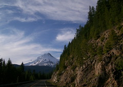
NFD 48 climbs basically all the way up to highway 35, sometimes steeply, but always relentlessly, but it climbs up the east side of the White River valley, which means that after a while almost every turn (assuming a sunny day) gives you another view of Mount Hood, each one more spectacularly sky-filling than the last. Eventually it gets so large that it ceases to be a mountain and becomes more of a snow-colored sky as you round the last curves and reach the junction of highway 35, which is only 7 miles away from Government Camp.
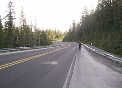
There’s a bit of climbing here, though. After crossing the White River for the last time, the road drops from about 4000 feet down into little valley, then climbs up to about 4200 feet to cross Barlow Pass, then drops about 700 feet to the junction with highway 26, and then climbs back to just barely over 4000 feet just east of Government Camp, where there’s another control so you can stop and get some food into you before heading back to Portland.
The six or so miles ahead are likely to be the coldest you will get on this trip. Highway 26 drops about 1800 feet down to Rhododendron, with most of the elevation given up in the first three miles. And in the evening and at night there’s always a cold wind blowing up the Zigzag River valley. So bundle up before heading out, and down you go.
I’ve come down this road in an automobile, so I know the views are pretty spectacular. But when I’m on my bicycle I’m too busy shivering to pay attention to anything except trying to keep from vibrating my bicycle into traffic or the ditch. But after you get down under about 2500 feet, it warms up and you can stop and delayer before you you reach another section where you have to pedal again.
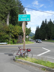
And that section is in Zigzag, where the route gets off highway 26 for a quieter run along the Barlow Road and Marmot Road. You duck north on Lolo Pass Road for about a mile, then turn back west onto Barlow Road, which takes you, mainly along the Sandy River, but occasionally swerving inland and running between vacation home developments, seven miles down the road to Marmot Road, which travels past vacation homes, woodland, and then ranch land, for about 4 miles before interrupting your forwards progress with a short, but insanely steep ramp up a bluff. This is a warning ramp, because another couple of miles brings you to Devil’s Backbone, which is climbed by a couple of almost equally steep, but much longer ramps (the first one zigzags up about 300 feet, then the road flattens out and runs through what’s left of the town of Marmot, and then another one which goes up about 400 feet, but without zigzags, and gets you up on top of Devils Backbone proper.)
If it’s still daylight, there are stretches along the road here where you can look left and see the hill sloping away from the road, then look right and see the same thing. Devil’s Backbone separates the Sandy River valley from the Bull Run River valley, and for some reason the settlers who originally made up the road decided that putting it over the top of Devil’s Backbone was the best way to do it. You’re done with the steep ramps, but the road keeps going uphill until it tops out at something over 1500 feet on a broad farm-covered part of Devil’s Backbone that local residents call Little Switzerland.
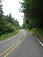
And then down you go again, dropping away from the farmlands and back into woodlands, then back into more farmlands on another broad plateau, then carving your way down to the Sandy River along a gently curving road that takes you down to the Sandy River and the last substantial climb of the day.
Here you cross the Sandy River and go up the side of the bluff – maybe 300 feet? – along a gently graded road that switchbacks up the bluff. At the top of this ramp you descend along Lusted Road for a couple of miles (it will likely be dark here, but you’re once again back in farmland and country houses)
you’ll turn onto Dodge Park Boulevard, which takes you up another bluff, but on the old Mount Hood Railway ROW, so it’s not steeply graded at all.
You’re now about 25 miles out, but the hard part of the ride is done. Take Dodge Park Blvd into Orient, then 282nd/Troutdale Road north to the final transit control, and then you work your way into Portland on city streets, all either level or gently graded, with only one climb left as you climb over the shoulder of Mount Tabor on your way to the bicycle boulevard on Lincoln St. And at the end of Lincoln St you work your way through the maze of diagonal streets that is Ladd’s Addition, then turn onto 11th Ave and head south all the way back to Sellwood, where your ride is finished.
Pictures from earlier rides are here and here, you can look at the cuesheet, and you can contact me to ride this route for RUSA credit. Note that you need to take lights and the full complement of reflective gear that RUSA mandates, plus it would be a very good idea to take an additonal layer and windproof jacket along for the descent down from Government Camp, and if it’s at all hot you will need to carry three waterbottles.
—orc Wed Aug 8 14:57:43 2012
Discount has, after a few months where I was occupied putting out a bunch of fires (then starting new fires … whoops!) been shoved up to version 2.1.5a with the addition of a whole bunch of tweakery to make it build and compile without the llvm C compiler throwing a screaming fit over imaginary deviations from the latest non-backward-compatable C standard of the year, as well as a small collection of new features.
The feature and bug list is
MKD_NOSTYLE – treat <style> blocks as regular html.- some github flavored markdown support; gfm_…() input
methods that put hardbreaks (== two spaces) at the end
of every input line
- a whole bunch of configure.sh tweaks to work around
the tiny detail that clang is even more anal-compulsive
than gcc is.
- support for github flavored markdown backtick-delimited
code blocks (in addition to tilde-delimited codeblocks)
- in the
markdown program, add
- -S flag (tell markdown to spit out style sections)
- -n flag (tell markdown not to output generated text)
This code has been pushed through the testsuites without failures (or core dump) and is now being used on this weblog (if you can see this post, it works), so it’s the ideal New Code! for you to load onto your machines and see what falls out.
(there was a 2.1.5 briefly, but then I discovered that I misplaced a #ifdef on a piece of experimental code and instead disabled SETEXT headers. Whoops! again, but for a different reason!)
—orc Wed Aug 8 12:06:34 2012
After a considerable interval, annotations has been pushed up to version 1.0.4.3 with the addition of a single feature.
My old archives were just a list of the year+month where I’d posted articles to the weblog. After a few years, this gets to be a fairly long list (8 years ~100 lines) which is hard to navigate. So I modified reindex.c to support calendar-style archives, where instead of a list you end up with a list of tables where each table looks like this:
which is considerably shorter than the old scheme.
It’s enabled by the option calendararchive in weblog.conf (this overrides the old simplearchive option (which was used to generate an unstyled list of <li>...</li entries)) and it’s written to archive.html just as all of the the otherly formatted archives are written.
It’s still a pile of garbage, of course, but it’s now a pile of garbage with a new archive list format.
—orc Wed Aug 8 10:15:31 2012
Aug 07, 2012
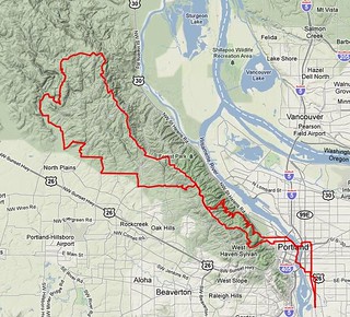
Despite appearances, not all of my routes head out SE of Portland. Some of them head northwest, and take advantage of some of the gravel roads that clutter the countryside around Portland.
This route is one of them. It starts, as is traditional, at Bybee & Milwaukie, then heads north towards downtown Portland, winds its way through the city center, then heads up Cornell Road to Skyline Blvd.
My normal route up to Skyline is to take Thompson Road, but when I made up this route Thompson road was closed because of landslides. So instead, it turns off onto 53rd Drive, which says Hello, Sailor! by immediately putting you on an eyepoppingly steep ramp almost directly up the face of the West Hills, and this ramp only moderates to just steep (with one small descent in the middle which is paid for almost immediately by a resumption of the steep ramps) until you’re almost at the end of 53rd Drive, where it drops down to the junction of Thompson Road, which will seem almost completely flat compared to what you’ve been through.
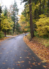
Thompson goes up to Skyline, where the route turns north and rolls along Skyline up to Germantown Road, where it goes west again and drops down into the Tualatin River valley (taking Old Germantown for much of the descent; Old Germantown is really steep and twisty, but it’s a residential road and there is almost no traffic on it compared to Germantown proper) and over to Old Cornelius Pass Road, which is where the first control – at the McMenamin’s Rock Creek Tavern – is located.
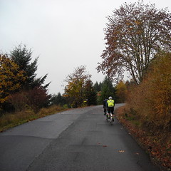
From this control the route goes west again, hugging the base of the hills to the north. Out Phillips, up Helvetia, up Jackson Quarry, then down Mason Hill to the Junction with Jackson School, which goes north to a junction with Shadybrook Road, and then north again to the junction with Dixie Mountain Road. And here the fun begins.
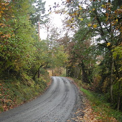
The first few miles of Dixie Mountain Road are pretty typical country road; it winds gently uphill along the side of a valley, undulating gently as it goes. But then you’re greeted with a ROAD OUT sign and have to jog across the valley on a detour (I’m not sure if calling it a detour is actually the right term here, given that Washington County has abandoned and ripped out about half a mile of road and the bridge that washed out) to Collins Road, which is paved for maybe 1000 feet and then turns to gravel. For 9 miles. All uphill :-)
The road winds uphill through forested areas (with houses and farms scattered left and right), crosses a bridge and becomes paved for about half a mile as it goes through the village of Shadybrook, then goes back to gravel and starts winding uphill in earnest. For a while it winds between farms, but then goes into forestland where the only signs of civilization are the logging roads that come in from the left and right.
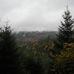
And it goes up and up, with breathtakingly beautiful views off to the left, until you finally top out on a long ridge and break briefly out into farmland before plunging back into the forest just before the next control at the Dixie Mountain grange hall. And from here you head back east, uphill for a while, but then (after reaching Rocky Point Road, which is paved) generally downhill (and occasionally steeply downhill) all the way to Saltzman Road, which is the start of another 9 mile gravel section.
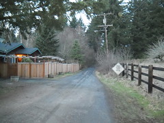
Saltzman Road is a fairly steep descent of the west hills – it starts steep and gets much steeper before you reach the bottom – but you’re only on it for about 3 miles before turning on Leif Erikson Drive, which takes you across the face of the West Hills, climbing a bit for a few miles, then descending, until you’re back in the populated part of Portland and on city streets at Thurman Ave, which is the end of the gravel excitement for the day.
Thurman takes you down into the center city, then you take Lovejoy, et seq, over to the Broadway Bridge and then drop down back into Sellwood via 21st/12th Aves. And you’re done! (and now it’s time to go home and get all the dust and grime off your bicycle.)
I don’t have any official preride pictures, but you can look at the bikeroutetoaster route, a cuesheet, and, of course, you can contact me if you want to ride this loop for RUSA credit.
—orc Tue Aug 7 13:36:59 2012
Aug 06, 2012
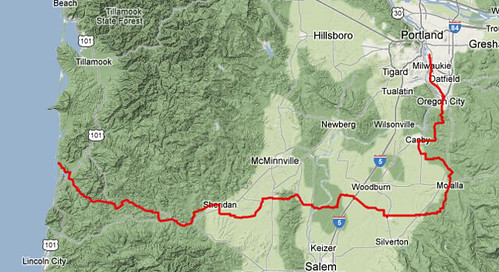
My Portland/Pacific City 160 populaire is a nice fast (if somewhat climby) way to get out of Portland and down to Pacific City, but it’s not quite so good coming back – the climb up to the summit of the Coast Range is a lot longer, plus you end up riding 30 miles on 99W during rush hour (finishing up with the Sellwood Bridge also at rush hour, which is an extraordinarily unpleasant experience.) So when I was making the routes to Pacific City, I made a different one for the return trip.
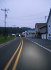
This route starts where the Portland/Pacific City 160 left you; at the Pacific Ave bridge over the Nestucca River. But instead of heading towards the Nestucca River Road, it follows the route that orrando’s Three Capes 300k uses to get from Pacific City back into the Willamette Valley; south on Brooten Road to highway 101, then east on the Little Nestucca River Road.
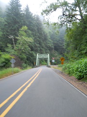
The Little Nestucca River Road is a very pretty route, but for the purposes of this brevet the prettiness is not quite as important as where how you go over the summit of the Coast Range. Here you go over Sourgrass Summit, which is at 572 feet (and it takes about 15 miles to get there from highway 101) and the approach to it is almost uniformly gentle – there are a couple of short steep ramps that might make you want to drop to an alpine gear, but the rest of the climb can be taken in your big ring at a good pace. Alas, it being a low summit doesn’t give you much of an opportunity to go rocketing downhill, but the highway (The Little Nestucca River Road joins Hebo Road about 5(?) miles west of Sourgrass Summit) gets sketchy when you get close to Grande Ronde (it’s been grooved in preparation for repaving, but in the last 3 years only about a tenth of it has actually been replaced) and is not particularly good for zooming right along.
When you reach Grand Ronde, the route cuts over to highway 18, passing by a general store at the intersection of Grande Ronde Road and highway 18 (more useful later in a longer brevet, but if you really need supplies this is a good place to get them) and then heads west along highway 18 for a while.
Highway 18 is a kind of grim route, but it’s the only way past the Confederated Tribes' casino, and not too far past there you need to get off the highway and onto the Yamhill River Road. The problem is that the Yamhill River Road is no longer connected to highway 18, so you have to hop off your bicycle and walk it down a 50 yard path past the barriers at the end of the Yamhill River Road. And then you continue east on a basically deserted residential road until it swings north, intersects highway 18, and becomes business 18 for the ride northeast(ish) to the first control in Sheridan.
Once you’ve finished in Sheridan, it’s time to head east again. Bridge Road (the main drag in this small town) becomes Ballston Road, runs south out of town, then turns east and a little north along the railroad line through Ballston and beyond, eventually becoming Broadmead Road before merging into highway 153, which drops you into Amity, which is where you bid farewell to the Three Capes 300k route and head off to the east.

East of Amity, highway 153 climbs through a low pass in the Eola Hills, then merges onto highway 154 for a six mile run down to the junction with highway 221, which you stay on for maybe a mile before turning east again onto Wheatland Road, which takes you to the tiny village of Wheatland and, more importantly, the Wheatland Ferry, which takes you out of the relatively hilly western part of the route and onto 20-odd miles of flat farmland as you head east across the prairies to the foothills of the Cascades.
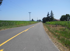
As you travel you’ll pass through Gervais, Mount Angel, and finally Marquam (though don’t blink here, because there’s not very much to Marquam except for a pub at the junction of highway 213 and Knowlens Bridge Road) so you’ll have plenty of opportunities to stop for a snack as you go. And then you run out of prairie – just east of highway 213 the route turns onto Wildcat Road, which enthusiastically climbs up onto the foothills of the cascades in a series of steep ramps, steep plunges into small river valleys, then steeper ramps that climb out of those valleys. It’s quite pretty here; it’s not terribly wooded (a feature that you might curse on a sunny day) but the road travels through small farms, orchards, ranches, and the occasional cluster of country houses. And eventually you reach the summit (at the junction of Wildcat Road and Fox Road) and immediately plunge down out of the foothills towards the next control at Molalla.
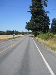
From Molalla, you go north and west on back country roads south of the Molalla River, then north on highway 170 into the final transit control in Canby, and from there it’s up onto the Boring Lava to go north on Central Point Road, then dropping down off the Lava, then dodging over to Leland Road to climb back up it again. And then, after working your way through Oregon City, you find youself back on River Road, then the Trolley Trail, then River Road, and then the Trolley Trail again as you head towards Sellwood.
A quick run up 17th Ave (the traffic signals at 17th/Harrison/99e are not designed for pedestrians or bikes, so you might find yourself better off just taking the sidewalk up 17th to the intersection with Lava Drive, then dropping back onto the street for the rest of the way and you find yourself at the final control at Milwaukie & Bybee in Sellwood. There are plenty of services here; 3-4 bars, a handful of restaurants, convenience stores north and south on Milwaukie, and a grocery store (QFC) three blocks north. So you’ll be in good shape to get your card signed, then have a chance to sit down, have a drink, and plot your next trip to the coast and back.
Pictures from my checkride are on flickr, you can look at the cuesheet, and you can contact me to ride this route for RUSA credit.
—orc Mon Aug 6 10:27:08 2012
Aug 05, 2012
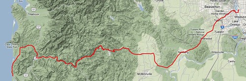
There are basically three ways to get over the Coast Range when you’re travelling between Portland and Pacific City. You can go on Highway 6 across to Tillamook, Hebo Road/Little Nestucca River Road, or Nestucca River Road. The shortest route is to take the Nestucca River Road & 99W, which is what this permanent does.
It starts out in Sellwood, works its way down to, then crosses the Sellwood Bridge, and takes my favorite route (Taylors Ferry->LaView->Corbett->Barbur) up the bluff on the other side of the river to get to 99W, which you then stay on for the next 30 miles before you reach the first control in Lafayette. 99W is a typically suburban wide busy road, but it has the advantage that it’s fast (and if you leave at 5 in the morning, it’s not that busy) and it travels through enough suburbs and small towns so that you’re never more than 4-5 miles away from services of one kind or another. And when you get south of Dundee, the road pretty rapidly diminishes to a two-lane country road which is far less hectic than it was closer to the city. But it’s still 99W, and it will probably be a relief to you when you turn towards Carlton on Mineral Springs Road.
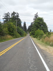
Mineral Springs Road dumps you onto Hendricks Road, and you then turn to the west and follow the road for about 42 miles, (in Carlton, it becomes Main St, and then on the other side of the town it becomes Meadow Lake Road, which becomes the Nestucca River Road after a considerable amount of climbing, and you only have to change roads when it dead-ends into Blaine Road about 7 miles east of the town of Beaver.) But before you go too far, you go through Carlton, where you should stop for supplies and to top off your water bottles, because after you leave town there is nothing in the way of services for the next 45 miles, and there’s a great huge hill between you and those services.
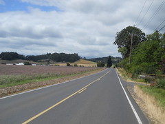
Meadow Lake Road starts off as a gently rolling country road, then crosses Westside Road and immediately climbs a set of huge steep hills before dropping down to the bottom of a valley and working gently upgrade for a while. And then the valley narrows and the road tilts upwards and starts snaking its way up a steadily steepening mountain. Up it goes, through ranches and tree farms, for 5-600 feet before levelling off on a saddle that lasts just long enough for you to think “is this it?” before it tips abruptly up again, climbing more steeply past small farms, woodlots, and just plain woods. One really steep short ramp at the very top of this section and you come out on a second saddle, which is longer but surrounded by enough hills so you won’t think that this is the top (at only about 1200 feet.)
As you start climbing the next ramp, high chainlink fences start appearing north of the road, all signed “CITY OF MCMINNVILLE WATER DISTRICT. KEEP OUT” at regular intervals, and eventually you come up on a very short saddle with a water district access road dropping off to a gate to the north. Are we done?, you might think? No, sadly not, because very soon after that access road Meadow Lake Road turns into two miles of an increasingly raggedy logging road (paved, but the pavement has seen better days and whoever is responsible for maintaining it isn’t really spending much time or money on it) which once again tips severely up and climbs up a moderate ramp to a BLM informational kiosk that marks the point where Meadow Lake Road becomes the Nestucca River Road (and becomes well-paved again, thank goodness!)
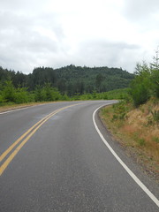
But are we done climbing? Oh, no, not in the least; the Nestucca River Road drops away to the west for a while, then starts climbing a gradual ramp again out into a logged over area where it appears to be aiming for a gap between two mountaintops. But, sadly, as you reach the end of the logged off area, the road curves sharply left and runs you all the way up to the mountaintop to the south, where it finally relents and levels off.
At about 2000 feet.
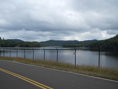
You roll along on gently undulating roads for a while, and then come to a large lake nestled in the mountaintops. This is McGuire Reservoir, and it’s the water supply for the city of McMinnville, and it also marks the top of the climb; to the west, it’s basically all downhill from here, and you can start making up the time you lost climbing up this hill.
There’s a 2.5 mile gravel stretch along this descent, but, sadly, I’ve never ridden it because on the day I did the checkride there was a construction project going on that blocked the gravel section and forced a slight detour. I’d dropped about 300 feet off the top of the mountain when I encountered a ROAD CLOSED sign which detoured me up a side road to get around it.
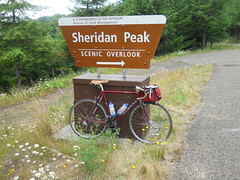
The side road is Bald Mountain Road (the detour is L Bald Mountain Road, R Bible Creek Road, L Nestucca River Road,) and it says “hello, sailor!” by going up 1000 feet in the first 3 miles, but to make up for it it’s a fairly quiet road and the view from the top is very nice. And then it rewards you by giving you 15 miles of fast curvy descent on quiet roads with good sight lines. It’s 5 bonus miles that are not to be missed (I will never put an info control on the Nestucca River Road to keep you from this detour) and will keep a smile on your face all the way down to Beaver.
But in either case you go skittering down the Nestucca River Valley all the way to the next control (and services) in the town of Beaver, which is less than 20 miles from the finish. And after getting your card stamped and restocking, you head north for a few miles on highway 101 before turning back towards the ocean on Sandlake Road, which runs west towards Cape Lookout for a few more miles before turning south and running you towards Cape Kiwanda and the end of the line in Pacific City. When you’re almost to Cape Kiwanda, Sandlake Road turns inland, but you continue directly ahead on Cape Kiwanda Drive along the beach, then around behind the cape before dropping into the northern side of Pacific City.
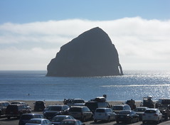
When you enter Pacific City, the Pelican Pub (and Pacific City’s Haystack Rock) will be off to the west, but resist the temptation to stop here because you still have a mile and a half to go. Carefully proceed south along Cape Kiwanda Drive (the road is not in the best shape and it has a series of spectacularly toothrattling potholes just sitting there in the southbound lane waiting for you,) then turn back east on Pacific Ave, ride up to Brooten Road and you’re done!
There’s a Shell Station on the NE corner of Brooten road that you can get a receipt at, or if you’re hungry for real food there’s a BBQ place a block south on Brooten, the Grateful Bread cafe a couple of blocks north on Brooten, and a couple of other beach town restaurants scattered between those places. And about 10 blocks north on Brooten is Pacific City’s little supermarket, so there are many choices here.
When you’ve got your card signed, then you can go back to the Pelican Pub and have a drink or two while figuring out which permanent you’re going to use to get back to Portland.
Pictures from my checkride are on flickr, you can look at the cuesheet, and you can contact me to ride this route for RUSA credit.
—orc Sun Aug 5 18:26:53 2012
Aug 04, 2012
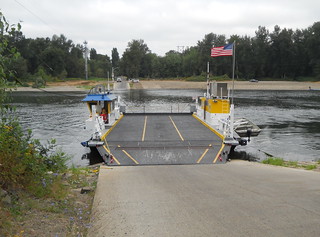
When we started planning to go down to Pacific City for a week, one of the early preparations I did was to make up a pair of transit permanents to get there and back. The trip out, a simple 160k loop that features 99W and the Nestucca River Road, is a good lazy morning ride (if climbing 4500 feet or so is your idea of lazy) where you can leave at 10am and still make it into Pacific City before dinnertime. The trip back is a somewhat longer loop that takes the Little Nestucca River Road, then cuts east across the Willamette valley until it splashes up against the foothills of the Cascades, then heads north to get into Portland (via a route that is not 99W through Tigard.)
I rode down on the Nestucca River populaire on Monday, and yesterday it was the return route’s turn.
This route felt like two different 100k rides laid end to end; the first one was cloudy, cool, and still, and I cranked out the 62 miles from Pacific City to the Wheatland Ferry in under 4 hours. But after I got off the Wheatland Ferry, I spent the next 100k riding east, then north against a stiff headwind (I passed one of those plywood “house for sale” signs north of Molalla and the sign was lying horizontally as the wind attempted to blow it away from the signpost) and took over 6h30 to claw my way back home.
The day started nicely enough; when I got out the door of the cottage, it was cool and cloudy, with some fog still clinging to the top of the Coast Range, but I warmed up pretty quickly as I proceeded (on the traditional Three Capes 300k route) south out of Pacific City to the western terminus of the Little Nestucca River Road. I had my cellphone in use as a music player, and I guess it helped, because I shot up the Little Nestucca River Road at an almost flatland speed (~15mph average) and reached the junction with Hebo Road, and then the top of the pass, almost before I knew it (1h05 to the top of the pass), then tipped down and flew down into Grand Ronde, where I jumped over to highway 18 for the short run out to the portage to the Yamhill River Road.
The connection to the Yamhill River Road is not terribly obvious, but fortunately I’m not the only person who’s had the idea of portaging there, and there is an obvious path there that gets you off the shoulder of 18 and down to the end of the road (about 50 feet.) I guess it would be possible for someone to just ride down there, but I just hopped off the mlcm and walked it over to the road. And then it was a quiet 4 miles over to the highway 18 crossing, and a slightly busier six miles down to the first control in Sheridan. And then off to the east, still following the route of orrando’s Three Capes 300, but eventually diverging from that route in Amity, where I continued going east and over the range of hills that separate Amity from the Willamette. And eight or so miles later, I rolled up to the Wheatland Ferry landing, just in time to see the ferry pull away and sail across to the other side of the Willamette.
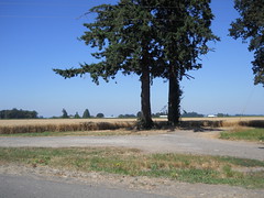
I reached the east side of the Willamette a little bit after 10am. At this point I thought that a <8hr 200k might distantly be doable, but a more realistic loop time would be slightly less than 9 hours. The weather, however, had a different idea about my brevet timings, and from Wheatland east I proceeded into the teeth of an enthusiastic headwind under a blazing sun.
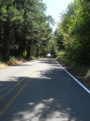
I tried to keep up my pace, but found it increasingly difficult to do so. By the time I’d cleared Gervais, my brevet average was down to about 13mph, and it inched slowly downwards from there as the unceasing headwind sapped my energy. I was hoping that when I reached the foothills of the Cascades that I’d get some respite from the wind, and I did, but the foothills of the Cascades came in the form of Wildcat Road, which went enthusiastically up in a series of ramps, many of which were so steep that I had to drop down to my dump gear and stand up to get even a slow creep up the ramps. (I had ridden Wildcat Road before, during the spring 200k, and it didn’t seem that bad, but I was riding with a friend then and we were riding south instead of north.)
Eventually I fell out of the foothills down to Molalla again, but by then I was out of water and getting close to being out of energy. The gas station that I used for a control on the Molalla 200k had closed, but fortunately there are several other stores (a Subway, a Hi-School Pharmacy, and at least one other convenience store) on Molalla Ave north of highway 212 so I could stop, get water and soda, then sit in the shade for a while before heading out again.
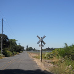
Now, one of the things I had forgotten when I headed out to Pacific City this week was to print out a brevet card and cuesheet. So I loaded the cuesheet onto an iPad instead and I was periodically taking it out of my rando bag and trying to memorize the next half dozen cues. This had been working pretty well (at the cost of having to stop repeatedly to pull out the iPad to read the cue sheet) but north of Molalla I fell victim to a bikeroutetoaster miscue (a R onto Sprague Ave was listed as Sprague Ave/Vicks Ave) and turned L on Vicks Ave, which is about a mile south of Sprague Ave, and rode all the way to highway 213 before realizing my mistake.
Oh well, can’t be helped. A few extra km never hurt anyone, particularly since the route hasn’t even been approved yet.
But once I fixed that, it was easy going as far as the cues go. There are a grand total of 3 turns from Sprague Ave before I reached highway 170, which is a really familiar route into Canby, and from Canby I’m basically home as far as my familiarity with the route goes. So into Canby for the Canby control, then east to Central Point Road, north to Criteser, east to Leland, and Leland into downtown Oregon City.
I ran out of water on Leland (after stopping in a patch of shade to cool down halfway up the hill; I looked at my watch here and it was already 9h07 into the ride, which meant that not only was I not going to get a <9hr 200k, I wasn’t even going to get a <10hr 200k.) so I stopped in Oregon City for nasty sports drink and strawberry milk, then pushed onwards against the wind.
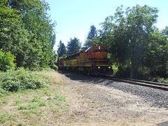
When I reached Milwaukie, I stopped briefly to photograph a P&W train that was paused on the Oswego Branch waiting for access to the ex-SP mainline, but that was the last stop of the trip and I rolled into my driveway at about 4:25, 10h33 after I started the ride in Pacific City.
My moving speed on this brevet wasn’t that bad (13.9mph) but my brevet average was just shy of 12mph (12.1 trip average, but that includes the Vicks Road bonus miles.) Drat, I wanted to do the loop faster and avoid the afternoon heat :-( Pictures are, as is traditional, on Flickr, and if you find my sanity on the road you don’t need to return it.
—orc Sat Aug 4 09:38:14 2012
Aug 03, 2012
I weighed myself after preriding the summer 400k (because my Chrome +4s were falling-off-my-hips loose all of a sudden, and came in at 179 pounds. I didn’t weight myself when I was out in Pacific City, but I did ride 188k getting down there, 88k when I explored Slab Creek Road, and 210k when I came back home to where the scale was.
Still 179, which is lighter than I’ve been for, um, about 20 years.
Gotta ride more. I’d love to get down under 170 pounds, because every pound I don’t have to drag up inclines is a pound that my legs can instead move the rest of me faster up those inclines. I’m not sure just how I’m going to do this, but my “ride two permanents a week” policy this summer certainly can’t hurt.
—orc Fri Aug 3 19:24:06 2012
Aug 02, 2012
When my family finalized plans to go out to Pacific City for a week, I cranked out a couple of permanents to get me there and back again (a 160k via 99W and the Nestucca River Road, a 200k via the Little Nestucca River Road, then a bunch of secondary roads over to the Wheatland ferry, and then secondary roads out to Molalla, Canby, and Oregon City.)
But I only printed out the outbound cuesheet, and left the inbound cuesheet unprinted and on the computer until it had departed Portland in the family car (I left a day later because the best didn’t want me to finish a 400k, then ride 160k to the coast immediately afterwards) and was unavailable to me to print before I left.
Oops. At least I brought the iPad to do some software development on, so I can take the pdf version of the inbound cuesheet and stuff it into iBooks, then use the iPad as a very expensive cue sheet on the way back.
—orc Thu Aug 2 19:34:40 2012
Pacific City’s Haystack Rock in the late afternoon.
—orc Thu Aug 2 19:06:01 2012
Aug 01, 2012
I was taking another look at the trip logs for my trip down to Slab Creek Road just to see what my average moving speed was (13.2mph, in case you’re wondering) and glanced briefly at the Max Speed line directly below it.
57.6mph.
So I crosschecked it with the nice graph that shows speed vs. time, just in case it was another one of those bizarre anomalies that my Garmin 205 sometimes spits out (it’s taken to saying that my max speed is on the order of 4000 mph, with, of course, no corresponding spike in the speed vs. time graph) and, to my shock and horror, I saw a nice spike going up to the 50s, then dropping fairly abruptly down into the 30s.
Now, when I went over the top of Cascade Head the second time today I was pulling a tourist with tire problems, and at the summit I gave him directions to the next town, then sprinted off downhill to make up some time. And soon thereafter the front end of the bicycle started shimmying in a rather alarming fashion, even after I tried to dampen the shimmy by pressing my knee against the frame, so I scrubbed off a lot of speed on one of the short straight sections. So that matches that speed profile.
That’s about 7mph faster than I’ve ever been on a bicycle, and I didn’t do it on a quiet country road but on a busy major highway.
*shudder*
If anything is a sign, I guess this would be a sign.
I’ll be curled in a catatonic ball for the rest of the evening.
Update: I double-checked the data by feeding it to ridewithgps, which does a good job at massaging the data to take out unsupported spikes, and as expected it found a different maximum speed: 100.7kph
If I’d crashed at that speed they’d still be picking pieces of shattered Orc out of the side of Cascade Head. double-*shudder*
—orc Wed Aug 1 23:56:25 2012
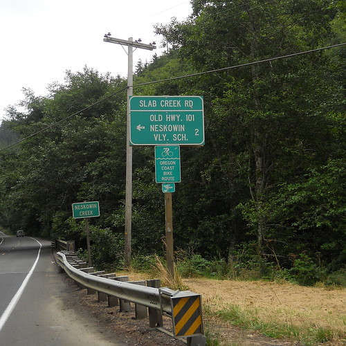
My first encounter with Slab Creek Road was a couple of years ago when I was plotting the route of the Oregon Coast 600k and followed it off 101 and up the mountain. For some reason I didn’t realize that this mountain was connected to Cascade Head, and thought that it was a bizarre climb that was put in just to torment the riders. I didn’t ride the Oregon Coast 600k that year, but the following year I did actually ride it, and when I rode up Slab Creek Road (in the dark, in the rain, following my friends Theo & Asta and being acutely miserable because I was climbing slowly even for me) it seemed like a nightmarishly steep potholed mess leading to an info control that was difficult to even see, let alone answer. And this spring, when I DNF'ed the spring 600k, the existence of Slab Creek Road was a small, but noticeable, part of why I bailed at Summit.
So when I found myself in Pacific City this week, I pretty much had to ride down there and see if my nightmarish memories of the road were at all accurate.
I’d ridden up on Monday, so I couldn’t do it then. I spent Tuesday (my birthday) being a sea slug and didn’t get out on the bicycle until about 4pm, so only had time to explore the southern end of Sandlake Road (a nicer way to get into Pacific City at night than the route that wraps around the nose of Cape Kiwanda, but it’s a nicer route with no shoulders and it’s a bit longer, so I can see why none of the brevets around here use it,) so decided last night that I would go out this morning and climb it once or twice (actually twice or 4 times, because once I transited Slab Creek Road, I’d need to transit it again to return to Pacific City) to see if my memories were at all accurate.
So at ~9am this morning (after a couple of hours of slowly getting ready to go) I hopped on the mlcm and headed out.
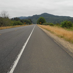
The cottage we’re staying (one of Julie’s college friends won a weeks vacation here, and invited our family along for the week) is in Pacific City Heights, which is up on top of the hill that pinches the southern end of Pacific City against the Nestucca River) is approximately 200 feet up from the ocean, so all of the riding I’ve been doing here involves a precipitious descent right off the bat, starting with a block of steep rutted gravel. So I was pretty awake by the time I got down to sea level and worked my way out to highway 101 (not via the traditional Orrando Brooten Road segment, but via a little farm road that runs along the other side of the hill that Pacific City Heights is on) and then pointed south for the 9 mile run down to my destiny.
The run down to Slab Creek Road is about as uneventful as highway 101 can be; a couple of miles across the wetlands around Nestucca Bay, a gradual climb over a few small hills, then dropping down to go just east of Neskowin, then the road tips up slightly and starts to work its way up to Cascade Head, and then, just about 500 feet before 101 tilts severely up, there’s the exit for Slab Creek Road, aka Old Highway 101.
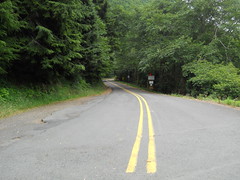
So I girded my loins, then turned off to the east and prepared to make the attack on Slab Creek Road. But no sooner than I finished the turn than I saw a construction sign informing me that Slab Creek Road was closed 4 miles up, and a hastily handwritten postscript mention that it was closed to bicycles and pedestrians as well.
Huh. well, I’ll have to see about that. On went the earphones, on went Crush Therapy, and off I went towards the oppressively steep and sketchy climb over Cascade Head. Oddly, it didn’t seem that steep today (I was chugging along in my big ring, and never felt that I was pushing to stay out of the alpine ring) and what was better is that some large stretches of the road had nice new smooth pavement at about the places where I remember attempting to dodge back and forth in the rain to avoid the potholes without also bodychecking Theo and/or Asta off the road into the canyon. And before I knew it, I was in the Siuslaw National Forest and coming up on a fairly substantial barrier marked ROAD CLOSED. So of course I had to go around it and see just how severely it was closed…
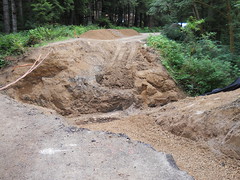
Well, no point in trying to cross here. I guess I’d just have to get to the other side of the road the old fashioned way – go back to highway 101, climb Cascade Head, then take NF 12 up to the other end of the washout. So that’s what I did.
The climb up Cascade Head on highway 101 is much more severe than Slab Creek Road is. The road pitches up about 500 feet past the Slab Creek Road exit, then climbs 700 feet without relenting in approximately 2 miles. A 6% grade isn’t that horrible compared to some of the stupidly steep ramps found elsewhere in Oregon, but it’s traditionally been enough to make me drop down to my dump gear and turtle up the hill at about 4 mph. But not today; I went down into the alpine ring, of course, but not all the way down to the bottom, and I managed to winch myself up the hill at the somewhat less slothful rate of ~7.5mph (dropping briefly to 6mph just before the summit where the road pitches up a bit more) and then flying down the other side at a more reasonably fast speed.
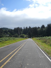
And before I knew it I was at Three Rocks Road, which cut across a valley, climbed over a low spur, and deposited me onto NF 12, which was conveniently marked with a ROAD CLOSED FIVE MILES sign and a professionally done NO PEDS NO BIKES sign.
Well, I already knew I wasn’t going to make it past the washed out bridge, but I was going to get as
close to it as I could. And because the road was closed, it was pretty certain to not be busy as I worked my way up and down the hill.
NF 12 starts as just another country road, winding past farmland and pasture as it climbs slowly out of the river valley it started in, but it soon runs back into the Siuslaw National Forest and starts pitching up more severely as it climbs Cascade Head. I was unable to stay in the big ring here, for some of the
switchbacks were fairly steep, but I made good time up the hill, only stopping once to photograph a small gravel section that I remember blowing through at speed when I was trying not to fall too far behind on the descent.
Highway 101 has a sign marking the summit, but the only indications you’ve reached the summit of NF 12 is a sideroad heading west and the main road pitching definitively down. Today there was a helpful road closed sign there, but if I had not already guessed it was the summit I would never have known.
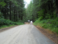
It was, as promised, 1.5 miles down to the road closure, but there I stopped at the barriers because, unlike earlier in the day, there was a crew working on the washout and it seemed like it would not be a fine plan to stroll blithely past them to get a closer picture of the disaster area. So I turned around and went chugging back to the top, once again never getting close to getting out of the big ring, and making good time until I tipped over the top and could let gravity have its way with me again.
And then I went back to Pacific City. On the way up Cascade Head, I encountered a bike tourist who had a flat but couldn’t fix it because all he had was a schrader pumphead but presta tires. So I stopped, gave him my spare tire, helped him inflate it, then escorted him to the top of Cascade Head (at 4mph, which was luxuriously slow,) then bolted off towards Pacific City.
The only items of note that happened on the return were that for some reason I got a wicked shimmy when the mlcm got up to 40mph on the descent from Cascade Head (it’s possible that having my saddle a little further back has unweighted the front to the point where it’s more willing to shimmy?) 57.5mph pn the descent from Cascade Head (oh, shit, no wonder the trucks were passing me slowly) and, when I reached the small stub section of Slab Creek Road that we were warned away from on the Oregon Coast 600 I decided that I would take it nevertheless and discovered that it wasn’t any worse than the other section of Slab Creek Road.
55 miles total, with ~4900 feet of climbing, in an elapsed time of 4h30 (~12mph brevet average even with a half hour stop to assist the tourist. Not that bad) and with a nice object lesson that maybe I tend to overthink things a bit, and should just do it instead of fretting about what to do in the first place. I don’t know if that lesson will help with any of my other demons, but it certainly won’t make things any worse, and it will be good to remember over what will hopefully be another 30 years of randonneuring (I’m sure there are some people who keep riding brevets into their 80s. Maybe I can be one of them?)
—orc Wed Aug 1 17:59:37 2012
—30—