May 31, 2009
I went out for donuts today, and, even after making my return a little bit twistier than usual (I swung down into the Sandy River gorge on Stark Street, which turned out not to add more than about 6km to the loop,) I arrived home with only 88 miles showing on the odimeter. Now, the last three times I arrived home with <90 miles on my odometer it was in the ballpark of 8pm, which is far too late to turn around and bolt out into the dusk to round my trip up to the nearest multiple of 100.
But I didn’t walk out the door at 2:30pm today. No, this time I headed out before noon, so, even taking into considering my ~1hr of parking myself at the controls (Joe’s Donuts & Kelley Point Park) that meant that me and my donuts rolled into the house at ~6:45pm. And the best was happy to let me head on out and try to round up to the nearest 100.
So I did. And not only that, but I stopped at the Big Big Store and did some shopping in the process (at MP 100.5, too – I rolled over 100 miles while looping through scenic Garthwick after I’d made a quick 12 mile dash to Gladstone and back.

This is a familiar route; I took the Springwater Trail all the way from Sellwood to Boring (including the non-improved parts; the Vittoria Randonneur tires (which claim to be 28mm; I measured them and they’re 25.5mm on the front, 26.5mm on the back) I’ve got on the Xtracycle are beginning to wear themselves square, but they’re still good for riding on the packed gravel of the trail east of Rugg Road) and encountered only one surprise when I came upon a deer wandering confusedly on the trail:

East of Boring, I varied my route a little bit by taking 213 to Orient, Orient to Kelso, and Kelso to Bluff Road. This turned out to be a pretty fast way to get to Sandy – the door-to-door time from home to Joe’s Donuts was 1h52 minutes, which was at least 8 minutes faster than I’ve ever gone uphill before.
The return trip was a little bit more complicated; after loading the bicycle with donuts (and me with a smoothie) I did my now traditional Bluff Road to Hudson, Hudson to Lusted, Lusted to Dodge Park Blvd (aka the Mount Hood Railway ROW,) and Dodge Park Blvd to (briefly) Orient and the Troutdale-Boring highway. But then I diverted east along Stark St and dropped down to the Sandy River gorge, where I followed the Historic™ Columbia River Highway into downtown Troutdale, where I swerved north to Marine Drive and headed back west.

Marine Drive was a bit of a pain, because there was a fairly annoying southerly wind that persisted in blowing in my face all the way up to Kelley Point Park. It was enough of a pain so I had to make an unscheduled stop at Chinook Landing Marine Park, where I just stopped for 5 minutes to drink some water, catch my breath, and watch boats being launched and retrieved on an industrial scale before heading back out for another 15 miles of headwinds.

The headwinds were persistant enough that I had to stop at a convenience mart to pick up a couple of bottles of sodapop to give myself enough oomph to reach Kelley Point, but I did eventually reach it, ate a donut for dinner, and turned my bicycle for the final (tailwind-assisted) run into town.
Marine Drive became Lombard, and in St Johns I dodged west to Willamette, which I followed down to Greeley, and Greeley eventually dumped me onto Interstate, which was almost trolleyless down to the Rose Quarter, where things got exciting for a while:
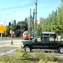
First I saw (and photographed) one of the Gomaco cars heading west out of the Rose Quarter Transit center, and then I spotted another Gomaco car heading east across the Steel Bridge, and then when I dropped down the ramp onto the eastside esplanade, I heard a train whistle blowing across the river and saw the 6:15 Cascades heading across the Steel Bridge:

From that point, it was back to the routine; the rest of the Springwater Trail, Umatilla & 13th to home, the realization I hadn’t gone far enough (the odometer had actually let me know about this several dozen miles earlier; Portland is a very small city, and I’m getting very familiar with being able to ride across it and not consume many miles) and the resulting shameless grovelling for another dozen miles to round myself up to the nearest multiple of 100.
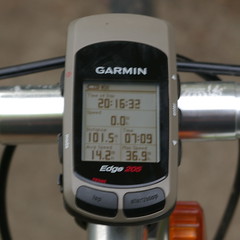
101.5 miles, 7h09 minutes, 1400 meters climbed, and when I got home after this micro death march (a proper deathmarch would be 4-8 times this, but I’m beginning to suspect that I don’t have the capacity to actually survive one of those) my weight was down to about 175 pounds.
—orc Sun May 31 23:59:22 2009
May 30, 2009
Discount has been pushed up to version 1.4.1 with the addition of a couple of small new features that were suggested by Mike Schiraldi @reddit.com:
- “autolinks” – expand unbracketed urls into links
(flag MKD_AUTOLINK, -fautolink in the markdown program)
- “safe links” – don’t linkify footnotes where the link protocol
isn’t a well-known protocol (currently http: https:,ftp:,news:)
(flag MKD_SAFELINK, -fsafelink in the markdown program)
The first feature (MKD_AUTOLINK) lets you set discount into a mode where every url it finds will
be converted into a hyperlink – if your source discount mentions a url, it will be
hyperlinked without having to <> it or wrap it in a [] link.
The second link (MKD_SAFELINK) makes discount do sanity checks on the url provided in a [] link; if the url isn’t a local reference (starting with a /,) or a http://, https://, ftp:// or news://-type url, the [] will not be expanded into a hyperlink but will simply be left as ugly text. This, apparently, helps prevent excitement when someone attempts to embed a script into a [] link (I’ve not encountered that myself, because none of the places I use discount allow users to enter their own [] links.
I’ve also put a couple of small optimizations into the code, but they do not affect output at all as far as I have been able to detect. They might speed things up a little
bit (I had a url checking loop that was doing repeated strlen() calls on constants in an array, and I replaced that array with a structure containing the constant and the length of the constant; strlen() might be a fairly cheap function call, but it’s still a lot more expensive than a structure dereference.
I’ve been testing this and playing around with it for a couple of days, so it (heh heh) works for me. Why not try it out? After all, it’s New Code!
—orc Sat May 30 13:52:10 2009
May 29, 2009
 <-
<-

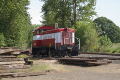
When I was out bicycling around this afternoon, I rode through Liberal (which appears to have a population of approximately zero) and spotted two Molalla Western Oregon Pacific eng!s sitting in the little yard there (the yard is not more than a mile away from end of track now that the last three miles into Molalla have been lifted.) #602 (an ex Bamberger, ex Oregon, Pacific & Eastern SW-8) doesn’t look like it’s going to be used in the near future – perhaps it’s being kept as a spare parts engine for the working eng!?
—orc Fri May 29 23:14:00 2009
May 24, 2009

A cute but stupid cat in her wicker nest.
—orc Sun May 24 23:08:05 2009
May 23, 2009
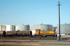
A BNSF switch engine sits in the sun at the north end of the Northwest Portland yard late this afternoon. I used the cheapy pencam, but I actually stopped the bicycle for this snapshot.
—orc Sat May 23 22:20:30 2009
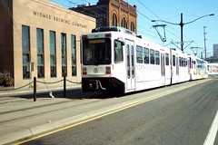
I was returning from a loop up to St. Johns this afternoon when I realized that the trolley tracks next to me were starting to make the sort of buzzing sound that they tend to make when a couple of streetcars are approaching. There wasn’t any chance that I could successfully race this train, so I dug the cheapy camera out of my pocket, turned it on, and snapped this picture as the train pulled ahead of me.
—orc Sat May 23 19:42:27 2009
May 22, 2009
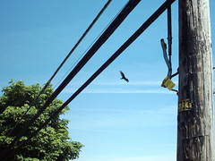
When I was riding south through West Linn on today’s ridiculous loop, I spotted a bunch of turkey vultures circling over the paper mill on the west side of the Willamette River by Willamette Falls.
I cheated and pulled out the pencam because it was faster, despite not being able to zoom the resulting picture.
—orc Fri May 22 23:40:37 2009

Dust Mite poses next to a very tiny el-cheapo pencam.
—orc Fri May 22 23:29:31 2009
May 21, 2009

Someone parked their trike at the downtown REI, so I just had to pose my Trekracycle next to it. They may not be the most conventional bicycles around, but Portland is a town where esoteric bicycles can shuffle around the streets without anyone mocking them .
—orc Thu May 21 22:01:11 2009
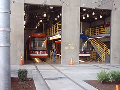
Astra #002 (Blue/Red?) shares the Marshall St. carbarn with the the newly delivered Oregon Iron Works Astra-clone at around 1:20 this afternoon. From the roofline of the OIW car, I’d guess that the shop crew hasn’t finished reassembling it after delivery, but nevertheless it’s nice to see a new trolley from a second American manufacturer sitting on the tracks in Portland.
—orc Thu May 21 17:29:30 2009
The one problem I’ve been having with taking my Pentax when I go out on the line is that it’s a fairly complex production to get pictures onto it. I need to
- . stop the bicycle,
- . get off the bicycle,
- . pull my purse out of the xtracycle saddlebag,
- . pull the *istDS out of my purse,
- . turn it on,
- . focus (I almost never do autofocus anymore, but use M42 screw-mount lenses and rely on a Katzeye split-focus screen to help my indifferent vision. It’s still a process that takes a pair of hands and a not-inconsequential amount of time,)
- . take the pictures
This is fine if I’m taking pictures of something immobile or if I’m sufficiently motivated to take a picture, but for the sort of quick snapshot I might want to take while I’m pedalling along, it’s not really going to happen.
I was hoping that I could set up a front rack and carry the Pentax up there, but the front rack I installed (a MEC front rack) only lasted about 200km before the fork crown connecting strap vibrated itself in half (and this after I’d carefully rubber grommeted the strap to dampen vibrations. Sigh) and put an end to that experiment (and it wouldn’t have been the greatest way for snap photos anyhow, because my Pentax is fairly heavy, requires two hands to focus, and is pretty much irreplacable – sure, Pentax released newer cameras before they went out of business (Hoya bought Pentax, then immediately merged the company, leaving nothing but the Pentax name,) but as far as I know the *istDS is the last of the Pentax cameras that still supports TTL flash (which is all I’m going to get from the elderly flash unit I’m using.)
And for that matter, my dream bicycle camera (an Epson R-D1, if I could get it, with some nice super-fast Voightländer lenses) would still require two hands for focusing, which would tend to wave goodbye to snapshots while in transit.
However, all is not lost. One benefit of the ridiculous market churn in the electronics world is that yesterdays expensive toy cameras have become todays cheap toy cameras, and for not much more than the cost of a dozen donuts I can buy a camera that I can wedge into my pocket, operate one-handed, and not care too much about if it hurls to its demise when I’m plunging down some steep hill at 40mph.
The Aiptek cameras are well-regarded by several much-more-serious-than-me randonneurs, so I sacrificed the cost of a dozen donuts to buy one, stuffed it into the convenient cellphone pocket of my pants, then dragged myself out the door at noon yesterday for another inefficient ride to Sandy for donuts…
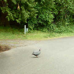
Getting there is an old familiar route, and it was still cloudy and cold, so I didn’t take very many pictures between home and then end of the paved trail at Rugg Road. The only thing of interest was a flock of guineafowl that was wandering loose at the Portland end of Circle Ave – the pencam is not my Pentax by any means, but the guineafowl were moving slowly enough so I could get a few too many pictures with it as I rode slowly by.

This is what the Springwater Trail looks like most of the time out past Rugg Road. It isn’t paved, but the gravel and ballast is packed down enough so that it’s a very fast and smooth surface, and on this trip I took the 4km from Rugg Road to downtown Boring at ~17mph.
I’m still trying variant routes from Boring to Sandy; yesterday I ended up taking OR212 directly east out of Boring, over OR26 and onward onto Compton Road (aka Dunn Road) all the way to Bluff Road, and then a short sharp uphill to paradise, aka Joe’s Donuts.
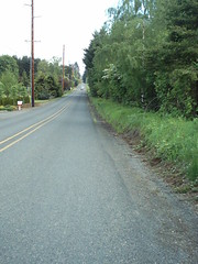
Compton Road becomes very rural after OR26

And it abruptly, but scenically, deadends at Bluff Road
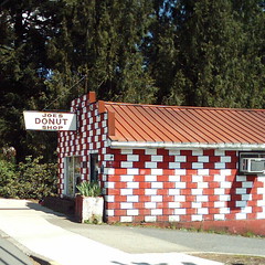
A brief jog south on Bluff Road, a brief ride uphill to downtown Sandy, and here’s the promised land!.
I’ve gotten to the point where, if the wind is obligingly downhill, I can reliably make the 82km loop from home to Joes in about 4 hours. Today the wind was coming out of the northwest, so it didn’t help or hurt (until later), but I still made it up there in just a finger over 2 hours (left home at 12:20, got to Joes at 14:25, and this included a brief stop to inhale a cookie bar at Rugg Road. This may not be very fast, but it’s fast enough for me.) I’ve now been in there often enough so that they’re starting to know me as “that guy who rides up from Portland to get donuts,” to which I have to plead guilty.
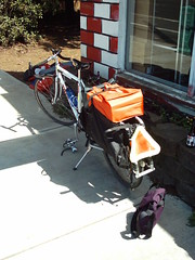
Loaded up with sugary goodness.
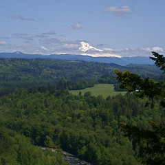
Mount Hood signals that the rest of the day will be clear.
I bought a couple of dozen donuts, ate three, then packed up the remaining 23 and set off on the rest of my preplanned loop. These days, I almost always return via Dodge Park Boulevard, because it’s the old Mount Hood Railway ROW and thus it’s flat and not very curvy except on the ramp up from the ledge that Dodge Park is on. So, after the obligatory stop at the Bluff Road scenic overlook (the morning overcast obligingly evaporated while I was at the donut shop, and by the time I reached the scenic overlook all that was left were scraps of clouds around the north side of Mount Hood,) I turned right – and then d-o-w-n – on Hudson Road and proceeded north to the Mount Hood Railway ROW for my trip into lovely Orient, Oregon.
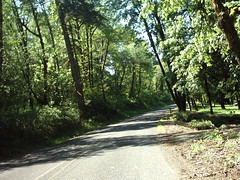
Mount Hood Railway ROW, 70 years on.
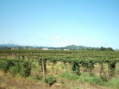
Multnomah county farmlands threatened by suburban sprawl.
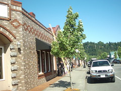
Downtown Troutdale, looking east towards the foothills of Mount Hood.
At Orient, I diverged from my traditional Orient Dr->Powell->Springwater Trail route by turning north on to 282nd Ave, which skirts the eastern edge of Gresham before passing through a district of berry farms and nurserys, then abruptly crashing through the southern edge of the Troutdale UGB and then through souless suburban sprawl until I reach the dipped-in-plastic spendour of downtown Troutdale.
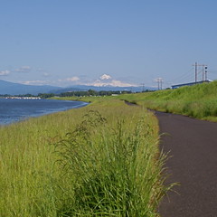
Mount Hood from Marine Drive.
From Troutdale, it was a simple (if ugly) route under freeways and along frontage roads to Marine Drive, where I made the horrifying discovery that I’d managed to fill up the memory card on the little el-cheapo camera (and not all by choice; when I got home, I discovered that there were a dozen or so photos of my fingers and the insides of my pants pocket from when I accidentally triggered the shutter when putting the camera away,) and if I wanted to take more pictures I’d have to revert back to the 12-step method I have for my traditional camera. But, fortunately(?), the next 30 kilometers or so was just me, the Columbia River, a nasty headwind, and about a zillion trucks that don’t really believe in the 3-foot-gap traffic regulation – even if the cheapy camera was functional, there was no way I would distract myself from paying attention to the road to whip it out and take pictures. And I would burn the final 30 kilometers or so when I reached it.
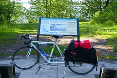
The obligatory “a bit deranged” Kelley Point photo.
Going home from Kelley Point includes lots of places where I could get photos, but none that I wanted photos badly enough to actually stop to take them (except for locomotives – after watching the 6:15 Cascades go by, I wasn’t going to just pedal past the NW Portland pumpkin patch.) So down Lombard to St. Johns (with a nice tailwind), across the bridge (with a nasty sidewind and, fortunately, little enough traffic so I could take a lane without stacking 70 automobiles up behind me,) and d-o-w-n the ramp to OR30, where I saw an Amtrak train go by without being able to take a picture and along OR30 into NW Portland, where I zigged and zagged down to Naito Parkway, the east side esplanade, and the rest of the Springwater Trail to finish my loop back home.
134km, ~900 meters climbing, 355 minutes on the bike, 415 minutes door to door. I’m certainly not going to ever break any land speed records on my bicycle, but it’s a good reliable pace that I seem to be able to do until I run out of free time. I’m still not exactly sure what I’m going to do about the toe overlap on my front wheel, but it looks like I might have solved the short-term problem about how to get snapshots while I’m in transit.
—orc Thu May 21 11:47:50 2009
May 20, 2009

I took an inefficient loop when I went out to Sandy to get donuts today (42 km out, 92 km back) and saw a whole raft of ORANGE locomotives sitting in the BNSF yard in NW Portland. I didn’t see any green units – I guess this means that the paintshops have managed to clean out any signs of the BN in the same way that the BN cleaned out any signs of the CB&Q, GN, NP, and SP&S after that merger – but I did see (but not photograph, because it came into sight at the same time I shot down off the westside St. Johns Bridge ramp and I didn’t want to do a scramble for the camera at high speed) a northbound Cascades coming out of the yard and curving onto the approaches for the (ex-)BN lift bridge. But I did stop and get a few pictures of these units (I just kept taking the pictures until I got one without cars and/or trucks in front of the units. It took a while.)
—orc Wed May 20 23:42:07 2009
May 18, 2009

My Trek sits quietly in the Llewellyn schoolyard while I try to convince the bears that 16:00 is a good time to head for home.
—orc Mon May 18 20:26:17 2009
May 17, 2009
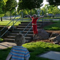
Russell lifts off while Silas taxis towards the launch pad.
—orc Sun May 17 22:58:38 2009

When I rode up to Kobos Coffee this afternoon, I reached Union Station at almost exactly the same time as this Portland & Western train cleared the south end of the platforms and started curving towards the Steel Bridge. This wasn’t the only train I saw today (I saw EPT1202 bringing a single reefer south towards the Milwaukie industrial park, and I saw a couple of Yellow Menace freights at a distance [one when I went into New Seasons later in the afternoon, one when I left New Seasons a while later]) but it’s not an example of a railroad that I see everyday, even though they do have trackage rights on the Yellow Menace mainline down to the junction with the Oswego branch.
—orc Sun May 17 22:43:42 2009

… because the Xtracycles are in bloom.
The other Xtracycle in the picture (the one with the upright handlebars, Stokemonkey, and padded skateboard) has got a wildly positioned saddle. I’ve pushed the nose of my saddle up a little bit so I won’t tend to slide forward when I’m sitting down and grinding up a hill, but even that little bit tends to mash my bits when I’m down in the drops. That other saddle, well, I guess it’s just a little bit of encouragement on those days when you really want to be a sailbike.
—orc Sun May 17 21:42:28 2009
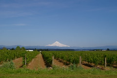
Mount Hood looms distantly behind a vinyard (or a berry orchard; I’m afraid I didn’t look too carefully) on Amisegger Rd just south of Boring.
—orc Sun May 17 00:45:25 2009
May 16, 2009

At the very last minute, I decided that I would run a loop out to Boring (which turned out to be only 70km instead of one of the far more extravagant routes I would have considered if I’d headed out the door six hours earlier) instead of climbing Pete’s Mountain again, and when I crossed over the SPYellow Menace mainline I noticed
- . that the signals were on
- . that the east main signal was blinking caution, and, finally
- . that there was a set of rapidly approaching headlights to the north of me.
And I’d stuffed the Pentax into my saddlebag. Oh happy coincidence!
—orc Sat May 16 19:58:25 2009
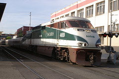
The 6:15(?) Cascades scoots across East Salmon St just minutes after leaving Union Station this evening. I was returning from a trip to deliver a computer, and I’d just crossed the Steel Bridge when I heard the train whistle itself away from Union Station, so I then pedaled as fast as I could to get down to the neighborhood of the Hawthorne Bridge, where I could turn inland and get over to the Salmon St crossing.
(Picture taken with my 28mm Tamron wide-angle lens, at f9.8 (or thereabouts))
—orc Sat May 16 02:54:35 2009

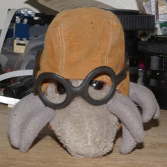
It’s the ideal hat for a Dust Mite, if you ignore the piping, the whispering, and the unnatural geometric shapes that you see out of the corner of your eyes when you’re wearing it.
—orc Sat May 16 01:22:15 2009
May 12, 2009

Silas considers his next move.
—orc Tue May 12 21:33:45 2009
Discount has been pushed, kicking and screaming, up to version 1.4.0, and has been hurled out the door so other people can find bugs in it. Why have I so rudely evicted it from the development machines today? Because I went through and added a handful of
new functions to the published interface, and have split and renamed some of the existing functions to try to fit into the grand naming scheme I’m trying to follow.
I’ve not actually taken anything out of the published interface, but I’ve renamed some of the functions (mkd_style, mkd_text) and left the older names merely as #defines.
The new functions are
mkd_css- Allocate a buffer and populate it with the
<style> sections found in the code
mkd_generatecss- Write the
<style> sections to a file (this is the old mkd_style function)
mkd_line- Process a line of text, then place it into an allocated buffer.
mkd_generateline- Process a line of text, then write it to a file (this is the old
mkd_text function)
An internal function has been pulled out and made into a pair of public functions. I had a private function ___mkd_xml() which someone wanted access to in both write-to-file and write-to-buffer formats, so I expanded it out:
mkd_xml- Allocate a buffer, then populate it with an xml'ed version of the input.
mkd_generatexml- Write the xml'ed version of the input string to a file
(the xmlification of a string is simply replacing “>” with “>”, “<” with “<”, “&” with “&”, “"” with “"”, and “'” with “&apos”, plus stripping out all the control characters (0x00-0x1f))
There are also some cleanups in the way I handle utf-8 characters (so that they’re actually handled instead of silently dropped) and I’ve cleaned up some of the documentation to have it not comment on features that vanished in the 0.x era.
So this was enough to bump the version to 1.4.0, and it’s certainly enough to make all the cautions about New Code! extra important. The code works for me (if it didn’t you’d not be seeing this message on tsfr, nor would you see the web page describing the new land mines for you to stumble upon) but if there are any little surprises elsewhere you might find them faster than I will.
So why not download the code, compile it, and see if your workstation will implode, catch fire, or both?
—orc Tue May 12 13:40:44 2009
May 10, 2009
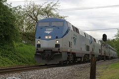
I was very sluggish about getting out of the house today, and didn’t drag the bicycle out the door until around 2:20. I was planning on riding down to Canby, which involves (at least until the Oregon City bridge is closed) riding down to Oregon City and crossing over to the west side of the river for the trip down to the Canby ferry. This, happily, takes me right past the Oregon City Amtrak station, so I always take the tiny detour to see if the signal shows any train coming.
Today I got there at the crack of 3pm. I looked over towards the signal (all dark,) and as I started to pull my bicycle around so I could continue when I heard an Amtrak train hooting nearby. I didn’t need any more invitation to yank out the camera and wait the 30 seconds or so until the Coast Starlight popped into view and whooshed on past on its way up to Portland Union Station.
—orc Sun May 10 22:47:25 2009
May 09, 2009

After racing the northbound Coast Starlight up to Union Station this afternoon (I needed to get a package to the downtown post office today because the mail rates go up on monday,) I stopped and took a picture of all of the afternoon batch of trains. From left to right, the Northbound Coast Starlight, the northbound Spokane section of the Empire Builder, the not going anywhere special train with Portland’s own GS-4 as motive power, and an about-to-head-north Cascades.
—orc Sat May 9 23:37:54 2009

A train heads east towards Gresham at about 6:30 tonight.
—orc Sat May 9 00:45:09 2009
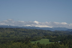
This has not been one of my more successful weeks for riding my bicycle. A couple of weeks containing too many rainy days (and partially rainy days) left me with basically no desire to go for a long ramble in the country this week. But today (Friday, with only 63km under my belt for the week so far) I forced myself to make up a good route (out to Sandy, which, conveniently, contains Joe’s Donuts) and attempted to ride it.
The start of the route was fine – the cue sheet said “go east on the Springwater Trail until you run out of trail,” and that’s a pretty easy thing to follow (having done it a half-dozen times – I’ve gotten almost to the point where I can run at line speed on the unimproved part of the trail out by Boring.) But once I reached Boring, I headed into terra incognito on the roads south of OR213. The first few turns were fine (and scenic; south on Richey Road past Liepold Farms, east on Kelso past even more farmland, then south (and precipitously down) on Tickle Creek Road through second and third-growth forest down to Tickle Creek. But at Tickle Creek my “sharp left turn onto Knox Road” cue fell foul of the teeny detail that Knox Road was an unimproved dirt road, and, worse yet, was blocked off with a “I am a logging road”-style gate.
Oookay, so using googlesoft maps comes with free surprises inside. Like directions to roads that don’t exist. But this is not a problem – I’ll just improvise here and take Tickle Creek Road further along and I’ll either run into OR211 or OR212 and then I can proceed to Sandy from there. So I zipped across the Tickle Creek bridge (at ~400 feet ASL) and was immediately faced with a road going up. And up. AAaaaaaand up.
A twisty road, with lots and lots of false summits and false flats (nasty short upgrades that looked flat because they were punctuated with even nastier ramps at the end) going up and up to slightly over 850 feet ASL in slightly less than 2 miles, with all of the nasty steep parts at the end. It was an extraordinarily pretty deathmarch; the second or third growth forest down by Tickle Creek gave way to horse and cattle farms up around 700 feet ASL, and the true summit was also forested, with gaps in the trees showing some pretty spectacular views off to the southwest.
And from 850 feet, Tickle Creek Road then plunged like a stone down to around 600 feet to where it met up with OR211 just east of the Deep Creek bridge. And what happens on OR211 just east of the Deep Creek bridge? Why, it goes up, in one gently curving grade of about a mile, to 850 feet or so, at which point it drops you into gently undulating farmland that almost, but not quite, disguises the detail that you’re climbing up to 1000 feet on the next 3 miles into downtown Sandy and the always-welcome sight of Joe’s Donuts (where I inhaled three donuts before I strapped the remains of the obligatory baker’s dozen onto the bicycle and headed on home.
My route home was doomed to revision after discovering that Knox Road was closed. It ended up taking me 2h20 to get to Sandy even with the ridiculous climbs, and that meant that at my very best speed it wasn’t likely to be much over 50km out. So my previous plan of Bluff Road to Hudson to Dodge Park Blvd to Orient to the Springwater Trail (and then a loop in town to round up to 100km) was out. My revised plan (punctuated by me crashing on Dodge Park Blvd when a driver stopped me to ask if this was the road to Portland – after riding in toe clips for coming up on 30 years now, and despite using platform pedals and non-knobby shoes, today was the day my left foot stuck in the pedal when the bicycle slowly and majestically toppled over to the left instead of to the right, where my other foot was waiting to catch it. Sheesh. Another bruise on my left leg, and a nice gouge on my right calf where my big chainring took a bite out of it.) was to take Orient all the way into Troutdale (Orient becomes 257th Ave, which goes right to Marine Drive) and then ride along Marine Drive into Portland, where I could take the I205 path home.
Dodge Park Blvd is always nice to ride on (modulo the hideous “executive estate” development at the Orient end.) It’s an old railroad grade, so the ramp out of the Sandy River gorge is very slight (I realized, at about the point where I topped the grade and was turning onto the long tangent down to Orient, that I had gone up the hill with the bicycle in the 107" gear (52x13) and hadn’t even had to stand up and push once, and I’ve ridden on Orient Drive often enough so it’s just a short familiar loop that I can ride almost in my sleep. 257th isn’t quite as familiar (I have ridden it the other way, but it’s been a while) but it’s simply a long urban descent to the Columbia River and Marine Drive, and Marine Drive is the traditional wheel-eating road of death that I’ve grown to know and tolerate.
As I was heading down Marine Drive towards town, I had a foolish idea – “I know, I’ll ride on Clinton Street all the way in from 92nd and get a chance to ride the entire bike boulevard!” This is a foolish idea because the bike boulevard doesn’t start until 52nd, and Clinton St east of 52nd is a festival of road surfaces (ranging from dirt with huge potholes to gravel with huge potholes to innovatively surfaced road to nothing at all) which pretty much guarantees a trip experience like swimming through treacle. But once I got through that, the bike boulevard got me to the Willamette River quickly enough, and then I went sailing down the Springwater Trail towards home as if I’d not been on a 100km loop at all.
The Tickle Creek Rollercoaster & Other Variations

So. 45km out to Sandy, and 65km back. 110.7 km (68.8 miles) in 5h30 riding time, 6h15 travel time. Tickle Creek Road did cruel things to my travel time, as did the 40 blocks of Clinton Street cyclocross when I got back into town. I could probably have gone faster if I’d looped through Barton & Eagle Creek, and then struck off the Clinton Street cyclocross in favor of taking Marine Drive up to Kelley Point Park (and then rolling on home via the St John’s Bridge, OR30, and the Eastback Esplanade to connect me to the Springwater Trail. Of course that would have pushed the ride out closer to a round 100 miles, but it would have been an extra 30 miles without narsty steep hills and unimproved Portland roads.)
I do need to get some sort of working handlebar bag, though; having the camera tucked into the panniers doesn’t do much at all for grabbing quick pictures on the fly, and having my cue sheet wedge into my hip pocket being sweated on doesn’t exactly improve the legibility of these hopefully scrawled route suggestions.)
—orc Sat May 9 00:39:15 2009
May 08, 2009

Donuts, lambic, and maple syrup. All that’s missing is a heaping platter of skin flakes to make it a Dust Mite’s paradise.
—orc Fri May 8 23:44:39 2009
May 06, 2009
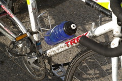
I crunched my front fender last week (Trek 1000s have a bit of a toe overlap problem even with their recommended supernarrow tires; now that I’m riding on nice fat 28mm tires, the toe overlap is substantial. Last week my front wheel wobbled when I was accelerating away from a stop and the fender attempted to mate with my foot, resulting in a crashed bicycle, a bruised hip, and a fender twisted on itself like a pretzel) and have not replaced it yet (I suspect that the only safe replacement scheme would involve replacing the bicycle frame, but the combination of “short bicycle” (the wheelbase of the current Trek+Free Radical is a hair shy of 54 inches, while some of the modern bobtail touring frames start out at 42 inches without xtracycley additions) and “longtail™-style” puts me firmly into the cu$tom frame$et category. And I don’t have US$3000 lying around to buy a frame right now, what with the whole business of living in a house with a defective roof and defective plumbing, but without any income other than scavenging our retirement money and selling stuff online.) So that means that when it rains, water ends up sitting on parts of the Springwater Trail that haven’t been paved, so when I ride past the end of the paved road to get to Boring, I ride through those watery parts, which my front wheel cheerfully picks up (along with a healthy portion of the mud that the water is sitting on/in) and hurls at my bicycle and me.
If I had US$3000 lying around, I’d probably not commission a bespoke frame anyway; I’d try to get signed up for a framebuilding class at UBI and learn how to make the thing myself – the world of commercial longtail™ framesets seems to be catering more towards the “poke around in the city with your kids and cargo” crowd than the “ride a couple of hundred kilometers out in the country then stop at the Big Big Store on the way home” sort of riding I want to do. Plus they’re not lugged frames, and I’ve become fond of the old truss bridge look of bike lugs in my old age (plus the “anyone can weld it” aspect of a steel frame is more appealing than the “chisel the shattered tube free of the lug, then epoxy new tubes in” repair regime I’d have to do if my Trek ever had a frame element fail. But, to be perfectly honest, the cosmetics of lugs is what does it for me.)
It’s too bad all of the 650B tires out there are so fat. Buying a slightly longer fork and putting a 650B wheel on the front would give me ¾ths of an inch of additional clearance, which may not be enough to completely get around the toe overlap, but would at least reduce it down to the state it was in when the bicycle was running un-fendered 25mm tires.
—orc Wed May 6 22:34:54 2009
May 05, 2009

At least they did on Saturday, Sunday, and Monday. (Saturday I just avoided being caught out in a torrential downpour; Sunday I was racing the torrential downpour home from Boring and would have beaten it except I was caught by a red light at Tacoma St and ended up riding the last 750 meters in hail mixed with typhoon-style rain. Completely soaked, down to and including my shoes [which, to be honest, were doomed anyway because I haven’t replaced the front fender on my bike since the last time I crunched it into the front fork] and the only thing that was good about the rain is it washed off the thick layer of mud splatters that I’d picked up when riding on the unimproved part of the Springwater Trail into Boring) and Monday I just stayed at home because it was pouring down rain all day (to the point where rain came under the soffit at the SW corner of the house and down onto Silas’s (unused) bed.) Today it didn’t rain so much, but I stayed up last night fretting about how to repair the damned roof, so after dropping the bears off at school I came back and fell asleep instead of riding.
I fully expect that since I’m going to get 8+ hours of sleep tonight that it will pour down rain tomorrow. If so, I’m going to spend some of the day riding from bike coop to bike coop, seeing if they have any used lugged steel frames that are suitable for fitting 700c tires, fenders, and front racks to, and the rest of the day pulling the offending soffit off the house so I can put up a new one once it stops raining (but I’ll be hoping that a GIANT METEOR will strike the house instead so I won’t have to worry about it.)
—orc Tue May 5 22:02:33 2009
May 02, 2009
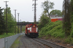
I was on my way back from the Big Big Big Store this afternoon (in the rain, I will add – it was mostly sunny when I went up to the store, but when I came out from the store the clouds had rolled on in and it was starting to rain. I had my raincoat, and none of the stuff I was carrying was water soluble, so I headed off towards home despite the downpour. This proved to be a fortunate choice, because about 10 minutes after I got home a line of torrential rain moved through Portland and if I’d be caught in that I’m pretty certain that I would have melted in the deluge) when I heard #1202 whistling for a crossing south of me. I was almost to the end of the downtown segment of the Springwater Trail at Umatilla St, so when I got off the trail I pulled the bicycle off to the side of the road, put my camera bag on the seat to protect it from the rain, and waited for a train to roll on by.
#1202 was pushing a passenger train (the new UP caboose, the ex-Simpson caboose/sightseeing car, and the regular sightseeing car) northwards, but I didn’t get any non-cluttered pictures until after the train had passed me by and was receding towards the Sellwood bridge. And then I hopped back onto the bicycle and finished dragging my 65lbs of groceries back home.
—orc Sat May 2 22:47:42 2009
May 01, 2009

More pictures about dust mites and cats.
—orc Fri May 1 21:57:45 2009

Workers of the world unite,
you have nothing to lose but your chains.
—orc Fri May 1 19:53:27 2009
—30—


