Apr 30, 2012
After putting clipless pedals on the project bike for a while, I moved them over to the mlcm so I could see how they’d work on a reasonably long loop. Unfortunately, they put my feet lower than regular pedals, so I needed to drop the saddle a little bit (5mm?) which meant that the bars ended up a little too high for my tastes. So, after preriding the multnomah falls populaire yesterday, I needed to pull the bars off and pluck out the sole remaining spacer.
Sigh.
The only spacer-type objects left on the fork are my decaleur and bell, and I need both of them (the decaleur keeps the big rando bag stable, and the bell needs to be set above the decaleur to keep it from fouling the stem.) I put a longer-setback seatpost onto the mlcm after the breitenbush 300k, so I can always push the saddle back a little more to increase my virtual drop, but the physical drop is as low as it can go now (without putting a -17° stem on, which would, of course, foul the decaleur!) and I’m not really sure what I’ll do if I want more saddle to bar drop, aside from buying a lottery ticket, winning the lottery, then buying a torch and making my own frame.
On the bright side I think I’ve finally dropped my bars to the point where I can put on the ridiculously low-trail electra fork I got a few years ago, so I should go and get a couple of rack mounting points brazed onto it for experimenting with after the summer series is over with.
—orc Mon Apr 30 22:42:52 2012
Apr 29, 2012
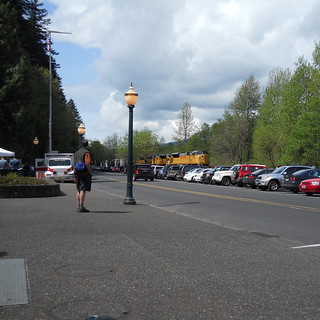
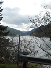
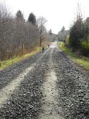
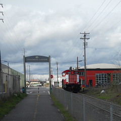
An eastbound UP freight approaches Multnomah Falls.
—orc Sun Apr 29 22:47:11 2012
Apr 28, 2012
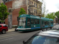
Blue/Green approaches Flanders street on its way north (and then west) to 23rd Ave
—orc Sat Apr 28 17:39:18 2012
Apr 27, 2012
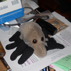
Dust Mite puts on some legwarmers to avoid the chill of a cold April morning.
—orc Fri Apr 27 23:40:41 2012
Apr 26, 2012
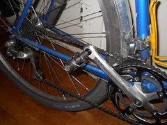
I’ve put clipless pedals onto the project bike so I can see if they’ll do anything about the balls of my feet cramping up when I ride a fast 200 or 300. I don’t know whether they will help there, but I do know that they’re pretty easy to use – I spent about 30 seconds practicing clipping and unclipping, then took the bike out for 13 miles of riding around East Portland without managing to kill myself even once.
—orc Thu Apr 26 19:31:58 2012
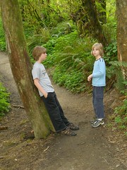
Russell & Silas at Tryon Creek State Park.
—orc Thu Apr 26 19:25:29 2012
Apr 24, 2012
I mentioned in a postscript that I thought I was starting to overrun my clothing choices during the Breitenbush 300k, but that seems to be what people are commenting on there. So I have brutally moved those comments here, so I can see what people have to say about bicycle-specific clothing for warm weather without having to wade through pages of commentary about some boring old 300k :-)
(And, upon some further consideration (and after looking at photos other people have taken at me on the bike) I think that I’m just a little bit too broad in the beam to wear tights without feeling horribly self-conscious about it. It would be a shame to toss a wad of money down for clothing that would end up keeping me off the bike.)
—orc Tue Apr 24 15:59:56 2012
Apr 22, 2012
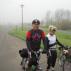
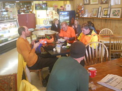
Yesterday was Orrando’s spring 300k, which, freed from the need to be near Portland by the existance of a Portland-based summer series (organized by yours truely, Theo, Ed, Lynnef, Susan O, and Joshua Bryant), took a route – Newberg to the vicinity of Breitenbush Hot Springs – that had laid dormant since 1997 and brought it back to life. I’d signed up to ride this loop, but hadn’t really planned how I would get there (aside from vague thought of “well, I guess I can ride down there the morning of the loop; it’s only 31 miles and other Portland randonneurs have done it in the past”) until this last week, when my friend Theo arranged crashspace with one of his friends who lives down there and I converted my “well, maybe I’ll go” into “I neeeeeed to ride this loop.”
We made plans to ride down there on Friday afternoon, which became Friday evening as we fitted it into our other plans for the week. Ed bowed out because of a commitment at the Community Cycling Center friday afternoon, so only three of us departed Theo’s house at 7pm(ish) to ride down via Macadam, Boones Ferry, and Wilsonville Road, arriving (after an extraordinarily pleasant ride; leaving at 7pm meant that we avoided the bulk of rush hour and got us onto Wilsonville Road at twilight, which is a very nice time to do sailing along close to the river) at somewhere in the ballpark of 9:30, and then after a little bit of last minute prep went to sleep for a 4:45am wakeup so we could stagger the two blocks to the start in time for the 6am ride.
Well, everyone else did their last-minute prep; I’d done mine the night before, loading up the big rando bag with everything I’d thought I might need (two pairs of socks in various obnoxiously colourful stripes, two baselayers, two pairs of gloves, additional underwear, armwarmers, and a reflective sash for when the sun went down on the way back. Plus my camera, an auxilary battery for the GPS, and a pile of food, ranging from science diet to cookies to a bakers dozen baked potatoes.
I’d figured this would be enough for the late evening hours when I was riding slowly and the night chill was creeping into the air. I’d been chatting with Michael Johnson about this ride, and he said he wanted to take it easy and do more of a social loop, so I figured it would be a reasonable 16-17 hours to run up into the mountains and back.
At the start, we met up with Michael and several of our other friends, including new rando Stasia, who has two speeds – ridiculously fast and insanely fast – and chatted very briefly for the few minutes before we were released for our 6am departure.
But when the flag went down, we were off to the races; the fast boys bolted down the road as if chased by a herd of rabid wolves, and since my now-traditional solo brevet start involves running full-out until I start to burn up, I simply modified it to gluing myself into the group, then bolting down the road with them while hoping they would start to burn up before I did.
Over the Willamette at an average speed of 17.6mph; plowing through
the fog along Champoeg Road, then south towards Gervais at the same
rate, then bending east on Howell Prairie Road and rocketing towards
Slayton at a steadily increasing speed until we were averaging
17.8(or .9) as we shot southwards. Somewhere along here Michael
asked if anyone had a cuesheet for a suggested detour on scenic roads
between Slayton and Lyons, but I was the only one who answered yes.
Comments were made about
having to either wait for me or to beat me up for the cuesheet, but
this conversation had barely started before we hit a toe of the
Cascades (south of Pratum) and I was, as I expected, dropped when
the climb lasted more than about 100 feet. The fog started to
clear as I reached the southern end of Howell Prairie Road, and it
was clear (but cloudy; the fog was hovering about 200 feet above
our heads) when I transited Shaw Highway and approached the junction
with OR22.
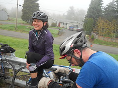
And there the fast guys, as expected, were cooling their heels (and taking advantage of shrubbery along the road to attend to the call of nature) waiting for the cuesheet (and also me); I stopped briefly to take a few pictures, then we all roared off up into the valley, dodging on sideroads into Stayton, then crossing OR22 to take another sideroad up closer to Lyons.
There’s a pinchpoint in the valley here, so all of the roads need to climb up a bit to get over it. I had been riding along with Stasia and Kevin, but when we started climbing my stomach started to make “ahem, excuse me, but I believe a little something would be just the thing” noises and when I slackened my speed to unwrap and consume a piece of science diet I was, again, dropped by everyone, and ended up riding along towards Lyons by myself (at a much more moderate pace than before; my brevet average speed dropped to 16.8mph by the time I reached the control at Lyons) as the clouds evaporated under the pressure from the warming sun.
I reached the Lyons control to find everyone in the throes of finishing up. The control was crowded, so I barely had time to get my card signed (and buy a couple of ballpoint pens, because that was one thing I had forgotten to pack) before I had to hustle to catch my friends, who had made short work of the control and were heading out.
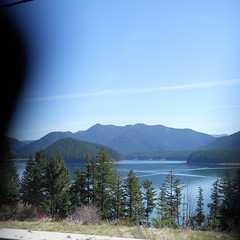
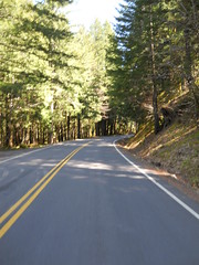
Past Lyons, we took a side-road (along the old Oregon Pacific line up towards Santiam Pass, now truncated to Mill City because of Detroit Lake) to Mill City, where an unexpected (the weather forecast called for “light” winds; this was not light) headwind sprung up to bedevil us. And then at Mill City, after breaking up briefly so some of us could use the bathroom, we jumped onto OR22 for the long stretch against headwinds up to NFD 46 and beyond.
At this point, I was starting to run a bit out of puff, so I was religiously latching myself into someone’s slipstream, but that came to an abrupt end when we reached Big Cliff dam, where the road tilted steeply upwards for 150 feet and I was left behind in a puff of bicycle-shaped implosions (I was not more than about 1500 feet back when I crested that ramp, but I couldn’t make up the distance and completely lost them when we reached the second, and far more impressive, ramp up past the main Detroit Lake dam.)
And then I staggered along – into the increasingly annoying headwind – by myself for the next 25 miles or so. I saw one rider at the convenience store at the intersection of OR22 and NFD 46, but they passed me when I jumped into a scenic lookout a mile up NFD 46 in search of water (no, there was none, but it cost me about 3 minutes to discover this) and I was overrun by Dieter Loibner, who is another of the riv-fit riders who goes my speed without bothering to have aero fit on his bicycle, but it was mainly just me, the steady uphill grade, and that stupid headwind.
The really fast guys passed me about 4 miles up NFD 46 (on their
way to ~10-11h finishes) but I didn’t see anyone else until I was
about 3 miles from the turnaround, when Stasia came whipping by
downhill, followed at a respectable interval by Ian Shopland, then
dribs and drabs of smaller groups consisting mainly of my friends.
Soon after the last group passed me, I came over a rise and dropped down into a small depression where the wind died down and allowed me to coast up to the turnaround (at the BASE of the steep climb up to the top of the saddle that NFD 46 uses to get over to Ripplebrook.) I found the info control, took a picture (in case I forgot it), then turned around to head back west to see if I could overrun any of my friends.
And then I climbed to the top of that rise and into the face of a headwind. Imagine my delight. So I squoze myself into the most aero position I could get and bolted off down the hill towards Newberg.
Well, actually “bolted” may be an exaggeration. I was starting to run quite low on water, and I was pretty exhausted by trying to maintain a good moving average, but I still managed to make it down to Detroit in good time. Michael Johnson, Ed, Kevin, John, and Dieter were there, but were moving pretty slowly, and I zoomed in, grabbed some nasty sports drink (sugar and salts for $3.50. Ugh), loaded my water bottles, and headed out almost before they registered I was there.
And then it was back along the shoreline of the Detroit reservoir, against that stupid headwind. I’d seen Ian heading across the OR22 bridge across the Breitenbush River just as I arrived at the store, so I was thinking that I might catch him, but it was a nasty slow-feeling crawl along the road, punctuated nicely by the much-nicer descent down the ramps next to the Detroit dam and Big Cliff dam. Dieter caught up with me along here, and I drafted him for about 6 miles before he outpaced me in Mill City, and I was back to crawling along, muttering obscenities every pedal stroke, against the stupid headwind for the next 8 miles down into the next control in Lyons.
At the Lyons control, I overran a couple of my faster friends, but
was tired enough so that I didn’t have the energy to snap through
the control and keep rolling. So aside from getting my control
card signed I also got an ice cream sandwich and peeled off my
knee-high stripy socks in favor of some shorter ones before falling
in behind them and religiously sticking to their slipstream for the
next 15 miles or so.
From Lyons, we shot west towards the control in Stayton (the route is slightly longer on the way back than it is on the way out, so it needs to be controlled to keep people from skipping on by on OR22; I suspect it’s more like a YOU NEED FOOD NOW type of control so people won’t completely forget to eat and die in the last 45 miles. At this point we were all going through water at a pretty good clip, so got nasty sports drink to top off our water bottles until the next convenience store) and after a short stop there back onto Shaw Highway, then Howell Prairie Road (which seemed a lot longer coming back than going out, thanks to not maintaining 18mph average across it.)
As we approached Gervais, my left foot started cramping like mad (so I had to resort to dropping to a low gear and spinning like it was going out of style to go up ramps without having my foot go into agony) so I said I needed to stop for 5 minutes to stretch my foot and get an ice cream sandwich. It turned out to actually be about 12 minutes, but it was enough to reduce the cramp to a dull ache before we hopped onto our bicycles to do the last 19 miles into Newberg.
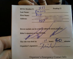
We did that last 19 miles in a hour and six minutes, and got into the ultimate control in Newberg 45 minutes before the sun went down, officially finishing the loop in 13h19 (we’d gotten there a couple of minutes earlier, but took some time stacking up the bicycles and getting into the hotel where the control was located.)
And all of my nighttime/cold clothing? It was still in my big rando bag, doing nothing except packing the poor thing to overfill.
The things that worked on this loop?
- my vanity, for trying to keep up with much younger and faster friends, which was helped by
- the ~25,000 miles I’ve ridden my bicycle in the last 3 years, and
- having finally arranged the bicycle to fit my style of riding.
My vanity is a huge part of this, because it took forever to catch up to my faster friends after being dropped on the ramp at Big Cliff Dam, and during that long stretch I had to deal with periodic “oh, why am I doing this? I should just DNF and go home on NFD 46!” mutters from the paranoiac depths of my subconscious. At almost no point did I seriously think I would actually catch up to them, but I figured that I was not going to actually die if I tried (I might feel like I was going to die, but when I was sprinting along in an attempt to get up to brevet minimums on the fléche it was an exceedingly painful couple of hours, but by G-d we were making up the time and that was worth it) so there was nothing to lose if I gritted my teeth and made a run at it.
Things that didn’t work out quite so well.
- I am afraid that I’m outrunning my clothing choices. The last couple of loops I’ve done (the sub-10 hour Portland-Ripplebrook-Portland, and this loop) I ended up with the balls of my feet cramping fairly severely. I am afraid that when I push myself along at a fast-boy pace I end up flexing my feet too much for them to be happy.
- And in the outrunning clothing choices department, I found today that my regular pants scheme of ¾ths length wool underwear with +4s over the top became very sweaty once it got up into the 70s. If my vanity keeps trumping my common sense, this will make any summer brevets/permanents that I do a festival of perspiration, which is not exactly how I want to spend the summer.
- When I get tired, I lean on my handlebars, which crunches my carpal tunnels and makes my hands go numb. It’s worse when I’m at speed, because my normal remedy of resting my hands on the brake levers isn’t nearly as comfortable as plunking myself into the drops.
The handlebar problem might be solvable by lowering my bars and/or increasing my saddle setback a little more to balance my position, but the other two seem like they might be basically insoluble without making the supreme sacrifice and switching to bike-specific clothing. My shoes are starting to get somewhat worn, so I’m thinking of putting a pair of clipless pedals onto the project bike and replacing the shoes with ones that have clips on them, but the pants problem looks like I may need to try out a set of tights (bicycle-specific if it’s possible to get them without chamois pads, I’m not sure what type if it’s not) and learn to live without the pockets I so dearly love.
PS: Oh! Before I forget: pictures!
—orc Sun Apr 22 14:23:56 2012
Apr 21, 2012
I rode Orrando’s Breitenbush 300k today, and not only tried to keep up with my fast friends but basically succeeded (I was dropped on a couple of ramps, but in the first case they waited for me because I had the cue sheet for a scenic reroute and in the second case I put my head down and cursed my way along for 6070 miles and caught up with them.)
The gory details for the brevet were
- 13h19 (over a hour faster than my previous fast loop), including
- 3 hours at an average speed of 17.8mph (yes, that’s 50 miles in 3 hours),
- first < 7h 100 mile run ever,
- fastest 200k ever (8h30),
- and a brevet average speed of 14.3mph (moving average of 15.6mph)
A more detailed trip report will follow later
—orc Sat Apr 21 23:55:12 2012
Apr 20, 2012
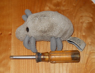
Dust Mite measures a socket driver I found when riding down to Sellwood to retrieve Russell’s bicycle.
—orc Fri Apr 20 16:54:50 2012
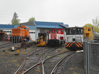
A collection of stored/out of service/under repair locomotives sit quietly in the yard at Portland Traction’s McBrod Ave shops.
—orc Fri Apr 20 16:17:13 2012
Apr 18, 2012
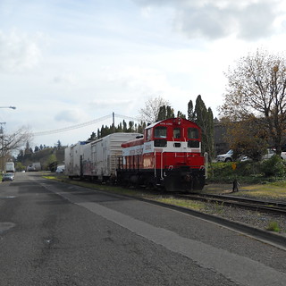
The new replacement working Eng! sits on the McBrod Ave lead at around 5pm today.
—orc Wed Apr 18 21:47:29 2012
Apr 17, 2012
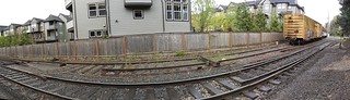
A photostitched panorama showing the new switch that the Oregon Pacific is putting on the Portland Traction mainline between 11th and 13th Aves.
—orc Tue Apr 17 20:33:46 2012
Apr 15, 2012
Last month, one of my friends volunteered to help staff the Brewpub
populaire and when I caught up with her at the
end of the loop I suggested that she ride
Sellwood-Birkenfeld-Sellwood
with me the following weekend so we could get in some companionable
miles before the spring
200 and the
flèche.
She thought this was a splendid idea, so we roped her stupidly fast
notofficiallyaboyfriend and another friend to ride the loop with us.
Alas, at the last minute she came down sick and the friend got swamped
with work, so I spent most of the day trying frantically to stick to
a much faster wheel, and which ended up with staggering
back home feeling as if I’d been whacked repeatedly by a mallet
after the climb up to Skyline road.
A couple of weeks later, while we were riding the flèche (at
around 3:30am, when we were chatting to keep ourselves from falling
asleep) she and I scheduled a rain date for the ride, but this
time on a somewhat flatter loop because the flèche looked
like it might have too many soul-nibbling climbs for either of us
to want to repeat the next weekend. So we arranged to fill the
gap between the flèche and the spring
300 by riding my
Portland-Ripplebrook-Portland
loop, which seems to be about as flat as I can make a loop these
days. Once again, the notofficiallyaboyfriend was invited along,
but this time no illnesses struck anyone down so everybody invited
actually showed up.
The weather was forecast to be pretty nice, but when I woke up in
the morning it was still pretty cold (36°F) and overcast. So
instead of bringing a pair of light gloves I brought along my
midweight wool ones and wore a pair of my thicker and more sedate
stripy socks, which may have been practical, but did not have
nearly the optical impact of my lighter stockings.
After a few minutes of doing the necessary paperwork, we got onto our bicycles and headed out towards the Springwater Trail. It was just a little after 7am, so the streets were pretty much empty as we wound our way through inner NE/SE Portland, and, aside from a few early morning joggers and riders coming into town, so was the trail.
It was sunny in town, but there was still a bank of clouds piled up next to the Cascades, so as we headed east the clouds built up above us and made the morning fairly dark and gloomy. We tried to stop at Linneman Junction to use the toilets in the depot there, but for some reason the city of Gresham has taken to locking those toilets up at night, so we had to go all the way out to the control in Boring to use the facilities there.
Everyone else was moving slowly,
but I was feeling a little bit extra speedy, so I spent a good deal
of the morning zooming out ahead of the two of them. I gapped
them by a fairly good distance dropping down Amisegger Road (the
handlebars on the
mlcm are
working their way lower as I get more flexible, and they’ve finally
gotten down to the level where I can get into something resembling
an aero tuck) and so was able to make it about half of the way up
the Judd Road ramp before being overrun.
And then, after plunging
down the cliff-face on Van Curren Road, I managed to gap them coming
up out of the Eagle Creek basin and sailed all the way into Estacada
before they caught up to me.
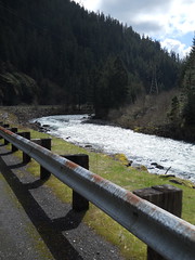
We didn’t bother to stop in Estacada, but continued onto OR 224 and headed south into the mountains. It was still cloudy when we jumped off OR 224 and took Faraday Road along the PG&E reservoirs, but the clouds had started to break up before we’d gone another 10 miles up the Clackamas and we did the majority of the rest of the ride under sunny and increasingly warm skies.
The second big ramp (the one up to Ripplebrook proper) saw, as
expected, me being dropped by the both of them, but not embarrassingly
so.
And then we shot along the ledge the last two miles up to the
Ripplebrook Ranger Station, where we paused to refill our water
bottles, get some coffee (well, I got some coffee; I’m not
nearly as picky about coffee as any of my friends are) and had a
brief snack before heading back north.
The wind had picked up a bit and was blowing at ~10mph up into the mountains, but that didn’t stop us from going about 18mph into the teeth of it while we chatted and took pictures of the scenery and each other. And almost before we knew it we were first back on Faraday Road and then popping out of the gorge into the flat(ter) lands north of Estacada.
As we approached Barton, the idea of bathroom breaks and/or a little something started wandering through our minds, so we stopped at the Barton store for a while to get a few goodies and use their (apparently very nice; I didn’t use them, but Asta said very nice things about the new interior bathrooms that took the place of the porta-potty that used to be there) facilities.
We spent about half an hour there (enough time for our legs to start freezing up on us, whoops) but still made it out of the store and across the Bakers Ferry bridge before the 8 hour mark. And then we were on increasingly familiar ground, so the miles just flew by as we sailed towards the penultimate control at Oregon City. There was a little bit of traffic on Bakers Ferry Road, Springwater Road, and Clackamas River Road, but not nearly as much as I’d seen on afternoon returns in the past, so I could just open up and fly along without worrying about needing to squeeze myself up next to the edge of the shoulderless road as I went.
We made it into Oregon City (mp 112) with 8h40 minutes on the clock,
so that gave us 80 minutes to go 13.5(ish) miles to do a <10h loop
(I managed to briefly scare everyone by saying “well, we’ve
got 80 minutes to finish the loop now” without first qualifying it
with “if we’re going to do the loop in less than 10 hours …”)
And then it was an increasingly faster run up to Portland; I started
to fade a little bit on River Road (there’s one steepish ramp at
the southern edge of Milwaukie where I fell about 100 feet behind
Theo and Asta, who were moving along in a tight fast pack) but
managed to keep up with them even after reaching Portland proper
and the mass of stoplights on 12th Ave between Powell and Burnside
(we were stopped at every single stoplight there, so it was a
festival of everyone zooming away from the stop, me grinding
away and slowly catching up, only to then be stopped by the next
stoplight. Ugh. I was very happy when the light at Couch
didn’t stop us and I was able to, for the last time of the day,
overrun them and make it into the ultimate control at 14:51,
approximately 2 seconds ahead of them :-)
And then, to reward ourselves for a loop well done, we retired to the Los Gorditos at Division & 12th (I’ve been by there approximately 500 times, but never been into the restaurant until yesterday) to have a little snack and hang out for a while before we needed to go our separate ways.
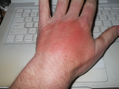
It was only then that I realized that I’d gotten my first sunburn of the year during the return trip from Ripplebrook. I think I need to root around in the basement and see if I have a set of thin full-finger gloves I can hack the fingers off, so I can keep the backs of my hands unfried while not having to deal with the horrible padding that most bicycling gloves have in them.
We did the loop in 9h51 minutes (actually a a bit less, because we didn’t pull out of the starting control until a couple of minutes after 7am), and the only thing I noticed going wrong, despite this being the third-fastest I’d ever finished a ~200k loop, was the balls of my feet cramping up every time I got off the bicycle in the last third of the loop. My existing shoes are starting to disintegrate, so for the replacements I will probably experiment with more traditional clipless bicycle shoes to see if that solves the problem of more foot stress when moving faster.
For what it’s worth, all of the pictures I took can be found on Flickr.
—orc Sun Apr 15 21:56:29 2012
Apr 13, 2012
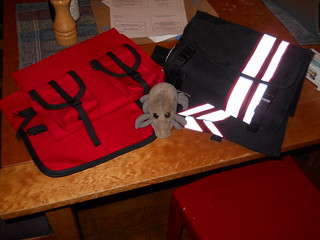
Dust Mite is planning on guarding a couple of handlebar bags until I can replace the drive belt on my Pfaff.
—orc Fri Apr 13 21:46:05 2012
Apr 12, 2012
Apr 11, 2012
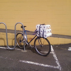
The project bike sits at Trader Joe’s with a load of paper towels.
—orc Wed Apr 11 22:47:52 2012
Apr 10, 2012
Last weekend saw the Christian Easter feast, which for a large part of the world includes hunting for easter eggs, eating yourself sick on sweets, and sitting down for a leisurely meal on Sunday. For randonerds in the NW US, it also includes an exercise in insanity called Flèche Northwest, which ends up in Olympia, Washington after starting 24 hours earlier and at least 224 miles away.
I did it last year, so I really wanted to do it again this year, but it was complicated by the 6th being Silas’s birthday . But after much shuffling and rearranging of scheduled events (Silas wanted to do his birthday party the week before his actual birthday, which, thankfully, only conflicted slightly with the ORrando spring 200k, so I was able to get back into town and clean up before the party started) I managed to carve out a block of time starting at ~9pm on Friday and ending at ~noon on Sunday, which was just barely enough time to ride up to Olympia, nap for a few hours, then take the train back down to Portland.
So the ride was on. We didn’t have the entire team from last year – Theo had been recruited by a faster team that wanted to ride 480km or so – but the team still had Bill Alsup, Ed Groth, Asta Chastain, yours truely, and the new team member Ryan Good. Ed had made the route, done the paperwork, named the team (flèche reconstituer), and left only the riding up to the rest of us.
So starting around 8pm on Friday, we started drifting into the Thai restaurant just around the corner from my house (my house wasn’t really usable, because I was down at my parents house celebrating Silas’s birthday), and promptly(ish) at 9pm we headed out towards the Springwater Trail, to ride into downtown, then over skyline via the insanely steep 53rd Drive. It was cool, but not cold (the weather forecast called for mid to high 30s nighttime temps along the route from Portland to Westport (where we were to take the carferry across the river to Cathlamet), and it didn’t take very long before we completely forgot about the temps as we climbed up to Skyline.
I don’t think of myself as a very fast climber (my traditional climbing position is to be faaaar in the back as everyone else evaporates into the distance on any climb longer than about 60 feet) but I seem to be getting faster. I found myself, to what would have been my surprise except I was too busy trying to remember to breathe as I pounded upgrade, climbing as fast as Asta was on this first long ramp.
We regrouped on the top (it was considerably colder up here) then dropped down the other side of the hill into the Tualatin River valley, where it was colder yet, and then proceeded eastward towards Timber Road (which would eventually drop us onto highway 47.) But we weren’t moving all that fast, and found ourselves unsuccessfully chasing the closing hours of the grocery stores and minimarts that are scattered along the roads on the north edge of the valley. We reached North Plains just after the grocery store on Commercial St had closed (we stopped in the city water bureau’s pocket-park to snack and layer), we reached Banks after the Thriftway and gas station had closed, and we reached Glenwood after the gas station, store, and bar had closed. (We stopped here anyway because Glenwood was a control, so we needed to take pictures and toss on every layer we had because it had become quite cold indeed.) and then we headed north on Timber Road up past the headwaters of the Nehalem River and into banks of thick freezing fog that would stick with us all the way to Mist, where we would finally climb out of the Nehalem River valley.
There aren’t any services from Glenwood to Vernonia, but there was a minimart there. But it was closed. And after Vernonia, there were no other services until Clatskanie, so we ended up riding 100 miles before our first fud stop.
But to get there was interesting. It was in the mid to high 20s (Fahrenheit) in the Nehalem River valley, and it was foggy, so everything was coated with a thin layer of frost except for our bicycles, which were picking up sheets of ice on every forward facing surface (including us.) By the time we’d reached Vernonia, our water bottles contained icy slush instead of water and/or science diet, and those of us who wear glasses were needing to wipe the glasses like clockwork every minute or so before our vision disappeared into the fog.
And it was cold (did I mention it was cold) enough so that every time we stopped we immediately chilled, so we had to keep moving to stay warm enough (I found that spinning my pedals as fast as I could go was the best way to warm up fast, so I spent a large part of our transit up to Mist pushing a 100+rpm cadence in a very low gear.)
But as we approached Mist, it started to lighten, and the long climb up Clatskanie Mountain was done in the pre-dawn light. Asta and I gapped everyone else by a long stretch on this climb, with me trying (successfully) to keep up with her while she tried (and succeeded) to stay barely ahead of me as we climbed. And then we stopped at the summit of the highway, tried to stay warm (or nap), and waited for everyone else to show up before plunging down the other side of the mountain to the town of Clatskanie, where we hoped to find somewhere that had coffee and maybe breakfast.
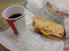
There was coffee (standard american cafe coffee, which is not the sort of coffee that Portlanders usually drink) and fud at the Clatskanie Subway, and it was warm there, so we paused for a considerable amount of time before getting on our bicycles and heading for the ferry terminal in Westport. The ferry runs on 1 hour headways, so we had to wait, but not for very long (20 minutes, I think,) and then we sailed across the mighty Columbia and rode on to the west.
But unfortunately we still weren’t going all that fast, and after a hour or so on Washington Highway 4 we were down to
- a brevet average of 9.1 mph (control closing times are based on 9.5 mph), and
- a little over 3 hours to go 70 kilometers to the next control if we wanted to make it there before it closed.
A brief emergency meeting was needed, so we stopped at the side of the road and discussed what to do; either abandon the flèche or try to go like the dickens to make it to the next control on time.
I didn’t want to abandon, and Ryan, Asta, and Ed were willing to try and go for it. Bill didn’t think he could maintain the needed pace, so he decided to ride the rest of the way in at a more sustainable rate, and that left the four of us to ride west as fast as we could go. Ed lit out for the coast at top speed with the rest of us tagging along in his slipstream, then Asta took a turn pulling us along, and then I stomped on the gas and yanked us along at 27mph for a few miles before I ran out of power and had to follow behind, but, uh oh, we’d lost Ryan already – it turns out that he’d fallen behind when Asta was pulling and was long gone :-( But there were still three of us, and that’s how many people had to do the loop to get credit for it, so we cranked on as fast as we could go trying to get those kilometers out of the way before we ran out of time.
By the time we’d reached highway 101, our water supplies were starting to run down and we had decided that when we passed the next store or gas station we would need to stop and get some water. But, as we eventually realized, even though
southern Washington is a bit of a tourist spot and there are lots of vacation spots along the coast, highway 101 is not along the coast and all of those vacation spots are 2-3 miles (or 20-30 minutes) away from the highway. And we didn’t have 20-30 minutes to spare. So we screamed up the coast, water supplies slowly dropping down to 0, until about 10 miles out of Raymond (our next control) my water ran out, and, soon thereafter, so did my energy – I had been snacking pretty much continually as we shot up the coast, but when I didn’t have water to wash down the nasty science diet I just couldn’t eat it. So no water => no food => no power => dropping abruptly from 20mph down to 13 and watching as Asta and Ed disappeared into the distance when we hit the next hill.
And then for the next 8 miles I staggered along, cursing on every pedal stroke, trying to keep up with them. I caught up with them about 3 miles south of Raymond (they’d stopped for the call of the wild and putting air into a tire with a slow leak) then passed them by saying that I would stop at the first store or the Raymond city limits to wait for them.
And, just about 1000 feet this side of the Raymond city limits (and with 17 minutes before the control closed) I saw a grocery store, so pulled off, dashed inside, and returned with water and nasty sports drink just as Ed & Asta saw my bicycle and started pulling into the lot.
We stopped, inhaled a bunch of the water, got some snacks and ate them as if there was no tomorrow, then called this grocery store our Raymond control and signed it off on our brevet cards.
And this left us 6 hours to ride 100km (to get into Olympia) or 72km (to get up to 360km, which is all we needed) which seemed like it would be pretty easy to do.
Except that the secondary roads we were planning on using had long gravel sections that climbed abruptly up to the tops of mountains, then plunged equally abruptly down to their feet. Our 22 hour control, which was originally Oakdale, was relocated back to the second mountain summit (I labelled it as “GODFORSAKEN GRAVEL ROAD, WASHINGTON” on my brevet card) and that left us with 32km to ride to get up to the 360km minimum.
This last bit was fun, in a sort of soul-destroying way. First, we wanted to just get off the mountain, so we went sledding down at various speeds (Ed, on his nice rSogn, disappeared into the distance, followed at a distance by Asta, who was followed more closely by yours truely) until we went over a bridge and were magically back onto a gravel surface with 28km to go in 1 hour and 40 minutes.
The three of us knew that this was doable, so we put on (what was left of) the afterburners and shot towards Olympia, knocking off 21km in 40 minutes before the clock ticked over to hour 23 and all of our energy reserves went away to die.
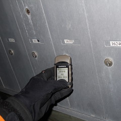
It took us 58 minutes to go 7km. Some of that was because Asta had a flat (her third of the loop) and it took about 15 minutes to change the tire, but mainly because we were all pretty nearly out of puff and could only stagger on at about 10km/h. At 23h56 minutes my GPS ticked over to 360km, so we declared the flèche over and crawled up to the nearest intersection (a short side road with a row of mailboxes) to write down the street address, sign each other’s cards, then take a picture of my GPS showing the distance and the time.
And then we called the organizer, got a route to get into Olympia that was a little more direct (19 miles) than the 22 miles less than our planned route was,
and crept towards the end of the line. Ed had burned off all of his energy, so he eventually stopped and called for a cab, and after he’d gotten picked up Asta and I had recovered to the point where we could ride at a more normal pace into Olympia, where we met up with Ed & Theo (Theo’s flèche team had DNFed the previous day, so he just rode up by himself to meet up with us and go to the brunch that SIR was putting on) then eventually Ryan and Bill, and then I got to take a 5 hour nap before waking up, riding out to the Amtrak station, then taking the first Cascades home so I could help with easter egg gathering. (Ed, Asta, Theo, and our friend Kevin (who was on yet another team) did not have to be back in town by noon, so they got to ride back. Color me insanely jealous!)
The gory detail are
- 360.2km in 23h59
- 12,000 feet of climbing according to my (elevation corrected) GPS track
- 79 photos
- 39 hours door to door (and that included a brief stop for coffee before I got home.)
- Almost no services on the route :-(
—orc Tue Apr 10 22:57:16 2012
Apr 09, 2012
I’ve been using Apples Time Machine to do automatic backups of my work computer for a couple of years now, and I had a huge long list of backups going back to the beginning of time.
Had is, alas, the operative word. My mac got confused about the backup disk, so it first complained about the disk being full (it’s a half-full 1gb disk) and then it wiped out the entire backup volume before starting from scratch again.
Sigh.
Now that’s quality software engineering. It’s so good to see that FreeBSD can be fucked up to the point where it’s operationally indistinguishable from Linux.
—orc Mon Apr 9 22:28:40 2012
Apr 08, 2012
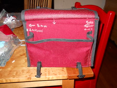
The resewn big rando bag isn’t quite square, so I’m going to have to pull the whole thing apart and go over it with an angle so I can make the lid not want to lunge to one side or another :-(
—orc Sun Apr 8 22:29:52 2012
Apr 06, 2012
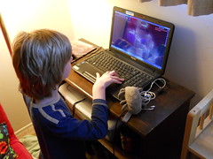
Dust Mite helps Silas solve a maze in the computer game Terraria
—orc Fri Apr 6 18:05:22 2012
Apr 05, 2012
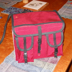
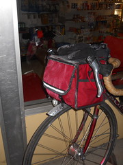
I need a bag with lots of pockets for the fleche I’m riding tomorrow (at 9pm, so you can tell I’ll be at my very best) so I took my big rando bag, which I’d dismantled to correct a few defects (front pocket lid folds back at speed, back pockets tearing apart, top seams had stretched so water got into the bag when it rains) and put it back together, adding a few experimental touches to see how they would work.
I still have to finish taping the body, but that’s only a matter of a hour or so (if I hand-sew; if I machine-sew it’s either 10 minutes or 2-3 hours if I end up messing up the seams) and maybe putting a lining in (20 minutes to sew the lining, another 30 minutes to sew the zipper into the bag) but I really don’t need either of those to be done to use this bag. If worse comes to worse, I can just toss it onto the bicycle with naked seams and deal with it when I get back after my 400km loop tomorrow and saturday.
—orc Thu Apr 5 23:22:32 2012
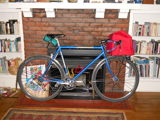
The project bike sits in the living room, fully loaded after a trip down to the Big Big Store.
—orc Thu Apr 5 21:12:52 2012
Apr 04, 2012
The new replacement working Eng! sits at the head of the Springwater Trail.
—orc Wed Apr 4 23:53:31 2012
Apr 02, 2012
This year, Oregon Randonneurs is running two rando series; a summer series based in Portland, and the regular spring series that’s not based in Portland.
The existance of the Portland series has made it possible to push the spring series out further into the countryside, reusing old routes that have lain dormant for a couple of years and creating new routes that start a long ways away from Portland.
The spring 200k was one of the new ones. It’s a Michael Wolfe route, which pretty much guarantees a lot of steep climbing, and also guarantees that my only personal best would be to actually complete it instead of DNFing out on top of some mountain.
And it starts/finishes in Canby, which is 18 miles away from my front door.
Ugh.
Sometime last week, before I’d even made the leap from signing up for the loop to figuring out how I would actually get there to ride it, my friend Theo sent out mail to a bunch of the Portland crew mentioning that he was planning on riding down there and maybe we should do it en masse.
A few exchanges of mail later, it ended up being that me, Theo, and our friend Asta would be riding down with maybe a couple of other people doing it as well.
So at 4am on Saturday morning, I woke up, took a quick shower, ate a bowl of cereal, then went outside to meet them at a little bit after 5am. They were running a bit late, so I took the opportunity to ride the mlcm up and down the block to test for rattles and fix them. And then Theo & Asta arrived and we shot off towards Canby via River Road (where I discovered that I must have knocked my pusher out of alignment by the simple expedient of having the thing derail my
chain into the bottom bracket when I shifted to the alpine ring), then 99e from Oregon City south.
When I got up at 4am, it was drizzling, but it had stoppped by 5am and there was actually clear sky visible. This did not last, and we arrived in Canby just as the clouds opened up and started dumping down rain. And this rain was still coming down when 7am rolled around and we were shooed away into the deluge.
Most of my Portland friends are quite fast (and all of my Portland friends who showed up for this ride are in the quite fast category,) so if I wanted to ride with them at all I needed to be quite fast as well. And I managed to do this by religiously following Theo and Asta off the line and sailing along with the fast guys down the road as far as the Molalla River, where the route curved abruptly south and up a longish steep ramp.
At which point I attempted to shift into my alpine ring and it didn’t work. It didn’t derail, but it didn’t shift, and trying to push 240 pounds of bicycle and Orc up an 11% ramp in 50×24 (I have an 11-28 cassette, but get huge chainrub in 50×28) doesn’t actually work very well. So I stopped to hand-shift and all the people I was riding with simply evaporated into the morning rain.
Okay. So I hand-shifted and ground off after them. I saw a couple of the tail end of the fast guys in the distance for a while, but by the time I passed the Dickey Prairie store I was riding by myself, and didn’t see any other riders for
a considerable period of time. (A not particularly happy situation, this was an outandback up into the headwaters of the Molalla River and the cues were somewhat iffy; you go upgrade on Dickey Prairie road for a while, then cut over
the river and go up Molalla Forest Road for a long while, but there’s a nice wye connecting the Molalla Forest Road to the Dickey Prairie connector stub that’s not signaled and I ended up riding a little way the wrong way before remembering that I needed to be going upgrade into the mountains.)
So up I went, seeing nobody except a couple of riders who passed me on steeper sections of grade, until about a mile and a half from the top control where the fast guys came screaming downgrade (the lead pack, including Theo, were about 12 minutes up on me, then another pack was about 8 minutes up, and then a few single riders came past until I rode into the control just as Asta and Steven Casper were pulling out.)
I wasn’t particularly interested in riding alone if I could help it, so as soon as I got my card signed I waved goodbye to the control, lit off my afterburners, and sprinted back down the mountain trying to catch up to any of my friends.
I was fairly lucky this time; I managed to overhaul Asta just before I ran out of energy and blew up, and was able to reduce to a fast but still sensible speed and ride with her the rest of the way down the mountain towards Molalla. And we basically stuck together for the rest of the loop, which was fortunate because the both of us had a devil of a time following some of the cues and would have gotten horribly lost one way or another without having the other say “whoops, we’re going the wrong way” after yet another misstep.
We’d been maintaining a brevet average of 15mph up until Molalla, but that plan went right out the window when we had the choice between either warming up or bolting onwards and blowing up. So we stopped for a considerable period of time at a gas station/minimart on OR 211, and then (after a festival of misreading cues) proceeded south towards Silverton.
It had stopped raining about the time we reached the Molalla control, so that meant I could actually start to enjoy the ride (or at least the parts that weren’t climbing – the climby parts involved me going as fast as I could so I wouldn’t lose sight of Asta, and then making up for the lost distance by sprinting ahead to catch up to her.) The route went through a really hilly section south of Molalla, but it was a fairly farmy hilly area, and we spent most of it going past various horse, cattle, and llama/alpaca ranches, with the occasional crop field thrown in. And then we plunged back down to the valley and headed over to Meridian Road for a quick ride south into Silverton (with yet another miscue that threw us a long ways off the route before we corrected and got back to where we needed to be :-()
And in Silverton? It was lunchtime, so we stopped for food and coffee before starting the climb up to Silver Falls State Park. And then we missed the turn for the climb and ended up riding past the Oregon Garden before realizing our mistake and going back. And then we settled in for a nice loooooooong climb from ~250 feet asl to ~1750 feet asl.
One good thing is that the clouds had broken up and it had become a nice sunny day. But this was compensated for by a stiff south wind, which was either a headwind or a savage crosswind (savage enough to blow open my porteur-randonneur bag and whisk my cuesheet away, so I had to stop and run across a field to recover it) for the bulk of the climb (the non-windy part of the climb was a 3 mile 900 foot climb to the entrance of Silver Falls State Park, which featured a brief hailstorm as I crawled, cursing, up the ramp while Asta vanished into the distance, not to be seen again until I sailed into the south falls/park lodge parking lot where she had paused to demolish some of her collection of rando fud.)
We found the lodge (not an easy task if you’ve never been there before; the signage is not intuitive) and parked ourselves there for about 45 minutes to warm up (there was a lovely fire going inside the lodge), get more water, use the bathrooms, and relayer for the descent. Alas, I did not get any photos here because I was too busy being fried from the climb.
And then all we had to do was get back to Canby. This involves riding around the waterfalls on OR214, then plunging down the mountain into Silverton, and then riding north (with the wind at our back) up Meridian, et seq, to Canby.
The descent is pretty nice. You climb up about 300 feet from the south falls to a bridge just southeast of the north falls, then climb in and out of half a dozen shallow ravines, then tip over the edge of the hill and fall down into the valley, first along a series of long tangents and then along a sinuously wiggling road (but not tightly wiggling) that carves down the side of a ridgeline. If you’re used to descending, you can do this without brakes,
and it almost makes for the pain of climbing all the way up that mountainside.
When we reached Silverton, we stripped off most of our layers, then bolted north, with the wind at our back, to finish the last 22 miles of the loop.
Asta was flying along here, so I followed along as fast as I could go and managed to just barely hang on as we shot north through fields, farms, and small villages, arriving in Canby just as the evening Cascades went zipping through towards Salem and points south.
Not a very fast loop, I’m afraid, but we finished before the sun went down and before the evening rainstorms started. And then, after a considerable time spent sitting in the restaurant that was the closing control, we were rescued by Oliver Smith and given a ride back into town instead of having to ride, through the pouring rain, that last 18 miles back to civilization.
And then I had to spend six hours cleaning for Silas’s 10th birthday party.
Pictures? Yes, right here. Sanity? Nope, not at all, and that’s the way I like it.
—orc Mon Apr 2 00:14:55 2012
—30—