Permanent 1278 – Sellwood-Birkenfeld-Sellwood – 230km
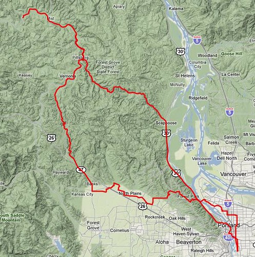
I have a smallish stack of Portland based permanents, most of which involve stupid amounts of climbing. This is not one of them. It starts at somewhere around the corner of Milwaukie & Bybee (the exact location is unsure, because the opening/closing controls are open, but the Marsee Baking just west of Milwaukie is a good place to start, and the Staccato Gelato just west of that is a good place to finish) and proceeds up into NE Portland, across the St. John’s bridge, and up highway 30 to Scappoose, where you cut west up and over the Nehalem divide, then north along the Nehalem River to the tiny logging town of Birkenfeld.

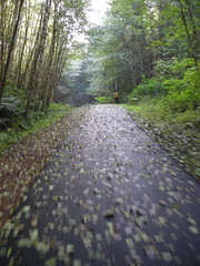
The route back to Portland is slightly different; instead of recrossing the Nehalem divide at Pittsburg, the route proceeds southwest to Vernonia, where it diverges onto the Banks-Vernonia linear park for the 20-odd miles into Banks. This is an old railroad ROW, so it’s moderately graded (except for a gap just north of the summit where a long bridge burned; the replacement path plunges down the hill to cross highway 47, then ascends just as steeply up the other side of the valley to rejoin the railroad ROW for the rest of the trip down to Banks) and an easy climb and even easier descent.
One game I like to play when I’m riding this route is to just stop pedalling at the top of the grade and to see how far I can coast before I have to pedal. There are a couple of grade crossings, a pair of extremely rough bridge approaches, and a gravel road crossing at almost the bottom of the grade, which make this a bit of a challenge, but it’s a fun way to burn off 8-9 miles of the loop.
And then you’re at Banks, where you go back onto the public roads for the last 30 or so miles into town. There’s one last climb on Old Cornelius Pass Road (the Rock Creek Tavern sits right across from where the route deposits you onto Old Cornelius Pass Road, so this is a good place to stop for a snack if the idea of another 1000 feet of climbing is daunting) and a correspondingly terrifying descent on Germantown Road before you get back into Portland for the last 10 miles of riding back to the end of the line in Sellwood (An acceptable reroute is to take Skyline further south to Saltzman Road, which is a gravel pedestrian/bicycle route in Forest Park that deposits you on St. Helen’s Road a mile or so south of where Germantown Road would drop. I have gone down Saltzman Road in the dark on 25mm tires, so it’s not exactly what you’d call a technical descent.)
A cuesheet is available here, and if you want to ride this for RUSA credit contact me at orc@pell.portland.or.us.