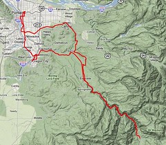
Permanent 1302 – Portland-Ripplebrook-Portland – 206km
This is the other of my flat permanents; there’s about 4000 feet of climbing here, but there are only two long steep ramps in the entire loop.
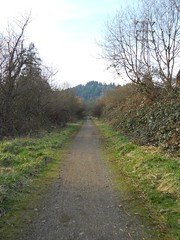
The loop starts in NE Portland (originally at the Kettleman’s Bagels on Broadway, but Kettlemans got et by Noahs, so now it’s an open start/finish) and, after a couple of miles of wandering through city streets, deposits you onto the Springwater Trail for a 20 mile run out to the end of the line in Boring (the paved part of the trail ends 2 ½ mile short of Boring, so the cuesheet directs you onto the adjacent county road, but if you stay on the gravelled railroad ROW you’ll be deposited in Boring right across the street from the road south.)
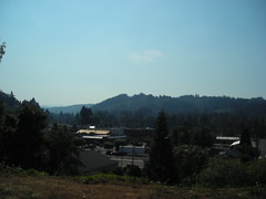
The road south of Boring rolls for a while through berry orchards and exurban developments, then plunges down off the edge of the Boring Lava down to the Clackamas River Valley. And then, to pay for the descent, you climb back up to the top of the bluff and roll along quiet country roads until you reach the edge of civilization in Estacada.
Once you leave Estacada, there are no services until Ripplebrook except for a minimart at the Promontory Point campground 7 miles up the line, and that minimart is not open during the offseason. If you’re feeling like you need a little something, this is a good place to stop, because after you hop onto OR 224 and head into the gorge (with a brief detour onto PG&E’s Faraday Road to get around a horrific hillclimb on 224) there’s nothing there except the gorgeous scenery as you and the Clackamas River wind up into the mountains.
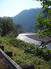
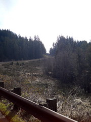
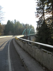
You’re climbing here, but for the most part it’s not noticable because you’re riding alongside the river, only occasionally going up a short ramp and then waiting for the river to catch up. And then you cross a couple of bridges, then two more, and then you go up 600 feet or so to reach the ledge that Ripplebrook sits on.
And at the top of the ramp it’s just a couple of miles until you reach the end of the line at the Ripplebrook Ranger Station, where you can stop for a little something and a receipt before turning around and heading back the other way.
It may have seemed like a long time to get down to Ripplebrook, but that’s because of the invisible grades. Going back can be considerably faster; if you were battling strong headwinds going towards Ripplebrook, those winds will blow you back down the gorge faster than you can say Jack Robinson, but even if they aren’t blowing you’ll find yourself at Faraday Road, then Estacada, almost before you can blink.
If you know the area, you can detour off OR 224 here and follow Eagle Creek Road north for a while before being forced back onto the highway, but in any case you need to follow the highway north until you reach Barton, because that’s where you jump across the Clackamas River to ride backroads (Baker’s Ferry Road, then Springwater Road, then Clackamas River Road) all the way into Oregon City, where you loop through downtown before heading back north into Portland.
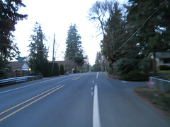
You’re in the city for the rest of the ride now (12 miles, more or less) but most of the roads going back towards Portland are very wide and have generous bike lanes, so it’s generally not the sort of urban riding experience you might expect.
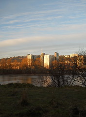
And when you reach the end of the line, you’re back in one of Portland’s business districts, so there are many coffeehouses and pubs where you can get cards signed and have a little something before heading home.
A cuesheet is available here, and if you want to ride this for RUSA credit contact me at orc@pell.portland.or.us.