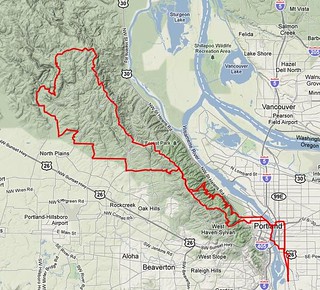
Permanent 1303 – Dixie Mountain 100 – 114 km
Despite appearances, not all of my routes head out SE of Portland. Some of them head northwest, and take advantage of some of the gravel roads that clutter the countryside around Portland.
This route is one of them. It starts, as is traditional, at Bybee & Milwaukie, then heads north towards downtown Portland, winds its way through the city center, then heads up Cornell Road to Skyline Blvd.
My normal route up to Skyline is to take Thompson Road, but when I made up this route Thompson road was closed because of landslides. So instead, it turns off onto 53rd Drive, which says Hello, Sailor! by immediately putting you on an eyepoppingly steep ramp almost directly up the face of the West Hills, and this ramp only moderates to just steep (with one small descent in the middle which is paid for almost immediately by a resumption of the steep ramps) until you’re almost at the end of 53rd Drive, where it drops down to the junction of Thompson Road, which will seem almost completely flat compared to what you’ve been through.
Thompson goes up to Skyline, where the route turns north and rolls along Skyline up to Germantown Road, where it goes west again and drops down into the Tualatin River valley (taking Old Germantown for much of the descent; Old Germantown is really steep and twisty, but it’s a residential road and there is almost no traffic on it compared to Germantown proper) and over to Old Cornelius Pass Road, which is where the first control – at the McMenamin’s Rock Creek Tavern – is located.
From this control the route goes west again, hugging the base of the hills to the north. Out Phillips, up Helvetia, up Jackson Quarry, then down Mason Hill to the Junction with Jackson School, which goes north to a junction with Shadybrook Road, and then north again to the junction with Dixie Mountain Road. And here the fun begins.
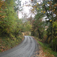
The first few miles of Dixie Mountain Road are pretty typical country road; it winds gently uphill along the side of a valley, undulating gently as it goes. But then you’re greeted with a ROAD OUT sign and have to jog across the valley on a detour (I’m not sure if calling it a detour is actually the right term here, given that Washington County has abandoned and ripped out about half a mile of road and the bridge that washed out) to Collins Road, which is paved for maybe 1000 feet and then turns to gravel. For 9 miles. All uphill :-)
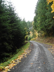
The road winds uphill through forested areas (with houses and farms scattered left and right), crosses a bridge and becomes paved for about half a mile as it goes through the village of Shadybrook, then goes back to gravel and starts winding uphill in earnest. For a while it winds between farms, but then goes into forestland where the only signs of civilization are the logging roads that come in from the left and right.
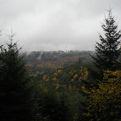
And it goes up and up, with breathtakingly beautiful views off to the left, until you finally top out on a long ridge and break briefly out into farmland before plunging back into the forest just before the next control at the Dixie Mountain grange hall. And from here you head back east, uphill for a while, but then (after reaching Rocky Point Road, which is paved) generally downhill (and occasionally steeply downhill) all the way to Saltzman Road, which is the start of another 9 mile gravel section.
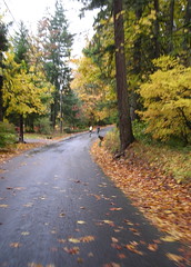
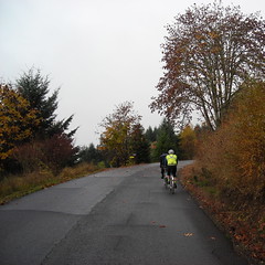
Saltzman Road is a fairly steep descent of the west hills – it starts steep and gets much steeper before you reach the bottom – but you’re only on it for about 3 miles before turning on Leif Erikson Drive, which takes you across the face of the West Hills, climbing a bit for a few miles, then descending, until you’re back in the populated part of Portland and on city streets at Thurman Ave, which is the end of the gravel excitement for the day.
Thurman takes you down into the center city, then you take Lovejoy, et seq, over to the Broadway Bridge and then drop down back into Sellwood via 21st/12th Aves. And you’re done! (and now it’s time to go home and get all the dust and grime off your bicycle.)
I don’t have any official preride pictures, but you can look at the bikeroutetoaster route, a cuesheet, and, of course, you can contact me if you want to ride this loop for RUSA credit.