And that would make three
Earlier this week, when my friend Kevin and I were discussing whether to ride a permanent this weekend in addition to what is becoming a weekly midweek permanent, I brought up the idea of riding my new 300, but after a day he had a better idea.
“ I’m up,” he wrote, “to ride your new 400 instead of a 300.”
Well, I wasn’t planning on riding that loop until next summer (my end-of-summer calendar is getting a bit crowded; I only have one more wednesday, possibly a thursday, and maybe enough of a saturday to ride a populaire before the school season starts and I’m back to scrabbling for time to ride one a week until the end of the year) but I’d be a fool not to ride if someone wants to do it with me.
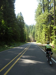
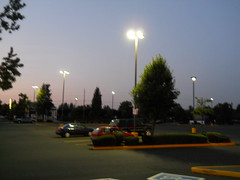
So, at 7am on Saturday morning (the advantage of a permanent over a regular organized brevet is that you can set the starting hour to something more reasonable) I quickly finished my coffee, and the two of us hopped onto our bicycles and headed for points south. There’s not anything to be said about the run out into the country – I take River Road south to Oregon City, then go east on Clackamas River Road, and I do it for many of my permanents, so it’s not as if there’s anything much to describe that I haven’t already described.
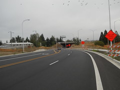
The only thing new about the route out to as far as Ripplebrook is that the jughandle project has progressed far enough along so that the Clackamas River Road/Washington St underpass is finished and open. This means that my permanents through here no longer have to do the Apperson zigzag to get around the construction zone, and I’ve started redoing the cuesheets for all of my Oregon City perms to use the new underpass. It makes the start of a long loop much more satisfactory when you don’t have to cool your heels at the Abernethy/Redland Road intersection waiting for the stop light to change, then winch your way up and over highway 213 so you can drop down on the other side.
The day started cloudy, but as we headed east and away from the Willamette River we popped out into clear skies and spent the rest of the day under a hot sun. This wasn’t all bad, because there was still some residual haze at the lower elevations and our (speedy) trip up to Ripplebrook felt almost as if we were cycling through an oil painting. (And the trip was speedy; it was 4h18 by the brevet clock, but we didn’t get away from Marsee until 7:08, we stopped on Faraday for a snack, and we stopped on river road because one of my water bottles ejected when I was unable to avoid a pothole. Probably 3h50 of actual moving time, which isn’t bad for uphill.)
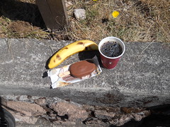
We made up for our speedy trip up by taking our sweet time there; I had a leisurely snack, we refilled water bottles, I connected to the wifi there and posted this update, and we didn’t get back on the road until sometime after noon.
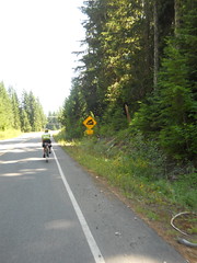
Prior to this day, every time I came up to the end of highway 224 I’d turn left and climb NFD 57 up to either Timothy Lake (via NFD 5810 or NFD 5810/5820) or High Rock (NFD 58.) But today we turned right and proceeded onto NFD 48, which was a revelation.
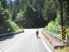
“Why haven’t I ridden this road before today?”, I kept asking myself as we wound upgrade for miles and miles and miles along the Clackamas River. It is, if anything, prettier than the lower reaches of the Clackamas River between Estacada and Ripplebrook, and even though it’s the scenic route from Detroit to the Portland area there is still not much traffic along it. It climbed very slowly for many miles, then started pitching up steeply for the last 700 feet or so to the summit (~3800 feet) which slowed us right down to a crawl, but not, apparently, for very long, because we still made it from Ripplebrook to Detroit (45 miles) in 3h18.
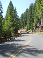
The summit of NFD 48 is pretty nice if you’re coming from the north; you false summit a couple of times, climb over the actual summit, false descend a couple more times, come upon a steep grade warning, then fall off the edge of a cliff and plunge down 2100 feet or so in the next 10 miles. Six miles down from the summit is where the turnaround point for the spring 300k was, and, yup, the “twisty road next 6 miles” sign still doesn’t say “… and 1500 feet of climbing. Hello, bicyclists!”
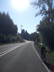
And then it’s familiar territory for me (I was acutely aware of the scenery as I went up and down that part of the road this spring.) My water finally ran out about 5 miles west of Detroit, and it was hot enough so that the 15 minutes it took to cover that distance completely dried me out (I drank a lot of water on this ride; almost 16 bottles worth, and much of the last 2/3rds of the ride was a race against my water running out, which only happened twice after Detroit.)
And, just for that additional touch of familiarity, we left Detroit and went directly into the teeth of a strong headwind. It was 20 miles down to our exit at Mill City, and for the first 12 miles I sprinted as fast as I could go into the headwind, and then when I blew up Kevin dragged me the rest of the way to Mill City at close to the same speed.
One annoying thing happened on the way to Mill City, though. The third bottle cage holder that I put onto the mlcm has the problem that it’s all made of plastic and that it uses the bottle cage to keep the toothed belt in place. This makes the bottle cage mount into a lever, so if the bottle cage is on the bottom of the frame and loaded with a bottle of water it will twist the plastic bottle cage bolt mount up and down. Get a big enough bump and it will twist far enough to let the belt loose, with the expected results.
In my case, we were rattling down the dubious pavement on highway 20 when I heard the thump of something falling from my bike, and when I looked I saw the water bottle lying on the ground behind me. I stopped, turned around, and tried to go back and retrieve it, but it had started to roll and it rolled all the way across the highway, passing under at least one camper van and truck in the process, but not being squashed while doing so. When there was a break in traffic, I ran across and retrieved the bottle, only to realize upon returning that the bottle cage was gone – and back about 50 feet there it was, lying quietly on its side in the bike lane.
So I finished off one of the existing (and almost empty) bottles, stuffed it into my rando bag, then tied the bottle cage to my tool roll and continued on my way. With only two bottles. Grr. I’m going to buy some water bottle cage mounts and experiment with the gaspipe frame to see if I can actually braze on a bicycle with the tiny torch I own (if that works I’ll put a second set of bosses on the downtube and a set on the DS seatstay so I can carry a fourth bottle on particularly arid brevets.
But, anyway, we got off highway 20 at Mill City, proceeded along the Lyons-Mill City road, then turned south onto highway 226, which we would take most of the way into Scio. Highway 226 climbs over a point of land to get into the Thomas Creek (which has at least three covered bridges over it, all of which we crossed during this permanent) watershed, and we hopped from bridge to bridge as we headed west. And then we headed west a little more so we could cross the North Santiam River, then head north and east back towards Stayton, which would be our first actual timed control for about 60 miles.
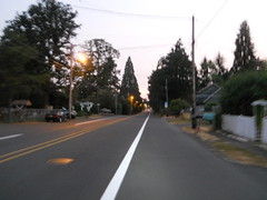
The sun had been getting lower and lower as we raced from bridge to bridge across the valley , and by the time we turned back west it was getting very low indeed. It was still dusk when we rolled into the control in Stayton (an open control, so we stopped at the Roths on the west side of town) but while we were taking our (leisurely) stop the dusk went away leaving us in the dark.
So then we had to finish the loop at night. There were good things about riding at night; farmers were working at night, so we passed several farms where they were plowing, baling hay, and harvesting wheat under the lights of their combines, and when we got up to about 1200 feet we could look west and see the lights of all of the cities and towns from Salem up to the southern suburbs of Portland. The bad things were that it was dark, so our navigation was to look at the cuesheet, memorize the next half dozen cues, then try to estimate how far we had gone since the last cue. I had loaded the cuesheet on my cellphone, but didn’t want to try and juggle it at night so it spent most of its time uselessly in my jersey pocket. Worse yet, some of the roads I used were ones that the online mapping software I use claim are acceptable bike routes. One of them was a steep loosely gravelled road, another one was a country lane that was blocked off in the middle. So I had to do some route tweaking in my head as we went along. When we found the gravel road (up on the highlands between Silverton and Stayton) the detour was to go a mile further east to Drift Creek Road, which also got us into Silverton, but at the cost of 4 extra miles. To make up for that, I struck Wildcat Road from the route between Mount Angel and Molalla and used highway 213 (not very busy at midnight!) instead.
And then there were hills. Some pretty scary. The route I took out of Stayton north went up some amazingly steep hills that I had to climb in my big ring because the mlcm started throwing its chain every time I shifted from the big ring to the small. And after Canby, the route east to Redland went up and down and up and down and up and down until we were almost sobbing with frustration. Fortunately I’d managed to get the mlcm into the alpine ring, but I left it there until we got out of Redland and had reached the summit of Redland Road. My crankset is fairly narrow, and the upper 3 gears aren’t accessable (well, I can shift to them, but then the bicycle makes horrible grinding noises when I pedal) if I’m in the alpine ring, so I spent a lot of time spinning like mad to keep up with Kevin.
And it had gotten cold after we transited Silverton. First the dips in the valley were cool, then cold. And then cold fingers started reaching out from the streams. And then the cold damp fog started, and by the time we summited Redland Road it was misty all the way down to Oregon City. Like a fool, I just coasted down that hill, and I was pretty much saying “F__k, it’s cold! F__k it’s cold!” all the way down to the junction with Abernathy Road, where I stopped, waited for Kevin (he was proceeding slowly down Redland Road because he didn’t want to freeze) and shivered until the cold was shaken out of my bones.
And then to home along the traditional path. River Road, Trolley Trail, River Road (again), 17th, and home. 23h09 in total, which isn’t fast but still gave us 4 hours of breathing room (or sleeping room, if this wasn’t a 400 but the initial 400k of a 600, 1000, or 1200) as well as 4 hours of leisurely stops at various controls.
This is my third 400 of the year, and it’s the only one so far that I’ve really enjoyed. It helps that I think this might be my absolute best route so far (even with the sinuous wiggles at the end to get it over 400k) but it was nice to just have it go without fuss, muss, or anything (Well, there was the bottle cage and the shifting starting to go wonky, but that’s just mechanical things and they don’t matter.)
Pictures are, as always, on flickr and I will post a formal route description as soon as my route revisions are approved by RUSA.