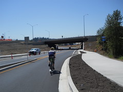
Jul 31, 2012
photo by Silas Wright
—orc Tue Jul 31 20:52:19 2012
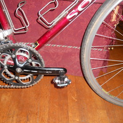
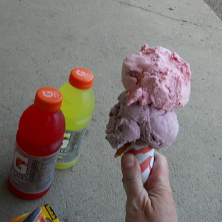
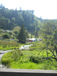
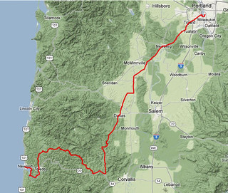
For once, I find myself in Pacific City with the mlcm but without a brevet clock ticking. So *now* it’s time to take pictures of the thing posed against various things of scenic interest. (It’s also my birthday, and I hope that my next natal year doesn’t end with the cascading series of catastrophes that 2011-2012 did!)
—orc Tue Jul 31 18:44:13 2012
When I repaired the mlcm’s rear flat tire yesterday, I couldn’t help but notice that the rear tire was getting pretty worn (decorative tread not only worn smooth but the tire was starting to square off. “What’s going on?” I thought “these tires are not even two months old and they’ve worn this much?”
But then I counted the miles I put on them. I ordered the tires around around the time of the Multnomah Falls populaire, got them around the time everything went utterly and completely to hell with a couple I’d been riding with, and put them onto the mlcm right after I got a flat that threatened to defeat the <9hr ride I’d done up to Ripplebrook and back.
And in the seven weeks since then I’ve ridden 2000 miles on the mlcm (2300 miles in total, but most of my riding has been brevets and permanents, which these days are the exclusive province of the mlcm.)
(I’d also ridden an already worn chain and cassette for 1600 miles, but replaced them because the cassette started to skip when accelerating and I didn’t want anything to slow me down on the 400k preride (well, at least I didn’t have any mechanical issues slowing me down, which was good.))
2000 miles on a pair of Ruffy Tuffies is pretty good. I should be thankful that these 1000+ mile months only happen 4-5 months out of the year.
—orc Tue Jul 31 11:51:30 2012
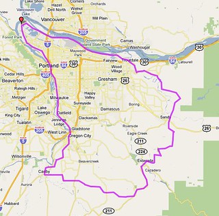
My plans for after the summer 400k were to immediately get on the
bicycle and head west for a week at the coast. And after doing
it in a much more inelegant manner than I wanted, I needed to do a loop
by myself without distractions.
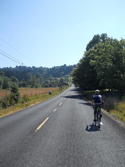
Fortunately my Portland-Pacific City 160 had
been approved last week, so I could kill multiple birds with one
stone here. And it uses Nestucca River Road, which means that
there will be about 4000 feet of climbing which I could possibly
do without being as embarrassingly slow as I ended up being on the
Barlow 400.
It turned out to be more adventurous than I thought, but I still
clocked in a less embarrassing brevet average despite everything.
But where to start? My original plan was to come back from
the summer 400k and head for Pacific City, but
the best put her
foot down and said “no” when I woke up from my 2 hour
nap (which was enough to keep me within hypothetical brevet
minimums for a 600k) so I had to defer it until Monday.
And on Monday morning, after the alarm clock woke me up at
4am and I realized that I had about 2 hours of chores to
do before I could go out, I decided that I would much
rather avoid the morning rush hour and leave at 9am, so
I went back to bed for a couple of hours, woke up at 6am,
did my chores, and was well on track for a 9am departure
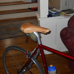
until I checked the mail and found a new Berthoud saddle
sitting in my mailbox,
which pushed my departure time back to almost 10am.
At 10am, there is considerably more traffic than there is
at 5am, and so 99W is less appealing. But it has bike
lanes most of the way out to Lafayette, and the traffic
outside of rush hour is tolerable. So I got over
the Sellwood bridge (sprinting upgrade at 24mph to keep
ahead of traffic; I slowed down on the downgrade because
the pavement is not so nice on the west side of that bridge
and I’d hate to crash and put myself into the hospital
just before my birthday) and up to Barbur (via the traditional
Taylors Ferry/LaView/Corbett route, which isn’t nearly as
steep as any of the alternatives) in good time, and was
maintaining a brevet average of about 15mph as I sailed
south to Tigard, where, just as I was climbing the north
side of Bull Mountain, the mlcm rolled over a staple
that punctured the rear tire and slowed me right down.
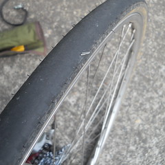
It wasn’t so much the puncture that slowed me down (it took a leisurely 15 minutes to change the tire, but I wasn’t in a hurry until afterwards, when I looked at the GPS and saw that my brevet average was down to 9.4mph,) but the realization that
I’d used up my last patch when the old Clement Strada
tires got a flat on the return from Ripplebrook on my
<9hr loop a few months ago. So I swapped out the inner
tube for my spare, then gingerly proceeded towards
Pacific City while keeping a sharp eye out for an open
bicycle shop. (Monday is a religious holiday for
Portland-area bicycle shops, and I had to go all the way
to Newberg before finding an open shop where I could
buy another patchkit and inner tube.)
South of Newberg, as you may not know, 99W becomes gradually
more and more rural, and by the time you reach Lafayette it’s
not much more than a busy secondary road. But the roads are
about to get much nicer, because after you pass through Lafayette
you go over a bridge, then turn off onto Mineral Springs Road,
which is the first of many miles of narrow scenic country roads
with minimal traffic. You go north on Mineral Springs Road
for a handful of miles, then turn west on Hendricks Road towards
Carlton and points west.
Carlton is a fairly small town, but it does have at least one
market on Main St (Hendricks Road becomes Main St in Carlton)
which you need to stop at and stock up on water and food (if
needed), because once you leave Carlton, it’s 45 miles and
several thousand feet of mountain climbing before the next
chance to get water. I was paranoid here, and not only
filled my two water bottles but picked up a third bottle and
stuffed it into my jersey pocket just in case.
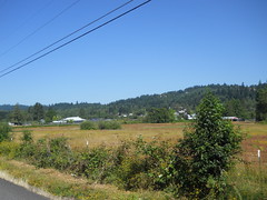
West of Carlton Main St becomes Meadow Lake Road, which rolls
along for a few miles (including a couple of whopper climbs
that made me think the Coast Range had crept up on me before
they pointed down) through farms and ranches, then tips up
and climbs up about 1700 feet before tipping downwards for
the run to the coast.
It’s quite a climb. You climb steeply for a few miles, then
the road flattens out on a saddle as if it was about to summit,
then it laughs and goes up steeply again (three times in all)
before eventually becoming Nestucca River Road (after a 2 mile
stretch of a poorly paved logging road) and going up again
to a rollery stretch at ~2000 feet that skirts the McMinnville
water supply before finally tipping downwards and heading
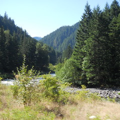
for the coast. And all of this travels through a designated
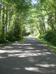
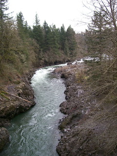
wilderness area, so it’s stunningly beautiful.
But I found some extra adventure on the way down towards the
coast – up on the east side of the mountain, at the point
where Meadow Lake Road becomes Nestucca River Road, there’s
a BLM display noting the natural beauty of the
area, and stapled to the frame of the display are several
notices regarding things like burn restrictions, hunting
restrictions, and a note that the Nestucca River Road was
closed for construction and you needed to detour – via
Bald Mountain Road and Bible Creek Road – around a 14
mile stretch of Nestucca River Road.
On paper, it didn’t look that bad (except for the “Bald
Mountain Road” name of the road) but when I reached the
actual detour the detour sign pointed to this road that
appeared to be painted on the side of the mountain.
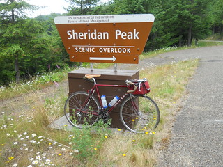
And that’s because Bald Mountain Road climbs up to
the summit of Sheridan Peak, which is 2600 (or 2800
feet; my GPS and ridewithgps.com both claim that I
stopped out at 2800) feet ASL.
And the foot of the detour is at 1600 feet, and you
need to pay off that 1000 feet in three miles.
So up I went, on an almost completely deserted mountain
road. After a quarter mile, I passed a pulloff and
fired up the music player on my cellphone, put in one
earplug, and started playing my Crush Therapy collection
on a random loop to help encourage me to climb faster.
It worked, and I managed to maintain about 7mph (as
opposed to the 5mph I was doing without a soundtrack)
for the rest of the climb up to the summit of Sheridan
Peak, where I stopped, got a picture, then looked at
the steep descent and decided that this might be a
good time to layer up (my cloud-chamber jersey was
completely soaked with sweat, and it was still
cloudy, so not having a windbreaker here seemed like
it would be an excellent chance for summertime hypothermia.)
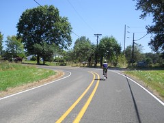
And then down I went – Nestucca River Road descends about
1200 feet on the closed section, but I’d gone up 1000 feet
so I had a 2200 foot descent. And it was a marvelous
descent, because there was no traffic on the road, the road
surface was in excellent shape, and there were good sightlines
on almost every corner. And the Berthoud saddle has enough
extra setback so I could drop into a nice low aero tuck and
go screaming down the curvy road like there was no tomorrow.
In unlogged country, too. The BLM has set this area up as
a ATV playground, so ATV singletrack is threaded around the
road, but since it was monday nobody was out playing on it.
So it was just me, my music, and the howl of a 30-40mph
descent for 30 minutes or so and I swept around corners and
switchbacks as if I actually knew what I was doing.
And then I got squirted out onto the Nestucca River Road
again, which went another 25 miles before it dumped me
onto highway 101 at Beaver. But that 25 miles was no
waste – sure, I couldn’t go at freefall speed, but the
road first wanders along the Nestucca River in the
designated wilderness area, then along the Nestucca River
past more farms and ranches, and then, briefly, through
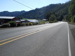
the town of Beaver before it dumps you onto highway 101.
And there I had my second adventure – my cuesheet told
me to go R on 101, then L on Sandlake, but I read it as
L on 101 and didn’t realize my mistake until I was 4
miles offcourse. Ugh. I should have realized that
I was going the wrong way earlier, because 101 north
of Beaver has wide-enough bike lanes along the road, but
south of Beaver has maybe a centimeter between the
white line and, often, 3 foot deep drainage ditches.
And 101 was pretty narrow here, so all of the logging
and livestock trucks when whipping on by about a centimeter
away from me (to match the “bike lanes” on this stretch.)
But eventually I realized my mistake and turned around
to work my way north (against a stiff headwind) up to
Sandlake Road, where I turned west and was able to reap
the benefits of a nice stiff tailwind all the way into
Pacific City. 12 miles of 20-25 mile an hour cruising?
Yes, please, and thank you!
I arrived at the final control just after 7pm (which
is about when I was predicting when I called to say
I was running late) having ridden 114 miles (and
climbing something over 6000 feet) in 9h17.
I’m not so sure how nice the route would be in reverse
(even though it is reversable) because the climbs there
are more gradual, which means you’ll spend more time
grinding out the miles and less time plunging like a
stone from the heights (and then there’s that pesky
99W runout into Portland) but it’s a spectacular
route going outbound.
Things that worked and didn’t work?
The Berthoud saddle worked and didn’t work; it feels nice
and comfortable out of the box, plus the rails are designed
to allow a little bit of extra setback, which is one thing
I pretty desperately need on the mlcm. It didn’t work in
two ways; the first is that it’s not broken in yet, and
my seatbones started to complain afer 105 miles, and the
second is that the setback is now so long that my legs
are rubbing against the toolroll I’ve got tied to the
saddle.
The Shimano cleats are still a work in progress. I’m having
more trouble with the right shoe than the left, and am moving
the cleats around to get them to fit right, but until then
I need ot put up with my right foot cramping on sustained
climbs :-(
—orc Tue Jul 31 04:32:32 2012
Jul 30, 2012
I was going to leave at 9am to checkride my Portland/Pacific City populaire, but when I opened the mailbox at 8:55 what should I find but the new saddle I ordered last week after I realized that my Brooks Pro had sagged to the point where it would require major work to make it ridable again. So instead of leaving at 9am, I’m going to leave closer to 10am, but I’ll also be testing out this nice new Berthoud saddle (I don’t remember the name of it, but it’s the 157mm width one) and when I get back from Pacific City I can yank the Swift off my trek and replace it with the black Pro that I pulled for the summer 400k.
(There were some problems with the 400k, but the only mechanical problem I had was that the black Pro has sagged to the point where it’s starting to be uncomfortable to ride on the cantleplate. I can fix that, even if it means I have to sell my body on the streets to pay for it.)
—orc Mon Jul 30 09:35:30 2012
Jul 29, 2012
Same dust mite, same saddle, same route segment. The difference was that I did not DNF the brevet this time around, even though I wanted to 2/3rds of the way up the Bull Run Road ramp.
—orc Sun Jul 29 16:51:31 2012
I am helping staff orrando’s summer 400k (this is basically Michael Wolfe’s Barlow 300 with the Maupin end filed down a bit and a departure from Portland bolted on at the start/finish) next weekend, so I’m obviously not going to be riding it then. So, instead, I went out with most of the volunteers at 5am yesterday morning (leaving home at 3:45am to get up to the vicinity of Hayden Island at a hair before 5am) to ride around the loop to look it over and get our chance for ride credit.
I’d done all the prepwork on the bicycle on thursday (for a change; this gave me the chance to take it out for a couple of short shakedown rides to make sure things wouldn’t fall off, break, or otherwise incapacitate me) and had it all loaded up with food and water (except for perishables) on Friday night, so all I had to do on Saturday morning was shower, get dressed, toss the perishables into my big rando bag, unplug the electronics and store them around the bicycle, then get out the door. This I actually managed to do within 5 minutes of when I wanted to get out the door, which was good because it took me about a hour to get up to the vicinity of Hayden Island and find the correct hotel.
It was still dark when we left (me, Michal Young, Lesli Larson, Susan Otcenas (one of the organizers), and Kevin Brightbill) and worked our way south across the city. We were going faster than I was going on the way down, but not much faster due to annoying things like traffic controls and traffic, but we made it to the Springwater Trail 48 minutes after we pulled out from the starting control. And from there it was south, then east, along the Springwater Trail, stopping only to verify a cue or two and to find an open bathroom that had not been colonised by a homeless person (most of the bathrooms along the Springwater Trail are closed because of this, but we found one unlocked porta-potty that we couldn’t use because someone had sacked out there.)
There’s not much to say about the Springwater Trail I haven’t already said. If you’re going directly east to the mountains, it’s a nice low-grade route that takes you 3/5ths of the way to Sandy before you have to dodge onto the public roads and start working with more substantial inclines as you get closer to the big volcanoes.
But today we weren’t going directly east. No, we were heading southeast to make the climb up to Timothy Lake (on our way to the town of Maupin on the Deschutes River) so all that taking the Springwater Trail did was to put us on top of a bluff that we didn’t want to be on top of. So after a quick fud+bathroom break in Boring, we aimed south on Amisegger Road, which isn’t anything special except that it drops us down to the Clackamas River Valley before we turned left and climbed up another bluff (via Judd Road, which seems steep and pointless until you reach Van Curen Road, which makes it all worthwhile.)
I was feeling well fed and watered, so I was feeling fast, and I managed to gap everyone climbing up to Kelso Road, gap them further dropping down Amisegger, then climb up Judd faster than anyone else (they’d caught up somewhat when I’d started climbing, because I could hear their voices, but by the time I reached the top of the bluff all way quiet except my gasping for breath.) So I plunged off the top of Van Curen Road all by my lonesome (Van Curen Road is basically a strip of asphalt that was painted on the side of a cliff. It’s gratifyingly steep, and when I was weighing around 200 pounds I could regularly make 50mph freefalling down it) and screamed up towards Estacada in solitude.
In Estacada, I stopped and waited for them, and from that point until Ripplebrook we moved along as a more-or-less bicycley blob of uniform density.
It had been cloudy in the early morning, but the clouds started breaking up as we reached the mountains and we headed towards Ripplebrook under bright sunny skies.
I was still feeling in fine form when we reached Ripplebrook, but felt that I needed a little something right then to keep from running out of energy. But, alas, I became distracted there and forgot to get food (I only got coffee and soda, which was not the right choice) so when we left and I lagged behind to get some photos I discovered that I was not able to unlag. So it wasn’t very long before the masses of bicyclists ahead of me vanished into the distance, leaving me to turtle along at a distressingly slow rate up along NFD 57, then over to NFD 5810 and up from there.
I was moving more slowly over time, and it wasn’t long after reaching NFD 5810 when I basically ground to a stop and found myself having to lean the mlcm up against a tree and scrounge through the big rando bag for food that I was willing to eat (a sad side effect of burning all my spare calories is that food just isn’t that appealing, so I had to choose the least unappealing items and cram them into my gullet before they became any less appealing.) Sadly, I ran into the caloric limitation of my digestive system (I can metabolize ~400 kcal/hour if all I eat is nasty sports food, somewhat less if I eat real food,) and I was burning substantially more than that as I stomped my way up the mountain. So this started a race of my ability to constantly eat enough so that my body would burn fat instead of flopping down by the side of the road and giving up. This was not exactly a recipe for speed, except in one or two sprint situations where a piece of fruitcake would suddenly metabolize away and give me a couple of thousand free calories which I would then immediately waste going faster.
But anyway, here I was on the slopes of Mount Hood, with about 1500 feet of climbing left before I topped out and descended towards Timothy Lake. So up I went, but only for a few hundred feet before I realized that I was carrying a distraction in the form of a cellphone with some music on it, and I could plug in some earphones and work my way uphill to the tunes of whatever music I’d put on the thing (I’d thought I’d put the Mekons on this thing, but, no, all I had on the thing was Carly Rae Jepson (Call Me Maybe, which is a terrific crush song, but possibly not so much after the first 30 repetitions), Bonnie Tyler (Total Eclipse of the Heart), Evanescence (Away From Me), Liz Phair (Why can’t I?) and Katy Perry (I Kissed A Girl).)
By the time I reached the water feature on NFD5810, I was singing the lyrics of these songs about half a second before the songs were :-)
… what? You want to know what I mean by “water feature”?
Well, once upon a time NFD5810 was a paved road leading from NFD58 to NFD57 up at Timothy Lake, but then Anvil Creek flooded and washed out a quarter mile of the road, and the Forest Service said “eff it!” and abandoned that part of the road.
It’s not accessable by automobile, but you can walk it or carry your bicycle across it. Michael Wolfe arranged this for the Barlow 300 (the alternative options are to either take NF46 to NF42, or take NFD58 all the way up to High Rock, then across to NF42 several miles and about 800 feet above the ranger station (and water) at Clackamas Lake) and the organizers of the summer 400 thought that this was a wonderful plan, so they kept it.
At least the water level was low, so I could totter across on my newly becleated feet without falling over and killing the bicycle or my other shoulder. And then up to the road again and off I went to the east.
An inconvenient routine started developing here. I was riding very slowly compared to everyone else, so the routine at controls is that all the other riders would get there, do their routine, then sit around waiting for me and then bolt out very soon after I got there. If it wasn’t for Kevin Brightbill moderating his pace for a goodly amount of the loop I would have ridden the entire thing by myself, only seeing the other riders briefly at controls.
So I rolled into the Timothy Lake control, and soon thereafter rode out after everyone else for the longish climb up to Highway 26. (Here I took advantage of my familiarity with this part of the route to stomp up a couple of short ramps and accelerate down the other side, gapping myself out from about 15 miles before I was inevitably overrun on on highway 216.)
The nice thing about highway 216 is that after a few miles of bouncing into and out of small river valleys it falls off the eastern slope of the volcano and drops precipitously down towards the Deschutes River. It is easy to spend 24 miles doing 30+mph if you’re not suffering from a severe calorie deficit (on the Barlow 300, I did just this on the trek) but even if you are there are still stretches where you look down and you’re coasting along at 30-35mph.
The last 15 or so miles into Maupin, however, are in the middle of the high desert, and today was sunny, hot, and dry. Kevin was dawdling along to keep me company, and the both of us ran short of water halfway across the baking plains and had to stop at a conveniently located store to get more water. And once restocked, we kept going west until we had to turn south, then down, to drop 300 feet down into the Deschutes gorge to reach Maupin, where we met the other riders in the middle of a leisurely stop for lunch.
I finished slightly before everyone else, so said I’d start off first because I was climbing slowly (and we had to climb out of Maupin to get to the next control at Tygh Valley.) The wind was blowing from the north at about 8mph, which was about the top speed I was able to maintain on the long ramp out of town. So for the first quarter of the climb I proceeded in a still hot envelope of air, which only dissipated when I realized that if I just slowed down to 7mph that there’d be a slight breeze. And at the top of the ramp the highway (highway 197) fishhooked around a cliff and aimed north, directly into the teeth of the wind.
Did I mention it was hot and sunny? Normally I regard headwinds as if they were some sort of tapeworm, but today this breeze was doing quick work of evaporating the sweat off my body and cooling me down, so as I got more comfortable I accelerated and was going about 18mph when we fell off the plateau and down into the White River gorge, which is where Tygh Valley is.
A quick resupply at the store there, and then we had to get back home (and over the mountain again) Up we went on Wamic Market Road, which climbed back out of the gorge, then over a low summit, rollered down into the town of Wamic (once upon a time there was a Wamic Market, but it closed in the last couple of years), then tilted up again and made a run for Mount Hood.
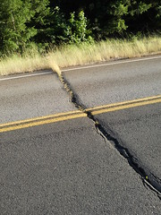
This is a long stretch of road, and it’s all uphill or has features. The most spectacular feature is that a stretch of the road was paved in concrete once upon a time, then tarred over with asphalt. The high desert tends to have fairly wide temperature extremes, so the concrete slabs expand and contract and squash the asphalt between them, leaving deep wide fissures in the road surface.
You enter the National Forest over a cattle guard. About half a mile down the road is another cattle guard, and immediately after that the expansion cracks start up. For five miles. It’s a relief when the road finally tilts uphill in earnest and starts climbing up towards Barlow Pass.
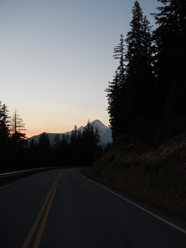
I rode for a while with Susan, and then after a regroup (after being dropped for a while when my right foot cramped up (I still need to adjust the positioning of these Shimano cleats)) I ended up riding the rest of the way with Kevin, who was very patient on the long stretches of climb where I could not for the life of me get above 5mph (the steady state between what I ate and what was being burned to keep me going) as we ground up to the summit before the White River, the second summit before the White River, and then the 9 mile climb up to Barlow Pass.
It was somewhat chilly up in the vicinity of Barlow Pass, so I was impressed when I could make the descent from the White River bridge wearing no top layers except my blue cloud chamber jersey, given that the last time I came through here late at night I ended up hypothermic. The actual descent from Barlow Pass was a little bit longer, and closer to the boreal blasts that come up from the Sandy River gorge, so I eventually had to stop (because I was shivering so much that I couldn’t control the bicycle) and throw on my cheap REI windbreaker.
We met up with everyone else in Government Camp (at the Huckleberry Inn, where Kevin and I bolted down some soup and I inhaled a strawberry malt,) then put on every layer we could find and headed down towards Zigzag and a detour off onto Barlow Road/Marmot Road. Everybody else vanished into the distance just like that, but I proceeded downwards more slowly because I had sat still just long enough to drop my core temperature to normal and was thus freezing as I crept (relatively speaking) down the ramp.
In Zigzag, I met up with everyone else and we headed over to the Barlow Road, and onwards on Marmot. The eastside ramps on Marmot are fairly steep, and the middle one defeated me. I decided to walk up the first section of that ramp,
which I did, but I then discovered that the second section was still steep enough to ensure that I couldn’t actually push off and get the bicycle moving fast enough to balance, so I had to walk up that one as well.
Ditto with the Bull Run ramp, which I made it up about 2/3rds, stopped, said “I’m done; I’m going to DNF and go home.” Kevin said that this would not be a fine plan, but asked where I’d be bailing (Hurlbert, because that’s the Only Way Out.) So he rode up to the top of that ramp while I walked, then we continued along until we reached the climb out of Oxbow, which I again just walked because my legs weren’t even going to make the slightest effort. And at the top, he was waiting and pointed out that there was still 2.5 hours until the Troutdale control closed, so why not try to make it up that last ramp to the Corbett info control (and info control that I’ve been past so many times that I usually know exactly what the answer is.) Sure, I said (expecting that I’d end up walking up another hellish grade) but then I discovered that the route up to Corbett is basically nothing and only required going down to my emergency low gear for about 300 feet in the middle.)
And that, after somewhere in the ballpark of 6 kilometers of climbing, was that for the climby parts of the brevet. We dropped down to the Sandy River (taking the Columbia River Highway instead of Bell Road because Bell Road is fairly potholey at its lower stretches and we were both worn down enough so that it did not seem like a fine plan,) went into Troutdale for the control there, then bolted (fsvo “bolted” – we were averaging about 15mph on this stretch) for the vicinity of Hayden Island to finish the loop.
Which we did, in the leisurely (but it didn’t feel that way) time of 25h11 (to go 408 horizontal km, 6.1 vertical km.) During the loop I went through probably 14 waterbottles of water + nasty sports drink pills, another 5-6 sodas, ice tea, or coffee, and about half of the supplies I brought along. I walked into this workers ride weighing about 186 pounds, and finished up at 179.
My original plan was to get home, then head directly out to the coast, but I found that I was so tired that I was falling asleep at the keyboard when uploading photos. So I took a 2 hour nap, and woke up ready to go, only to have the best put her foot down and say that I’d likely die if I went out with this little sleep. So I’m going to take a long nap this evening, then head out bright and early tomorrow morning to take my Nestucca River Road populaire from my door to Pacific City.
Photos are on flickr, and my sanity is somewhere on the road. Now I need to decide whether to hunt for co-riders and try another 600 to make up a series for the year.
—orc Sun Jul 29 15:18:30 2012
Jul 27, 2012
I’m volunteering on the summer 400k so I can’t ride it then. Instead I’m going to be doing the workers ride tomorrow (awake at 3am, ride up to Hayden Island at 4am, head south (going within a mile of my house. Grrr) at 5am.) The organizers require, along with the usual pile of rando junk that any brevet requires, that riders carry three water bottles. This was a problem, because the mlcm only has two water bottle mounting points.
The solution was to go to my LBS and ask them for a third bottle solution. They recommended the VIP bottlecage clips, by Elite, which I bought sight unseen and stuck onto the mlcm. It’s not a very good solution (the design is better than the implementation) but it should work well enough for tomorrow.
It’s also just the right size for a Dust Mite even though this is likeliest the dirtiest part of the bicycle (I will probably wrap the top of any bottle I put in here with aluminum foil, otherwise it would be far too disgusting to even decant the water into a usable bottle.)
—orc Fri Jul 27 19:11:44 2012
Jul 26, 2012
The Eggbeaters didn’t work, so back to REI they go to be replaced with Shimano mountain pedals. Let’s see how they work.
—orc Thu Jul 26 22:17:48 2012
Jul 25, 2012

I was wondering if the divots in my saddle were not severe enough so I could ride a 400 on them. Um, no, this doesn’t seem to be the case – I spent a good deal of today’s populaire sitting well back on the saddle, because if I slid forward the front edge of the cantle and the rivets would start digging annoyingly into my butt.
So for the short term I need to cannibalize the project bike for the saddle, and then try to decide whether to buy another Brooks Pro or spend approximately 2× as much to try a Berthoud saddle (Boulder Bicycle has a fairly liberal “if you don’t like it, you can return it” policy on saddles, which makes the terrifying price less daunting.) And then when that’s sorted out, I need to sit down and figure out what I need to do to reblock this saddle to pull most of the indentations out and make it usable again (at which point I can worry what to do with the sag in the soon-to-be-cannibalized-from-the-project-bike pro.)
—orc Wed Jul 25 21:55:31 2012
I’d been thinking of riding a permanent today, and my friend Kevin expressed some interest in joining me, but when the day got close he said he’d rather ride something shorter so he could fit work in before the workers ride for the summer 400k (which we’re both doing on Saturday/Saturday night) and he would be happy to ride one of my hilly populaires or his new Greater Boring Area 100k (which takes some of the quiet side roads that crisscross the Boring Lava.) The Greater Boring Area 100k looked intriguing, and it had the advantage of only being 100k (which meant that we could start at the somewhat more reasonable hour of 9am) so we both gravitated to that route.
It is nice that the route takes sideroads, but the side-effect of sideroads is that you do bucketloads of climbing, much of it up fairly steep ramps. You don’t climb very high (all of the ramps top out between 100-200 meters) but the topology makes up for it.
This route starts in Brooklyn, proceeds south on 17th, then turns onto Bybee to climb over a shoulder of the Eastmoreland highlands on its way to the Springwater Trail (there’s some climbing here after 27th Ave curves left and becomes Crystal Springs Blvd, but that’s short – the descent from 37th down to the Springwater Trail (super-steep, curvy, terrible sightlines to the east) is more stressful that the climb,) and then works its way east, climbing gradually, until almost the Portland city limits, where it jumps over to Foster Road and proceeds to climb like the dickens for the next 35 miles.
Foster Road diverged from the old interurban line and started climbing more steeply on its way to Damascus, and then Tillstrom Road climbed a whole lot to get over the somewhat taller shoulder of one of the approximately 25 vents that sit just west of Boring. It then relented briefly and ran along the side of the little valley that sits between Gresham and the more urbanised parts of Damascus, but then pitched up again before depositing us on 242nd, which dropped down into the valley briefly before we had to turn onto Sunshine Valley Road, which twisted its way up to an unnamed pass and then fell down towards Boring (this road is a blast going west, because it’s steep and curvy, but generally has good sightlines, so you can spend a lot of the descent just sailing downhill at line speed. Going east is not quite so much of a blast, because it’s not such a steep descent and it’s nowhere nearly as curvy) and eventually (afer a few intermediate turns and a stop at the Boring control) deposited us onto Amisegger Road, which dropped us into the Clackamas River valley and forced us to climb up the other side.
The other side started with a loop along Eaden Road, which goes to almost exactly the same place as Harding Road does, but travels through much more scenic farms and forest before we had to creep up the side of the gorge to reach Springwater Road. And then (after giving most of that elevation dropping down into Fischers Mill) we turned right (instead of going directly ahead onto Ridge Road as I usually do on my permanent that runs through this area) and wound our way up onto the Boring Lava again to get to Redland.
There’s a store in Redland, which is nice to know for my longer brevets, but it wasn’t a control for this ride. Instead we rode right on through downtown Redland (climbing all the way) and turned off onto a sideroad for a trip along to an info control placed south of Redland Road. This part of the route went up gradually for a while, then turned left onto Maplelane Road, which immediately dropped into a deep ravine, and then, oh G-d, climbed all the way out.
We bounced around on the top of the Lava for a few miles, then, finally, fell back down to Redland Road and proceeded on into Oregon City. But, sadly, we weren’t staying there but instead turned right and onto Forsythe Road, which went all the way back up the Lava in one big steep climb, and then sailed along the edge of the Clackamas River gorge almost all the way to Carver (dropping, I hasten to add, into a series of deep notches with steep walls that had very little earthmoving done to them to lessen the grades.)
And then we fell off the Lava again and dropped down to Carver, and the climbing was basically done for the day; 35 miles of climbing, to the tune of about 3000 feet.
The rest of the loop was the usual uneventful southern gateway to Sellwood and Brooklyn – a quick run up Clackamas River Road (made better by the highway construction project; Highway 213 now goes over Clackamas River Road instead of there being a nasty grade crossing, so nobody needs to do the Forsythe/Apperson dance to get around the traffic and stop signs), then up River Road to the Trolley Trail, then back onto River Road, bike paths, and 17th Ave all the way into Brooklyn and the end of the loop.
5h36 (20 of which was a lengthy stop at a Taco Bell for a little something), and I’m happy to have done it that quickly. I’m obviously going to have to step up my “stupidly climby/stupidly steep” game to build a permanent that’s more horrifying than this one.
pictures are on flickr, of course.
—orc Wed Jul 25 18:24:56 2012
Jul 24, 2012
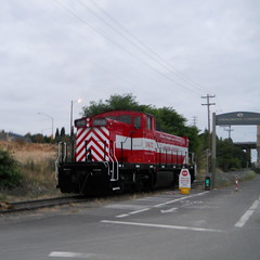
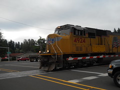
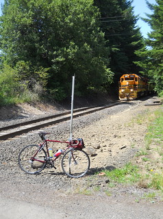
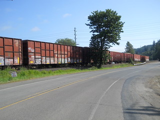
I went out for a short fast(ish) (it would have been about 16mph average except for approximately 50,000 stoplights, which brought me down to 15mph) loop this evening, On the way up the i205 path, I crossed paths with a Clackamas-bound train and tried to take a few pictures, including this over-the-shoulder one, which didn’t actually fire until I had started to pull the camera back. Whoops!
—orc Tue Jul 24 23:41:40 2012
Jul 23, 2012
Last night I must have rolled onto my right side sometime when I was asleep. My right side is the one that contains my shattered shoulder, and sleeping on that side managed to drive my scapula into my collarbone (or would have, except the collarbone is freely floating) which meant that it seems to have bruised the devil out of the bone, the muscles, and pinched some of the nerves running into my arm.
Ouch.
Ibuprofen doesn’t seem to be working on it, either – I might have to get out the Good Drugs (and antinausea drugs, because opiates make me feel like I’m about to throw up for about a hour before they kick in) or a battery of hotpacks to sooth the stupid broken parts of my body.
Hopefully I won’t roll over on my right side when sleeping tonight :-(
—orc Mon Jul 23 17:52:30 2012
Jul 21, 2012
The organizers of the summer 400k have decided that the workers ride should start at the same time as the actual ride. Which is 5am. From the expo center. Which is about 10 miles away from my door (or about 35 minutes if I stomp on it, 45 minutes if I go at a regular pace.) Which means that I’d need to leave home no later than 4am to make room for unforseen incidents. Which means that I’d need to wake up at ~3:15 to get myself ready and out the door by 4am.
Ugh.
To add insult to injury the outbound route passes about half a mile from my house. It almost makes it worth it to preemptively DNF the ride, then meet up with the other rides as they transit Sellwood. (And then I could ride a 200 on the Saturday of the ride – take off for Ripplebrook when the last rider clears Sellwood, then part company with the 400 riders there and return on the return leg of portland-ripplebrook-portland before the closing control opens at 6:30pm.
I’ll have to see if my portland/pacific city permanents are approved before I go to pacific city the day after the preride (or the day of the preride; my family wants to go up on the 29th, so if that happens I’d end up getting home at 9am, then immediately turning around and bolting for the Coast Range (yes, this would be effectively riding through another 600) and hopefully getting there before it got dark and I collapsed from exhaustion.)
And if I did this, I will cheerfully turn around and ask the local RBA if RUSA would waive their “can’t ride brevets/permanents on the days of a ride you volunteer on” rule for a ride that starts after the route closes.
—orc Sat Jul 21 22:37:24 2012
Jul 20, 2012
It’s one week and a day before the summer 400 workers ride, and the midlifecrisismobile has the following things that need to be fixed:
- broken front rack fork crown mount (stainless steel is a real pain to braze)
- no fenders
- worn out chain, cassette, and (probably) chainrings
- no dynamo taillight
- Eggbeater clipless pedals (not strictly the pedals, but the second pair of cleats are worn out. I’m on a trajectory of burning through eight pairs of cleats in a year. Oh the effing joy.)
- My saddle has started to collapse and needs to be reblocked pretty desperately.
I can leave the chain and cassette be for now; they both need to go into the trash, but are wearing equally enough so that shifting still works. I can probably ride the saddle for another week or so (I’ve got the 400k, a 200k, and, if I can carve out enough time, either a second 200k or a 160k that I’m going to ride on the mlcm. In the worst case – if the leather sags to the point where there’s an uncomfortable edge on the cantle plate – I can pull the saddle off the project bike, punch and lace it, and use that for the 400k.
I need to wire a taillight somehow, and the effing pedals have to go. In the worst case, I’ll put the clipped and strapped Silvan pedals back on and ride in my regular shoes.
The most annoying thing about this is that the saddle (a Brooks Professional) is collapsing after no more than about 15,000 miles (and the other one has only about 10k miles, and it’s starting to develop an unhappy sag in the middle.) I’ve grown accustomed to burning through 2-3 sets of tires a year now, but I was hoping that the saddles would last at least a decade before having to resort to desperate measures.
I guess I should be happy that I won’t have to build a new set of wheels for the thing until this winter (that’s about when the front rim will finally wear out,) but, damn, if it’s not one thing it’s another.
—orc Fri Jul 20 23:27:49 2012
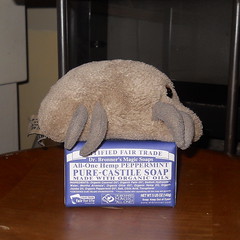
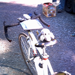
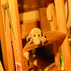
Dust Mite attempts to get clean by osmosis.
—orc Fri Jul 20 23:05:20 2012
Jul 19, 2012
I’d like to say that I built up this permanent by picking scenic roads around Portland and then stitching them together with direct connections (like the organizers of d2r2 used to claim before the event became popular because of those allegedly “direct connections”), because it does go over some very nice stretches of road and only suffers from rando-style “we gotta add some kilometers to push ourselves up to 200k!” dyslexia in the last 40 miles of the route, but, no, this was the result of a game of chicken between me and my friend Ed where I’d make up a route, say “enough climbing for you?” and he’d say “sure, but it would be more fun if you did <x>”
In any case, this is a tour of scenic roads south and east of Portland that features miles of quiet country roads travelling through quiet farmland, woodlots, and the remains of old farming villages. It also features long fast descents off the top of various bluffs and mountains where you can zoom downhill on good pavement for miles and miles before you reach the bottom of the ramp. It also features some climbing; about 9000 feet of it, in fact, often at grades around 10% for a larger fraction of a mile than you’d want it to be.
And then it deposits you into the city on Marine Drive for a fast run along to Columbia to the confluence of the Willamette, and then south along the Willamette back to home.
You start, as is traditional with my brevets, at the corner of Milwaukie & Bybee (Marsee Baking is a good place to start, since it opens at a reasonably early time of day) and then head south into Clackamas County. A quick run down to Oregon City on River Road (alternatively you can request to use the Trolley Trail to avoid the fairly steep approach to River Road. I don’t mind if you avoid this climbing, because there are plenty of other ramps that you need to deal with before you are done) is followed by a steepish climb up the Boring Lava, and then an equally steep drop off the other side as you work your way south towards the town of Canby, where the first control (and the last on-route services until Estacada) is located.
From Canby, you turn east and climb right back up onto the Boring Lava again as you head towards Highland Butte and Estacada. The climb starts gradually as you climb up towards Central Point Road, stays gradual as you turn south, then swing eastward on Union Hall Road, and then goes up abruptly to an intersection with highway 213, and soon afterwards gives up most of that elevation as Buckner Creek Road plunges down into the Buckner Creek watershed (if you’re watching carefully, you might be able to spot where the Willamette Valley Southern crossed the road 85 years ago) and then demands that you pay for that descent by climbing up to the heights you just departed via a short 2km ramp.
(You’ll notice that each of these steep climbs are along nicely wooded cliffsides or creeks. The advantage of building roads up nearly vertical cliffs is that they tend to stay wild longer than they otherwise would.)
Once you’ve finished this climb, you roll along going gradually uphill for a while. There are many small farms here; you’ll pass by some grain fields, filbert orchards, and many many hobby farms with alpaca, goats, sheep, and emu. This area might seem thinly populated, but there are a lot of people living around here, and you’ll pass by a school to prove it. Eventually you reach Beavercreek Road (if you frantically need supplies, Clarke’s General Store is about 4 miles north – Molalla is about 8 miles south of here, but it’s all downhill and you’ll have to climb up to get back to the source if you go that way) and the road starts climbing a little more enthusiastically to get up to the upper plateau of Highland volcano, and then it turns a little bit southward to roll along the edge of that plateau towards an intersection with highway 211.
This is christmas tree farm and tree lot territory, and not much else. There are some small farms and rural houses here, but you’re mainly travelling through treelots of one sort or another here.
And then you reach highway 211, which takes you up a little ways, then drops you down into the valley of Clear Creek, which you then have to claw your way back out of before you get to the descent into Estacada. But that descent doesn’t happen for a while, and you ride along the (fairly) quiet highway through a small collection of nurseries and farms before the road pitches downhill and drops you – on six miles of smooth pavement – all the way down to Estacada and the next control.
It’s not that far from Estacada to Sandy (the next control) but it’s not any less climby than the previous 28 miles were. From Estacada, you work your way up and out of town (6th St->Coupland Road) until you can cut over to Snufflin Road, which rolls through farm and range for a couple of miles before dropping you down (via a steep and twisty descent) to Eagle Creek, which is pleasantly undeveloped and a joy to ride downstream along. But, and there’s always a but, you shouldn’t relax too much, because just the other side of Eagle Fern Park you turn right onto Kitzmiller Road, which, after a short level stretch, proceeds to go up for a considerable time until it deposits you onto a spur of the Cascades above the city of Sandy.
It’s flattish here; you do work up to about 1200 feet before you descend into Sandy, but the top of the plateau here is cut with deep valleys and you’ll plunge into and winch your way out of about 3 of them before you reach 1200 feet and start descending towards Sandy.
One treat you’ll find when you drop towards Sandy (after you turn onto Trubel Road) is two nice parabolic valleys that the road climbs into and out of. You’re going slightly downhill here, so if you punch it on the way down into the valleys your momentum will almost pop you up the really steep looking climb on the other side, and if you keep pedalling like mad you’ll sail up to the top without doing more than breaking a mild sweat.
But after this (and two other parabolic valleys on Langensand Road that only 650b randobikes will be able to appreciate, because the pavement here is not very good) you find yourself in Sandy, where you are required to go to Joe’s Donuts because on this ride it’s not only a good idea, it’s the law.
And after you depart Joe’s, there are only two more serious climbs left to do before the final runout in town.
Cross highway 26 and get onto Ten Eyck Road, which goes down really steeply into the Sandy River gorge. Cross the Sandy River, then climb back up to where Roslyn Lake used to be, and then fall down into the Bull Run watershed before the last big climb. It takes about 3 miles to go up 900 feet, and then you ride along (generally going down, but with some climbing) until you reach Multnomah County again, where the pavement immediately improves and the road tips downwards for about 10 miles.
Here you can fly downhill with minimal effort at 20-25mph. The grade slackens a bit 2/3rds of the way down (where Bull Run Road becomes Gordon Creek Road) but almost immediately pitches downhill quite sharply into a twisty (but not terrifyingly so) plunge down into the Sandy River valley (be aware, however, that the last half mile of this descent switchbacks down the side of a bluff; when you see the truck descending a triangle roadsign you want to slow down because there are two stupidly steep switchbacks right up ahead.
The bottom of this descent puts you down by the Sandy River across from Oxbow Park, which, if you’re at all familiar with the roads around here, doesn’t actually have a water level route across the Sandy from it. No, this little stretch along the Sandy River is followed immediately by the last big climb of the day – 300 steep feet back up to the top of the gorge, and then a mile across to Hurlburt Road, which bounces a couple of times, then points down and drops you onto the Historic Columbia River Highway, which takes you all the way to Troutdale (where there’s yet another control) before expiring.
And now there’s basically no more climbing at all, and you can make up some lost time as you skitter along Marine Drive all the way up to Kelley Point Park, and then from Kelley Point Park through St Johns and down again into Sellwood.
And then you’re done, and the only climbing you might have to do is to get up the step into the Tri-Met bus you ride home (or to your hotel) on.
A stack of pictures from the checkride can be found on flickr, a cuesheet can be found here, and if you want to ride it for RUSA credit you can contact me at this convenient hyperlink.
—orc Thu Jul 19 00:15:34 2012
Jul 18, 2012
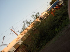
Kevin Brightbill and I went out to run a loop of my Hills to the Yeah! permanent today, and when we crossed 99e on our way towards Canby we spotted the headlights of a train in the near distance. So we had to stop and get a few pictures of the FYEs as it shot past on the last leg of its trip up to what used to be Brooklyn Yard.
—orc Wed Jul 18 20:45:30 2012
Jul 16, 2012
After I rode down to Newport for the last-minute vacation last week, I found myself at the end of the week needing to get back into town. I needed to come back on Friday, too, because I was going to staff (and try to run sweep for, but that didn’t work out) the summer 300k on Saturday.
So on Thursday evening I ziptied the broken rack, then loaded up the midlifecrisismobile with what I needed for the ride back. And Friday morning (at ~4am) I woke up, ate a little breakfast, then rolled out the door into the bitingly cold (~50 degrees) predawn light.
Newport was completely deserted, so I was able to shiver my way through town and onto Yaquina Bay Road without any fuss, muss, or bother. And, as I suspected, the biting cold relented when I got about 4 miles away from the coast and out of the marine layer (it was 51 degrees in Newport, 61 degrees 50 minutes away in Toledo) so I was able to strip off one layer of clothing before heading north on 219 towards Siletz.
The Siletz River sits higher in its valley than the Yaquina River sits, so climbing over the divide on 219 is a more substantial process than it is the other way, but it was still early in the morning so the climbing didn’t bother me that much.
And then into Siletz (over a just repaved bridge over the Siletz River) and onto Logsden Road for the long climb up into the mountains following the river. This climb was much like last year’s Oregon Coast 600 climb (modulo riding with other people, of course :-() and the miles rolled under the wheels of the mlcm much faster than they felt on the way down. It was a weekday, so there was not much traffic, and the bulk of that traffic was logging trucks, which were almost universally very considerate about moving well out of the way of the solitary bicyclist.
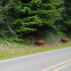
When you get about 8 miles east of Logsden, Logsden Road runs through a stretch of open range, marked with sedate official highway signs and more truculent home made “YOU HIT YOU PAY” signs. I’d not actually seen any cattle on this open range before, but this morning I rolled through a large herd of them – one very large bull and a dozen or so cows – who stared at me with great interest as I rolled slowly through their midst and said hello in a very calm and sedate voice. And soon after that, I fell off the edge of the pavement and onto the gravel section, which I made quick work of this time because I could climb the hardpack on the (steeper) west side without getting off the bicycle. I did have to stop about halfway down the east side to stretch my arms, which were starting to cramp from braking (I am afraid that Ruffy Tuffy tires, which are quite nice on good pavement, are just about exactly the wrong tire for gravel and sketchy pavement – they are wide enough to float on loose gravel instead of digging in, but aren’t wide enough to bridge multiple chunks of gravel, so they end up rolling the top layer of stones as they skitter sideways. This made descending the east side of the Logsden gravel a little more exciting than I wanted, and probably will convince me to either deconvert the mlcm (back to 650b like it originally was) or go back to 25mm tires like the short-lived Clement ones I was using this spring.)
Even though I had left the marine layer far behind, it was still cloudy (and drizzling a little bit where Logsden Road squoze up against the northern side of the Little Rock Creek valley) as I worked my way up to the east end of Logsden Road and turned to climb the long ramp up towards Summit (and, eventually, Blodgett.) But after I worked my way up to the top of the ramp (a task that seemed much easier than it was last year) I climbed past the edge of the cloudcover and into an absolutely sunny day.
I reached the Blodgett Store around 4 hours after I departed Newport, and that was a little early in the day to have an ice cream cone. So I had a milkshake (and jalapeño poppers) instead, and then after a somewhat shorter break (20 minutes instead of a hour :-) I headed east towards Kings Valley Road.
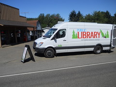
When I turned onto the Kings Valley Highway a bookmobile came whizzing by me, but when I approached the Kings Valley store I saw it sitting out in front, open for business. I didn’t stop there (no library card for that library system) but when I reached the Ritner Creek covered bridge (moved sideways to sit between the highway and the long-demised Valley & Siletz mainline) I did stop to get pictures of the mlcm on the railroad ROW and in front of the bridge before hopping back onto the bike and heading north towards Dallas.
In Dallas, I refilled my water bottles (this time I’d remembered the Nuun nasty sports drink tablets, so I didn’t have to buy premade nasty sports drink) and stopped for a piece of fruitcake and chocolate milk. I stopped again in Dayton to refill water bottles, but that was the last stop I made until I got into the Portland area.
The stretch from Dayton to Newberg on 99W was not much of a pain at all; the early friday rush hour was starting to jam up the southbound lanes (particularly in Dundee) but there wasn’t much traffic going north and the bikelanes were generally wide, clean, and in good repair. North of Newberg saw rumble strips appearing along the road for the climb up Rex Hill, but there was enough bikelane outbound of the rumble strips to not have to worry about accidentally riding into them and being sucked out into the traffic lanes (highway 26 east of Sandy is really bad in this regard; the bike lanes are narrow on the climb out of the Sandy River gorge, don’t have striping, and have the rumble strips set well into them. When I did my first checkride of Sellwood to Hood & Back I had routed it on 26 through here, and that one ride was enough for me to push all of my alpine routes over onto the less trafficked but way steeper Marmot Road) and in any case the rumble strips vanished when I reached Sherwood and I was left on acceptable bikelanes for the run into town.
Unfortunately this happy situation came to an abrupt end when I reached Tigard, where the highway department had decided that putting bikelanes on the long climb up to the top of Tualatin Mountain was a bad idea, as was keeping wide lanes on the road. So 99W became much narrower, the bike lanes went away, and I though “oh, to devil with it!” and hopped up onto the sidewalk for the last long climb of the day.
The rest of the trip (the last 8 miles) were not the most pleasant thing in the world; the bike lanes came back after I reached the Portland city limits, but Barbur at rush hour is a much less pleasant experience. And when I reached Taylor’s Ferry Road I ran headon into the horrible Sellwood Bridge 2-way rush hour, which is going to be a permanent fixture of this loop until the replacement bridge is built sometime in the next 3-4 years.
And then over the bridge, up Tacoma to 13th, 13th to Bybee, Bybee to 17th, finally arriving home 11h58 after I’d set out in the morning.
The same things worked and didn’t work this time around, but at least I ended up at home, so I could rip the Eggbeaters off the mlcm and replace them with the pair that were on the Trek (I need to get new pedals for the Trek now; perhaps I’ll just put flat pedals on on everything except the mlcm until I can find clipless pedals that actually work.)
I was hoping to do the loop in less than 11 hours, but just couldn’t find that additional oompf to do it. Oh well, maybe the next time we’re invited down to Newport.
Pictures can be found on flickr.
—orc Mon Jul 16 22:42:00 2012
Jul 15, 2012
A couple of weeks ago my mother surprised the family by inviting us all down to Newport for a week at one of the rental cabins that their favorite motel has available. It was short notice, but not so short that we had to just drop everything and head out the door immediately.
No, we had time to prepare, and my preparations included deciding that I would not ride down in a car, but would just take the midlifecrisismobile there and back.
So I sat down and built up a route that would get me down there and back with a minimum of fuss, muss, and bother. And then I submitted it as a permanent so the next time we ride down to Newport I’ll be able to snarfle up some RUSA miles in the process.
So last Sunday, after a couple of days of vapourlock trying to schedule a bunch of things (I was planning to preride the summer 300. Nope. I wanted to ride a 200. Nope. But I did manage to pack the handlebar bag before Sunday morning at least) I woke up at 4:30am, ate a little breakfast, and managed to get out onto the road by ~5:20.
At 5 in the morning, there’s basically no traffic on the road, so I was able to cross over to 99W and head south without any fuss, muss, or bother (my now-traditional route up the hill to 99W – LaView->Corbett->Custer – is never congested, but 99W gets fairly busy when people start to wake up) and rode the first 30 or so miles on 99W in fairly short order. 223 was also fairly uneventful, except that as I headed south out of Dayton the promised N/NW wind not only didn’t materialize, but was replaced by a slight, but constant and noticable S/SE wind, just like what happened the last time I rode this route segment. But at least the sun was out, so it was a warm crawl south against the wind through the valley until I reached Perrydale, where, after the obligatory photos of the traction engine I rode into the lee of the hills that separate Perrydale from Dallas and got a hour or so’s worth of riding without a headwind.
(Climbing, yes, but no headwind.)
Dallas is basically the end of T-Mobile cellphone territory, so I stopped there for a little snack and a phonecall home, then continued onto Kings Valley Road for the long hilly run out to Blodgett, ice cream, and the turn west onto the Blodgett-Eddyville Highway (aka OR 180, aka Summit Highway.) As is usual, this took longer than I wanted, and included a stretch where the balls of my feet started cramping up on me (I’ve been experimenting with clipless pedals, and started off by trying Eggbeaters, which have not been working out very well) and I had to stop to go ouchouchouchouchouch!!! until they stopped hurting before continuing south and which finished with a 4-mile race against my rapidly emptying water bottles on the climb up to Blodgett on highway 20.
And what’s in Blodgett? The Blodgett Country Store. And what’s in the Blodgett Country Store? Nasty sports drink, of course (I’ve been carrying Nuun nasty sports drink effervescent tablets, but left them on the kitchen counter at home) and real ice cream that I can sit in front of the store and take my own sweet time eating before getting back on my bicycle and heading west.
So that’s what I got, and it was very good. And after a considerable period of time I jumped back onto the bicycle, carefully crossed highway 20 (insanely busy, even at 1:30pm on a Sunday) and proceeded (against, sigh, a headwind) towards Summit and points west.
But after riding west for a little while, I started to hear distant mechanical noises like a tractor trailer working its way up a ramp. I didn’t pay much attention at first, but then I started to hear a distant quiet squeaky metal chorus that sounded an awful lot like a train. I stopped, listened carefully for a second, then turned around and sprinted back east for a section of line where I could get off the road and get a picture of what was indeed a train.
Score :-) ‘vantage bicycle commuting!
I got pictures of each locomotive on the train (5 locomotives and one slug), then got back on the bicycle and headed west while the rest of the train rolled eastwards past me. And soon thereafter I reached Summit, then plunged down into the upper Yaquina River valley to Nashville, where I turned right, crossed the railroad again, and headed towards Siletz on Logsden Road.
I thought that part of the reason for this annoying two-mile stretch of gravel on Logsden Road was to keep the tourists off it and on the main drag across to the coast, and it was certainly quiet when I came across it at 7 in the morning on the Oregon Coast 600. But it wasn’t quiet last Sunday; while I was walking up the east side of the pass (annoyingly, the loose gravel on that side appears to be a permanent feature, and the combination of it, the Ruffy Tuffy tires I’m using now, and the washboarding on the hairpins meant that when I reached a hairpin the rear wheel would break free and start sliding sideways, which is a fairly disconcerting feeling. My patience for this lasted about 1/3rd of the way up the pass before I dismounted and walked the midlifecrisismobile the rest of the way to the top) a steady stream of pickup trucks, SUVs, family sedans, and regular automobiles hauling camping trailers went past me in both directions. Maybe 30 vehicles in the 10-15 minutes it took me to push the MLCM up half a mile of mountain road, which was pretty amazingly busy for a one lane gravel mountain road. I can’t imagine just how busy this road would be if it was paved the whole distance, but it would most likely be just as bad as highway 20, but with many more accidents.
At the top of pass the gravel becomes more hardpacked for the descent down the west side, so I was able to go skittering on down to the end of the gravel section without cramping my arms from too much braking. And then it was merely a matter of going downhill for 17 miles to Siletz (or, as I soon discovered, 10 miles down to the Logsden Store, because my nasty sports drink supplies were running fairly low) which should have been no problem, except that for some bizarre reason it seemed to take forever (the last time I went over this section was from west to east on the Oregon Coast 600, and I was riding with other people, so I wrote that off as not noticing how much time it took because I was too busy chatting, but then when I returned on Friday I rode the same section by myself and it didn’t seem to take all that long) and I was ready to be done by the time I reached Siletz.
But, no, Siletz wasn’t the end of the line. There was still another 22 miles to go; 7 miles on highway 219 south to Toledo, a couple of miles through Toledo, and then 13 miles on Yaquina Bay Blvd from Toledo into Newport. So turn left at the end of Logsden Road, climb out of the Siletz River watershed, then descend back into the Yaquina River watershed again, ending up at Yaquina Bay Road for the last run out into Newport.
The Lincoln County bikemaps, after making dire warnings about highway 20 being completely and absolutely unsafe for any vehicles under about 20,000 gross weight, point to Yaquina Bay Road as a nice bike route because it’s low traffic and has nice bike lanes on it. You’d never guess this from the Toledo end of the road, though; it starts out as a narrow shoulderless road that first runs a little ways along the stub of the old line down to Newport, then pitches steeply uphill along a steep landslidy hillside.
Fortunately, this is a fairly deceptive start; you do climb a ways to a saddle (where a gravel sideroad – Criteser Loop – diverges and runs steeply uphill; I didn’t bother to check it out, because I’d already ridden 128 miles and I wanted to get back into T-Mobile cellphone territory) and then plunge back down to water level, at which point the road goes around the bend and transforms into the promised wide quiet road with good bike lanes.
And a headwind, alas (I rode this road back to Toledo a couple of times during the week and was given stiff headwinds both directions both times I rode it) but not so much of a headwind that it would discourage me, because Yaquina Bay Road runs more-or-less along the old railroad line from Toledo to Newport, except in a couple of places where the road swerved inland to avoid a little bay, but the railroad used to go directly across. The railroad is long-gone, but a lot of the old trestlework is not, and it gave me another thing to sightsee as I rolled west towards the ultimate control.
It had been a clear and warm sunny day for the entire ride up until now, but as I approached Newport I rode into the marine layer, which was manifesting itself as a large cloudy 50-degree mass blanketing Newport. So I got colder and colder the last few miles into town, but not so quickly that I wanted to stop and relayer myself. And then, in Newport, Yaquina Bay Road became Bay Blvd, which goes right along the fishing/tourist part of town (so I had to slow way down to navigate around tourists on foot and in cars, as well as local cannery trucks working their way down to the fish processing plants and back) and then a turn up and over the point of land that Newport is founded on before dropping on second street down to the oceanshore and the cottage we had rented for the week.
And then I was done, 11h53, 142 miles, and 9300 feet after leaving home in the morning. A good trip, punctuated by longish stops for trainspotting, food, and doing field editing of the cuesheet to put in cues that bikeroutetoaster had left out. My cloud chamber jersey did the trick for everything other than the last 3 miles (putting armwarmers on would have kept me warm, but at this point I didn’t want to stop for anything aside from my “here I am in cellphone territory, are you here?” (yes; my family got into town about half an hour before I did) call, and I never got particularly tired while I was on the line.
A few things didn’t work. The replacement lug for my front rack had a fork crown mounting point brazed to it, but, alas, it’s a piece of stainless steel tubing and I don’t yet have enough experience brazing stainless steel, as was proven by the mounting point snapping off somewhere along the Kings Valley Highway. Fortunately the rack wraps around the front brake, so when the fork crown mount snapped loose the rack merely slid forward 1/8th inch and was stopped by the brake caliper. I ziptied it back into position for the return and will clean and rebraze the joint sometime this week, and this time I may reinforce the crown mount by running a small bolt through the tubing to hold the mount until I can flow enough bronze into the joint to hold it for good.
The second thing that didn’t work were my Eggbeater petals. They’d started to squeak every pedal stroke, and I discovered that the reason they were squeaking was that the retaining clips were bent concave and were sliding back and forth on the pedal spindles. Grr. Not even 3000 miles and the pedals are trashed; time to take them back to REI and purchase another type of pedal.
The full photoset of my trip down is on flickr.
—orc Sun Jul 15 20:15:24 2012
Jul 14, 2012
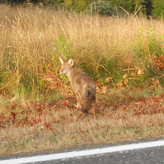
“Ho hum, just another couple of people on bicycles” thinks the coyote as we sail on by.
—orc Sat Jul 14 14:46:48 2012
Jul 13, 2012
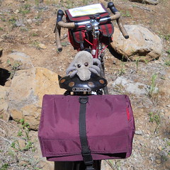
Dust Mite takes precautions for the day.
—orc Fri Jul 13 22:03:21 2012
Jul 11, 2012
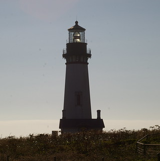
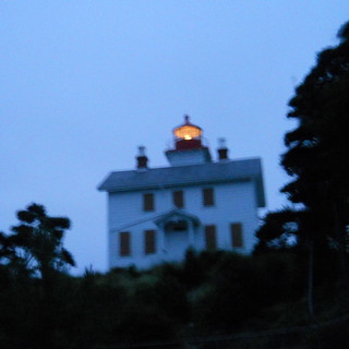
If I shoot almost directly into the sun, I get lovely reflections through the big fresnel lens in the Yaquina Head lighthouse.
—orc Wed Jul 11 10:50:01 2012
Jul 10, 2012
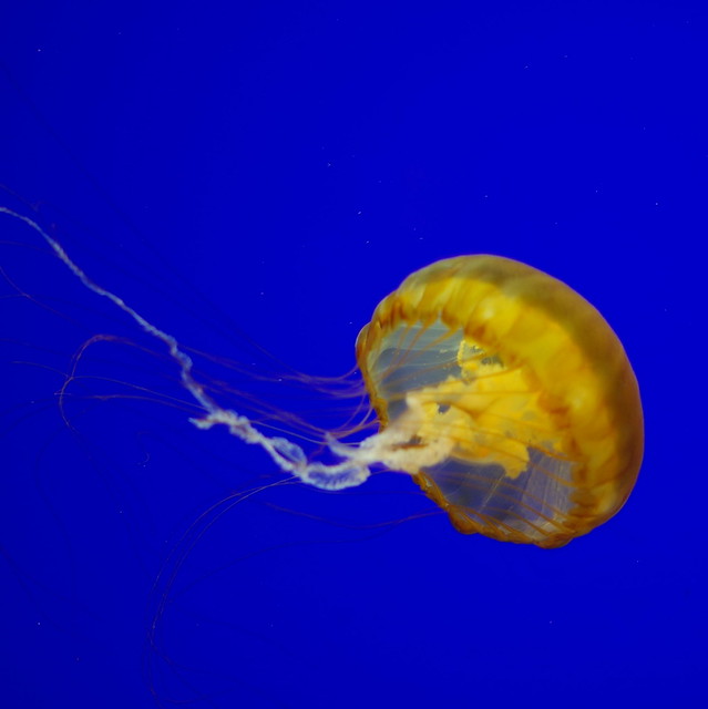
A jellyfish at the Oregon Coast Aquarium.
—orc Tue Jul 10 22:59:18 2012
Jul 09, 2012
A P&W freight interrupts last Sunday’s checkride of my Portland-Summit-Newport permanent. It would have been a little more photogenic to catch the train at the bridge over Summit Road, but it was already an amazing stroke of luck for me to catch this train in the first place.
—orc Mon Jul 9 19:53:52 2012
Jul 07, 2012
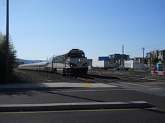
A demotored F40 leads a southbound Cascades towards the Thurman/15th crossing as it approaches Portland Union Station.
—orc Sat Jul 7 20:56:16 2012
Last year I rode a 600 that crawled over the Coast Range just north of highway 20, then proceeded north for quite a long distance along King’s Valley Road before it jumped off onto tertary roads for the final run up to Forest Grove. And this spring I rode down to Newberg, then rode the first 70 miles of a 600 that went south along King’s Valley Road before turning to cross the Coast Range again, just north of highway 20.
So when the family got a last-minute invitation to spend a week down in Newport, it didn’t take long at all for me to decide to take the midlifecrisismobile down instead of wedging myself into a car for the long trip there. And then I drew up the map and realized that this would be an ideal route for a permanent; mainly secondary roads (except for the initial 20 miles of 99w, which isn’t that bad if you do it at 5 in the morning,) no bizarre routing to make up miles (the Summit/Nashville/Logsden routing is to avoid highway 20, which has no shoulder, is very narrow, very twisty, and choked with traffic. Oh, and it’s also clogged with construction debris because the DOT has an ongoing project to try to build bypasses around the worst twisty parts. Trust me, you do not want to try and ride that segment.)
So.
This route starts, as is traditional, in Sellwood (at the intersection of Bybee & Milwaukie) and heads south. But unlike most of my other routes, it turns west at Tacoma and crosses the (soon to be replaced with a more bike-friendly) Sellwood bridge, then switchbacks up the bluff to Barbour Blvd (aka 99W, though you will not see any signs saying that it’s 99W until you reach Tigard) for a 25 mile run south to the junction of OR 223, which takes you cross country past Dayton and Amity to close to Perrydale, where you dodge a little bit west (and past a traction engine that’s displayed in the forecourt of an abandoned gas station) to take Perrydale road over hill and dale into Dallas, where you rejoin OR 223 for a 25 mile run up Kings Valley and a short stretch following highway 20 to Blodgett (and the Blodgett Store, which has very good hand-scooped ice cream.)
From Blodgett, you flee highway 20 for the much quieter environment of Summit Highway, which wanders across the highlands of the Coast Range for a half a dozen miles before plunging down into the Yaquina River valley and into the tiny town of Nashville (just before the road plunges down into the valley you’ll go under a railroad bridge, and just before you reach Nashville you’ll go over a railroad crossing. It’s the same railroad; it just took a somewhat more circuitous route to get to the bottom of the valley than the way you’re taking.)
And at Nashville, Nashville Road urges you to go left and back to highway 20. Do not pay attention to it; you want to go right, onto Logsden Road, which is a much quieter and (mainly) well paved tertiary route over the mountains; you head west (and a little north) up along the Yaquina and Little Yaquina rivers for a few miles, at which point you cross over a bridge (Hamar Lake will be off to your left) and the pavement comes to an abrupt end, leaving you on a gravel road.
It’s still Logsden Road, but this is why it’s such a pleasant untravelled road; there are three miles, and a mountain pass, of gravel that you need to traverse before the pavement resumes on the other side of the pass.
So up and up, gingerly picking your way along (when I last rode this route in 2011, the east side of the pass had been recently repaved, so it was a wee bit bumpier than I liked) and then slithering your way down the other side of the pass. And then in less time that it might feel like, you’re back on pavement, and will remain there for the rest of the way down into Newport.
The Logsden Store is up ahead in a few miles, so you can stop for a snack and water there if you desire, and then after that comes Siletz, where you turn onto highway 219 to head south towards Toledo. And in Toledo, you cross over Depot Creek and find yourself on the banks of the Yaquina River (here it’s a large tidal estuary) on Yaquina Bay Road for the last dozen miles into Newport.
And in Newport you ride along the waterfront for about a mile (passing many restaurants and other touristy attractions; be cautious here that you don’t get splatted by a SUV that’s trying to get that last parking spot, and that you don’t splat tourists who are crossing the street from parking to a restaurant) and then climb up one last ramp to get to the official end of the line at highway 101 (there are plenty of shops along 101 where you can get a brevet card signed, or you can turn around and go back to Bay Ave for a little something and a signature.)
Some interesting features about this loop are (aside from the gravel) that
- apparently there is good cellphone coverage for about half of it. I have t-mobile, so am used to having the cellphone just not work for about 99% of my rambling, but the western half of the Willamette valley is well covered. From Dallas south to Newport, well, the coverage isn’t quite so good, but if you’re lucky you can get a signal around Blodgett before you drop back into radio silence for the rest of the way west to Toledo.
- This route is reversable, so if you’ve got a holiday in Newport you can ride out for credit, then turn around and ride back for more.
I am planning on riding this route both directions this week, so may be able to flesh out the description with more photos and commentary (and will change the title when the RUSA permanents coordinator approves the loop, of course!)
A cuesheet is available here, and if you want to ride this for RUSA credit contact me at orc@pell.portland.or.us.
—orc Sat Jul 7 13:23:30 2012
Jul 06, 2012

The family has been invited to spend a week in Newport next week (returning just in time for me to volunteer/organize orrando’s summer 300k. The original plan was to drive down there, but I’ve ridden most of this route already in both directions, so my suggestion was that while everyone else drives down I’ll just wake up at 4am and do it as a couple of 200ks.
Not for RUSA credit, alas (the timeframe is too tight to submit and get them approved) but there is more to life than chasing RUSA miles.
The route is very very simple; climb the hill on the west side of the Sellwood Bridge, hop onto 99w, then head south to highway 223 and take it south all the way to Blodgett (okay, there’s a little bit of Priest Road and highway 20 at the end), then, after ice cream and other control-related activities, head west on Summit, Nashville, and Logsden Road to Siletz, where you turn south onto highway 229 into Toledo, and then onto Yaquina Bay Road for a lower-traffic water-level runout into the Newport docklands, then up to highway 101 to finish.
Almost all paved, except for a 3 mile stretch where Logsden Road turns to gravel and does a 200 meter climb to the summit of the Coast Range (a climb and descent that I will do fairly carefully) and it’s only got about 5000 feet of climbing, most of which is easily graded.
I might do 100 miles tomorrow to whet my appetite, but I’m getting excited about this loop. (I wonder if it would make a good outandback 400k? I’d need to clean up the runout from Newburg to Portland to avoid 99w, because the fast guys would hate me for routing them onto 99w during rush hour, but aside from that it’s basically all on lightly travelled secondary roads.)
—orc Fri Jul 6 23:59:23 2012
I hadn’t ridden a ride of any consequence since the tuesday before the summer 200k so I was starting to get a bit antcy as the clock ticked over until July. I originally thought of riding on Monday the second, but was a slug and didn’t get out of the house until about noon, so, no, no 200k for me that day, and it was promised to rain on Tuesday (it did, but not much) so I wasn’t planning on riding then.
Wednesday was, of course, the annual festival of state worship, explosives, bbq, and beer that is the 4th of July, so I was originally not planning on riding then, but then my friend Kevin mentioned online that he was, once again, unable to get under 10 hours on a 200k loop.
So I sent him a note saying that if he wanted to shave a hour off his timings I was planning on riding One Big Hill again with the plan of trying to get under 9 hours.
The plan was to depart from the Sellwood Marsee at 7am, which we more or less accomplished (I made one or two extra loops around the house getting everything set up, so didn’t make it there until about 7:02, and we didn’t get the waiver signed and brevet cards handed over until 7:05 (which became the official starting time; I’m not going to penalize riders for my slothful start) at which point I started the gps and we sailed away to the south.
Like before, I varied the route to take the Trolley Trail to River Road, the 99e bike lane to Park Ave, and then the Trolley Trail again all the way to Boardman Ave, and then back to River Road the rest of the way to 99e at the Clackamas River bridge. And, unlike before, I paid close attention to the route after we climbed up South End Road and made sure we didn’t miss the hard to see turn onto Partlow Road (Oregon City has many streets that change their names when they reach an arterial; Partlow Road is one of these – on the west side of South End Road it’s actually Lafayette, and on the east side the sign is obscured by a tree.) And after this we were on Central Point Road and could bolt southwards at a fairly quick pace.
It’s kind of hilly between Oregon City and Canby, but it was cool enough to encourage us to move along at a good pace, and after a brief stop at the Canby control we shot southwards towards Silverton. We weren’t really pushing it, but weren’t lagging either, and managed to maintain a 15mph brevet average up until we reached Silverton, where we paused so Kevin could refill his water/science diet bottles and I could finish delayering. And then it was time to go up for about 20 miles to Silver Falls again.
That climb is getting easier, too. It’s ~19 miles (with approximately 2200 feet of climbing) from downtown Silverton to the South Falls lodge, and Kevin and I managed to transit that in a little less than 90 minutes (arriving 4h31 after we departed Sellwood.) ~12.6mph average isn’t speedy, but it’s considerably faster than the first time I did this climb a few months ago.
And then at Silver Falls we did one small control change; instead of settling in for a long lunch we simply caught our breaths, refilled our water bottles, slathered on some sunscreen, then jumped back onto our bikes and bolted off towards home.
We’d been off the bicycles for about 10 minutes, and we could tell it; our legs had started to slowly freeze up, and it took most of the way to North Falls for them to warm up again (on my previous run I reached South Falls 4h37 after setting out, but then stopped for about a hour to have a leisurely lunch, which killed my energy for the return) but then had enough rollering across the top of the ridge to force them back into a riding mood before tumbling off for the descent down to Silverton again.
A large chunk of downtown Silverton was blocked off for July 4th celebrations, but highway 214 remained open through the festivities so we were not delayed in our second transit of the city.
And then we cut over to Mount Angel for the last transit control (at the same minimart I stopped at the previous time; this time I needed more water, and I got a bottle of strawberry milk for the road,) but we cleared the control after no more than about 5 minutes and headed east towards Meridian Road for the run up to Canby.
Unfortunately, a headwind had developed while we were up on the mountain, so our trip north was interfered with by that pesky wind. Kevin and I took turns dragging ourselves along, which was only slightly spoiled by my traditional behavior when confronted with a headwind (which was to put my head down and pull as fast as I could. I did that here for a while, and then looked back and *poof* no Kevin, so I had to sit up, softpedal, drink the strawberry milk, and wait for him to catch up before chugging northwards again) and was almost spoiled a while later when I was pulling along and rammed a wasp, which became stuck under the right temple of my glasses, freaked out, and stung the shit out of me before I managed to knock her away from my face.
As far as I know, I’m not allergic to bee-stings, so I didn’t bother to stop after being stung, and continued to crank my way north with a little extra profane commentary about the nature of bee-stings. And by the time we reached the Lone Elder Store the pain had died down to an annoying itch and didn’t bother me for the rest of the loop. But, of course it had to happen to my right side, which I’m half expecting will tear itself loose and run away one of these weekends when I want to do a fast loop or two.
I was distracted by the bee-sting, so the last half-dozen miles to Canby passed me much quicker than they usually do, and then it was time to turn east to climb up to Central Point Road and (eventually) up into Oregon City. And this is the point where we started to slow down – I’d done much of the loop in my 50×16 gear, but every little roller between Township Road and the top of the Leland Road ramp took just a bit out of me, so when we topped the ramp into Oregon City I geared up to my, um, 50×21; gear, which is pretty much the gear I stayed in for the remaining 12 miles back to Sellwood.
We topped out in Oregon City at 8h20 and 12 miles to go. I optimistically thought be might make it back to Sellwood by 9h10, but, alas, the transit between Oregon City and Milwaukie worked its usual anchor-dropping magic and we didn’t get back into town until 9h24 after our departure.
Sigh. Next time I’m going to push myself a little bit harder and get under 9 hours. There’s a sub-8 200k in me (and not an optically flat racers 200k, either) but I’m not going to see it until after I get myself under 9 hours.
But even with a 9h24 loop we still made it back to Sellwood early enough to avoid the evening crop of post-bbq drivers, and were able to enjoy a snack before heading off to our respective 4th of July activities (which, in my case, included a run up to the Big Big Store to get beer and snacky things before the evening munitions display.)
Not very many pictures, alas; I was in more of a transit than a sightseeing mood this time. Maybe next time (yes, of course there will be a next time; I am nothing if not someone who obsessively rerides permanents into the ground.)
—orc Fri Jul 6 22:49:47 2012

Dust Mite helps me load the porteur bag with stuff to return to REI.
—orc Fri Jul 6 19:26:49 2012
Jul 01, 2012
I don’t have enough 300km and 400km permanents yet. So I made a pair (300 and 400km) to fix that wagon.
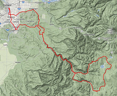
A nice 300k with a little bit of climbing.
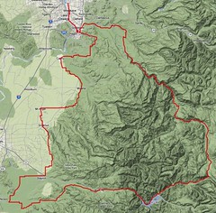
A nice 400k with about the same amount of climbing as the 300k has.
Normally I’d just ride these by myself, but, alas, 300k and 400k are substantially longer than 200k and I would find myself (on the 400 for certain, and possibly on the 300 unless I started at 3am) riding in the dark near the end of a moderately long day on the bike.
Note that the both of them take advantage of the run up to Ripplebrook RangerGuard Station and then wander further off into the impassable wilderness before returning to civilization. One spiffy feature about these routes is that since they climb into the mountains on forest roads they’ll be closed for about 7 months out of the year because of the snow.
—orc Sun Jul 1 23:26:01 2012
—30—