May 31, 2011
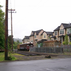
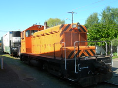
EPT’s ex-GN NW-5 sits alongside a couple of cars on the now-disconnected siding immediately north of the remains of Golf Junction.
—orc Tue May 31 13:10:41 2011
May 30, 2011
May 28, 2011
Now that the Portland(ish)-based spring series (200km,300km,400km,600km)
of long rides is over, there aren’t very many loops based out of Portland
planned. One of them, the
Snooseville Populaire,
was scheduled for this morning, and since I had no other plans for this
weekend (it would be unseemly to ride the
Hills to the Yeah!
loop again when I’ve not even submitted the paperwork for the first
loop yet, and I’m getting a little bit tired of riding loops by myself)
I thought it would be lovely to run out to Hillsboro, zip around the loop,
then come back and still have some time left in the afternoon.
So, at 5:30am, the alarm clock went off and I got ready to go out. I’ve
gotten shamefully lazy about preparing for short (<300km) loops these days,
and the extent of my advance preparations this time around were to do my
laundry so I could have clean clothing. I ate some breakfast, fired up
the computer to deal with spam, hurtled some extra clothing, a pen
and notebook, and a collection of science diet into my
rando bag,
then scooted out the front door to catch the 6:35 train to Orenco.
It was raining when I went out the door, so I wore a rain jacket (the
faux-waterproof Cannondale jacket had the stupid zipper fail yesterday
when I was caught in a sudden storm, so I had to drag out the neck-abrading
O2 jacket that I tried to retire after this spring’s running of the
At Eden’s Gate R400
and wear it instead) but by the time I made it down to the trolley station
at 2nd & Morrison it had stopped raining, so
I wadded the jacket up and stuffed it into my bag, never to use it again.
Orenco is only about 2 miles away from the
start of the loop,
so I ended up getting there about half an hour before the ride started,
and then filled in the time eavesdropping on other people’s conversations.
It was cold out, but the cold in May is not quite the same as the cold in
February, so I didn’t have to layer up to keep from freezing my butt off.
And at 8am(ish), we were off. As usual, I did my routine for the year of
stomping on the gas right off the bat and seeing how far I could go before
I blew up. (With the thought in my mind that if I could keep my starting
rate going for 30 miles, then pick up a “ride is about to end” second wind
soon thereafter I could make it back in an unreasonably fast time.) So I
drifted forward through the small group (only 9 riders today) and within
a matter of 1-2 miles found myself ping-ponging the lead with Tom Durkin,
which we kept up until about a mile past North Plains, when I bounced myself
over a couple of rollers and left him behind.
The weather forecast claimed a high chance (70%) of rain and/or
thunderstorms, so I thought it was just the weather taunting us
when the clouds opened up enough so we started casting shadows
on Jackson School Road, but by the time we rolled into North Plains
the clouds were beginning to gap open enough so that the patches
of sun, though still small and separated, were starting to consume
a noticable fraction of the sky. This lagniappe cheered me considerably
(I got rained on every single ride of the series, and even though
100km isn’t nearly as long as 600km, it still would have been 5 hours of
squelching along in the damp) and I hit the 8+ miles of false-flat city
that is Dairy Creek Road with a 17.1mph brevet average pushing me along.
Gravity pulled me back, and I was down to 16.5mph average by the time I
pulled into
downtown Snooseville
to answer the info control question there.
And then back down Dairy Creek Road, faster but, alas, not quite fast enough to make up for the grasping claws of gravity on the way up (I was back to a ~17mph average when I
reached Mountaindale, but the collection of short hills from that point on ate relentlessly away at my average speed.) And then I zipped, in the increasing sunlight,
along Mountaindale to the US26 crossing (there was almost no traffic on US26 that time
of the morning,) then across to Banks and onto Cedar Canyon Road.
Cedar Canyon road comes with a series of speed-sapping ramps, and also at this time of the morning it came with a gaggle of birdwatchers, who had just pulled up to a good stopping point about 5 minutes before I came by, and were in the throes of ambling down the middle of the road, with occasional jumps off to one side or another, as I attempted
to make my way through them. I was ringing my bell almost continuously, but it was painfully obvious that even though they may have been hearing it they weren’t actually recognising it, because several of them started walking across the street into my path and didn’t even realize I was coming until I stomped on the brakes and waited for their heads to eventually pivot around to the point where they could see me (at which point they said “Oh, a bicycle! I didn’t know there was a bicycle here!” – the mlcm has a very powerful headlight which is always on and a loud bell; I’m not sure what I would need aside from a klaxon to be make it more obvious.)
I reached the info control at the end of Cedar Canyon Road just ahead of Steven K., who overhauled me a little while later when I reached the last big ramp at Stafford Road, and who then remained a tantalizing ½ mile ahead for the rest of the way into Forest Grove.
At the control in Forest Grove (the traditional Forest Grove Control – Maggie’s Buns – is closed for Memorial day weekend, so I used a little deli on Main St) my average speed was 15.8mph, dropping to 15.3 by the time I got back on the bicycle and headed east. But Steven K and I coalesced together here and did a halfhearted, but very fast, paceline all the way back into Hillsboro.
Most of the roads through here are fairly familiar, but there are a couple of new ones; from Verboort Road, the route goes south on Cornelius-Schefflin Road, then across
to Susbauer on Long Road, which is a tiny tertiary road which is very pretty, particularly
when it’s nice and sunny like it was today. And from Susbauer Road, it’s all “I can do this in my sleep” from Hornecker through Evergreen (which goes by a lot faster when
you realize that if you move along smartly you can get to the end of the line in less than 4 hours) and across to Imbrie Road to the last control.
And then, for a change from my traditional “okay, gotta go back home now!” end of ride routine, I sat down and chatted for a hour and a half before I got up and rode back home (for the first nine miles I rode along with Lynnef, then diverged to climb over the hill on the US26 bike path, then into town past the Zoo (where I heard, but did not see, the steam engine pulling a passenger train up from the Rose Garden station) then across the Hawthorne Bridge and down the Springwater Trail to the vicinity of home.
The gory details of the trip are
- 62.2 miles in 3h41 (16.9mph, unless that time is wrong, then it’s 3h50something and 15.8 mph)
- about 3500 feet of climbing when I add in going up over the hill by the Zoo.
- 6 interurban trains, one pair of light engines, and the smoke from a steam locomotive.
- 3 sodas, 3 containers of science diet, ½ pint of beer, and a large pile of tater tots.
- ~95 miles door to door.
- On 6 hours of sleep :-)
—orc Sat May 28 23:54:18 2011
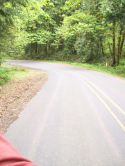
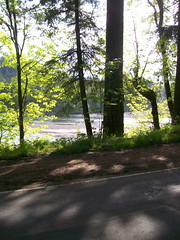
This morning – despite ominous predictions of rain – I woke up at 5:30 and took the train out to the Cornelius Pass Roadhouse to ride the Snooseville Populaire. And it didn’t rain, so I stretched my usual “go as fast as I unreasonably can until I start to blow up” out to 62 miles, and made it to the end in less than 4 hours, at a brevet average speed of either 16.9mph (if the time on the brevet card is accurate) or 15.8mph (if the time on the gps is accurate.)
And while I was doing this, I took a few pictures as I flew down the road.
—orc Sat May 28 17:59:56 2011
May 27, 2011
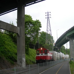
The working Eng! sits in the sun while stormclouds gather to the north.
—orc Fri May 27 22:36:11 2011
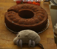
Dust Mite rests on top of one of my old lamps.
—orc Fri May 27 22:35:04 2011
May 25, 2011
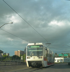
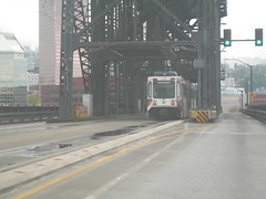
A Clackamas-bound train comes off the Steel Bridge & approaches the Rose Quarter station (with our car following closely behind.)
—orc Wed May 25 22:57:27 2011
May 22, 2011
Mavis naps on the loveseat
—orc Sun May 22 17:07:41 2011
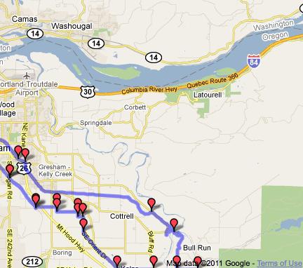
On Friday, my plans were to wake up earlyish on Saturday morning, then go out for a leisurely 200k up to and around Sandy (perhaps the Sellwood->Devil’s Backbone populaire I’m building, with an extension out to Zigzag to push it over 100 miles, then some fiddling around closer to Portland to pick up the last 20 or so miles.)
Unfortunately I’d been running so short of sleep all week that I didn’t wake up until 11am, and then didn’t stop feeling like a stunned ox until almost 2pm. So that killed that plan deader than a doornail (I’m faster than I was a couple of years ago, but I’d need to do a 7 hour R200 to get back home at a reasonable time, and I don’t have either the body or drugs needed to get to that pace) and I had to throw my plans out and make something up as I went.
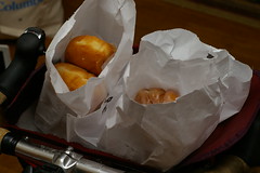
Donuts are, of course, an essential part of any ride up towards Sandy, so I had to pack very lightly to leave room for cargo; I tossed on a tee-shirt and jersey (actually a “jersey-ish”; I wore my now ancient and somewhat tattered Ibex shak jersey which doesn’t have the back pockets you’d expect to find on something you’d call a jersey), stuffed one of my only waterproof in my dreams vests into the rando bag, then filled one of the side pockets with science diet and the other with my smallest CBC (a Kodak C763 which used to be Silas’s before the lcd screen was cracked, and which further got battered when I hit a deep pothole on Powell one afternoon, which ejected the camera right into the path of the bicycle. The optics survived that crash, but not the lcd screen. Whoops!) and wandered out the door with little in mind aside from getting up to Sandy.
One of the things I’m working on right now is building up a from-my-front-door populaire to go along with the stack of longer permanents I want to do. I’d ridden it a few weeks ago (before the flèche, the 600, and the 200) and found a few places where I wanted to investigate alternatives. On the outbound leg, I wanted to see how it would work if I extended the leg on Waybill Road out to Revenue Road (just because of the name “Revenue Road” :-)) and on the inbound leg I wanted to see if there was any way I could avoid the approximately 95 million stop signs on the Davis greenway between 70th and 15th. I can alway just ride out to Davis & 70th any day, but Waybill & Revenue is well suited to combining with a donut run.
So out I went, following almost exactly the route of the Sellwood->Devil’s backbone populaire until I reached the intersection of Waybill and Orient, at which point I just continued east until Waybill dead-ended into Revenue. It’s much nicer than Orient through here; the road travels through much the same countryside (it’s at most a mile east of Orient) but it’s a tertiary road with quite a bit less traffic.
It does dead-end into Orient, but it does that just north of Compton Road, and from there it’s only a couple of miles up to Kelso, where I switch to Kelso road for the run up into Sandy proper, where I made another little detour from the route onto newly built residential streets that loop through a new housing development (densely packed houses – more densely packed than most of Portland – crammed onto a hillside just south of the new Sandy High School) and drop me off on Bluff Road just south of the old Sandy High School. Don’t look for these streets on g**gle maps – they’re new enough so that the map just shows dead-ends and empty fields with my gps track wandering through them.
And once I’m in Sandy, what do I do? Bumbershooten! And then after that I needed to figure a way back.
I’d thought that I would just trim the route short here by dropping down Ten Eyck to
Dodge Park, then climbing the Lusted ramp and taking the Mount Hood Railway back into Orient, but as I was dropping down into the Sandy River gorge I decided that I would be better off returning via Bull Run Road, and then, after crossing the Revenue Bridge (I wonder if it’s the same Revenues who named Revenue Road?) and approaching the junction with Marmot I thought that it would be a shame to come out this far and not loop up to Shipley Road.
It’s only about a mile from Ten Eyck to the upper end of Shipley, though you can’t really tell when I’m creeping up the ramp. But at least from the creepy snail on a bicycle viewpoint I’ve got, it’s shorter today than it was a month ago, and the descent on Shipley is gradually graded enough so I can actually clatter on down it without needing to lean on my brakes excessively. And after Shipley road comes Bull Run Road, which gives up a couple of hundred feet almost immediately, then demands it back with interest in one lump sum payment of 7-800 feet.
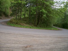
A lump sum payment which is getting easier, if not any shorter, to pay. These days I’ve actually got enough energy to climb that ramp in something other than the absolute bottom gear on the mlcm even if I’m pushing a dozen donuts up the hill with me. I did stop about 2/3rds of the way up, but that was because I wanted to take a picture of the hairpin curve there, not because I was about to die.
And from the top, it was all downhill (mainly) though woodlands and farmland to Oxbow Park and the 400 foot climb back out of the gorge. About a quarter of the way down, I was passed by a bunch of motorcyclists on their Harleys, then about halfway down I had to stop because there were a couple of Multnomah County sheriff’s cars blocking the road where one of the Harleys had dumped, then slid off into the ditch (without injury? Nobody was down and the body language of the sheriffs were not the sort of jittery thing I’ve seen when police are trying to guide traffic around a bad accident.
The sun came out when I reached the descent down into the gorge at Oxbow Park, which didn’t make the climb out of the gorge seem any less steep, but certainly made it more pleasant (but not for my legs; by the time I’d made it up to the top of the Oxbow ramp my legs were feeling pretty rubbery, so I decided to follow Hurlburt into Springdale instead of climbing Evans up to Corbett and the Women’s Forum) and, by the time I descended into Springdale I had recovered enough to take Woodward across to Troutdale instead of following the Columbia River Highway back down into the gorge. Woodward is shorter than taking the Columbia River Highway, but it also climbs a lot more going out of Springdale, so any benefit I might have gotten from it was rudely taken away by having to claw my way up onto the point of land above Troutdale. But at least there’s less traffic, and the part where it cuts along the hillside has a somewhat more comfortable shoulder (I’d needed to ride this anyway, because it’s part of Piled Higher & Steeper! and we’d missed in when we cut the route short on the last preride.)
And then I was back in the city, winding along the Columbia River Highway into downtown Troutdale, then up Halsey to 238th, where I cut over (and up the bluff through Wood Village) to Stark Street, and from there over to Burnside for the long ride into town.
One nice thing about riding along Burnside, of course, is that it follows the old Mount Hood Railway route from Montavilla out to Gresham, and that route is now being used by the Tri-Met Gresham-Hillsboro interurban. There are a lot of trains running on that line; it took me about 25 minutes to go from the intersection of Stark and Burnside to 122nd (where I turned south to go down to Market St) and in that time easily 7 trains passed me going one direction or another. Not a good sight if you’re an auto über alles faux-libertarian, but I was happy with it :-)
I went down to Market Street on 122nd because I wanted to see how it would work out for the return leg of the Sellwood->Devil’s Backbone populaire. There are fewer stop signs on it, but once you get west of 92nd Market street pretty rapidly diminishes to being nothing more than a badly paved alley before (if you miss the jog south to Mills) ending alltogether and forcing a jog north to Clay Street before running into an unsignalled intersection with 82nd. Pity, too, because I’d rather route people along Market than along Davis, but an unsignalled crossing with 82nd is much worse than stop signs, because 82nd is likely to be physically dangerous .
And then I went home; I zigged down to the Lincoln Street greenway, which took me over the shoulder of Mount Tabor, then down into Ladds Addition, where I then made my way down to the Springwater Trail to loop down to Spokane and then go up 17th to my front door. Despite the 30% chance of rain, the showers held off until I was about halfway between downtown and Spokane, when a light drizzle started and kept going until I picked up my bicycle and carried it in the front door.
And then I ate 3 more donuts. Yum!
40-odd photos in 70.75 miles & 4100 feet of climbing @ 12.9 mph semi-brevet time (I turned the gps off when I was in Joe’s Donuts.) The CBC, despite not having a viewfinder or working lcd screen (about all I can use the screen for is an indication of whether it took a picture or not; the screen flashes when a picture is taken) is easy enough to point so that most of my photos actually turned out to be photos of the item I was intending to photograph. The light balance sucks, which is to be expected from a cheap point-and-shoot that has been run over by a bicycle, but some of that can be corrected by brutal photo retouching.
—orc Sun May 22 13:34:54 2011
Despite what Google is trying to tell me, I do not believe that QC366 comes this far west or that it is an international highway.
—orc Sun May 22 11:54:15 2011
May 21, 2011
I went up to Joe’s Donuts for donuts this afternoon, but instead of taking the trek I took the mlcm (I wanted to see if I could actually fit a dozen donuts into the big rando bag, and it turns out I can.)
I took the scenic route coming back (Ten Eyck -> Marmot -> Shipley -> Bull Run -> Woodward) and despite 3000+ feet of climbing during my 44 mile return, the donuts made it back in excellent shape.
I actually bought a baker’s dozen, but, alas, I ate one of the donuts before it could be packed into the rando bag.
—orc Sat May 21 21:03:36 2011
May 20, 2011
If
it’s big enough to carry a dozen bagels, it’s
certainly big enough to carry 3.5 quarts of ice cream!
—orc Fri May 20 21:10:58 2011
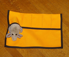
A new maxi-sized tool roll, but, alas, it’s not maxi enough to properly fit a
Dust Mite.
—orc Fri May 20 13:38:44 2011
May 19, 2011
EPT 100 rests on the McBrod Ave switching lead.
—orc Thu May 19 21:17:50 2011
May 16, 2011
I was coming back from Noah’s with a dozen bagels when I spotted a suspiciously high headlight coming towards me on the Springwater Trail. I pulled out the camera and then,
happily, my suspicions were confirmed.
—orc Mon May 16 16:18:43 2011
May 15, 2011
A couple of months ago, I submitted my
Hills to the Yeah!
loop to RUSA as a permanent route,
and a couple of weeks ago it was finally
approved.
Alas, I couldn’t actually ride it at that time, due to pesky
flèches and
600s, but this
weekend had nothing planned and I was ready for another short loop
around East Portland. I asked some of my friends if they’d be
interested, but, alas, they either had to work or already had other
plans. But this was not a problem; 200km is a short enough loop
so I can do it by myself, and given the choice of riding by myself
or blowing it off until I had a chance to be social, riding by
myself wins (I can already ride it again with other people.)
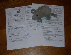
I wanted to do all of the paperwork by the book, so I printed
out a copy of the RUSA application form & waiver, put on my
rider hat, signed it, then took off my rider hat and filed it
away. When I filled it in, I was planning on leaving the house
at 8am on Saturday morning, but then reconsidered, crossed that
time out and wrote in 9am.
And then I got out the door at 9:40. Oy.
I wasn’t exactly hurrying along today (I think I may have torn
my left side lat, so I’m not exactly leaping up and using my arms
to pull my bicycle up hills) but neither did I tarry, and so I
managed to make it into the first control about 5 minutes before
it closed (the route from Sellwood to Canby is fairly routine; you
spend the bulk of it travelling through the suburbs along River Road,
then up through Oregon City, and only end up spending about 6 miles
out in the countryside after Central Point Road spits you off the
edge of the Boring Lava and before Territorial drops you into the
developments at the edge of Canby. Not really anything worth
mentioning here.) I actually had time to get a couple of sandwiches,
then ask the cashier at the Thriftway if she’d sign and date my
brevet card (I was going to try and do this loop as close to the
books as possible and get receipts and signatures from every
control) before I hopped back onto my bicycle and headed off to
the east (and into a gentle, but noticable, headwind.)
It’s obvious that I’m getting more comfortable with climbing. I’m
not getting any faster at it, but I found myself grinding first up
to Central Point Road, then further up the lava on Union Hall Road,
without the usual internal wails of despair that usually accompany
each ramp. Perhaps I was distracted by the relentless ticking of
the brevet clock, or maybe I was distracted by the stupid front
derailer rubbing against the crankarm after the first shift into my
alpine ring, then back out. But in any case I worked my way up onto
the lava without stress, then, after plunging down into the Buckner
Creek valley, back up on Buckner Creek Road without even close to as
much annoyance.
But what did become an annoyance was that, after I stopped to try
and adjust the front derailer to stop it from rubbing, that it instead
decided (after the first stage of the Buckner Creek climb) that it would
just stay in the alpine ring and not bother to shift back to what I call
(for lack of a better description for a 42t large ring) my running ring.
This necessitated several stops for me to sit down and adjust the derailer,
finally ending up with the horrible kludge of me setting it so that the
shifter would deliberately pull it into the crank for upshifting, and then
I would manually trim it down into a non-rubby position (I have a 3-speed
brifter for the front derailer; I was running it so that top gear ==
top gear, and bottom gear == middle, but I have changed it so that
bottom gear == bottom gear, top gear == middle, and scrapy == top gear.
I don’t shift the front very often, so I may be able to get used to this
behavior before I can sell enough junk to get a somewhat more relaxed
crankset.)
And then after that, and then the climb up past where I’ve spotted coyotes
in the past, past the emu farm, and onto Windy City Road, my ride was
further interrupted by an encounter with a bee, which decided that it
would fly into my ear just as I was trying to fly through a roller.
It is difficult to brake when a tiny insect is buzzing like mad in your
ear, but I did it. It is difficult to swerve onto the shoulder so that
oncoming traffic won’t run you down (there’s not much traffic here,
but there is some,) but I did it.
Regrettably, it is also very easy for the bicycle to wash out on the
gravel on the shoulder and cause me to pitch headfirst down into the ditch,
fortunately missing the clumps of nettles that were alluringly placed
all around.
At least the crash shook the bee out of my ear, so, after I scooped up
the stuff that spilled out of the rando bag and shoved it back in I was
able to get back onto the bicycle, rerail the chain, and be on my way
without more than a 5 minute delay. (Which was not enough to blow the
Estacada control. I’d crashed at ~1000 feet, so I only had 200 feet to climb,
then 200 feet on OR211, then another 300 feet on OR211; in any case, I
made it into Estacada with about 25 minutes on the clock, which is better
than my traditional loss of ground when crawling up those hills.)
East of Estacada was a little more difficult, oddly enough; the
climb up Coupland Road seemed to take longer than usual, and the
plunge down Snufflin Road seemed steeper and more hairpinny than
usual. But that was made up for by Kitzmiller seeming to be
much shorter than usual, and then the ravines up on the top of
the hill seeming to be a lot shallower, even if I kept putting
on the brakes as I plunged down into them.
I made one small route variation in Sandy proper; the route
takes you on Langensand Road all the way to US26, then looping
west to Meinig Ave and thus into Joe’s Donuts (and then along 26
to the turn to Ten Eyck.) But if you turn left onto McCormick Dr,
that feeds you directly into Meinig Park, and then you can turn right
and take a path uphill into the parking lot that’s directly behind
Joe’s. And, similarly, after you leave the control, you can take
Meinig across 26 to a right turn on Pleasant Street, which will
drop you onto Ten Eyck without having to touch 26 at all.
And then it’s down into the gorge, past Roslyn Fen, and down into
the Bull Run valley, and up and up and up and up along Bull Run Road
to the heights above the Sandy River Gorge, followed by (after a few
bumps) a long fast descent to the east side of Oxbow Park, then a grind
up to Springdale, and then finally a descent down to (eventually) Marine
Drive, which, if the wind is right (and it was right) is an extraordinarily
fast run all the way up to Kelley Point Park and the info control there.
Unfortunately, Marine Drive is closed just past Kelley Point Park :-(
There’s a big resurfacing project going on on the other side of Columbia
Slough, and so the city is taking the opportunity to remove the bridge
over the slough.
I was able to cross, but the bridge removal equipment was in place and
by tomorrow there won’t be enough bridge left to cross unless you’re
much more foolhardy than I am.
But, after crossing, it’s only about 15 miles from Sellwood, so I put my
head down and zipped on home, stopping only once or twice to try and take
pictures,
and arriving just before 9pm (11h50 brevet time; 11h10 my time.
It may have felt faster today, but it certainly wasn’t any faster.)
This was a marvel of unpreparedness. I just chucked a bunch of science
diet into my rando bag, then grazed at the controls as I went. I hadn’t
even gotten around to changing out my rear wheel yet (and by the end of
the loop it was making interesting thump! noises whenever I would forget
and brake it) because the extent of my limited concentration was eaten
up by making up a brevet card and tweaking the cuesheet so that it would
fit onto one piece of paper. I guess that riding much longer loops makes
the whole business of riding a 200km loop seem fairly sedate, even if it’s
an annoyingly vertical one.
At least I remembered my bicycle and camera!
—orc Sun May 15 21:00:24 2011
An downtown-bound airport train crosses the center span of the Steel Bridge this afternoon.
—orc Sun May 15 20:28:14 2011
May 13, 2011
I’m planning on riding the Hills to the Yeah! permanent tomorrow (I want to run up to Sandy for some donuts, so why not take the scenic route?) so Dust Mite is reviewing the paperwork for me.
—orc Fri May 13 21:29:20 2011
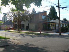
Down at 21st & Rex, a couple of old bungalows were scraped and replaced with a pair of huge modern houses (the bungalows were in the <2000 ft2 range, these new houses are, um, much larger.) The house that went in first was an historical reenactment house that leaves me absolutely cold (it has that sort of waxed and polished Architectural Digest look to it which says nothing to me except “we spent a lot of money on this house!”) but the second one, which replaced a mid-century bungalow, is a lot nicer.
Yes, it’s shriekingly modern, but the lines of the roof (a two-piece stepped roof, yes, but it’s not actually flat but was designed by an architect who realized that it does occasionally rain in western Oregon) and the way the front porch is fitted to the house look like a direct descendent of many of the craftsman houses that infilled many of the neighborhoods here 85 years ago.
I could easily see living in a house like this. Nice generous eaves (in the context of modern structures, which have a pathological horror of having the eaves actually shade the structure even if a lack of eaves means that rain will blow into the top story windows if there’s any sort of breeze at all,) the windows are (slightly) inset so that they won’t be rain sponges, and a refreshing lack of modern ornamentation for the sake of it being modern ornamentation.
More new houses like this, please.
—orc Fri May 13 14:28:00 2011
May 11, 2011
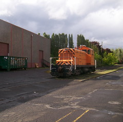
The working Eng! sits in the new East Portland yard, looking for all the world as if it was a model.
—orc Wed May 11 19:31:41 2011
May 10, 2011
Last year I didn’t ride the Oregon Coast 600 for a host of reasons,
not the least was the teeny detail that it was scheduled for the
exact same weekend as Pacific University’s graduation, so unless
you jumped on the room reservations early nothing could be found
for love and/or money.
This year I didn’t have that excuse; room space was offered at the
start (I couldn’t stay over at the end because I have to be home
on mondays for morning bear
herding) so all I needed to do was to load up and get out there on
friday for a relaxing loop around
NW Oregon. And my friend Ed had worked out a bunch of group rooms at
the ~2/3rds point in Lincoln City, so people who wanted to crash for a
while in the middle of the loop (and, really, who wouldn’t?) would be
able to do so for cheap.
So on Friday morning I made up a list, baked a fruitcake, then packed
everything on my list into the
rando bag
and a backpack that I was using as a drop bag. Normally I wouldn’t worry
about a drop bag, because I’d either be riding the loop or riding home,
but each of the 400s I’ve ridden were made much less painful by being able
to crash for 2-4 hours between handing in my brevet card and riding back
home from Wilsonville, and I thought that being able to do something like
that in the middle of a loop and being able to get new clothes would be a
very good thing indeed. Oh, and there was the teeny detail of the weather
forecast for western oregon being universally “cloudy with 70% chance of
showers” – and in my experience in this state, “showers” includes torrential
downpour, hail, sleet, or a combination of the three.
So I had the rando bag full of fruitcake, baked potatoes, science diet,
and a couple of spare pairs of socks, my pitiful excuse for a rain shell
(a Cannondale shell that’s nice and light, doesn’t have neck-scraping
junk at the neck, but which makes up for that by not actually being
rainproof at all) and a sash that I threw together so I wouldn’t have
to bring the over-the-head emergency spare one (my mesh vest had been left
in Wilsonville after the last 400, and
Lesli L was going to bring it
along to return to me, but paranoia easily covers 90 inches of reflective
ribbon and a couple of 6×1 strips of velcro. And the drop bag
had an entire set of clothing (except for the +4s; the Chrome ones I’ve got get
really wet really fast, but are thin so they dry just as quickly)
and a pair of shoes (I wear
five-ten “Guide Tennie”
shoes when riding, and they’re very nice – they’re solid enough so I
don’t feel every part of the pedals through the soles, and they’re 95%
waterproof (the non-waterproof parts are where I stick my feet in, of
course – wool socks do a very good job of wicking water into them –
and the tongue, which is, mysteriously, made of a very waterphiliac
material) – except that when they get wet, they stay wet,) plus some more fruitcake,
a charger for the GPS, and a toothbrush.
Oh, and I went by Staccato Gelato and bought a hideously colo(u)red bike
cap (my cotton one, which is being sacrificed to be a master pattern, is
a stench magnet and wants to be washed after every time I wear it) for luck.
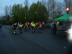
So I was ready to go. And at 5am on Saturday morning, I fell out of bed (I
was offered the upper berth in a bunk bed, so my extraction was awkward,)
put on my regular clothes (I wear +4s all the time these days, and wool
shirts and sweaters don’t look so much athletic as geeky,) and dragged the
mlcm out to
the parking lot for the 6am start.
After a brief round of route announcements, the
organizer asked if anyone was
planning on riding through, and when some people said yes gave some
recommendations about what they should do at some of the night
stops. I didn’t pay much attention to this, because I wasn’t
planning on riding through, and was simply waiting for the ball to
drop so I could head on out.
These days the start of an organized brevet is becoming a bit of a
routine. I sit near the back of the pack, the fast riders evaporate
with the traditional *pop* of imploding air collapsing into
bicyclist-shaped vacumns, then almost everyone else rides out into
the street, and somewhere between “almost everyone else” and “the
last stragglers” I drag myself into action.
And when I’m moving, I find a good natural pace, bump myself up a
little faster, then run ahead for as long as I can before I reach
a control or blow up and am overhauled by other riders. Today was
no exception; I started accelerating up to somewhere in the ballpark
of 20mph, then just went charging forward until the climb up to
Tophill (on the Banks-Vernonia trail) brought my average speed down
to ~17mph and made me easy to catch when I brought my headlong rush
down to a slow creep when looking for an information control on the
path (I’d actually thought I’d missed it and was about to turn
around to retrace my steps when I was interrupted by a huge mass
of fast riders charging down the trail at me, calling out “have
you seen the info control yet?”)
No. But I’d be happy to jump into your pacemob and help you look
for it, then proceed down to Vernonia at speed (easer said than done;
the Vernonia end of the Banks-Vernonia path is older and somewhat
more sketchy. The occasional right-angle zig in the path is almost
as good as the pavement buckling over tree roots to slow you down
to a crawl.)
In Vernonia, the paceline disintegrated as people bolted for the
coffeeshop and the gas station to get fud and to get their brevet
cards signed. Ed G. and I were both at the Black Bear coffee
shop, and we both got in and out of there fairly smartly because
(at least in my case) our legs were starting to realize what was
going on and were trying to prevent it by freezing up on us.
And off we (and by “we”, I mean that Ed shot off down the highway
like a rocket and I had to ride like mad to actually catch up with
him) went to the north, winding up highway 47 at a satisfactorily
ridiculous speed until about a mile south of Birkenfeld, when Ed’s
bicycle ate a nail or something, which had the desired effect of
flattening his rear tire and stopping us dead. And while we were
stopped doing the replacement, bunches of riders were shooting past,
asking – en passant – whether we needed help or not. We didn’t,
so most of them didn’t stop. Asta C. and Theo R., on the other
hand, shot by with the usual exchange of “need help?” “no, just a
flat!”, followed about 10 seconds later by “damn! Now I’ve got a
flat!” and a screeching stop so they could sit by the side of the
road (350 feet north of us) patching their own flat.
After a few minutes of this, it started to pour down rain, and I
eventually had to abandon Ed and run up to the Birkenfeld store
because I was starting to chill thanks to the nonwaterproofedness
of my rainshell (I promised to wait there, which was not quite as
selfless as it might seem because the Birkenfeld store is considerably
warmer inside than it was outside.)
And up I went to the Birkenfeld store, where I said hi to Lesli and
Kevin B (who’d I’d ridden with on the
400), but they
were about to leave and departed before Ed rolled up and we headed
off into terra incognito (for me; I’d never been north of the Birkenfeld
Store before this) and down into the mountains (for we were following
the Nehalem River, which winds down from the neigborhood of Timber in
a large loop that ends up dumping into the Pacific Ocean near Manzanita)
for a considerable amount of time before diverging at the remains of
Jewell and climbing abruptly 1000 feet up to the summit of the Coast Range, then dropping (in a very satisfactory manner; the summit of the Coast
Range here is crossed by a road that climbs along a ridge, dips into one
or two small valleys, then plunges down from that point all the way to
the ocean. Ed was about 250 feet in front of me when we summited (the
climb, although steep, was not steep enough to completely kill me, and
I only started to fade near the top) but by the time I’d made that 250
feet he was already half a mile down the road and accelerating. I didn’t
catch up to him until we were almost down to Olney, where there’s a store
and a control. Lesli and Kevin were finishing up there, but Ed was on a
mission and we rolled into and out of the stop in no time flat, then flying
ahead to the next destination.
Ed was moving along at a pretty relentless clip, and I was getting kind of
hungry (and was staving it off by science diet, so even though my stomach
was unhappy it wasn’t suicidal,) so when Theo and Asta caught up with us
(taking longer than I thought they would; apparently they’d had two flats
and decided to time-trial their way up the mountain(!!!)
to run Ed and I down) and almost immediately mentioned that they were very
hungry and needed real food, I said I thought that was a splendid idea and
said I’d join them if they did.
And they did, in a little diner along highway 104, and it was lovely to
have some nice hot food to make up for the rainshower that had just gone
by while we were looking for this restaurant.
And while we were eating, I asked them if I’d heard right and they
were indeed planning on riding through, and, yup, they were. Would
I like to join them?
Now if I was sensible (or had the sense that G-d gave a rock) the
story of this loop would be a bit different. But I was not, and I
had to admit that riding it all at once sounded like it would be fun,
so if they’d stop and wait for me after dropping me on hills I’d be
delighted to do so.
So, after a leisurely lunch, we got back on the bicycles and rode
out to Fort Stevens for an info control, then turned back and headed
into a disappointingly strong headwind for the looooong ride south
to Lincoln City.
Scott P. (on his recumbent again) joined us at Fort Stevens and rode
south with us until Manzanita, where the combination of steep ramps
and icy rain knocked him out of the ride.
And south we went, upping and downing a bunch of small capes (each
of which would see Scott and I dropping back on the climb, then each
of which would see Scott rocketing ahead at 50-60mph on the descent)
while the pouring rain played hopscotch with brilliantly sunny skies.
I’ve not ridden south of the US26 junction on 101, so I’d never had
the non-automotive experience of climbing Neahkahnie Mountain. It’s,
um, interesting. It starts by climbing through a tunnel (with a special
“there are bicycles on this road!” flashing light) then continuing on
for another 150 meters or so, where you then turn around and drop into
a small valley before turning around and climbing ~300 meters up to a
long ledge carved into the cliffface for US101 to cling to. It’s a
lot of climbing to happen ~250km into a loop, and when I was on it it
felt like it just went on and on and on (and I really didn’t notice
much of the scenery until the grade had started to level out along the
cliffside north of Manzanita. It’s quite impressive there.)
Theo and Asta were waiting in one of the scenic overlooks, so the three
of us waited for Scott to arrive. He was completely smashed by the
time he rolled in, and decided that he was going to stop in Manzanita
for food no matter what (the next control was Tillamook, another 20orso
miles down the road, and Asta, Theo, and I were thinking of just killing
two birds with one stone there) so we arranged to part company there
unless he overhauled us between Manzanita and Lincoln City (alas, no,
he didn’t; he was flattened badly enough that even food didn’t help
and had to DNF there :-( )
So here we were in Manzanita, rolling south towards Tillamook and
about to turn upstream along the Nehalem River (which took a somewhat
more direct route to the Pacific Ocean than we did) and then onto
the Miami-Foley Road, which isn’t any longer than highway 101, but
which is much more scenic. The Port of Tillamook Bay Railroad
along here is starting to develop distinct signs of being an abandoned
railroad (weeds growing between the rails, small landslides starting
to encroach on the ROW – the POTB claims that the line is just embargoed,
but the facts on the ground look very different) but I was unwilling to
stop and drop out of the group to take pictures today.
I was feeling in good spirits, but very very hungry. I was hoping that
we could have made it to Tillamook in time to stop in at the cheese
factory and have a little something including ice cream, but, alas, we
rolled into Tillamook a little before 8pm (overhauling Ed just before
the factory; but we were dead set on stopping at a restaurant with
tables while he wanted to pop into a grocery store and get food there,
so we split off pretty quickly to stop – for about a hour – at a
pizzaria where we had sandwiches, coffee, and soda (all of which,
including the soda, was liberally salted.)) And then, after a brief
discussion with a drunk who wanted us to loan him a bicycle so he
could ride it home along 101, we put on all of our reflective gear and
set out into the evening dusk.
And then it rained on us most of the way into the control at
Pacific City, only stopping
just before we turned onto Sandlake Road to climb Cape Kiwanda (the road
was wet enough so that I managed to not see at least one
bicycle component eating
pothole) and down into the city, where we found Ed and
Joel Metz at
an oceanside bar that was about to close (Ed was drinking decaf, and
obliquely warned us that this was all they had. We ordered regular
coffee, which was served to us without complaint, but we ended up
getting it for free (which was probably a sign; I’d commented while
we were drinking it that if it turned out to be decaf I’d know because
I’d be sobbing by the side of the road by the next morning; I did not
actually end up sobbing by the side of the road, but I certainly thought
about it after the promised caffeine did not materialize in my bloodstream) and, after
a considerable amount of time, we rolled out the door and towards Lincoln
City and into the teeth of another bout of torrential rain.
Oh, but did I say “towards Lincoln City” but forgot to mention one
teeny little informational control that is conveniently located at
the top of a ~800 foot ramp up a little poorly maintained
forest road called Slab Creek Road.
It stopped raining just before we reached Slab Creek Road, but I still
thought I was going to die. I seriously considered just DNFing at
several points just so I wouldn’t have to climb up to that effing
info control. I was positive that I was going to abandon riding
through and just stop in the hotel at Lincoln City for a long nap
before continuing. But in any case I clattered up this horrible
little road, trying to dodge potholes but not succeeding enough to
avoid shaking loose both derailers, my front rack, and getting the
front shifter’s cable housing to punch through the end of a cable
stop and into the guts of my left brifter.
Fortunately the road got better on the other side of the info control
(the cue for the info control should have been “if the road becomes
passable, you’ve gone past the info control. Turn around and look
for the wumpus here”) so it was only the matter of climbing another
couple of hundred feet, then plunging (through the cold damp coastal
air) allllll the way back down to 101 and then into Lincoln City
and another torrential downpour (at which point Theo, when we were
approximately 200 feet from the hotel, hit a pothole which caused
the contents of his rando bag to all spontaneously eject onto the
street. *sigh*)
And then we were in the Lincoln City control, where
the organizer, a large variety
of snacks, and our drop bags could be found. I walked into the
room fully expecting that I’d be sleeping at this hotel tonight,
but after warm food (including tea!), a nice long warm shower,
and a complete change of clothes (including shoes) I felt back to
normal (which is to say “normally insane”) and was actually eager
to roll out the door and continue the loop.
Note to self: I need to carry more layers, and find shoes that are
drier after being rained on.
While we were going out the door at 3:30ish,
Michael W
was getting ready, so we said “hi” as we left (we’d not see him again
for another hour and change, when he blew past us on a level spot on the
climb up to the summit of the Coast Range) and rode off to the Siletz highway
and the land of hallucinatia.
At 4am, the Siletz Highway seems like it’s climbing very steeply, but
perhaps that was the hallucinations.
Up we went, in a sort of sleep-deprived haze, each of us grimly hoping
that we’d stay awake long enough for the sun to start brightening the sky.
When we were close to Siletz proper, my front tire, which had been
punctured by a fine pointy
thing several hours ago (possibly on Slab Creek Road?) finally deflated
to the point where the sidewalls started to buckle as I pushed along upgrade.
I’m not sure just when I picked up the puncture. I tend to let the tires
on the mlcm drop air until the ride quality starts to deteriorate, and I’ve
had them down to about 30psi (on 26mm tires rated at 100ps) before I’ve noticed
handling and/or speed problems. But when the sidewalls started to buckle,
I had to pull over to see what was wrong, and then pump up the tire so I
could proceed to the next town, find a shelter (because, surprise, just as
we stopped it started to rain again!) and then change the tube out.
The next town was Siletz, it was only about a mile down the road, and
the Siletz cafe was open when we got there. I sat down in the shade
of the roof at the bank next door to the cafe and worked on my tire
while Asta and Theo went into the cafe to get food and coffee. I pulled
the punctured tube, felt inside the tire for pokey things, didn’t find
them, then put a new tube into the tire, pumped it up, patched the
now-punctured tube just in case, put everything away, and went into
the cafe myself to finish my coffee and have some hash browns (which
had been sitting out for a little while and were not piping hot, but
were more than hot enough for me, particularly when smothered in catsup.)
Michael W, Vincent M (one of the very fast riders; he’d spent the night
in Lincoln City, and had passed us around the time
I stopped to pump up the tire for the run down into Siletz), and John P were in the cafe as well, but
they left before we did, and when we finally left the cafe and headed
east we were by ourselves again.
A turn onto Logsden Road and we left the Siletz River valley and proceeded
into some steeper climbing. Asta’s knee decided to go on strike somewhere
in here, which was very unfortunate because Logsden Road comes with a “nice”
gravel section where the county decided to stop maintaining it. That gravel
section includes a 300(400?) foot climb that’s very twisty and, of course,
gravelly, followed by a slightly longer and even more twisty descent down
into the Yaquina River valley.
In its favor, it’s a nice quiet road. Not more than 6 SUVs came barrelling
by us while we were climbing, and the countryside is very pretty out here.
But the grades suck, the twists suck, and the gravel sucks, and we ended
up walking part of the little hill (50" climb, maybe, but we were done
with it until the road paved itself again) that separated that big climb
from the paved road.
And then, after reaching a paved road, we continued into the tiny town
of Nashville, where we turned onto the road to Blodgett, which said
“hello” by immediately putting us onto a loooooooong climb up out
of the valley. I needed to stop for a bathroom break about a third
of the way up, so I did most of the climbing by myself, then met up
with Theo and Asta at a flat section near the top. Michael J. came
by while we were recovering and cheerfully claimed that the climbing
was over. Do not believe his lies; you end up climbing basically
the entire way up to the Blodgett Store (on highway 20 at the end
of Blodgett Road.)
The Blodgett Store is pretty much the end of the serious climbing.
There are a couple of unhappily steep ramps between it and Forest Grove,
but that 95 miles are optically flat compared to the previous 95 miles,
and we could (now that we had restocked with ice cream and painkillers)
open up the throttles and move along at a faster (fast enough to be at
the limit of my speed; a slightly faster group came by and we tried to
latch onto it, but I kept rubberbanding off the back of the group until
Theo and Asta also called it quits and dropped down from 18-20 to 16-18mph)
clip all the way back to the end.
We stopped a few miles out of the Blodgett Store to delayer. And then almost
immediately got rained on, so I had to stop again to relayer, then hustle to
catch back up.
And then we encountered mile upon mile of rollers, which I never got the
knack of until this year. But this was a day where I did get the knack
of them, so I spent the next 46 miles zipping up and down the rollers as if
I’d not already ridden 290+ miles that day.
This, alas, was rudely punctuated on Hopewell Road, where the front
end of the
mlcm started
to flop alarmingly from side to side when I stomped on the gas to
climb a long roller. Whoops, guess that means I’ve got another
flat! But I didn’t want to stop for it until we reached Dayton
(only ~11 miles away at this point) so I stopped playing the roller
game and proceeded more sedately until Theo took a look at my (now
almost completely flat) front tire and suggested in a fairly urgent
manner that we should stop right now to change it.
Okay. Off to the side of the road, off with the wheel, off with
the tire, feel around for a pokey thing, find nothing, put in the
new tire, pump it up, and turn around to discover that it had gone
completely flat while I was packing things away. Theo offered to
try the next change, and he actually found the pokey thing, so when
I pumped it up this time it actually stayed inflated (at about
45psi. I love being able to ride narrow tires that aren’t fully
inflated) and we could continue on (after a couple of emergency
stops first to close the brake quick release, and then to reclose
the wheel quick release, which I must not have closed properly
because when the front wheel started making washboardy vibrations
on smooth pavement I looked down to see the quick release flopping
in the wind. Sigh) onto Webfoot Road, then into Dayton for the
final transit control.
Webfoot road is pretty flat, but there are a few rollers. Theo
and I were feeling fairly punchy, so we raced several of these
rollers, laughing hysterically as we did it. Asta, sensibly,
stayed well away from the crazies.
And north of Dayton is Lafayette, and then it’s all roads I
know. Lesli, Kevin, and Michel Y. had overhauled us when
we’d stopped for my last flat, but we caught up to them at Dayton
and rode together up through Lafayette to Abbey Road. But then I
decided that I would stomp on ahead to get an over the shoulder
picture, then Asta & Theo decided they would catch up to me by stomping
on ahead as well. And then the three of us flew through the last 23 miles
up to the Grand Lodge; I kept putting on the gas, dropping Theo
& Asta, slowing down so they could catch up, then forgetting
and putting on the gas again, and finally decided at Fern Creek
Road that what I’d do was to just time-trial my way into Forest
Grove, but then wait for them so we could turn in our brevet
cards en masse.
I was in no hurry, but I only had to wait a couple of minutes (2-3?)
before they rolled up. 37h43? 37h34? I didn’t take a picture
so I’m not sure; we got in before Lesli, Michel, and Kevin, and
they made it in at 37h44, then Ed and Joel appeared soon thereafter.
And then, after inhaling a couple of pieces of pizza, I shouldered
my drop bag, jumped onto the mlcm, and rode back home, where I
managed to pull my
pictures off the camera and get them uploaded
before falling asleep in front of the computer.
And by the time monday rolled around, rando amnesia had set in.
When’s the next 600?
The gory details of the trip are sketchy; the GPS ran out of power
330 miles into the loop, and it exhausted internal memory before that,
so the first 25 miles of the loop (where I was averaging 17mph including
climbing the United Traction line up to Tophill) were lost, but what I
do know is
riding distance
: 385 miles
average brevet speed
: 9.9 mph
average moving speed
: 13.4 mph
elevation
: 15,000 feet
time on bike
: 28 hours
max speed
: 37 mph
kcals burned
: 29000
What worked? Almost everything. The only things that didn’t work were
the p-clamps for the front rack, which shook loose, the stupid Delta
bottle cage which snapped, and all of my battery-powered accessories,
which ran out of power. My handlebars need to be rewrapped with another
layer underneath to fatten the grip areas out, because when I’m tired I
tend to lean on the handlebars and that makes my hands (particularly when
I’m wearing insulated/padded gloves) go numb (the big and little fingers
on my right hand are still numb two days later.)
… and I also need to get waterproof shoes (or spats), better fenders
(the SKS fenders have the strut attachment points inside the fender, so
water pools up beside them, then spills out directly in front of my shoes),
and, just as a change, a rain shell that actually keeps the effing rain
away from my body.
Oh, yeah, and now that I’ve finished this 600k it means I’ve done a full series (200, 300, 400, and this 600) each one in order, and each one without sleep (or sanity.) If I had more money, less sense, could deal with the crowds, and could afford to take my family to Paris I could actually try to register for the traditional epic death march this fall.
Also see:
—orc Tue May 10 11:22:09 2011
May 09, 2011
One fluorescent green bottle cage, one bright yellow bottle cage? What could match better than that?
—orc Mon May 9 21:31:26 2011
Late saturday night, as I was approaching the Pacific City control (for the Oregon Coast 600k,) I ran directly into a big pothole that made a metallic snap noise come from the mlcm.
I though it was something being ejected from my rando bag but everything was present for investigation. I didn’t realize it was the stupid bottle cage (the second of two Delta cages) breaking in exactly the same way as the other did.
Imagine my surprise at the Lincoln City control when I pulled the (empty) water bottle out of the cage and saw this loose end just hanging out.
—orc Mon May 9 11:03:36 2011
May 06, 2011
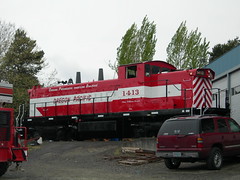
The new GMD-1 idles in the shop yard this afternoon.
—orc Fri May 6 16:06:09 2011
Dust Mite helps me prepare footstocks for the Oregon Coast 600, which I’m going to be chained to all weekend (and will thus need fruitcake to help keep me alive.)
—orc Fri May 6 13:01:54 2011
May 05, 2011
The RossIsle steams towards the Ross Island lagoon.
—orc Thu May 5 16:12:28 2011
May 04, 2011
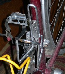
The rear wheel on the mlcm appears to be approaching the last roundup a little bit faster than I’d like it to be. The rim wear notch is, as you can see, worn down to almost complete nonexistance, so I’ll be needing to get a replacement rim (another Open Sport, or a generic TB-14?) before I put too many more miles onto this thing.
Hopefully it will outlast the 600 that’s coming up in 2 days. I’ve got an alex rim I can relocate over to this wheel after that’s done with, but riding a R200 on a shiny new handbuilt wheel is far less stressful than riding a R600 on one.
—orc Wed May 4 22:43:11 2011
May 03, 2011
Russell and I went out for a short loop this evening, but when he saw this cat he
had to stop and pet it for a while.
—orc Tue May 3 20:43:18 2011
Discount has been put up to version 2.0.9 with what may count as the most trivial update I’ve ever done. After a couple of months of 2.0.8 floating around uneventfully, I got a bug report that configure.sh was unable to detect scalar sizes on what turned out to be a standard linux x86_64 platform.
Now, given that discount has been working on x86_64 for quite some time now (and I’ve actually built it up on one of them and tested it, too) this was an unexpected result, and upon further investigation I discovered that configure.sh was unable to detect scalar sizes because it couldn’t run the test program, and it couldn’t run the test program because /tmp was mounted noexec by default on whatever virtual hosting service the user was using.
*siiiiigh*
Now, the chances of my complaints changing the now-traditional Linux CADT security process are about as good as the chances of my complaints changing gcc so it’s actually a C compiler (which is to say: not at all, if I’m lucky) so instead I needed to put in another workaround to get around this feature, and I did that by having configure.sh write executables that I intended to execute directly into the working directory instead of /tmp, and that leads directly to this New Code! which may fail during configuration, but will at least fail somewhere else.
—orc Tue May 3 10:40:02 2011
May 02, 2011
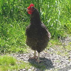
An red junglefowl (more commonly known, at least for the last 6,000 years, as a chicken) that I spotted walking down the Springwater Trail this afternoon (it was walking down the trail; I was, as I usually am, out on my bicycle.)
—orc Mon May 2 19:35:23 2011
May 01, 2011
I’m riding a lot this spring. I’ve got the
mlcm
knocked into a nice comfortable shape, I’ve gotten it
racked
and bagged
to my satisfaction, it’s well-lit, and I’ve got the handlebars into a
shape where I can ride them for hundreds of miles barehanded without
any unhappiness. So there’s not much (aside from the rain, and
that
doesn’t
seem
to be enough to drive any sense into me. Cold still drives
me away from riding, but that’s mainly a feature of not having
found appropriately windproof shoes and/or shoe covers) to keep
me from riding.
A few weeks ago, I ran into my friend Ed when he was on his way
home from work, and as we wandered around chatting about various
things he mentioned that
Flèche NW
was coming up and was I planning to ride in it? I said I’d like
to, but I hadn’t planned anything nor did I have a team, so I’d
have to try to graft myself parasitically onto someone else’s team.
One thing led to another, and almost before I knew it I’d been asked
to be a member of Bill A’s
team (Bill, Ed, Theo R, Asta C – all faster than me, but not by
very much these days) for an almost-direct run up to
Olympia on Friday (the 29th of April) afternoon.
So on Friday, after a day starting at 6:30 (I wake up early so I can get
tea into me before getting
the bears awake,
dressed, and off to school) I baked half a dozen potatoes, packed
half a dozen hard boiled eggs (we had 36 easter eggs, and I’m doing
my part to make sure they don’t go to waste) into an egg carton,
loaded all this plus clothing, camera, alarm clock, Amtrak tickets
(I needed to get back from Olympia, and the
bike
did too) and some science diet into my
rando bag,
showered, remembered that I was going to deliver a mapcase to Ed, loaded
that, remembered that I’d forgotten to load water bottles, loaded them,
and rolled out the door at 3:45pm for a scheduled 4pm arrival at Bill’s
house (which conveniently was the start of the flèche, but we wanted
a hour or so to compare notes and have a little snack before heading north(ish.))
The route out there is pretty simple; it’s the start of the one I use
whenever I ride out to Forest Grove for a brevet. I ride down to Tacoma,
across the Sellwood bridge (in traffic – there is no bike lane, so you
can be guaranteed that I’ll be in the middle of the traffic lane as I
zip across the span), dodge north to Taylor’s Ferry, zig onto Laview,
wind my way up to Barbur, then ride the Red Electric (aka Bertha + the
Beaverton-Hillsdale Highway) out to Beaverton. I arrived there at
4:30, just as Asta arrived (she’d taken the trolley out to Beaverton,
but got jammed up in traffic lights; Ed and Theo were already there
sensibly taking naps) and settled down for the promised snack and
pre-ride planning.
We didn’t get out the door at 5pm; it was closer to 5:20 by the time
we hopped on our bicycles and headed south for the Oregon Electric
(the Fanno Creek trail, then Multnomah Blvd) for the trip out to
Portland Traction’s Bellrose/Gresham line (the Springwater Trail.)
There’s not much to be said about this loop; the Fanno Creek trail
was put in long enough after the Oregon Electric abandoned their
branch from Portland to Beaverton so that the ROW has been gnawed
upon by property developments, and thus the path lunges erratically
from one side of the ROW to the other instead of sailing stately
forward like it does on (most of the) Springwater Trail, and the
streets in SW Portland are still a shrine to the Flying Spaghetti
Monster. The descent through Riverview Cemetery is awfully nice,
as usual, and the cemetery ownership has reshaped the speed bump
at the throat of the road so that it’s a little less spectacularly
jarring than it was when it was first put in.
Everyone else spent most of this part of the trip zooming ahead
enthusiastically. I, however, stayed at the back and took the
opportunity to take some pictures, because even though it was
sunny then it was still late in the afternoon, and I was unsure
about how the CBC would handle nighttime photography.
After a stop at the Bell Station convenience store (the first
control; the Springwater Trail is not overly crowded with stores
and if there wasn’t a control there you could short-circuit the
loop by half a mile by simply going across the Sellwood Bridge and
cutting north to Woodstock) we proceeded north along the i205 path,
across the i205 bridge over the Columbia (a nasty crossing as usual;
loud, windy, and the path is littered with cracks and debris,)
then northish and eastish to the second control in rural Camas (a
convenience store where Brunner road turns south and is renamed into
one of the millions of numbered streets,avenues,lanes,and whatnots
that litter the Vancouver submopolitan area) where night fell with
a resounding clank and rendered my camera absolutely useless for
the rest of the night.
And then, in the dark, we waded north. Through Battleground,
stopping at a safeway for a late evening control and snacks, then
east along the Lewis River into Yacolt, arriving at the strike of
midnight (where we had to sign our own brevet cards, because nothing
is open in Yacolt at 00:00 on a Friday night), then piling on all
of our cold-weather gear, turning back west and climbing slowly up
the hills that stand east of the Columbia gorge here.
We did a lot of leapfrogging here. Theo spent a goodly portion of
this part of the ride up in front of everyone else, and the rest
of us drifted back and forth within a ~1 mile window of him. We
were all gathered together fairly closely (after a series of short
upanddowns that I tried my best to zip up at top speed – I’m fairly
fast at short climbs where I can burn short-term energy) when we
reached the top of the gorge, but I fell quite a way back during the
screaming (and cold) descent down to Woodland where we had yet another
control before going back on the road and encountering the first unhappy
surprise of the night:
For most of the way between Portland and Olympia, you can travel along
secondary roads that hug the river valley and don’t climb steep ramps
just because they’re there. True, many bicyclists will cheerfully
diverge up to the steep roads for the fun of it, but if you don’t want
to climb you can get away without climbing. Except in one place.
Just north of Woodland the Old Pacific Highway is absorbed into I5,
and if you’re on a bike, you’ve got to ride Green Mountain Road,
which has this name because it goes 750 feet or so up the steep
side of Green Mountain in one swoop.
Theo hit this ramp and teleported to the top almost too fast to see.
Asta followed Theo at almost the same speed, and I put my head down,
stomped on the gas, and tried to keep her taillights in sight.
I didn’t lose sight of her taillights (which were at that point looking
like they were floating in space 100 feet above where I wished the road
would be if it was sanely graded) until I was about 600 feet up from
the valley, which is something of an accomplishment. Even more of
an accomplishment is that I never got out of breath, and I know this
because I was making up imaginative commentary involving sex and chainsaws
for much of the increasingly slow creep up the ramp.
When I reached the top of the ramp, Asta was there, but not Theo
(he’d dropped down the other side of Green Mountain Road and we
regrouped with him there) and the two of us waited for Ed and Bill
to arrive before plunging back down into the valley.
I thought that Green Mountain was the last surprise, so I was in
pretty good spirits as we wound our way along the valley to Longview.
It was about 4:30, and I was starting to feel a little tired, but
I knew that sunrise was coming and my tiredness subsided when I
started to see the dawn light appearing in the patches of sky
between the clouds as we passed through Pleasant Hill, then turned
east and crossed over the highway on (Weyerhauser) Headquarters Road.
It’s about a 1000 foot climb up to the top of the bluffs here, but
Headquarters Road isn’t that steep (4-5% grade, maybe?) so you’d
think that it would be, if not fairly easy, at least not terribly
hard. Well, no. It’s 4-5%, but it appears to be evenly graded,
so it’s 4-5% all the way up the ramp; Theo, Asta, and I had
stopped at the foot of the grade to wait for Bill and Ed, who
came screaming by at top speed to make a run at the ramp, and
then they (Theo and Asta) redshifted away, and I pretty rapidly
ran out of steam and got to watch, as I rolled down to a sustainable
climbing gear, the whole lot of them (for it was now dawn, and I
could see more of the damned road than I ever wanted to see) advance
steadily ahead until they disappeared around a corner never to be
seen again (until I reached Silver Lake Road; Theo had run ahead of
everybody else and was waiting for them. He congratulated me for
dropping them [sfx: high pitched hysterical laughter] until I told
him I’d not seen anyone on the way up. It turns out that there’s
a sideroad called the Davis Spur that connects Headquarters to
Silver Lake Road, and Asta, Ed, and Bill had taken advantage of that
instead of the (not quite correct in some places) cuesheet. But
neither Theo and I knew this, so we waited around for 10 minutes,
then decided to head on into Toutle in the hopes we’d find them at
the next control. Imagine our delight when we passed the lower
terminus of Davis Spur) until the control at Toutle.
So Theo and I stomped on the gas and went plunging down Silver Lake
Road. Theo has a working cellphone, as does Asta, and we were about
a quarter of the way down the road when his cellphone got a signal
and a voicemail from Asta asking where we were. He called back and
left a voicemail asking where they were, and then he got an actual
phone call saying that they were at the Toutle convenience store, which
by happy coincidence is where we were going.
I was quite hungry by this time. Climbing Headquarters Road took a
lot of energy, and I certainly didn’t want to stop to unwrap a potato
or egg, so I kept myself running by eating science diet (Clif shot bloks
with caffeine, Clif shot goo with caffeine) which may be enough to keep
me from collapsing in a sobbing heap by the side of the road but isn’t enough
to keep me from wanting to collapse in a sobbing heap by the side of
the road. But instead of collapsing in a heap Theo and I spent the
10 miles from Headquarters to Toutle moving as quickly as we could, speeding
up as we got closer to our destination, where I had the best horrible
convenience store sandwich and hot chocolate I’ve ever had in my life.
The sandwich was actually pretty good. It was certainly calorific enough,
because about 30 minutes after I ate it (we stuck around the store for a
while after eating, because we weren’t sure if we’d actually finish the
flèche in time and were wondering if we should instead continue
at a more leisurely pace and decide whether to actually finish at the
22 hour control. I thought we were on time to finish, as did Theo, so
we put off any decisions until later) just
about the time we’d crested the first small hill on WA-505 (we’d ridden
east on WA-504 to the junction with WA-505) I all of a sudden had energy
to burn, so when Theo and Asta split off from the rest of the group on
a hill I downshifted, spun myself up to 100orso rpm, then upshifted and
shot ahead to catch up with them.
But when I reached them I was still accelerating. Uphill. And I rapidly
dropped everyone and ended up sailing north(ish)by myself all the way up to Toledo
and the next turn onto Jackson Highway, where I ground to a stop, ate the
last bits of the sandwich, took a few pictures, and otherwise waited around
for something on the order of 10 minutes before they caught up to me.
When I reached Jackson Highway, I’d gotten my trip average speed
up to ~10mph, and it had only dropped to 9.8 by the time everyone
else reached me. This was comfortably enough to complete the ride;
we needed 9.6mph to make up for our late start and this gave us
about 25 minutes of breathing room. So we were in pretty good
spirits now; it was daytime, the sun was coming out, and the last
of the sustained nasty climbs were over; we pacelined down Jackson
Highway to Tucker Road, pacelined down Tucker Road to the tiny community
(with a convenience store) of Ethel, and then after getting our brevet
cards signed we went back to Jackson Highway and headed on towards Centralia
and the north.
The section of the trip between Ethel and Tenino was fairly uneventful.
Chehalis had a “WTF? WTF-F?!?” moment when the cuesheet pushed us off
Jackson Highway onto Washington Ave, which sat at the other side of a
40 foot ramp that must have been 25% at the least, and which deposited
us back onto Jackson Highway (which had changed its name going through
Chehalis – between Chehalis and Centralia it’s known as Kresky Ave) at
the other end of town, and we also had a moment of cuesheet confusion in
Centralia because Pearl Street (aka WA-507) was two-way NORTH of our
turn, but one-way SOUTH of our turn, and we read the sign and though it
meant one-way everywhere.
WA-507 parallels the BN/SF mainline north of Centralia, so I had to
stop abruptly to take pictures about a mile north of town when a
southbound Coast
Starlight (with a Cascades-painted F69 as the second Eng!) shot by,
and then I had to take more pictures when a northbound freight thundered
by a couple of minutes later. Fortunately everyone else had stopped
for a bathroom break so I didn’t have to bolt to catch up here.
In Tenino, we switched over to a rail-trail built over an abandoned BN
branchline. But before we got there we were toodling along Crowder Ave
(Asta, Ed, and I in front, Theo and Bill in back) when Theo decided he’d
make a run for it and shot by us at 22-23 mph.
I watched him go by and did nothing. Ed watched him go by and did nothing.
Asta watched him go by and took off like a rocket.
Oh, what the hell. Shift down, spin up, shift up, and I’m off to the races.
First catch up to Asta, then dodge around her, spin up some more, and catch
up to Theo, who responded to my move by also shifting up and accelerating away.
Or trying to accelerate away; I matched his acceleration and we both went
screaming down the road at 25(26?) mph until Crowder Road turned sharply left,
then deposited us into the town of Tenino, where we had to stop and wait
for Asta, Bill, and Ed to catch up.
And then Ed got a flat. So while we were changing it (Ed changed the flat,
Theo patched it, I flattened out the old tire, rolled it up, and stuffed it
into a protective plastic bag) Bill decided to ride on ahead under the not
unreasonable assumption that we’d catch up.
After the tire was fixed, I jokingly said to Theo that we’d need
to time-trial to keep up. I should have kept my mouth shut, because
he was off like a shot and it didn’t take much more than a mile and
a quarter before I had to give up the race. But then Asta and Ed
(who had been following along in my slipstream) shot around me and
continued the chase, but at a somewhat more relaxed speed (19mph
instead of the insanely fast at this point of the day 20mph) which
I could sustain, particularly when I was in someone else’s slipstream.
And soon we caught up to Bill and Theo, and were looking at getting into
the 22 hour control with a hour of spare time, when suddenly we were
surprised by the dreaded™ secret control:
Carol Nussbaum and Amy Piper (both, not surprisingly, SIR members.
This flèche is a SIR joint after all) were waiting at a grade
crossing to sign our brevet cards and offer us coffee, chocolate coated
coffee beans, and other equally healthy fare. We stopped, chatted, had pictures
taken, and otherwise burned off time until we finally headed off, now with only
about 35 minutes of projected time at the 22 hour control in Yelm.
Which we got to, had a little snack, then headed out at pretty much exactly 3pm for
the 30km in to Olympia. We sailed out of Yelm, then down the gradual slopes of the
Cascades into the outskirts of Olympia, and then into town where we started to look
for the “Woodland Trail” (another abandoned BN branchline; part of it was taken over by the City of Tacoma, and part of it was trailised in an amazingly incompetent fashion.) The cuesheet said “go left, then right and you’ll be on the trail” except that the trail runs, poorly marked, through a roundabout and we ended up going the wrong way for about a mile and a half along this
trail, only stopping when the trail ended. And then after turning ourselves around, we found ourselves back at the roundabout where there was a teeny little sign pointing to the other side of the trail, which was cut into handy block-sized chunks for the next mile and change, each block being punctuated by traffic filled streets and bicycle signals that appeared to do nothing other than start a recorded voice saying “crossing traffic may not stop!” (which we could have figured out from context, though at least the crossing traffic did stop. Not that this was guaranteed; the closer we got to Olympia the ruder the traffic got; many many SUVs got their kicks by brushing by us, and several of them actually went out of their way to roll down their windows and yell incomprehensible insults in our directions.)
Eventually the Woodland Trail became an actual trail winding down into the old city of Olympia, and we shot down the hill into the old city. Where we got lost again – the cue sheet recommended that we should turn “toward Deschutes Ave”, which was inconveniently on the other side of a park – so instead we went UP a really steep hill before realizing that we’d gone the wrong way. And then we routed through that city park, first the wrong way for a quarter mile, then back the other way to, finally, Deschutes Ave, and the last turn onto Evergreen Park Drive, which we reached at 16:55. The turn onto Evergreen Park Drive was ½ mile from the end of the loop, and we had five minutes, so no worries, right?
Wrong. The very last surprise on the loop was 200 vertical feet of 15% grade. Which took 4 minutes, leaving us a grand total of a minute to stagger 500 feet over to the ultimate control which we reached just as the clock struck five.
And then, after chatting for a little bit, I got a ride to the Amtrak station and caught the 18:43 Cascades back home (the standard assumption was that the riders would hang around until sunday morning and have a group brunch. I had to bow out of this because it would cost more money than the entry fee for the upcoming 600km loop, plus it would take me out of the house for all weekend two weeks in a row. So I just took the last train home instead.) I’d taken my alarm clock (remember the alarm clock; I put it in my rando bag) under the assumption that I’d fall asleep as soon as I got on the train, but, no, I stayed awake all the way home (except for maybe 10 minutes of napping? I closed my eyes for a little bit south of Woodland, but then a bunch of northbound container freights passed us and attracted my attention) and managed to eat a stack of food, then copy a bunch of pictures to flickr before I finally fell asleep.
24h00, 227 miles, 11000 feet of climbing. It was fun, I’ll have to do it again.
I can hardly wait for the 600k next weekend.
—orc Sun May 1 23:53:26 2011
—30—