Sep 29, 2012
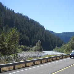
I ran the High Rock 300 with Michael Powell Parich today, and the weather more than made up for the haze last time I rode the loop. Absolutely clear and stunning volcano views, crystal clear skies, sunny and warm (from noon on), and, alas, a big pile of mechanical delays that brought our loop time down to 15h50 (dark when we left in the morning, dark when we got back.)
~8500 RUSA km and ~9200 miles for the year so far. All I have to do is keep my right arm from falling off for another 950 miles (Oct 20th, unless the rains start early) and I’ll be over 10/10.
—orc Sat Sep 29 23:07:51 2012
Sep 28, 2012
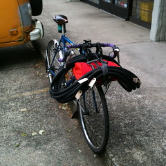
Repurposing a broken rack as a lawn chair.
—orc Fri Sep 28 20:28:52 2012
Sep 27, 2012
One day (or two?) before I did the checkride for my High Rock 300, my friend Kevin mentioned that he was going to be riding his Cedric Diggory populaire (Brooklyn to Vancouver, then up along what used to be Washington Highway 501 until it ends, then back) with Lynne Fitz on Sunday morning.
Well, I wasn’t doing anything on Sunday, and it seemed like it would be a lovely thing to do as a digestif for Saturday’s 300k, so I asked if I could go along, and got onto the ride.
It started at 9am, in Brooklyn, at what turned out to be a now-closed convenience store, so I started the day off by looping from the closed store to Kevin’s house and back to the closed store again, where I finally met up with Kevin and Lynne, not more than about 2 minutes late. And then we headed north for Kelley Point.
There are a few ways to get from the south side of town to the north side of town. Most of them have about 6,000 traffic controls. The trip across to Willamette Blvd took a considerable period of time, because basically every corner had a stop sign, if not also a stoplight, and we were all pretty happy when we finally reached Rosa Parks Way and could ride, uninterrupted, for blocks at a time on the way west to Willamette Blvd, then north to Lombard, then Marine Drive.
I’ve ridden Marine Drive a lot over the past four years, but most of the time it’s been from east to west, then north to south. We were riding south to north on this trip, and, goodness, there was a lot of traffic – all trucks – moving up the road and in the direction of I-5. We tried to stick to the road, but only made it about a mile away from the intersection of Lombard before we gave up and shifted over to the bike path (concrete slabs, which we went *bump* *bump* *bump* over for the next 3-4 miles before we actually reached Kelley Point Park.) Sadly, the info control for Kelley Point Park wasn’t inside the park, so we didn’t have a chance to pop down and see the slightly deranged historical marker.
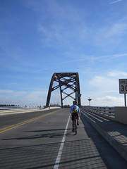
And then, after the Kelley Point info control, we continued, on bike paths, east to the Interstate Bridge and our jump across the river into Washington. We stopped briefly at the restrooms at the east end of the Smith & Bybee Lakes area, paced a train on the N/S mainline to Vancouver, then, after skittering by where the ex-steamtug Jean and landing craft LCI(L) 713, onto the horrible maze of twisty passages and narrow noisy sidewalks that take you from Oregon over to Washington.
After this, the crawl up through downtown Vancouver (which really needs a trolley line, though sadly may not get one for quite a while because of anti-Portland agitators) seemed fairly uncomplicated, and we soon reached Fourth Plain for the run up to the end of Washington 501 (which used to go further, but, alas, it was built along the Columbia River for scenic views, but then the river cheerfully washed out large sections of it for several miles a few decades ago, and the state decided that it was too expensive to rebuild the road.)
There were bike paths to ride along, and, alas, a moderate headwind that slowed us down to about 15-16mph on the way up, but at the end of the road we could eat blackberries and take pictures of Sauvie Island (which I am becoming fairly familiar with, thanks to riding the eff out of Kevin’s Cuthbert Binns populaire) before turning back south and heading back into Portland.
I’ve gotten considerably faster this summer, but have not mentally adjusted to this, so when I’m in the front of a group of people I tend to put on the gas so I won’t hold them back, only to lose them because I’m no longer quite so pokey as I was. So I made certain to not be in the lead, but to follow along. So this kept our moving speed down to about 20mph as we screamed back into Vancouver, only slackening when we popped over the BNSF railroad yard, and then slackening to a stop at a park in downtown Vancouver where we used the bathrooms and got some more water.
And then back into Portland via the same stupid bridge and maze of twisty passages. And then we got onto Marine Drive again and headed east for the airport and the section of bike path that leads from 34th over to the I205 path. A light tailwind let us wind up a bit here, and we flew all the way over to I205, then slowed and ground our way up the I205 path through Maywood Park and the Gateway Transit Center.
And then it was all downhill from there. We took the I205 path down into Lents, crossed over to Woodstock (via Harold, Ellis, and 87th), then worked our way west towards Westmoreland. At 52nd I delayed our forward progress when I hit a pothole, then a sunken drain, didn’t crash, but managed to eject my poor camera onto the street and had to recover it. We flew through Eastmoreland (helped by the nice steep ramp down from Chavez,) rode up Bybee to 17th (where I failed to DNF by turning north rather than south :-) and up 17th to what would have been the closing control at 17th & Holgate.
Since that control was closed, we just remembered our arrival time and relocated to Kevin’s house to do the paperwork, then sat around and chatted for half an hour or so before we pried ourselves to our feet and headed off in our respective directions.
5h24 for the loop, which was a nice refreshing change from the faster loops I’ve been doing. Pictures? On flickr, of course.
—orc Thu Sep 27 23:51:19 2012
The last time I went up to Joe’s Donuts I didn’t get very many donuts ‘cuz vegan. But what I didn’t realize is that my family had gone off Joe’s donuts, too (if I get donuts more than about once every two months it’s too much,) and today, when faced with one last remaining donut slowly getting stale, I couldn’t bear just tossing it, so I broke vegan and ate it.
It, um, didn’t taste that good, and not in the traditional “too stale to eat” way, but in a “is this actually food?” way. I appear to have, despite trying to be pragmatic about it, gotten new believer evangelicalism and now food that I know has animal products in it just doesn’t seem right to me.
I don’t know how I feel about this. It’s nice to not like the food that I don’t wish to eat, but I wonder just how much of my traditional favorite foods were my favorite foods not because of the taste, but because they are the things I’m supposed to like. And now that I’m not supposed to like them, I don’t?
Oy. That’s just weird.
—orc Thu Sep 27 20:03:54 2012
Sep 25, 2012
This morning, as I was walking Silas to school, we saw a little kid attempting to ride his bicycle between a SUV and the curb. He almost made it, and was clear of the SUV’s rear bumper when the bicycle veered into the curb and abruptly flipped over, carrying the kid, head-first, into the pavement.
There were quite a few other adults around, all closer, so we didn’t stay to help after they rushed over to assist the now-shrieking child, but, boy, that would have been an unpleasant impact if he’d not been wearing a helmet.
And this is the second time I’ve seen someone headfirst into the ground and have a helmet get in the way (the other time was me, and my helmet did not survive the impact even though I – except for my right shoulder, which obligingly disintegrated with, no doubt, a bunch of twang!s as all the ligaments tore apart – did) of at the very least would be a spectacular bruise. I will note, however, that neither of these accidents happened when the rider was moving at speed, but when the rider was just sort of ambling along at 5-10mph (I have a helmet with a nice dent in it where I didn’t see a hanging branch on Clinton Street until I clipped it at about 23mph, but I didn’t crash that time, nor did I crash the time I was riding along the Historic Columbia River Highway and got whacked in the head by a rock coming off a cliffside, so they don’t count in the “headfirst into the pavement” category.)
—orc Tue Sep 25 11:34:42 2012
Sep 24, 2012
… but when I opened my mailbox today and found a Special! Mailing! from RUSA which turned out to be a PBP memory book, my first reaction was not “Oh, that’s nice; it will encourage me to go for a ride with 5000 of my closest friends” but “well, that’s an effing waste of money” as I tossed the thing into the recycling bin.
Yes, yes, I know that a large part of the reason that RUSA exists is so that people can qualify for PBP in the United States instead of having to fly to Europe to ride the qualifiers, but, well, that’s not why I joined. I joined because the structure of the events got me out of bed in the morning to do the rides instead of sleeping in until noon and having to scramble to do even 100 miles before it got dark (I’m better about getting up at the crack of night to go out on a nice 300km ramble now, but it’s still easier to get up when the brevet clock starts at 6am and I can’t just use organizer fiat to roll it back to 7am. I’m going to have to work on that, though, given that there’s no Portland series next year and I’m not going to ride out to distant suburbs for bike camping, even if it’s bike camping that comes with a nice ACP stamp that will let me spent thousands of dollars going for a ride with 5000 of my closest friends.) These days I’m a member because RUSA keeps track of the miles I ride on permanents, so I can chase a megameter of completed rides in a year.
So I rolled my eyes and threw out the stupid memory book. At least PBP only happens every 4 years so I won’t have to toss another one until 2016.
—orc Mon Sep 24 23:22:36 2012
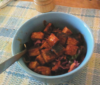
North Carolina BBQ with tempeh and vinegar slaw. Is it better than BBQ pork? I don’t know, and it would be cheating to run a taste test, but this dish was really good (hack up tempeh into cubes, fry it for a few minutes until browned on all sides, then turn off the heat, pour in some North Carolina vinegar sauce from the fridge, and stir until it stops boiling. Dump it over a bed of vinegar slaw – the Big Big Store is selling what they call “Harvest Slaw”, which is cabbage,carrots,kale,turnips, and fennel – and try not to eat in one big bite.)
—orc Mon Sep 24 13:09:08 2012
Sep 23, 2012
I wanted to go out and ride Kevin Brightbill’s Nicolas Flamel populaire this morning to check out the layering I’m trying to use on these fall days when the day starts out at ~50°F and goes up to ~70°F in the afternoon, and I wanted to finish the 64 mile loop in < 4 hours.
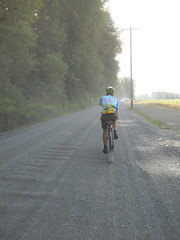
I was hovering on the edge of a sub-4 pace when I reached Gresham, but that pace went right out the window when I exited Gresham via Orient Drive – a drift of gravel at an intersection turned out to be a drift of gravel + stabby things, and the result of the stabby things was about a 45 minute delay before I could continue on (and it also meant that I made it to Sandy after the earlier church services had let out and I had to stand in line for about 25 minutes to get donuts to bring home) and a total loop time of 5h13 (moving time of 4h04, grrr!)
Oh well, so it goes. That sub-4 populaire will happen sooner or later.
(YTD miles are now about 9000, completed RUSA brevet km is at 8081, and my rolling 30 day average is 1750 miles. Can I do another 1000 miles in the next 3.25 months, and another 1200 RUSA brevet miles? Yes, and Mmmmaybe.)
—orc Sun Sep 23 13:34:43 2012
Sep 22, 2012
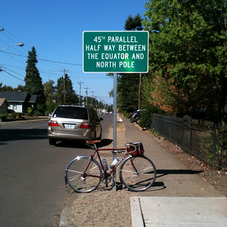
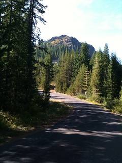
After riding past it many many times, I finally stopped at the 45° marker in Silverton to get a picture (I dropped down off the hill from Silver Falls much faster than Kevin did, so I had about 5 minutes to take pictures here while I waited for him to catch up.
(btw, we did a slow 200k. But these days a slow 200k is between 9 and 10 hours; we took 9h49 to do this one.)
—orc Sat Sep 22 18:51:18 2012
Sep 21, 2012
Using the trek to bring home workbooks for grading.
—orc Fri Sep 21 23:58:36 2012
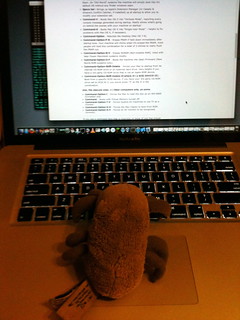
Dust Mite helps debug a dead macbook.
—orc Fri Sep 21 23:55:44 2012
I may not be going bike camping tomorrow, but I will be getting some miles in by riding a 200 (and maybe a 100 early Sunday morning if I get back from the 200 in good time) and this means that I need to put fenders back on the mlcm unless I wish to enjoy the fall rains far more intimately than I ever wanted to.
So it’s fender time. I took off the 45mm fenders because they were too wide for the fork, and then put 40mm fenders (using a cut-down daruma and a handmade wedge washer to help keep the fender aligned) on instead. They’re too wide, too, but not as too wide as the 45mm fenders, and, until the day when I get out my torch and braze canti studs onto the fork (along with the braze-ons for the rack and a couple of ports for internal wire routing) they’ll just have to do.
As you can probably guess, I dgaf that the fenders look kind of ugly. They’ll keep some of the wet off me when I’m riding, and that’s worth more than the looks of the things.
—orc Fri Sep 21 21:29:01 2012
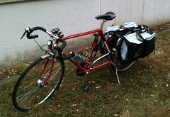
The project bike carries a load of tires home from the bike shop.
—orc Fri Sep 21 13:15:43 2012
Sep 20, 2012
I was riding the trek down to the Big Big Store to get lunches for the bears and some vegan fud for me (Oh, yeah, I’ve switched to a vegan diet. I’ll talk about that some day or another, and it probably won’t be a spittle flecked rant about how everything in the house/store contains dairy and/or eggs) when it started to make a horrible scrapy squeaking noise. My outbound route looped through Garthwick, and the scrapy noise started around the time I reached the junction of Milwaukie & 17th, so I had about a mile and a half to try and isolate the problem while I was riding along, and, by the time I reached the store I was pretty certain that it was the (cassette == nonrepairable) bottom bracket.
I checked the cranks out before I went into the store and it certainly looked like the squeaking was coming from the bottom bracket, so after I finished shopping and went home (to an increasingly loud chorus of scrapy noises which made me wonder if the bottom bracket was about to seize or break in half) I derailed the chain and spun the cranks to verify.
Yup, the bottom bracket is toast. Sigh. Time to throw it into the recycling (or just tear it apart for spares) and run – on the project bike, not the trek – up to the LBS and pick up a new el-cheapo sealed bottom bracket.
At least this is a component that only costs about $10.
—orc Thu Sep 20 22:44:39 2012
Sep 19, 2012
Silas decided that he wanted to try and learn how to ride his bicycle today.
It took him about 20 minutes to get to this point.
Now I have to build a porteur rack and dynamo wheel for this bicycle, too.
—orc Wed Sep 19 18:39:07 2012
Sep 18, 2012
My plan was to have ridden my 300s much earlier this year, but, alas, catastrophes happened and before I knew it it was August (and then I ended up riding my 400 instead of either 300) and then, almost before I blinked, September.
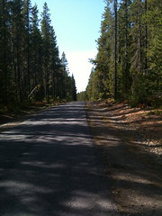
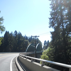
So something needed to be done. I have two 300s, both of which run up into the mountains south of Mount Hood. One of them (Sellwood to Hood & Back, which borrows liberally from the western half of Michael Wolfe’s Barlow 300) treads familiar roads that I’ve ridden at least once this year (with the notable exception of NF 58 to High Rock, which is, um, kind of steep going up to High Rock from the west.) The other one, the High Rock 300, takes roads that I have not used before, plus takes NF 58 from east to west, hopefully avoiding the insanely steep ramps that weigh down the climb up to High Rock.
Plus it’s a new perm and I’ve not even had a chance to do the checkride of it yet. So I set a date to ride it (the 15th) and asked a few of the usual suspects if they wanted to help me checkride it. Nobody did for various reasons ranging from bike camping to wanting to take a rest week before The Big Lebowski (I must admit I can’t think of anything more restful than a nice 300k, but then again I’m the person who warmed up for the summer 600 by riding a 200 two days before it,) so I ended up having to do it by myself.
Which actually worked out pretty well.
My planned departure time was 5am, so I’d set the alarm clock for 4:30 to give me enough time to throw on some clothes and get out the door, but, alas, the inevitable effects of not riding with anyone happened and I didn’t get the mlcm out the door and onto the road before 6am.
The first and last 60 miles of this loop tread very familiar ground; there aren’t that many ways to get out to Ripplebrook (OR 224, looping south through Detroit and coming up NF 46, or, um, gravel forest roads) and the one I prefer is OR 224, which I’ve now ridden up and/or down 11 times this year (this ride, the Hot Springs-Covered Bridges 400, the summer 400k, the summer 600k, and *7* loops of my Portland-Ripplebrook-Portland 200k.) So there weren’t any new surprises for me (aside from hitting 55mph on the Van Curen descent, thanks to sprinting up to the edge of the bluff, then doing a pretty good tuck on the way down) and I could just ride along and enjoy myself.
Not quite as fast as usual, though (4h22 to get to Ripplebrook) because I’d burned off a lot of power by doing fast loops up to Sauvie Island and Sandy in the 3 days previous to the 15th, but the day was just starting and there was no reason to burn off much energy before reaching the hilly part in the middle. And then I stopped in Ripplebrook for over half an hour to eat a nutritious (fsvo “nutritious.” It had a bunch of calories, which, I guess, is something) breakfast and look at the net (my iPhone doesn’t have a data plan, but Ripplebrook has wifi) before I dragged myself, just before 10am, back onto the mlcm for the alpine section.
The first part of the alpine section is on NF 46, which, despite teasing you with a collection of hills just past the end of OR 224, settles down to a distinctly non-alpine gradual climb along the Clackamas River for a dozen or so miles. But then the fun begins – NF 42, which is one of the few paved routes over to Timothy Lake, starts climbing immediately after the junction with 46, and really doesn’t stop until you’re almost at Peavine Mountain, which it then climbs as well.
It’s a terrific climb. Maybe averaging 5%(?), so I could bigring myself up it with only a few points where I started to worry about my sanity, and it’s all nicely paved and with very little traffic. Up and up I wound, through clear cuts, new forest, and old forest, stopping occasionally to delayer, make a note to add to the cuesheet (the first cue that bikeroutetoaster put in when I did the route was to not turn off on a road that ended up to be a blocked gravel logging road. No worry about that,) or to take a picture of a particularly scenic stretch.
Before you reach Peavine Mountain there’s a stretch where the road drops down into an alpine valley, then climbs out again. It does this in a sneaky way, by first dropping down into small valleys, popping up out of them (I was thinking “is this it? The topology must be wrong or I got really strong all of a sudden.”) and repeating it until you’re surprised by a long plummet down to the foot of the Peavine Mountain climb, which is noticably steep (but not steep enough to get me out of my big ring.)
This is a moderately long climb, too, but nowhere near as long as the climb I just did. And while I was climbing I saw a few other people on their bicycles, too, including a gentleman that I passed who was in full pain cave mode, and couldn’t be bothered to return the greeting wave I gave him as I passed (and the funny thing about this fellow in his pain cave is that though *I* was climbing, he was descending, and not on a fixie either.)
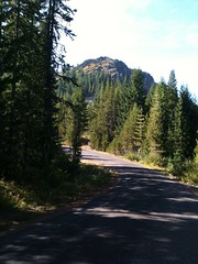
And then I rolled over the pass just west of Peavine Mountain’s summit and plunged down towards Clackamas Lake. A plunge that was interrupted just as I reached about 45mph by the road curving north and all of a sudden Mount Hood was right there in front of me. Sadly, by the time I said “Oh, shit!” and managed to stop I’d descended far enough so that much of the mountain was hidden behind a screen of trees (and I was not going to turn around and climb back up to get a good photo. Maybe the next time I ride the loop.) I took as good of a picture as I could, then continued downgrade to Clackamas Lake, where I rewatered myself (the visitor center appears to be closed for the winter, so I couldn’t see if they sell snacks) and discovered that one of the info controls for Sellwood to Hood & Back had been removed.
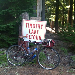
And then it was time to climb again. the road is flat across Clackamas Meadow and up to the junction with NF 57, but then it starts to work upwards towards the junction with NF 58. I started to see “TIMOTHY LAKE DETOUR” signs along here, and those signs were on NF 58 as well as along NF 42. Earlier, when I was having my breakfast at Ripplebrook, the staffers there asked if I was planning on taking NF 57 up to Timothy Lake. I thought nothing of their question (I was assuming that they thought I didn’t know that 57 wasn’t paved past the junction with 58) then, but when I started to see these signs I realized that they were going to tell me about a road blockage or something. In any case, there was a lot of traffic on NF 58 as I worked my way up towards High Rock.
The eastern approach to High Rock is not as long, or as high, or as steep as the western approach, but it has its own moments. It rolls upgrade, so i went over what seemed like an unending series of short descents followed by considerably longer steep upgrades. Not steep enough to get me out of the big ring, but certainly steep enough to make me very slow. And every time I reached the top of one of these ramps, I would be greeted by a surprisingly cold headwind, which got pretty tiring after a while.
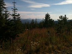
Eventually, after more time than I wanted to think about, I reached NF 58’s summit (at ~4550 feet) and the clearcut that normally gives me wonderful views of Mount Jefferson. Alas, this was a hazy day so all I saw was the ghostly white shape of the mountain against the white of the haze.
And then it was time to get down. I’d reached the Mount Jefferson vista/summit at ~3:20, so I thought I’d not get back to Ripplebrook before it closed at 5 (I think it’s about 21 miles away from this vista,) but I’d forgotten just how steep the ramps are here. I made quick work of descending down to the hairpin at the foot of High Rock, but then it started to get scarily steep; the top of the ramp up from NF 57 is maybe a 20% grade, and it’s a fairly straight half-mile down to the first tight curve, so after I rolled around the hairpin and surrendered the mlcm to the embraces of gravity I skooched myself into about as aero a position as I could get. Which ended up being a really good plan, because I’d forgotten (or never noticed) that NF 58 is littered with sunken sections and potholes, and I rediscovered this when, at 40mph, the mlcm went airborne over one of these sunken sections.
It’s a good thing my hair is already white, for otherwise I would have lost my youthful beauty on the spot.
The rest of the descent down NF 57 was a constant battle between me, my brakes, and the rough embrace of gravity – I didn’t want to completely let the mlcm go, because NF 58 is a lot more twisty going down than it was going up, but I didn’t want to ride the brakes because I didn’t want to melt them or the rims during my descent. So I *shot* down NF 58, pulsing the brakes on steeper sections and hoping that I’d not encounter any enthusiastic uphill traffic at one of the curves.
Thankfully, NF57 doesn’t have anywhere near the number of surprise sunken sections and/or potholes that NF58 has, and I could descend it stupidly fast without feeling like I might end up with a(nother) spectacular pothole crash.
It seemed like it took a long time to come down NFs 58 & 57, but it didn’t take much time at all. I dropped around the High Rock hairpin at ~3:30 and reached the Ripplebrook Ranger Station – 16 miles down the road – at ~4:15. So I stopped and had another snack before heading north for the last 100 kilometers.
Once again I was on the old familiar ground of my Ripplebrook ↔ Portland segment, so there’s not much to say. There was a headwind, but it was noticable at Ripplebrook so I could get myself up to line speed before hitting the long ramp that takes you down to the Clackamas River (this time I didn’t let up on the gas until I was going 36) and I managed to make it all the way to Carver before the sun finally dropped below the horizon.
It was late dusk when I reached Oregon City, but full night when I turned onto the Springwater Trail for the final fishhook up to an info control before going home. I wasn’t paying much attention to the time, though (I don’t use my GPS as my primary speedometer on the mlcm, because it has poor battery life and not enough memory to store any loop longer than about 500k; but it has a clock, and the el-cheapo Cateye bike computer I replaced it with does not) and was unexpectedly delighted to roll up to my front door at 20:58, 14h58 after I left in the morning.
It’s not, by about 100 minutes, the fastest I’ve done a 300k, but (a) it has much more climbing than those other 300k loops, and (b) I spent a lot of time stopped on this one that I would not have spent on a non-checkride. I’ll have to do it again. Maybe this Saturday, since I cannot carve out 4 days to ride The Big Lebowski.
There are pictures, of course, and there will be a route description sooner or later.
And now I’m only a 600k permanent away from a permanent-SR (motto: “all of the work, none of the credit”) for the year. Sadly, there aren’t any 600k Portland loops yet, so I don’t think I’ll get that SR this year :-(
—orc Tue Sep 18 12:05:05 2012
Sep 17, 2012
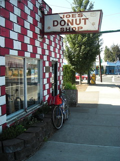
On Friday, I needed to (a) loosen my legs up for Saturday’s 300, and (b) go up to Sandy for donuts. My old route up to Sandy was Springwater→212→Orient→Kelso→Bluff et retour, but there’s now a new permanent populaire that I can ride instead; it’s about 10 miles longer, but that’s not very much in the grand scheme of things and it gives me 103k I can add to my pile-o-brevet-miles.
The problem with going up to Sandy is that that’s where Joe’s Donuts is located, and I seem to find it impossible to stop there for less than 20 minutes. So my ideal loop time for the ride up there and back (3h26) is not likely to ever happen (I’d need a loop average speed of 19.6mph, which is 1.5mph faster than I’ve ever maintained over any distance >50 miles.) But, you know, there’s certainly no use in not trying, and after getting within half an hour of brevet minimums on Kevin Brightbill’s Cuthbert Binns populaire, there was certainly nothing to be lost in trying it.
And by “trying it”, I mean trying for a land-speed record on the project bike, because it’s a lot easier to carry a dozen donuts on it that it is to carry them on the midlifecrisismobile.
So, after shooing the bears off to school in the morning, I dragged the project bike out of the house, started my brevet clock, and bolted off to the north. It’s always slow going doing a S/N transit of Portland because there are sections of the road (like 12th Ave between Division and Lloyd Boulevard) with approximately 10,000 streetlights, all of which are timed to be red when you’re attempting to move quickly on a bicycle. But once I got into NE Portland the streetlights diminished and I could start putting on some speed, working up to a fairly steady 19-20mph on the section of 33rd/34th from approximately Killingsworth up to Marine Drive.
Normally there’s either a strong tailwind or headwind along Marine Drive, but today there was only a very slight cross-headwind, so there was really nothing stopping me from putting on the gas and getting up to a comfortable cruising speed of 20-22mph. And I managed to keep that cruising speed for almost the entire distance from 34th to the end of Marine Drive in Troutdale, where the route turned inland and cut across Troutdale and Gresham to Orient Drive, but with one moderately steep long hill to climb up out of Troutdale.
The hill did slow me down, and by the time I reached the top and was transiting the endless sea of identical subdivisions that make up suburban Troutdale/Gresham my moving average was down to about 17mph, a speed that would slowly creep down as I climbed up towards Sandy.
The west end of Orient Drive runs along the ROW of the old Mount Hood Railway, so it’s fairly easily graded through here; I used to ride along here a lot, and still can while away the miles by trying to spot signs of the now-70-year-gone interurban line (there are a lot if you know what to look for, from suspiciously straight treelines & power poles running through front yards, to mysteriously level sections of ground between Orient Drive and houses/open fields just to the north, and even some screamingly obvious cuttings where the road went up to the top of a little hill while the railroad bored directly through it) but it was not too long before it diverged from the old ROW (the eastern section of the Mount Hood Railway has become Dodge Park Blvd, which is an excellent return from an alpine loop,) worked its way through the town of Orient, and then curved southeast for the run up to Sandy.
I, however, left Orient Drive here to take Bluff Road the rest of the way into Sandy. A couple of years ago this was a pretty hilly route that I had to spend a lot of energy slowly grinding my way up out of stream valleys, but these days, even with a fairly heavy bicycle, it’s become a much more level route with only one or two noticably long ramps when I got closer to Sandy proper.
So I sailed along at 16-18mph (much more level ≠ level, as my reduced speed proves) taking (some) pictures as I went (I’d normally take a lot of pictures, but until I get my many-times-smashed Nikon L21 recased I’m stuck with the old Nikon L6 I used to use before the memory card slot died and stuck me with only enough internal memory for 26 low-resolution photos) until I finally reached the steepish highway 26 ramp up to Joe’s (with, of course, stoplights, all of which were, as is traditional, red.)
When I reached Joe’s, my brevet average speed was something on the order of 16.5mph, which was comfortably under a 4 hour loop time. But, unfortunately I had reached Joe’s, so despite my best efforts to move quickly I still spent enough time inside to bring my brevet average down to under 14mph.
And then I had to get home. The official route of this permanent is Bluff→Kelso→Ritchey, but that doesn’t work because Kelso is blocked by highway 26. So, instead, I had to use Bluff→Kelso→Orient→Compton/212, which is nowhere near as scenic, but which is really fast and I was able to ratchet the project bike back up to 22-24mph for most of that segment, only slowing slightly at the hill just east of Boring, and then slowing more on the transit across Boring to Telford/whatever numbered street Telford is known as here.
Once clear of Boring Telford Road heads generally downhill to the northwest, and I could get up to 22mph here without too much trouble, but all too soon I reached Rugg Road and had to dodge onto the Springwater Trail, which, at least on the Gresham end, is heavily used and is not really good for high speed bolts back into Portland. But I persevered nevertheless, and managed to take advantage of ped-free stretches to move quickly enough to make up for the more cautious 12mph stretches around walkers and other, slower moving, bicycles, until I got back into Portland and had 7 miles of fairly quiet MUP to barrel westward on.
Normally, I take the Springwater Trail all the way to 19th, dodge north to Linn, then work my way north on 17th. Alas, this populaire doesn’t do that; it, instead, takes the insanely steep ramp up from the Springwater Trail to 37th and then works its way across to 17th via Crystal Springs Blvd, which not only has stopsigns but which deadends onto Bybee, which is fairly busy all the time except early in the morning/late at night.
I only had to wait about a minute or so for the traffic to clear enough to pass, and then it was a matter of 5 blocks to the end of the loop (Kevin allowed a route variant that started/ended the loop at 17th & Bybee, which is much closer to my house than Holgate & 17th) with only one stop light, which was red, before I pulled up to the ending control at 4h07 on the brevet clock.
Not bad. 16.9mph moving average, 15.5mph brevet average. If I hadn’t have had that leisurely stop at Joe’s it would have been a 3h47 loop, but if it wasn’t for the leisurely stop at Joe’s I wouldn’t have done this loop, because, well, donuts.
And unlike my previous high speed loop, which I had maintained a 16.8mph brevet average in, I didn’t spend any time at all cursing the headwinds as I shoved myself through them at top speed, and, instead, just moved quickly and comfortably along, stopping occasionally to take pictures or pick up rando junk.
Pictures? Yes, on flickr.
There will probably be more pictures soon, because we’ve already eaten most of the donuts and I’ve got to run up there to get some more. Maybe next time I’ll break the 4 hour barrier and get donuts as well?
—orc Mon Sep 17 13:41:21 2012
Sep 16, 2012

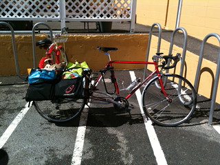
I am now three rides behind on write-ups, plus I need to do the route descriptions for the High Rock 300 (which I might do again next weekend, if the weather is good; if I don’t have to stop for route annotation purposes and info control picking, and if I don’t ride a fast 100k the day before, I might be able to chop an hour or so off the loop time, and if I can do an alpine 300 in 70% of the allotted time I would be a very happy camper indeed) and Hot Springs-Covered Bridges 400k. But those will take time, and it’s almost bedtime in Chateau Chaos, so instead here’s a picture of my Trek loaded with a bucketload of groceries.
Note that the front wheel has a 26mm tire, and the back wheel has a 27mm tire.
This, as they say, gives me all of it (unlike the iPhone, which only gives me some of it in the camera ergonomics and performance department.)
—orc Sun Sep 16 21:55:34 2012
Sep 15, 2012
I’m in the throes of riding my High Rock 300, and I managed to do the first 200k (including the alpine section with ~8000 feet of climbing, all of which I did in the big ring) in 10h18, including a half hour breakfast break at Ripplebrook on the way up.
Oh, yes, I’m getting faster.
Update: Done. In 14h58.
—orc Sat Sep 15 16:30:20 2012
Sep 14, 2012
Sep 13, 2012
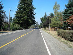
A commuter waits for traffic to clear on Bybee Boulevard this afternoon.
—orc Thu Sep 13 22:15:32 2012
Sep 12, 2012
Now that the school year has started, my midweek permanent habit has been pretty severely curtailed; I can no longer go out for 9-10 hours to ride 124 miles, because all I have is a 5h15 window between shooing Russell out the door in the morning and going over to Llewellyn to retrieve Silas in the afternoon.
But even though 5 hours isn’t long enough for a fast 200k, it’s more than enough for a fast 100k populaire. So that’s what I’ve decided to try and do in place of my previous midweek 200ks. And today was the first day to test it out.
I’ve ridden Kevin Brightbill’s permanents a bunch already this year, with a particular emphasis on his 110k Cuthbert Binns populaire, which is about as close to optically flat as you can get in the Portland area, plus which is scenic enough so you won’t mind the flatness. We’d (the other times I’d ridden it I rode with Kevin) managed to finish the loop in under 5 hours, including one flat-ridden try last Tuesday, so I thought that if I pushed my moving speed up just a little bit – and didn’t get any flats – I’d be able to do it in close to or maybe under 4 hours.
And it’s Wednesday, so it was the time to try it.
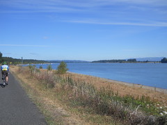
The weather wasn’t particularly welcoming, though – it was nice and sunny, but there was a pretty savage north wind blowing up the Columbia, and once I got up to Naito there wasn’t anything between me and the wind for the next 20 miles. So I dealt with it in the traditional way – I put my head down and tried to push myself through it as fast as possible. But today “as fast as possible” wasn’t really all that fast; in the past I’ve managed to shove myself at 20mph through some enthusiastic headwinds, but today it was only about 18mph, with the occasional “hello, mr. brick wall!” as I’d come out of a sheltered section and get the full force of the wind right smack in my face (note to myself: I need to lower my handlebars. How I’m going to do this, I don’t know, given that I’m down to the decaleur and bell spacers, but the bars feel much too high when there’s a strong headwind.) But, on the bright side, I managed to avoid all of the tire-eating debris that I became far too intimate with the last time around and made it to Sauvie Island with my tires intact.
Once on the island, there are enough windbreaks so that the upwind slog to the first info control wasn’t completely into a headwind. But the last 4-5 miles of it were, and as I ground north my speed slowly dropped from ~19mph down to 18, then 17, 16, 15, 14, and finally to 13mph for the last half mile (across Columbia County chip seal. Which isn’t nearly as bad when I’m riding Resist Nomad 700×28c tires as it was when I was riding Ruffy Tuffies) to the first info control. And then I was paid back on the return by being shoved, at speeds up to 24mph, all the way back down to the junction of Sauvie Island Road and Reeder Road, which I would then take north to the nude beaches on the northeast corner of the island.
On Reeder Road, the headwinds were spectacularly strong, and the only thing that saved me from completely stalling out was that the road zigs somewhat as it works its way northeast, and when the zigging died down there were enough windbreaks to give me a breather as I clawed my way northwards. When I neared the north end of Reeder Road, though, I entered a section where there were no windbreaks, just headwind, and I ended up moving increasingly slowly across the section (started at 18mph, ended at ~12mph) until I hit the gravel section, which was blocked from the wind by the hedgerow that separates the nude beach from the road.
Two weeks ago, this gravel section would have been a pain. But I’ve switched tires and can now blast across loose gravel at 18mph if I’m in a hurry and not feel like I’m about to be vibrated to death or about to have the bicycle slide out from under me. So I flew up to the second info control, info controlled myself, then turned around and bolted back south, at between 20 and 24mph.
Which I kept up, more or less, until I reached Willbridge Yard, where the wind broke up and became a headwind again, which it kept up for about 4 miles, then became intermittent as I worked my way across town towards the final control. The headwind was pretty discouraging, but I pushed as hard as I could – cursing all the while – through the approximately 2000 traffic controls that littered the route (I was given permission to try some alternate routings, and I did St Helens->Thurman->Naito instead of Kittridge->Front->Naito. This kept me away from approximately a dozen angled railroad crossings, but at the cost of many traffic controls) between the foot of Thurman and the final control.
Down Naito, across the Morrison bridge, then down Water Street, and then I worked my way up and over the Powell overpass at 9th St and up onto the hill that Brooklyn is built on. I took 10th across Brooklyn, then dropped down to Milwaukie for the last quarter mile to the end, and, after being stopped by one last stoplight, rolled up to the final control only to discover that I had not broken the 4 hour barrier.
Shoot. I guess I’ll have to try it again next week.
The gory details for the loop are:
- 4h04 minutes
- brevet average 16.8mph
- moving average 17.1mph
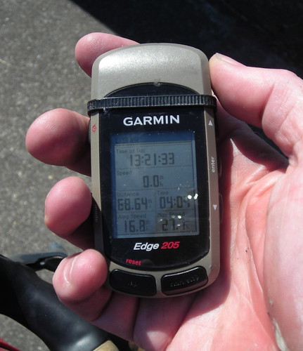
- Nine photos – I was using an old Nikon L6, which doesn’t do photos in motion very well. There were quite a few places where I wanted to take a picture, but the L6’s little brain exploded when I tried to activate the shutter. I need to recase the L21 :-(
- left at 9:17, back at 13:21, which left me 50 minutes before needing to go to Llewellyn to retrieve Silas :-)
—orc Wed Sep 12 21:15:55 2012
Sep 11, 2012
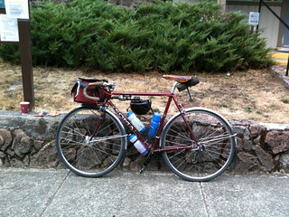
The Trek sits at Trader Joe’s before I rowed it up Schiller Street (9-15% grade for a couple of hundred meters) to take an indirect route home.
—orc Tue Sep 11 15:39:48 2012
brevets,permanents,checkrides
Now all I have to do is keep the momentum up over the school year + rainy season, because it’s 3 months to a RUSA R12, 4 months to 2 overlapping RUSA R12s, and 2945km to reach 10k metered RUSA kilometers (1890 miles to reach 10k miles) for the year.
—orc Tue Sep 11 09:28:00 2012
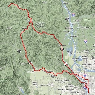
I’ve been spending most of my breveting energy on riding the eff out of routes like Portland-Ripplebrook-Portland, One Big Hill & Silver Falls and Volcanoes vs. Farmland and have left Hills to the Yeah! and Sellwood-Birkenfeld-Sellwood almost untouched (ridden them once each this year.)
Of those two, I’d left Sellwood-Birkenfeld-Sellwood alone the longest, so when I was arranging a weekend 200 with my friend Kevin, I mentioned that I was interested in trying to do a sub-10 hour run of this loop. Kevin wasn’t so sure about the sub-10 part, but it had been a while since he’d ridden out to Birkenfeld so he thought that this would be a better bet than my other suggestion (which was to try for a sub-8 One Big Hill; that may have to wait until November) and we were on for a nice 8am departure from Marsee Baking.
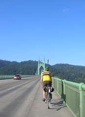
Which I was late to, as is traditional (this time I was late because I’d forgotten to print out the waiver and brevet cards before, um, 7:55am) so our 8am departure became an 8:07am departure. We worked our way north through Portland, being stopped by every single freaking stoplight on the way, until we reached Willamette Boulevard and could scoot along towards St Johns, the St Johns Bridge, and the long tedious stretch of highway 30 between Portland and Scappoose.
On the way up towards the Sauvie Island bridge, Kevin and I rolled smartly along at about the same speed, but there is a short series of undulations immediately after the bridge, and I found myself, with my newly found climbing speed, popping over these bumps and leaving Kevin far in the rear. So I slowed down, waited for him to catch up, then starting accelerating north just to get the eff off highway 30 again. And dropped him again on the next series of hills just south of Scappoose.
Sigh. I’m just not used to this newfound climbing speed I’ve developed. Another round of slowing got us coalesced again as we reached the central part of Scappoose and the turnoff onto the Scappose-Vernonia highway, where Kevin had the idea that it might be nice to follow the CZ haul road instead of riding on the highway.
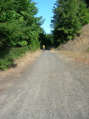
Can’t argue with that; the highway is nice and fast, but has about a centimeter of shoulder, while the CZ trail is nice and quiet and winds upgrade along the edge of the valley.
It’s also mainly gravel, with some sections that are fairly battered. And this slowed me right down, to the point where Kevin took the lead all the way up to the summit of the Nehalem Divide.
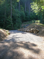
Columbia County has been slowly working on making the CZ haul road into a nice trail, and almost every time I’ve ridden on it since my first loop I’ve seen one thing or another being fixed up. Last year, the huge washout on Mollenhour Creek was filled (and paved with extremely coarse mill run gravel which I’ve walked every time I’ve gone up the CZ haul road since then) and this time the other washout (Alder Creek, east of Spitzenberg) had a honest-to-g-d bridge put in. This latter improvement is greatly welcomed, because fording Alder Creek was a bit of an adventure due to a tangle of downed trees across the shoofly down to the ford, which meant that bicycles needed to be lifted over waist-high trees or put on their sides and slid through the mud along with their riders. It’s not a perfect improvement yet, because for some reason the bridge was installed halfway down the embankment into the ravine and then the new steep ramps to it were paved in a thick layer of fine pea gravel, which neither Kevin and his Hetres or I and my Nomads could climb.
But, anyway, Kevin shot along this trail and I followed cautiously behind, only dropping to my alpine ring for the mile and a half 9% ramp that went from where the haul road diverged from the old Columbia & Southwestern ROW to the summit 700 feet or so up from there. And when we reached the top I suggested that it would be a lot more fun to descend on the highway than it would be to descend the haul road (which is still fun, but my shattered shoulder might have had words to say to me if I wiped out on the large patch of loose gravel at the first hairpin on the descent) so we climbed up to the highway and proceeded to drop down to highway 47 and the Nehalem River.
Have I mentioned that 28mm Resist Nomad tires are the bees knees? When I was riding Ruffy Tuffy tires, I descended about as fast as Kevin did (and I suspect not nearly as fast as any of my other riding partners present or past), but on this day he led out on the descent, but as it steepened the mlcm accelerated as if it had been dropped from an airplane, and I shot past him and plunged into the valley like a rocket.
Eventually I slowed down, then stopped for a snack and to delayer, and waited for Kevin to catch up. And then we were off again down to highway 47 and the north. 47 is a fairly level road through here, so we were able to shoot northwards at a reasonably fast 20mph, each pulling for 5-10 mile stretches until we climbed over a knee of the valley wall and dropped into Birkenfeld.
We pulled into Birkenfeld approximately 4h30 after we left Portland, which wasn’t bad considering the long gravel section. But at Birkenfeld we stopped at the (no longer a store, but a cafe/music hall) Birkenfeld Store for a leisurely lunch, and were well over 5 hours into the ride by the time we got back onto our bicycles and headed south.
If anything, the return from Birkenfeld down to Vernonia was even faster than our trip north from the highway junction at Pittsburg; Kevin pulled us along for 3-4 miles, then I got into the lead and stomped on the gas and yanked us along at 20-21mph for about 15 miles, only slackening when we got close to Vernonia.
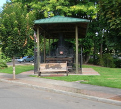
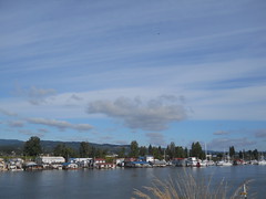
We didn’t need to stop for anything in Vernonia except water (we were both sucking down water like firehouses) so our stop there was very quick – enough time to refill bottles, then take photos of steam locomotives, and then we were off on the Banks-Vernonia trail for the next 20 miles down to Banks. This was not a part of the ride to go particularly fast, so we idled along at 15-16mph and chatted most of the way up to Tophill, then most of the way down to the valley floor north of Banks (I was trying to coast all the way down to the valley floor, so I lagged behind for a goodly chunk of this trip :-), then into Banks proper, where we refilled our water again and headed towards Tualatin Mountain and points east.
Now, here we needed to do a bit of a reroute. Washington County removed an old bridge on Old Cornelius Pass Road a couple of months ago, and is planning on reopening the road on September 22nd. But it’s not September 22nd yet, so we needed to find another route. Last time around we detoured onto Logie Trail, which was nice, but steep, and would have been a bit out of the way for this loop. I was thinking of Cornelius Pass->Kaiser->Brooks->Skyline, but Kevin suggested West Union->Laidlaw->Thompson and I thought it would be worth investigating.
It certainly was. Laidlaw is steep, but not as steep as Logie Trail, and Thompson is steep, but steeper near the bottom than the top, and once you get to the top (I actually shifted out of my alpine ring back to my big ring halfway up Thompson :-) you get to go down Thompson, which is now all the way open again. And, my, the descent down Thompson is great; there were a couple of places where I needed to scrub speed going into a 15mph hairpin, but for the vast majority of the descent all I needed to do was to try to stay in an aero tuck and keep my glasses from blowing off as I plunged down the hill.
Unfortunately, it turns out that the Thompson Road route is about 4 miles shorter than the Old Cornelius Pass route, so I’m going to have to shuffle my control points to force people up Old Cornelius Pass Road. But by the time I discovered our milage shortages here we were already down the hill and in Portland proper, so I had to make up the milage by looping around the southern edge of Sellwood on the Springwater Trail.
At least it made it more of a nonoverlapping loop!
We finished the loop in 10h58, which was not the sub-10 I was hoping for, but it did include a slower climb up a gravel road and a long lunch in Birkenfeld, so the sub-10 here is not completely out of the realm of possibility.
And I did verify that I can take pictures at 20mph even if some of them don’t turn out as I expected.
Gonna have to do it again, and this time all on pavement, when Old Cornelius Pass Road is open again!
7050 RUSA km now, and 8150 miles for the year. Operation “Ride the eff out of my bicycle” is progressing as planned.
—orc Tue Sep 11 00:09:53 2012
Sep 09, 2012
Sep 08, 2012
I rode Sellwood-Birkenfeld-Sellwood today, finishing in 10h58, which isn’t bad for 230km (I rode with Kevin Brightbill; we did the first 200km in 9h20, then needed another 1h38 to get those last 30 km in. Admittedly, some of those last 30km included a climb to Skyline) and found it to be a completely pleasant loop that didn’t leave me tired, or, amazingly, found me getting worn to a nub on any of the climbs.
And it included a couple of 20km pulls at a comfortable 20mph. I’m getting faster.
—orc Sat Sep 8 23:07:40 2012
Sep 07, 2012
Russell’s bike, not quite finished but perfectly ridable as a single-speed.
—orc Fri Sep 7 11:38:13 2012
Sep 06, 2012
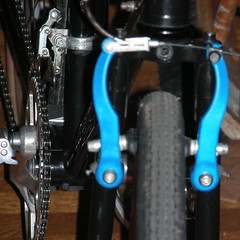
Russell wanted flat bars and MTB brifters on his new Kogswell, which meant that I didn’t have to screw around with cantilever brakes but could put v-brakes on as G-d Himself intended.
Alas, I found a matched set in blue, which may not match the blackandsilver scheme of the rest of the bicycle, but it is blue, and that makes up for it.
—orc Thu Sep 6 23:12:03 2012
Sep 05, 2012
The school semester started today, to the detriment to my riding schedule. But yesterday, when I thought I’d be spending the day baby herding, I was pleasantly surprised by my parents telling me that they wanted to take the bears for the day.
So I suddenly had a 6-hour block of time free. And what do do with it? Ride the eff out of my bicycle again. I was itching to do faster at the Cuthbert Binns populaire, so I asked Kevin if he’d let me ride it again (even though I’d already seen both info controls, and he’d have to take my word that I’d reached the ends of the line.) Not only was he willing to let me ride it, he wanted to ride it himself as well.
So, at ~11:30, we met up and headed out for Sauvie Island. He’d approved a couple of small reroutings to take us off some of the more problematic parts of the loop (the Eastbank Esplanade and Front→Kittridge) so we could spend more time going along at speed instead of picking our way through masses of slow-moving walkers or weaving about slowly to not crash on one of a dozen or so angled railroad crossings.
The run out started promisingly enough – we ran over the top of the hill that Brooklyn is built on, crossed the 8th Ave overpass over Powell, worked our way over to the Hawthorne Bridge, then headed north on Naito at about 19mph. Naito became Front, we rattled over a couple of right-angle railroad crossings (one of which was bumpy enough so that a packet of science diet shook out of one of the side pockets of my rando bag – I was more interested in keeping time than recovering it, so I left the poor thing lying forlornly on the ground,) but then turned west on Yeon and hooked back over the Portland Terminal mainline to get to highway 30, then wound back up to cruising speed and bolted north towards Sauvie Island.
I’ve ridden this part of highway 30 dozens of time on all of my bicycles (including the trek, which has this huge sail on the back that makes it particularly susceptible to crosswinds) so I dgaf about sharing a lane with trailer trucks, but Kevin found it to be most objectionable. Oh well, more evidence showing that I’m much more tolerant of traffic than most of the other oregon randos. But, in any case, there’s not more than a couple of miles with minimal room for bicycles until we reach the junction with Kittridge/St Helens and a bike-ridable shoulder reappears.
This is a fast level section of highway (it’s not completely level, but it’s very evenly graded and on days when there aren’t headwinds it’s pretty easy for me to make 20mph along here) and my new tires made it easy for me to keep pace with Kevin as he barrelled along at 20mph into the headwind that sprung up about the time we reached the St Johns Bridge. All was well, until the curse of trying for a speedy ride struck and I picked up a pointy piece of debris in my rear wheel, which
- stuck into the tire,
- cheerily went “*whap!* *whap!* *whap!*” for a couple of rotations,
- and then, before I could stop, punctured the tube and
- was blown free when all of the air that used to be inside the tire relocated itself to the outside.
Grind to a stop, lift the bicycle over the guardrail, pop the wheel, pop the tire, pull the tube, feel around for debris inside the wheel (there was none, and I checked pretty carefully for it), and halfway through putting the spare tube in the tire I had to stop briefly to take a picture of a W&P geep switching tank cars on below us on the Astoria line. Pictures taken, I pumped up the tire, stuffed the wheel back onto the mlcm, and we bolted off for the north again, this time a little more urgently because we’d just blown 15 minutes, which meant we would need to maintain an 18mph brevet average to do the loop in less than 4 hours.
Alas, not more than a mile down the road (less than half a mile from the Sauvie Island bridge) my rear tire abruptly went flat again, so I had to do the whole stupid thing again, but this time with the added chore of patching the flat in the first tire.
It turns out that my spare tire, which already had several patches on it, had a patch fail almost immediately after I loaded the wheel.
Siiiiiiiiiiiigh.
That sub-4 110k would have to wait for another day, and we’d just have to do a more reasonably paced ride today.
“Reasonably paced”, in this case, turned out to be a 16.8mph moving average; we moved moderately slowly for a mile or so just in case my rear tire was feeling particularly flatty, but then wound ourselves up to 17-18mph again as we shoved our way north through the headwinds, forming into a loose pace line and taking 1-2 mile pulls along Sauvie Island Road up to the first info control opposite Scappoose.
Oddly, after we clawed our way against the headwind up to that control at 17-18mph, we returned to Reeder Road at not much more than that speed, because we were enjoying just sort of toodling along at 18mph while the wind helped us for a while instead.
And then we were going crosswind over to the east side of the island. Crosswinds are usually as annoying as headwinds, because even though they don’t slow you down they try their damnest to blow you out into the traffic lane or into the ditch, so you tire out fighting to keep course. Fortunately there were lots of windblocking things along the road, so we didn’t have to deal with this until we started turning north to head up to the other info control just north of the nude beach.
Reeder Road isn’t quite as exposed as Sauvie Island Road, so it’s somewhat easier to keep your speed up against the north wind. And where it was exposed both Kevin and I put our heads down and charged into the wind, exchanging pulls at 18-20mph all the way up to the end of the pavement just south of the nude beach.
On Sunday, the gravel section was fairly problematic for me, because the Ruffy Tuffy tires I’d had on the mlcm were fairly slippery on gravel. But, as I may have mentioned, those tires aren’t on the mlcm any more, and the 28mm Resist Nomads are a much more surefooted beast on gravel roads. Sure, we slowed down from 20 to about 15, but this time around it wasn’t a case of my struggling to keep up with Kevin and his 650b Hetres, but my effortlessly keeping up and occasionally getting ahead of him.
We stopped for a little while here to get a snack and use the facilities, but then headed back south for our loop around the foot of the island. The northern part of Reeder Road is in Columbia County, so it’s lumpy chip seal which slowed us down to 18mph, but I took the lead around the time we crossed back into Multnomah County and decided to take advantage of the tailwind for a while, to the tune of sailing along at 22mph for the 4 miles down to Gillihan Loop, where we slowed down to a decadently slow 18mph for the few miles back to the Sauvie Island bridge.
Our brevet average speed was up to 14.2 here, but, alas, we were both out of water and needed more, so we had to stop and get some at the grocery store that’s right by the bridge. And, thus fortified, we headed across the bridge (the longest climb on the loop!) and back south on highway 30, which took pity on us by not puncturing any tires.
On the return, we tried the route variant of St Helens→Vaughn→Naito→Morrison Bridge→Water, which avoided both the shoulderless parts of highway 30 and the Eastside Esplanade.
This worked out well, because we were able to fly through here, putting our moving average up to 17mph before we reached Vaughn and had that speed slowly nibbled away at by ducks.
When we reached the end of the loop, our moving average had dropped to 16.8 and our brevet average had climbed back to the 14.2mph it had been when we stopped at the grocery store for water.
4h49 loop time, with just over 4 hours moving time. That’s easily doable in the 5h15 window I have between depositing and retrieving bears during the week, though it won’t leave much time for particularly interesting trip reports :-)
Not very many pictures on this loop (I want to recase the Nikon, and until then I’m using my iPhone, which is a much bigger ticket item – I’m not going to carry it in the handlebar bag and pull it out for photos when dropping it will put me either the cost of a new iPhone or force me back to a Linux phone) but what pictures I took are on flickr, as is traditional.
~7950 miles for the year now, of which about 5300 miles are brevets/permanents/checkrides (4250 miles of RUSA-credit brevets/permanents; I’ll need another 2000 to roll over 10k RUSA kilometers this year. I wonder how many of those kilometers will be re-runs of the Sauvie Island loop?)
—orc Wed Sep 5 12:03:41 2012
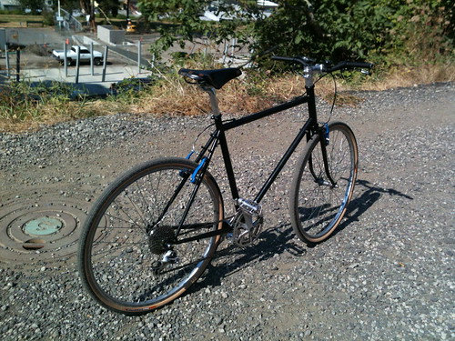
Sep 04, 2012
Holy god those tires are fast. And smooth-riding. And grippy on gravel (I rode Kevin Brightbill’s Cuthbert Binns populaire on Sunday, riding on Rivendell Ruffy Tuffy tires, and had to struggle to keep up with him on the gravel section of the ride. Today we rode it again with the Nomads on the MLCM and I was able to keep up, and even get ahead of him, with no trouble at all.)
And they’re $22/tire.
They’re wire-beaded, so they’re heavier than folding-bead tires, but I find that they’re easy to get onto and off Mavic Open Sport rims (I installed them in no time last night, then ate a nail or something on highway 30 this morning and had to pop the tire to change the tube, and then pop the tire again a mile down the road when one of the patches on the replacement tube decided to let go) and once you get about 60psi into them they ride like a dream.
The wider Nomads run narrow (the 45s I’d put on the project bike measured 43mm; the 35s I replaced them with (because of daruma bolt clearance, not because of any defect in the tire) also measured 2mm narrower than advertised) but the 28s, when inflated to ~100psi, measure 29.5mm wide.
I’m going to have to buy a handful of them before Resist either disappears or discontinues the tires (I am thinking, not particularly fondly, of Nashbar discontinuing the 26mm Duro tire before I ordered a dozen or so of them.)
—orc Tue Sep 4 19:13:39 2012
Sep 03, 2012
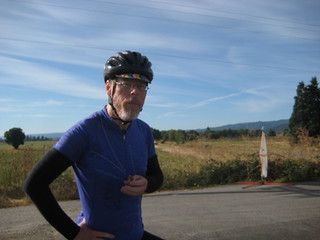
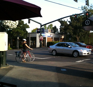
-Photo by Kevin Brightbill
When we were zipping around permanent #1650 yesterday morning, my friend Kevin took this picture of me while I was inhaling a chunk of science diet at the first info control. I had to grab a copy of the photo, not because it shows me looking skeptical, nor because it shows me in one of my cloud chamber jerseys, but because I look amazingly fit in it.
I don’t know that I’ve ever been this fit as an adult, and I hope I can maintain this level of fitness when the school year starts and I can’t go out to ride permanents during the week anymore.
—orc Mon Sep 3 19:53:13 2012
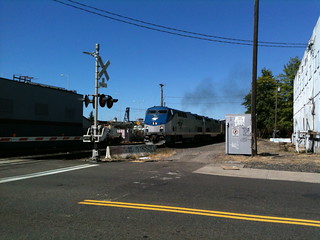
I was riding down to the office supply store to pick up the last school supplies for the quickly approaching school year (no more wednesday permanents for 9 months, sniff!) and spotted some suspiciously Amtrak-looking headlights off to the north when I crossed the Stark Street railroad crossing. I pulled off, pulled out the cellphone, and waited for about 20 seconds until this train came screaming across the crossing.
There are many things that can be said about Union Pacific’s hostile takeover of the Southern Pacific (what happened to antitrust? Well, it doesn’t count when Dick Cheney is on the Union Pacific board of directors) but the UP has fixed up the SP mainline through east Portland, and now passenger trains can wind up and blow through town at 80mph. This train wasn’t moving at 80mph (yet) when it reached the crossing, but it was easily moving 40mph, which isn’t bad for a train that had just come across the Steel Bridge at a princely 5mph.
—orc Mon Sep 3 17:17:55 2012
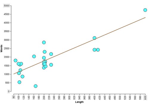
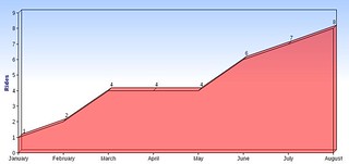
The best was curious about whether the length of my posts about various rides I’ve done varies according to the length of the rides, so I pulled together a dataset containing all of the rides I’ve done since May (5000 km, give or take a dozen) and handed them to her for plotting with Tinkerplots.
Huh, that’s interesting; the post length, at least for this summer, certainly looks like it depends on the length of the ride.
—orc Mon Sep 3 12:19:53 2012
Sep 02, 2012
Summer vacation is basically at an end (next Tuesday the best starts her new teaching job, and on Wednesday the bears start their school semester) so I can no longer do the routine I’d developed this summer, which was to ride a 200k during the week, and then another 200k (or longer) on the weekend.
No, if I’m going to ride during the week I need to ride for 4 hours or less. And the only way I can do that is to ride a fast populaire instead of a full 200k loop. Fortunately my friend Kevin has been developing permanents left, right, and center, and had mocked up a fast flat 110k where the highest summit was the top of the pedestrian overpass at 8th & Powell. I strongly encouraged him to submit it (I believe my exact words were “do it! I’d ride the eff out of it!”) and he did, and it was approved the weekend of the summer 600.
This week, I mentioned that I’d be riding up to Ripplebrook and as part of my attempt to encourage other people to ride it with me I said I’d ride the now-approved Cuthbert Binns populaire on Sunday if he wanted to ride it then. I didn’t convince him to ride with me (I ended up riding it myself, thus giving me my first solo 200k of the month) but he thought that today (Sunday) would be a good time to do it.
So, at 8am today I found myself back on the bicycle again, heading out for the wilds of Sauvie Island. Kevin had mentioned that one of the things he wanted to do with this loop was to get used to riding 18mph for long distances, and he was serious about it, because, after doing the initial segment along the Eastside Esplanade (and waiting for a train) we got onto Front Street and he wound right on up to that speed, which we stayed at for much of the next 40 miles.
It’s been several years since I was last on Sauvie Island (I believe the last time I went there was before the new bridge went in) and I’d never been there on a bicycle, so it was a nice day for sightseeing, though admittedly it was fairly high speed sightseeing.
The route has two outandbacks on it; first it goes up the west side of the island on Sauvie Island Road (to approximately across from Scappoose,) and then it goes back down to the little town at the intersection of Sauvie Island Road and Reeder Road and takes Reeder Road all the way up to the nude beach on the northeast corner of the island.
I’d forgotten that the island was divided between Multnomah County and Columbia County, but was rudely reminded of it when, as we were sailing north along Sauvie Island Road at 19mph, we went over the county line and the nice smooth macadamed surface converted instantly to bumpy chip seal, with a corresponding reduction of my speed down to 15-16mph, so I had to hustle to keep up with Kevin and his chipseal-ignoring 650b wheels (I didn’t have much luck with 650b wheels on the mlcm, but I do fondly remember just how they dgaf when the road went to chipseal or gravel.) We stopped at the info control at the end of the road, and killed our brevet average a bit by snacking after I filled in the info question on my brevet card (Kevin, of course, had organizers privilege and didn’t have to do that) before turning back south and heading for Reeder Road.
The Reeder Road leg of the loop is considerably longer than the Sauvie Island Road leg, and it took us across the island through farmland, a couple of tiny suburban hamlets, and finally north along the main channel of the Columbia River. Like before, the road converted to bumpy chipseal when we crossed the county line into Columbia County, but to make things even more amusing the road then went to gravel when we reached the parking area for the nude beach (and attached non-clothing-optional beach.) Kevin went sailing ahead while I slowed down and attempted to pick a line that didn’t hit every bit of washboard and/or leftover pavement (from the condition of the road I suspect that it used to be paved, but was then gravelled after a few spring floods washed out under the asphalt.)
Once again, the info control included a break for food, and then we turned around and headed south again. After the mile of gravel (again) and the long stretch of Columbia County chipseal, we went back into Multnomah County and smoother pavement for the rest of our time on the island. But instead of taking Reeder Road back all the way that we came, we turned onto Gilliham Road and looped around the southern edge of the island. It was later in the day, and many bicyclists were out on the road, mainly riding the other direction (if anyone was riding our way, we must have been keeping pace with them because we didn’t overhaul or were overhauled by anyone.

And then we were back to the Sauvie Island bridge and back to highway 30, which, ahem, is not quite as nice as the county roads. The shoulder of highway 30 is fairly debris-littered, and once you get closer to Portland it starts developing an amazing collection of potholes that we spent the trip back dodging.
Unfortunately, about when we crossed under the St Johns bridge, I managed to avoid missing a pothole and bounced through it accompanied by a plasticky *clank* *CRASH* as my poor Nikon flew out of the rando bag and slammed face-first into the middle of highway 30.
*Sigh*
We arrested our forward progress, I ran back and picked up the camera (it wouldn’t power on because when it slammed into the highway the front and top panel bulged out and misaligned the power button. I discovered, after we got to the end of the loop, that if I squeezed the case together that the thing powers on without complaint, and takes pictures just like normal) and we headed out again.
Both the outbound and return segments take Front Ave down to/from Kittridge, which isn’t the most perfect route because there are a dozen railroad sidings that curve off from the old SP&S yard just west of Front. When you’re going north, the sidings have curved enough so that it’s not too difficult to turn and get a good perpendicular line across them, but when you’re going south you’re right next to the yard tracks and the sidings come in at a fairly acute angle. I’ve already had my wreck on railroad tracks and I don’t want to repeat it, so I slowed us down quite a bit by carefully weaving and cutting across the tracks at a somewhat slower speed than Kevin wanted to, but despite all that we still rolled over 100k in 3h55.
But then we got to downtown Portland and the Eastside Esplanade, which was no longer as quiet and empty as it had been earlier in the morning. It was crammed full of people and our previous headlong pace was reduced to a creep as we wound our way around joggers, walkers, other bicyclists, skateboards, roller skates, and heaven knows what else. It ended up taking us 27 minutes to get that last six miles into Brooklyn, thanks to the Eastside Esplanade, and we arrived at the end of the loop 4h22 after we set off.
Not bad as far as speed goes (our trip average speed was 15.5mph – comfortably faster than the 14.6mph trip average on my last ride to Ripplebrook) but not quite as fast as either of us wanted.
And, my, when Kevin wants to maintain a high speed he’s a lot better than I am at doing it; when I’m cruising along at an average speed of 18mph, my speed varies all over the place from 21mph down to 16mph, but when he does it it looks like his speed varies from 17 to 19. I ended up drafting him for the entire loop because there was no way I could get ahead of him reliably (or even at all) and still maintain that pace. If we’d cut out stopping to food and routed away from the Eastside Esplanade we would have comfortably made the 110k in under 4 hours (at which point I would have fallen over dead; even at the somewhat relaxed speed we were going I still ended up with sore thigh muscles.)
Oh, yes, I think I’m going to ride the stuffing out of this loop this fall (assuming I can get suitable rainwear/cold weather wear so I don’t freeze.)
Pictures are in the same old place and this brings me up to 6700 RUSA kilometers for the year.
—orc Sun Sep 2 22:33:55 2012
When I left home at 9am on Saturday, the best asked when I was going to get back. I said I’d be back between 5:30 and 6, which committed me to doing the loop in <= 9 hours. A few months ago this would have been an idle boast (though I did do a barely sub-9 P-R-P in June, when I needed to get out and exhaust myself for a while) but I’ve been riding the eff out of the mlcm since the 26th of May and have developed enough horsepower so I could be moderately confident about that loop time.
So I needed to move smartly along, but I didn’t want to blow myself up, so I put in one earphone, put the cellphone into “plays music” mode, and settled in to a nice steady pace and went sailing away. I’d made a variant of the route that started in Brooklyn, so I rode north to the start of the Springwater Trail, then rode south and east along the trail at a speed that averaged about 17mph. There were not very many people out on the trail at that time of the morning, and I suspect that part of the reason was that it was pretty cold; the weather forecast was claiming it was 54°F when I went out the door, and it certainly felt cold (it took a considerable amount of time for my body heat to overcome the chill on my lower body, which was only protected by the elements by one layer of fabric) so I didn’t really push myself very hard until I reached Boring (where Telford curves under the old Portland Traction ROW, becomes 272nd, and goes up over the shoulder of one of the many vents in the Boring Lava Field) and had to stand up and shove myself up a few hills.
The hills around Boring used to seem moderately hard to climb, but aren’t anymore, and I was able to climb them at the higher speed I’ve recently developed. And almost before I knew it I’d hit the long ramp down into the Clackamas River Valley and was descending like a bomb towards the turnoff to Judd Road.
Judd Road is still pretty steep, but, in what must be a first for me, this day it was not steep enough to drop me into my alpine gears. Nope, I just geared down to 50×21 and started winching my way up the ramp, dropping further to 50×24 about halfway up, and then going back to 50×21 as I approached the top. This was moderately exhausting, and I staggered along at 13mph for a while before I caught my breath, then went up to my normal cruising speed and I wound upgrade towards highway 211 and the lovely drop on Van Curen Road (alas, I didn’t get very much of a tuck here and only got up to about 46mph) after which I dodged over to Eagle Fern Road and did my usual high-speed run up into Estacada.
After passing through Estacada and avoiding the big 224 hill by riding on Faraday, I went back onto 224 and discovered that the nasty north wind that had slowed me down on the tail end of the 600 was, apparently, still there, and was helpfully giving me a push as I sailed up towards Ripplebrook. This was very nice, and I settled into a nice 18mph cruising speed which went on for about 10 miles, until I failed to avoid all of a shattered bottle and got a shard of glass poking through a sidewall and putting a nice little hole into the inner tub on my rear tire.
Lemme tell you, it’s fairly disruptive to my routine when I have to pull off on the narrow shoulder/bike lane and change a tube when there’s holidaymaker traffic sailing on by. It took me about 15 minutes (guessing from the number of songs that went by on the cellphone while I was doing the whole tire routine) to change the tube, reinflate the tire, and remount it on the bicycle, and by the time this was all done my routine was in disarray, and it took another 10 miles to get back into my groove, which, conveniently, was just before the last bridge and then the Big Ramp up to the ledge that Ripplebrook sits on.
So up I went. I didn’t know if I could make it all the way up this ramp in my big ring, but what the hell, might as well try it. And, you know something, it worked – I wasn’t going particularly fast up the ramp (though 8mph is approximately twice the speed I’ve climbed it in the past), but I was going up the ramp in my big ring and only went down to 50×28 for the last steep pitch.
And then at the top, a minivan pulled over, flagged me down, and asked for directions to Bagby Hot Springs. And it took about 5 minutes to give them the directions, because their english was not that good (they sounded like Russian tourists who were taking a tour of the northwest) and they’d apparently gotten turned around and were heading north instead of south. But after much “you mean Bagby Hot Springs?” “Yes, yes, hot water from the ground, that’s the place we want” I think they finally understood my directions and we headed off our separate ways.
I reached Ripplebrook about 4h20 after I set out from Portland, did the control paperwork (and photography) as quickly as possible, then turned around and headed back north.
Last week the headwind caught me by surprise and stopped me dead at the head of the Ripplebrook ramp. Today I was ready for it, and was already crouching in the drops when I came out of the trees and was greeted with a blast of north wind. It slowed me briefly to about 10mph, but I put my head down and put on the gas to get onto the top of the ramp, and didn’t let up until my speedometer read a comfortable 30mph.
The trip back down the gorge was amusing. In some sections there would be strong headwinds and I’d be struggling to maintain 17mph, and then the road would curve into a sheltered section and my speed would like magic go up to 23-24mph up until the point where the road curved out and my speed would plunge back on down. Fortunately the wind was unable to be quite so aggressive north of Estacada because there was a lot more river valley for it to fill, so it was moving somewhat slower than it had been before.
Down 224 to Barton, then across the Clackamas River on Baker’s Ferry Road to Springwater Road, then up through Carver (where a fairly massive bridge-replacement project appears to be going on) and onto Clackamas River Road, which follows the Clackamas River all the way into Oregon City, and, now that the Jughandle Project has gotten far enough along to through-route Clackamas River Road under 213 to Washington St, no longer needs the detour up to Abernethy to avoid the construction zone.
I looped through downtown Oregon City for the Oregon City control (and to look for water, because my water bottles were basically empty. Alas, the only bubblers I found were disconnected; I had to get water at a little park along the Trolley Trail) and then north towards home. The sewer project that had closed the old Washington St bridge across the Clackamas was now finished, so I got to go back onto the bikepath-bridge-Arlington route that I’d originally set up for P-R-P (and then had to reroute around because no sooner had the route been approved than Oregon City came along and closed the path) and got to avoid the complex crossing of 99e and River Road.
When I reached the Trolley Trail, I’d been riding for 7h45. No chance of a sub-8 finish, but I only had about 12 miles to go and there was a pretty good chance I could do sub-9. I stopped at the Stringfield Family Park to refill the water bottles, then chugged away up the hill. I’d be just sailing along at a casual pace earlier on the loop, but I was moving quite a bit slower now and had to push it a lot to get my speed up to 16-17mph for these last miles. The water helped a lot; I tend to sweat all of my water away when I’m moving moderately quickly, and when I run out of water it’s like I fell off a cliff.
Up the Trolley Trail to Oak Grove, then over to River Road for the descent into Milwaukie. Up 17th into Sellwood, over to the Springwater Trail, up to the info control on Clay Street before looping around OMSI, and then back south towards Brooklyn.
I arrived back where I set off 8h38 after I started the brevet clock. Not quite a sub-8 200k, but it’s getting there.
Pictures are in the usual place; there aren’t very many of them, but after seven runs at this loop this year I’m starting to run out of things to photograph :-)
—orc Sun Sep 2 21:08:42 2012
Sep 01, 2012
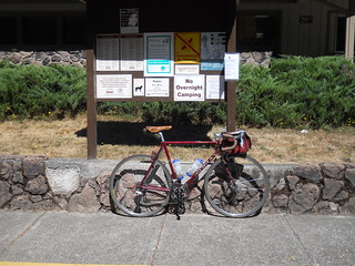
Let nobody say that I’m not a person who will find an interesting route and ride it into the ground. Today I rode Portland-Ripplebrook-Portland for the seventh time this year, and it was just as lovely as the last six times I rode it :-)
I didn’t get as much time to admire the view, though, because this time around I rode it in 8h38 without even pushing myself too hard (And this time includes the ~15 minutes it took me to deal with a flat tire after I ran over a disintegrated beer bottle.)
I’ve still not found that sub-8 200k, but I can smell it now.
—orc Sat Sep 1 19:44:51 2012
—30—