Another one for the road
The school semester started today, to the detriment to my riding schedule. But yesterday, when I thought I’d be spending the day baby herding, I was pleasantly surprised by my parents telling me that they wanted to take the bears for the day.
So I suddenly had a 6-hour block of time free. And what do do with it? Ride the eff out of my bicycle again. I was itching to do faster at the Cuthbert Binns populaire, so I asked Kevin if he’d let me ride it again (even though I’d already seen both info controls, and he’d have to take my word that I’d reached the ends of the line.) Not only was he willing to let me ride it, he wanted to ride it himself as well.
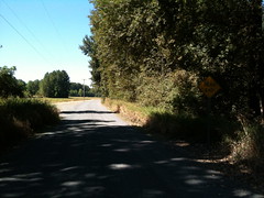
So, at ~11:30, we met up and headed out for Sauvie Island. He’d approved a couple of small reroutings to take us off some of the more problematic parts of the loop (the Eastbank Esplanade and Front→Kittridge) so we could spend more time going along at speed instead of picking our way through masses of slow-moving walkers or weaving about slowly to not crash on one of a dozen or so angled railroad crossings.
The run out started promisingly enough – we ran over the top of the hill that Brooklyn is built on, crossed the 8th Ave overpass over Powell, worked our way over to the Hawthorne Bridge, then headed north on Naito at about 19mph. Naito became Front, we rattled over a couple of right-angle railroad crossings (one of which was bumpy enough so that a packet of science diet shook out of one of the side pockets of my rando bag – I was more interested in keeping time than recovering it, so I left the poor thing lying forlornly on the ground,) but then turned west on Yeon and hooked back over the Portland Terminal mainline to get to highway 30, then wound back up to cruising speed and bolted north towards Sauvie Island.
I’ve ridden this part of highway 30 dozens of time on all of my bicycles (including the trek, which has this huge sail on the back that makes it particularly susceptible to crosswinds) so I dgaf about sharing a lane with trailer trucks, but Kevin found it to be most objectionable. Oh well, more evidence showing that I’m much more tolerant of traffic than most of the other oregon randos. But, in any case, there’s not more than a couple of miles with minimal room for bicycles until we reach the junction with Kittridge/St Helens and a bike-ridable shoulder reappears.
This is a fast level section of highway (it’s not completely level, but it’s very evenly graded and on days when there aren’t headwinds it’s pretty easy for me to make 20mph along here) and my new tires made it easy for me to keep pace with Kevin as he barrelled along at 20mph into the headwind that sprung up about the time we reached the St Johns Bridge. All was well, until the curse of trying for a speedy ride struck and I picked up a pointy piece of debris in my rear wheel, which
- stuck into the tire,
- cheerily went “*whap!* *whap!* *whap!*” for a couple of rotations,
- and then, before I could stop, punctured the tube and
- was blown free when all of the air that used to be inside the tire relocated itself to the outside.
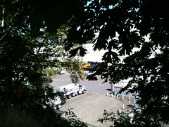
Grind to a stop, lift the bicycle over the guardrail, pop the wheel, pop the tire, pull the tube, feel around for debris inside the wheel (there was none, and I checked pretty carefully for it), and halfway through putting the spare tube in the tire I had to stop briefly to take a picture of a W&P geep switching tank cars on below us on the Astoria line. Pictures taken, I pumped up the tire, stuffed the wheel back onto the mlcm, and we bolted off for the north again, this time a little more urgently because we’d just blown 15 minutes, which meant we would need to maintain an 18mph brevet average to do the loop in less than 4 hours.
Alas, not more than a mile down the road (less than half a mile from the Sauvie Island bridge) my rear tire abruptly went flat again, so I had to do the whole stupid thing again, but this time with the added chore of patching the flat in the first tire. It turns out that my spare tire, which already had several patches on it, had a patch fail almost immediately after I loaded the wheel.
Siiiiiiiiiiiigh.
That sub-4 110k would have to wait for another day, and we’d just have to do a more reasonably paced ride today.
“Reasonably paced”, in this case, turned out to be a 16.8mph moving average; we moved moderately slowly for a mile or so just in case my rear tire was feeling particularly flatty, but then wound ourselves up to 17-18mph again as we shoved our way north through the headwinds, forming into a loose pace line and taking 1-2 mile pulls along Sauvie Island Road up to the first info control opposite Scappoose.
Oddly, after we clawed our way against the headwind up to that control at 17-18mph, we returned to Reeder Road at not much more than that speed, because we were enjoying just sort of toodling along at 18mph while the wind helped us for a while instead.
And then we were going crosswind over to the east side of the island. Crosswinds are usually as annoying as headwinds, because even though they don’t slow you down they try their damnest to blow you out into the traffic lane or into the ditch, so you tire out fighting to keep course. Fortunately there were lots of windblocking things along the road, so we didn’t have to deal with this until we started turning north to head up to the other info control just north of the nude beach.
Reeder Road isn’t quite as exposed as Sauvie Island Road, so it’s somewhat easier to keep your speed up against the north wind. And where it was exposed both Kevin and I put our heads down and charged into the wind, exchanging pulls at 18-20mph all the way up to the end of the pavement just south of the nude beach.
On Sunday, the gravel section was fairly problematic for me, because the Ruffy Tuffy tires I’d had on the mlcm were fairly slippery on gravel. But, as I may have mentioned, those tires aren’t on the mlcm any more, and the 28mm Resist Nomads are a much more surefooted beast on gravel roads. Sure, we slowed down from 20 to about 15, but this time around it wasn’t a case of my struggling to keep up with Kevin and his 650b Hetres, but my effortlessly keeping up and occasionally getting ahead of him.
We stopped for a little while here to get a snack and use the facilities, but then headed back south for our loop around the foot of the island. The northern part of Reeder Road is in Columbia County, so it’s lumpy chip seal which slowed us down to 18mph, but I took the lead around the time we crossed back into Multnomah County and decided to take advantage of the tailwind for a while, to the tune of sailing along at 22mph for the 4 miles down to Gillihan Loop, where we slowed down to a decadently slow 18mph for the few miles back to the Sauvie Island bridge.
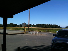
Our brevet average speed was up to 14.2 here, but, alas, we were both out of water and needed more, so we had to stop and get some at the grocery store that’s right by the bridge. And, thus fortified, we headed across the bridge (the longest climb on the loop!) and back south on highway 30, which took pity on us by not puncturing any tires.
On the return, we tried the route variant of St Helens→Vaughn→Naito→Morrison Bridge→Water, which avoided both the shoulderless parts of highway 30 and the Eastside Esplanade. This worked out well, because we were able to fly through here, putting our moving average up to 17mph before we reached Vaughn and had that speed slowly nibbled away at by ducks.
When we reached the end of the loop, our moving average had dropped to 16.8 and our brevet average had climbed back to the 14.2mph it had been when we stopped at the grocery store for water.
4h49 loop time, with just over 4 hours moving time. That’s easily doable in the 5h15 window I have between depositing and retrieving bears during the week, though it won’t leave much time for particularly interesting trip reports :-)
Not very many pictures on this loop (I want to recase the Nikon, and until then I’m using my iPhone, which is a much bigger ticket item – I’m not going to carry it in the handlebar bag and pull it out for photos when dropping it will put me either the cost of a new iPhone or force me back to a Linux phone) but what pictures I took are on flickr, as is traditional.
~7950 miles for the year now, of which about 5300 miles are brevets/permanents/checkrides (4250 miles of RUSA-credit brevets/permanents; I’ll need another 2000 to roll over 10k RUSA kilometers this year. I wonder how many of those kilometers will be re-runs of the Sauvie Island loop?)