A good way to waste a weekend
Last weekend was the date for the last ride in the Portland series that we (me and some of my friends who live in the Portland area) organized for this year. I’d organized the 200, helped with the 300, volunteered on the 400, but ended up not doing anything for the 600 because it ended up being a self-supported ride which didn’t need volunteers. So instead of volunteering, I decided to ride the thing. It was quite nice – the route wandered down the Willamette Valley past Salem, went west and southwest almost to the coast, then turned around and shot back to the mountains east of Sweet Home, at which point it climbed to the top of one of them, dropped down into a valley, climbed to another mountain pass, then returned to Portland via the old familiar route from Ripplebrook to home.
I tried to ride the spring 600 by myself (I’d been trying to arrange to ride it with a couple of other people, but that fell apart a month and change before the ride) but that failed because I just wasn’t having any fun after riding by myself from Portland to Newberg (on a cold foggy morning,) arriving late to the start, then riding, also by myself, into a headwind all the way from Newberg down to the Blodgett Store, where even the hand-scooped ice cream was not enough to keep me from abandoning and going back home. So this time I’d decided that if I couldn’t find anyone to ride with I’d just not do it at all; I asked around and my friend Kevin said that he thought it would be a good plan, so the ride was on.
At 5am on Saturday morning. Ugh. That meant I’d need to wake up at 3:45 to be able to get myself moving before rolling across to Woodstock Park at 4:20 (it’s about 4 miles from here to there, and I wasn’t expecting that I’d be breaking any land-speed records on the way there.) And a 3:45am wakeup meant I needed to get to bed at 8pm on Friday.
So when did I start getting ready for this brevet? How about 2:45pm on Friday? It’s not as if I needed to do anything new – I hose clamped a third bottle cage onto the mlcm, dug out my saddlebag and installed it, then filled the saddlebag with clothing, a spare tube, and a space blanket (Kevin and I were planning on riding through instead of stopping at a hotel, and the space blanket was a required piece of gear for doing that) and my big rando bag with food and a single extra baselayer, because it was supposed to be moderately cold on Friday and Saturday nights, set out my geeky bike clothing and got to sleep somewhere around 8am.
On Saturday morning, I woke up about 2 minutes before the alarm was ready to go off, and I puttered around slowly getting ready for 40 minutes before rolling out the door to ride up to Woodstock Park.
It was not just moderately cold. It was cold, and I found myself putting on my windbreaker to trap some heat before I rode over there. I looped around Woodstock park a couple of times before seeing a couple of rando-looking bicycles scooting by, and followed them to the park bench that was serving as the opening control for the ride.
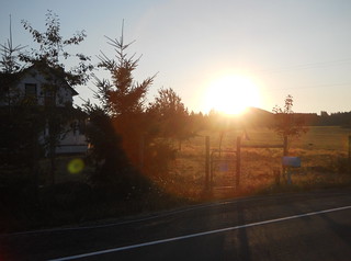
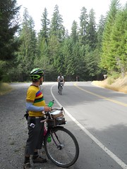
At 5am, after waiving myself and getting a brevet card+cuesheet, we were released to wander off into the predawn gloom, and headed south towards the traditional River Road route down to Oregon City.
From Oregon City, there are several ways to get up to the Boring Lava, some steeper than others. 7th Ave is one of the steep ones, so we took that (it’s pretty steep. It’s not as bad as some of the more horrific ramps on the Eden’s Gate 400k, but I was down in my dump gear and working hard to wind my way up that ramp within about half a block of the bottom) up to the top, then worked our way over to Beavercreek Road, which we used to get down to Molalla.
The fun thing about Beavercreek Road is that it climbs Highland volcano, passes within 4 miles of Highland Butte, then plunges down to Molalla. But first you climb and climb, mainly gradually, past suburban sprawl, then through a region of small ranches and vanity farms, then into farmland and woodlots before you reach Beavercreek and start heading down.
It was pretty cold climbing upgrade, but whenever we dropped into stream valleys and went past ponds we’d pass through pools of freezing cold air, and I was forced to put my windbreaker on even though we were climbing fairly quickly. And then we topped out, rolled downgrade for a while, and then I was very happy that I had the windbreaker because Beavercreek falls off the edge of Highland volcano on a mile-or-so 10% ramp. We screamed down into the valley, reaching speeds of either the high 40s or low 60s (depending on whether you trust my GPS,) quickly worked our way into Molalla, then headed out the other side to climb up to Wildcat Road.
Wildcat Road isn’t that bad climbing up from the north – I’ve transited it from the north and from the south this year, and it’s much nicer from the north – but as we rollercoasted our way down from the Wildcat Road summit I began to have a nasty suspicion that we’d not be seeing very much of the notoriously flat parts of the Willamette Valley here.
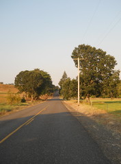
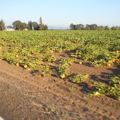
And we didn’t – from Wildcat Road we turned onto highway 213 just as it went across a spur of the mountains, crossed into Silverton to take it up onto the highlands that separate Silverton from Stayton, turned west onto Waldo Hills Drive just in time to claw our way into and out of several river valleys, then finally south across highway 22 to go into Aumsville, where we finally encountered several miles of flat farmland (including a stretch about halfway between Aumsville and Turner that looked for all the world as if it had been sliced out of central Oregon and plunked down in the Willamette Valley) before running headlong into the steep hills that sit just south of Salem.
There are some seriously annoying ramps there, including a roller coaster-style ride along Hylo Road (five rolling hills; I had to winch myself up the first two before successfully making a run on the third and bouncing the last three rollers) and a twisty descent down the west side of the hills that, when we were almost to the Willamette, becomes a terrifyingly steep and twisty ramp.
The Willamette river bottoms were, for a change, almost optically flat for a couple miles before we went over the river into Independence, where the road started undulating gently all the way over to Kings Valley Highway, which we reached just before it climbed up and over a spur of the Coast Range to highway 20, which climbed over another spur before depositing us onto the road to Alsea.
Highway 34 (which is the main road to Alsea) is, for quite a while, a nice slowly climbing road that, without fuss, muss, or bother, runs along a river. And then, all of a sudden, it isn’t a slowly climbing road, because it runs headon into Alsea Mountain, which it goes over with all haste.
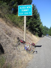
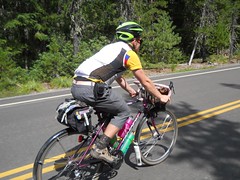
When we reached the Alsea Mountain ramp, a funny thing happened. Kevin was climbing just a little bit slower than I was, so I had to choose between climbing really slow to keep from overrunning him or just overrunning him at my natural pace. For a while I climbed really slowly, but then I found myself falling behind and tried to transition back to my slightly faster pace to catch up and discovered that the faster climbing I’d discovered on my last run of One Big Hill was not a fluke – I accelerated up to ~9mph, sailed past Kevin, and punched my way the next 800 feet up to the top of Alsea Mountain as if it was a railroad grade instead of a mountain road. This bizarre behavior persisted for the rest of the ride (with one notable exception), and I’d find myself, unless I was careful, dropping whoever I was with as I flew up one ramp or another.
But anyway, after climbing Alsea Mountain we dropped down to Alsea, where, for the first time, we encountered some of the other riders (Shun & Jim Poppy,) who’d gotten into Alsea about 40 minutes before we did. Unfortunately, Jim was exhausted and planning on abandoning and going back up 34 to the town of Philomath to find a hotel room, and couldn’t be convinced to follow the route forward past Alsea Falls (which would put him in the Willamette Valley about 15 miles south of Corvallis, which has somewhat better hotel accommodations and which is that much closer to the end of the ride. They told us that they’d seen Theo & Joshua leaving when they’d rolled in, so despite our relatively lazy riding we’d not fallen too far behind the fast boys (well, with the notable exception of Michael Wolfe, who was about 55 miles ahead by this time.)
We weren’t in much of a hurry, so we ate a leisurely lunch (well, “leisurely” in rando terms; we actually tasted the food instead of just wedging it into our mouths as fast as we could eat) then headed out to climb back over the mountains into the Willamette Valley.

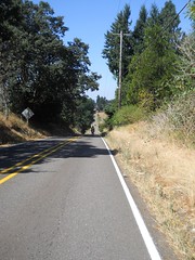
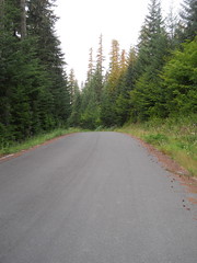
Highway 34 is an awfully nice road for the amount of traffic it has, but it doesn’t hold a candle to the Forest Service road (East Fork Road) that works its way up to Alsea Falls, then down to Alpine. Nice twisting roads climbing gradually through second-growth forest up to the summit, then dropping quickly down into the Willamette Valley, and with basically no traffic on a Saturday afternoon.
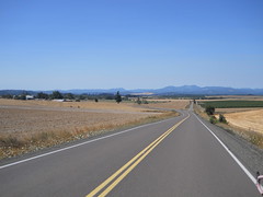
And, finally, when we reached the valley floor, we finally got the optically flat Willamette Valley I’d been looking for – miles and miles of flat riverbottom land, punctuated with the occasional town. We stopped in Harrisburg for a snack and more water, but the only elevation we had for the 15 miles or so across the valley was the overpass we took to get over interstate 5.

And then, just at dusk, we ran up against the eastern edge of the valley and said goodbye to level ground for the next 170 miles. The road turned north, ran up and through a small pass in the foothills, then deposited us in Brownsville in time for us to get a late evening dinner (at the Dari Mart.)
And then it was night. There was a new road going east to Crawfordsville, but then we were routed onto the route that the Eden’s Gate 400 uses to get from Sweet Home south to Crawfordsville. Sure, we were doing it in reverse, but it’s a pretty familiar route and it was no trouble to get up to Sweet Home from there.
We’d made it to Sweet Home just a little after 11pm, which is when almost everything closed, and had to search around for a while before finding a Texaco station that was still open for receipts, food, and water. And after stocking up, we headed out into the night for what would prove to be the most difficult part of the loop.
From Sweet Home, you got to Quartzville Road. From Quartzville Road, you go to NF 11. From NF 11, you go to Highway 22. This simple set of cues hides the teeny detail of a getting to the top of a 4000 foot pass. It was good that it was dark, because if we’d seen the mountains closing in around us it would have been fairly disillusioning.
As it was, we were pretty tired by now, and we’d given up any hope of riding through without sleep. We started looking around as we went for places where we could get off the road and take a nap, and finally found one by the Green Peter dam – there was some sort of informational kiosk set up on a concrete slab which we commandeered as a sleeping platform for a half-hour nap, and then headed east again.
East of Green Peter dam is, of course, Green Peter Reservoir, which is a hideously popular camping site, and we didn’t get very far east of the dam before we started to see dozens, if not hundreds, of campers and tents set up on every available open spot alongside the road. This went on for a dozen miles or so before we reached Yellowbottom park, where there was an info control and water. We refilled our water, wrote down the info answers, then headed east again, and soon reached the turn onto NF-11, where the road narrowed and started pointing steeply upwards.
Way back at the start of this brevet I’d dropped to my alpine ring to get up 7th Ave in Oregon City, then shifted back to the 50t ring at the top of the ramp. I’d not gotten out of the 50t ring since then, but I did it now, and left it there for the next 20 miles or so as we climbed and climbed and climbed.
But before we did much climbing we were riding along a windy not-so-steep section when all of a sudden I was falling-over exhausted, and said I had to stop for another nap. This time there was no convenient concrete pad, but the masses of campers had dropped right off when the road curved away from Green Peter and we found a suitably wide uncamped-upon grassy verge by a bridge where we could park the bicycles, lay out the space blankets, and lie down for a 45 minute nap.
That 45 minutes was basically just what we needed; the space blankets were nice and warm, 45 minutes was about a sleep cycle, and I actually managed to sleep deeply enough to dream before the phone started squawking to wake us up. And then we got back on the bicycles and went back to grinding our way up this very very long ramp in the middle of the night.
Some time later (I’m not sure just how long it was) Kevin was grinding along ahead of me when he saw something and stopped; he’d seen a bicycle, and then another space-blanket wrapped form. It was Theo, who we’d last seen about half a mile past the start of the ride, now riding by himself because Joshua had abandoned somewhere in the Willamette Valley. We swept him up and then it was the three of us creeping slowly up the ramp.
We weren’t moving all that fast, so the sun came up while we were still grinding our way up, and by the time we reached the flatter section where the road levelled off just before the summit it was dawn and rays of sunlight were illuminating the tops of the trees around us.
The scenery up here is gorgeous – it’s all been logged off once or twice, of course (those forest roads aren’t there for their scenic beauty) – but despite that it’s a wonderful world of second/third growth timber, deep rocky ravines, and spectacular vistas as the road wound around mountaintops.
But then, of course, the road dropped off sharply towards highway 22. Theo and Kevin zoomed on ahead, and I proceeded as recklessly as I felt safe doing (which is not very fast compared to basically every other randonneur in Oregon) and eventually caught up to them down at the junction with the highway. And then we rolled north towards Detroit, down a bit (but not particularly steeply; we’d done all that coming down from the summit of NF 11) but mainly levelly.
We weren’t moving particularly quickly (Theo was exhausted and not able to move quickly here; the three of us were planning on stopping in Detroit for some sit down food in a restaurant, but until then Theo, and to a lesser part me, were riding on fumes) so I had a chance to sightsee as we rolled along. What I was looking for was signs of the old Oregon Pacific, and I was rewarded for my efforrts when we rolled through Idanha by spotting a lonely railroad siding in front of an old sawmill. It’s not much of a reward, but it has been about 50 years since Detroit Lake was created, so any signs of actual railroad were an unexpected surprise.
After Idanha we rolled along the shores of Detroit Lake for a while until we reached Detroit proper, where we stopped, had a leisurely breakfast, then headed towards NF 46 and one last mountain pass before dropping towards home.
I was considerably revitalized by this breakfast, so I shot ahead by a long ways on the more gradual climb up to Breitenbush, and then we rode along together for a while until first Theo, then I, realized that we really needed to get to a bathroom, and the nearest one was about 30 miles ahead of us. Theo put on the gas and pulled ahead, then I put on the gas and caught up with him, negotiated briefly about who had priority, then dropped back to let him gap me so he’d have first dibs. And then, after he’d forged ahead out of sight, I tried to see if I could deliberately get into a higher speed climb, but, alas, I did this just as I reached the steep twisty section that went up to the pass, so all that happened was that I sweated all the way through my baselayer and had to stop to take off the sodden mass before going up that last mile of 6% grade to the summit.
Which I did successfully without stopping, even though I was moving at somewhat less than walking speed when I topped the grade. I stopped, rearranged my water supplies (I was carrying six bottles of water at this time – three ~22 oz bottles in cages and three small soda bottles that I’d refilled with water; two of the 22 oz bottles were empty, so I dumped the soda bottle water into them, crunched the soda bottles flat, and repacked things. While I was doing this Kevin caught up and we headed out together for a while.
Unfortunately, I still needed to use the bathroom, so I was moving with somewhat more urgency than usual. We stayed more or less together over the false summits, but when we came over the real summit and hit the steep downhill to the end of the first false descent I started putting on the gas and shot on ahead. And then I sprinted, about as fast as I could go, the remaining 20 miles down to the next bathroom at Ripplebrook Guard Station, almost overrunning Theo in the last couple of miles (I saw him in the distance at the start of a section where NF 46 swerved away from the Clackamas River and went over a series of short ramps, pushed up my speed a bit, and closed to within about 500 feet of him before he noticed and pushed up his speed to get to the bathrooms before I could. So 500 feet was about as close as I got :-)
At Ripplebrook, we regrouped (Kevin was about 4(?) minutes behind me,) used the bathrooms, got a snack, then headed out. Theo’s breakfast had obviously started to metabolize, because he was getting very ancy about staying in one place, and we sped up and got out of the Guard Station in much more of a hurry than our activities there would have seemed to have indicated.
And then the headwind started. I’ve ridden up to Ripplebrook a lot over the last few years, but this was possibly the worst headwind I’ve encountered returning. It was blowing hard enough to stop me at the top of the steep ramp, and by the time I’d managed to restart and get up to a unridiculous speed on the downhill Theo had reached the bottom and Kevin was about halfway down.
This was the last we saw of Theo; Kevin was having much more trouble with the headwind, so we regrouped and tried to form a paceline to get down to the bottom of the gorge.
But as we ground our way north against the wind, the oddest thing happened; the both of us started to feel like we were about to fall asleep. Perhaps it was the familiarity of this route segment – there are no surprises between Ripplebrook and Estacada anymore (except, possibly, “are there any new landslides we need to dodge?”) so it’s just a matter of pushing the pedals around while sailing through gorgeous scenery – or perhaps we were just tired enough so that the caffeine wasn’t working quite as well as usual, but in any case we had to stop to clear our heads on Faraday Road, and then we needed to sit for quite a while in Estacada to eat twinkies and sip convenience store “coffee” before going out onto the wider river valley between Estacada and Amisigger Road, where there was enough traffic to keep us from falling asleep (from the sheer terror of thinking that if we fell asleep we’d swerve out into traffic and *bang* the SUV that ran us down wouldn’t even stop until it got home.)
It was pretty hot on this part of 224, too; even though it was late afternoon and only in the mid eighties I could feel the sun slowly cooking the left side of my body as we scooted along. It’s been more than a year since I came back from Ripplebrook on a really hot day, so my memories of that trip are nothing more than the many stops I made at various convenience stores to get bottles of nasty sports drink, but I’m very happy that we weren’t transiting this road one one of the 100°F days we had the weekend of the summer 400k.
Turning off 224 to get over to Boring to hop onto the Springwater Trail brought us to the last notable climb on the loop – Amisigger Road climbs, with only one flat(tish) section, steeply up to the top of the bluff that Boring sits on. It’s shaded, which is good, but the margin at the side of the road is approximately an eighth of an inch wide, so we had to turtle our way up the ramp with traffic whizzing by right next to us. When we reached the top of this nasty ramp, we stopped in a tiny spot of shade and spent about 5 minutes catching our breath before going into Boring and dodging over to Telford Road to finish our transit to the Springwater Trail.
And then we “zoomed” into town, stopping once at Linneman Junction to use the bathroom there (open, miraculously, for once) and proceeding on city streets to where we thought the closing control would be. Nobody was there, so we called the organizer (Joshua Bryant, who’d DNFed Saturday afternoon and returned home) and discovered that the closing control had been relocated to his house (about a mile away from Woodstock Park.)
We’d reached Woodstock Park 37h58 after we left it on Saturday morning, called Joshua basically on the dot of 38h after we left, but reached his house and had our cards signed off 38h11 after we left.
So not a particularly world-shattering speed record (slower than the 600 last year, where Theo, Asta, and I rode through without, as far as I know, any sleep) but it was a loop time that only had us in the dark for about 45 mainly-up miles and got us to the summit of NF 11 at dawn so we could appreciate the whole thing. If I want a speed record, I’ll have to build a flatland 600k, improve my 200k speed to < 8h, then ride the f_ck out of that 600k until I go a <24h loop time. But not this year – I couldn’t be realistically happier about how the 600k went; beautiful scenery, interesting roads (who would have though that you could put so many hills on a route that directly transits the northern Willamette Valley,) mountain passes, intriguing night segment, and good company.
I used to think that 400k was definitely my favorite distance, because it was long enough (to someone who’s my speed) to ride morning, evening, and night, but the two 600s I’ve finished (with company; the longest I’ve ridden by myself has been 400k and that was not a very pleasant way to get a sub-20 hour 400k) have much more pleasant memories than any of the 400s I’ve ridden except for my Hot Springs-Covered Bridges 400k.
Did anything not work on this loop? No, not a thing; the chain on the mlcm started out grimy and got worse to the point where I had to coax downshifts, but it worked despite that. The hose-clamped third water bottle cage stayed in place for the entire loop, and the bottle stayed in it too (helped by a piece of rando crap I found; I found a toe strap lying on the side of the road on Beavercreek Road, grabbed it, then used it to tie the third water bottle to the frame,) the Atac pedals + cleats worked quite well and I only got a couple of cramps in my right foot after particularly long sprints, and I actually managed to pack exactly enough clothing for the loop.
About the only thing that went “wrong” was that I was drinking water like a hose during the first day, and only reduced my consumption when we reached Ripplebrook and I ran out of my nasty sports drink tablets.
Oh, yeah, and the Amisigger Road ramp sucked dead bunnies through a straw. If I had been feeling really tired, I would have been sorely tempted to take 224 to Barton, then Baker’s Ferry/Springwater/Clackamas River Road into Oregon City, then River Road and the Trolley Trail up into Portland instead of wnching myself up that ramp.
But other than that quibble it was a spectacular long day out.
Pictures are on flickr, my sanity is safely stored away in a box in the attic, and I’m more than ready to do another 600k. Too bad there are none within reachable distance for the rest of this year :-(
Comments
Yes, I noticed it as I went blowing by Riverford campground (it’s also got water, if I’m not mistaken) but by that point I didn’t want to make two stops and the call of nature had quieted down as I sprinted along. Six miles isn’t that far at 20mph, after all, and why use a pit toilet when you can instead use an indoor toilet, then pick up caffeine delivery systems immediately thereafter?
Comments are closed
Just fyi: there is a pit toilet at Riverford cg, just before the collowash river, about 6 miles from ripplebrook.