May 31, 2012
I’ve been maintaining copies of cuesheets inside openoffice for the past couple of years, and today I found myself wanting to modify a cuesheet by adding some rows to the start and to the end of the thing (to extend the starting and ending locations of the offending route into NE Portland.)
So you’d think that it being a spreadsheet and all there’d be a good way to set up a formula on a row to add the distance from the cell one row one up and the leg distance from the current row to get the distance for the current row. Something like =IFNUM([-1,0]) && IFNUM([0,-1]) SUM([-1,0],[0,-1]) (if the cell one row up contains a number and the cell one column to the left contains a number then fill this cell with the sum of those two, otherwise put in nothing.)
But openoffice doesn’t have relative addressing. There are documents all over that say “oh, just use absolute cell numbers then cut and paste and they will magically change!” but, first, it doesn’t work, and second I’m not going to cut and paste a formula 250 times just to populate a line in a spreadsheet. And there are other documents that say “oh, addressing is all relative, so if you do =SUM(A1) that grabs the cell one up to the left, and =SUM(A2) grabs the cell just left of you but that doesn’t seem to work either.
So I find myself having to either (a) hand edit a g-dd-mn spreadsheet to get the numbers to work (something that does not reliably work; I did that for an alternative start to Portland-Ripplebrook-Portland a few months ago, and ended up with about a 4km difference between my edited cuesheet and the actual milage) or to just redo the entire route, then remake the spreadsheet from scratch.
Gosh, that’s certainly a labor-saving design. It’s almost as labor-saving as, oh, writing my own spreadsheet software to make cuesheets, and about as frustrating.
—orc Thu May 31 00:06:57 2012
May 29, 2012
Never try to sew handlebar bags when you’re running on about 4 hours of sleep. I was attempting to sew the fasteners into a bag this afternoon and managed to destroy about half of the bag in the process.
G-dd-mn, that’s annoying. So I have to sit back down and remake all of the parts I just messed up.
But not today.
Maybe I’ll get 8 hours of sleep tonight and can do it tomorrow (provided my children are out of the house for long enough for me to get out on the mlcm for a couple of hours before I go to work.)
—orc Tue May 29 18:27:48 2012
May 28, 2012
I did manage to sort out the malfunctioning Mail.app by the simple expedient of grabbing a copy of mail from my last backup from poison and stuffing it onto the system (and then running software update a couple of times to pick up any updates to the ancient 10.4 version of Mail.app.) Thunderbird was just not usable, because it was a typically open source piece of craft that made too much of the internal workings of the interface meaninglessly visible, so I was pretty happy
to get a Mail.app that didn’t just not want to let me send mail.
But then I discovered a fun feature of iPhoto 11, in that when I tried to export photos it really wanted them to go into the Pictures directory instead of the Documents directory where I wanted them to go. I’d do the export, and up would come the selector pointing to Pictures. Change that to Documents, save the file, and export the next and it would go right back to Pictures.
And, at least according to the commentary I saw on various Apple forums, that’s just how it works and there’s no way to save images anywhere else. I tried to use some other image viewers to take iPhoto’s place, but they were indescribably icky and, worse yet, tended to wipe out all the exif data whenever I manipulated a file.
So how did I solve this? Why, I went to the last backup from poison and copied the older copy of iPhoto from there, then redownloaded the photo directory (because iPhoto 11 changed database formats and I did not discover the stupid export feature until after all 71gb of photos had been converted to the new format :-()
Sigh. I should not have to do this after setting up a new computer!
—orc Mon May 28 19:46:50 2012
A few months ago I’d volunteered to man the Vernonia control for the Forest Grove-Vernonia populaire and was planning on doing a preride earlier in the month along with the other volunteers. Unfortunately, things went crash in the day and all of my plans for the month were thrown into disarray.
After the crash, I was assuming that I would be off the bike for the forseeable future, so I changed my volunteering to staff the start and finish of the loop so that someone who could ride a bicycle could go out to Vernonia and man the control there. And finally, a few days before the event, I got mail saying that someone else was going to volunteer for the start and all I needed to do was to volunteer to staff the closing control at Forest Grove.
Sure, and that opened a window of opportunity. You see, the sad thing about type 3 shoulder separations is that they don’t heal, ever, and the only thing that surgery could do was to tie down my clavicle so it wouldn’t just float around in my shoulder causing muscle trauma every time I moved that arm for the rest of my life. And that surgery immobilizes that arm and shoulder for approximately 4 months. I could have had it done right then (and written off the 2012 rando season for certain) and then maybe the CC ligaments would be able to stitch themselves back together, or I could have it done later and use zombie ligaments instead of my own.
And the surgeon said that if I didn’t lift things above my head as a matter of course I would probably be just as well off without the surgery.
Well, perhaps, but no I’m not going to want to have that g-dd-mned clavicle floating around poking up in the air for the rest of my life. But I’d gotten back onto the bicycle 5 days after the crash and had ridden a couple of longish city loops without having my arm fall off, so I was becoming moderately certain that I could survive the summer then turn around and be immobilized for the fall (in the worst case I could resell the mlcm and project bike and get enough money to buy a tadpole to get around for those 4 months, and in the best case once the school session is over I’ll be able to actually have long stretches of the day where I can actually work without being interrupted by having to wake up early, deliver bears to school, retrieve bears from school, or do any of the other million and a half things that chop up my day to the point where I can’t do anything.) Over the next week and a half I’d done a bunch of riding, either short fast loops (without standing or cranking up steep hills, because both of those involve pulling with my arms and that hurt like mad) or stupidly long rando rides (not quite as successful, because my body shifted a lot of the load to my left side, which meant that after a couple of hundred km my left leg would become one huge painful cramp if I went up any sort of ramp in anything other than my dump gear. I took a hour or so longer than I should have taken on that particular loop because of what I was doing to prevent cramping on climbs, and then another 30 minutes longer because near the end of the loop I was just so disgusted with it that I just stopped at a gas station and slowly drank a very large gas station hot chocolate instead of just htfu'ing and wading directly into French Prairie.)
But I was capable of doing long rides, and I had about 90% of the flexibility and 60% of the strength back into that arm when I discovered that I only needed to man the closing control. “You could alway sleep in and come out at noon?” was what the mail said, but I had an even better idea, and that was to wake up at 4am, take a trolley out to Hillsboro, then ride to Forest Grove, get a receipt, and do an absolutely last minute preride which, if I was very fast that day, would get me back to Forest Grove before the actual ride started.
So that’s what I did. Not the “get me back to Forest Grove before the actual ride started” – my climbing has gone back to being as super-sucky as it was last winter – but the preiding part.
The weather forecast called for a chance of showers/thunderstorms during the day, and it was drizzling a bit when I woke up at 4:05am and pottered around getting a bowl of cereal and getting dressed. So the thoughts I had of just riding directly out to Forest Grove were put aside and I instead rode downtown and caught the first train west to Hillsboro.
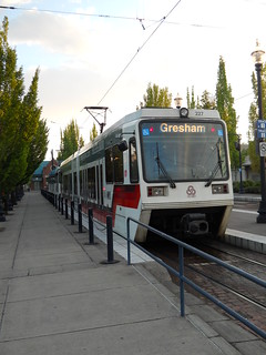
It was dark, drizzly, and rainy when I got on the train, but somewhere west of Beaverton Central we rolled out from under the edge of the low-lying rainclouds and into a partially cloudy day with no serious cloud-cover except for the bank of clouds over Tualatin Mountain to the east, and dribs and drabs of cloudcover over the Coast Range to the west. After exiting the train in Hillsboro, I made good time out to Forest Grove, arriving at the Grand Lodge at ~6:30, but then I stepped nextdoor to the local McDonalds to get a cup of coffee and a receipt, and that became a cup of coffee, a receipt, a egg muffin, and the pause that refreshes, so I didn’t start my ride until 6:55.
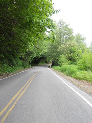
And then westward ho! through Forest Grove, plodding along at 18-20mph towards Gales Creek Road (and only missing one cue; McDonalds coffee is fine, but only one tiny cup is not enough to completely wake me up) and then sailing northwest towards highway 6 and my morning appointment with the Coast Range. Gales Creek Road trends generally upwards, but it doesn’t seem to be trending nearly as much upwards these days as it used to go in the past, and highway 6 works much the same way. I didn’t maintain 20mph for a good section of highway 6, but wound down to something over 17mph, because I’d come into this loop with a collection of mental baggage that needed sorting and could better sort it out if I wasn’t puffing along at my top speed at the same time.
And then Timber Road, which showed up about half a mile before the cuesheet said it did. Hmm, that’s not very good; I knew where I’d started, and I only added about 600 feet when I missed a turn on Gales Creek Road in Forest Grove proper, so I started to keep a close track of the milage in case I had to hunt for the info control locations along course of the loop.
When I turned onto Timber Road, it was bright and sunny, but as I progressed at speed towards the hairpin and climb up the side of the mountain I proceeded under the edge of a layer of clouds which hovered above me for the next 30 miles or so. And then I reached the hairpin, and my thoughts became wonderfully concentrated on just climbing the hill, which, unlike Gales Creek Road and Highway 6, remained just as steep as it had been in previous years. I’d hit the bottom of the hairpin at a brevet average speed of 16mph, but by the time I crested the top of the hill it was down to, um, 13mph.
(It’s probably not very steep if you’re in shape, but I have the lung capacity of a slug, so once I burn off whatever oxygen was stockpiled into my bloodstream my climbing rate drops precipitiously.)
At the top of the ramp the old SP/POTB railway grade runs alongside the road for a while. It was washed out closer to the coast about a decade ago, so it only sees the occasional inspection train, and the rails are thickly coated with fresh red rust. And then the railway line and the road diverge, with the line curving right around a small ridge and the road climbing up to the summit of the ridge, then plunging down the other side to a hairpin (with a railroad crossing) in the little town of Timber.
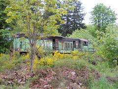
The end of the usable line is marked by the carcass of POTB 6164, which has been sitting there since the POTB decided to abandon the railroad and lease the track along Tillamook Bay to a tourist railroad. The first couple of times I rode through here the 6164 still looked in acceptable shape, but the coastal Oregon weather is taking a cruel toll on the thing, and soon it will be worth nothing except as scrap metal. So I had to stop and take a picture before I continued along. And the down to the Nehalem River, up the other side (there is apparently a ranch with bison here, but I did not see any lifestock except for a pack of farm dogs that ran happily along their side of the fence barking enthusiastically at me) and across to the highway 26 crossing.
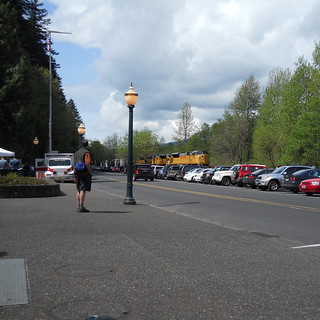
After highway 26, Timber Road runs basically downhill to the junction with Highway 47. There are a couple of climbs, but they’re only a couple of hundred feet and if you’re in shape you could make quick work of them. I’m not, but I was able to make quick enough work of them to not reduce my brevet average through here, and in less time than it seemed (Timber Road is just running along the Nehalem, and it seems to go on a long time. Not Peoria Road long, but still long) I was dumped out onto the highway for a quick jump up to Vernonia and a little brevet average eating pause at the Black Bear Coffee Company (I rolled into the place with my brevet average up to 14.3, I rolled out with it down to 12.9 :-)
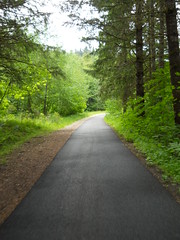
And then, after following the cuesheet out to the Shay, I turned back onto the Banks-Vernonia Trail to get myself back into Forest Grove before the fast boys overran me. It’s an old railroad grade, so it’s a fairly gradual climb (except for the crossing of Highway 47 at Tophill; the old trestle burned, so the state constructed a steep shoofly down to the highway, and a second steep shoofly up to the other half of the trail on the other side) and even if you’re watching for hazards and cuesheet distances (the half-mile glitch in the cuesheet had resolved itself earlier, but I was still unsure about the distances) you can make really good time up the ramp to Tophill.
And then it’s 12 miles down to Banks, and ~8 miles back into Forest Grove.
Normally I’d just coast down to the bottom of the hill, but I’d burned enough time in Vernonia that if I’d done that I probably would not have made it back in in <5 hours (if I was not wounded, I’d be pushing for <4 hours, because there’s a 700 coming up in a couple of weeks and if I ride it I have to be moving fast enough to get the eff off the Coast Range before nightfall on Saturday night ) so I ambled downhill at a lazy 20mph, only checking my forward progress to avoid clots of early-morning walkers and the horrid approaches to a couple of trestles where the pavement on either side of them is sinking.
Before I reached the bottom of the hill the clouds had started to burn off, so I took the opportunity to delayer before jumping back onto the public roads for the last leg into Forest Grove. There’s not much to be said about that leg; it’s a bunch of secondary farm roads through villages and farmlands, with only a couple of miles on primary highways, and I just chugged along until I arrived back into Forest Grove at 11:52am for a pathetically slow 4h57 loop time.
But it was still a lovely loop. I’d worked through the mental baggage before I got to Vernonia, so I spent the return leg just enjoying being out on a bicycle by myself (it’s a lot more enjoyable riding by myself when I plan it than when I’ve gotten dropped and have to either DNF or finish the loop by myself) and spent the rest of the afternoon collecting brevet cards from the people who started the ride three hours after I did.
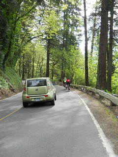
And then I rode back into town with my friend Kevin, who had suggested a scenic detour up Pumpkin Ridge Road (Pumpkin Ridge Road to Smoke Ranch Road to Otto Miller/Dixie Mountain to Rocky Point/Skyline) but who had managed to forget that it’s about 55 miles from Forest Grove to Portland via this route. A lovely loop, particularly the gravel parts (though my current gearing (11-28 cassette, 50/34 chainwheels) is not well suited to steep gravel ramps; there were two ramps that when I stood to crank my way up my rear wheel would start spinning and fishtailing, so I stopped and walked to the top. If I had a -32 or -34 cassette (or a biopace compact double, but, alas,there is no such thing as a 34t 110bcd biopace chainwheel) I could probably smooth out my power output enough to not fishtail, but the last thing I wanted to do on Saturday was to crash and remangle my shoulder up on top of a gravel logging road, so I walked.
When we got close to Skyline, I noticed that the gravel was getting wet, and there was a considerable amount of wet on Skyline proper. We were running late by now, so we ducked down Logie Trail to get to highway 30, and it became obvious that we had missed a hell of a storm when we were out on the west side; Logie Trail was overflowing with water, and there were many small landslides edging their way onto the downhill lane on that scary rutted potholed ramp. Kevin shot ahead, but I crept down so slowly that he was worried that I’d crashed by the time I finally emerged into view at the bottom of the hill. But we made up a lot of this time on Highway 30 – that’s a fast road, and once I was on a gently rolling road I could stomp on the gas and skitter down the road like a cockroach with roller skates and a jetpack.
We arrived back in Portland before 10pm, having ridden somewhere over 200k during the course of the day (but not at brevet speeds, thanks to the long gap at Forest Grove in the middle of the day.)
I took some pictures, but not as many as I wanted (I took no pictures of the return to Portland via Pumpkin Ridge Road, alas) and they’re on flickr. And I did prove to myselfthat I can still climb good distances even with a messed up shoulder (Pumpkin Ridge, et al, is about 3000 feet of climbing over 25 miles, and 15 miles of that is on gravel or dirt) so the 700 actually looks like it might be doable by myself (assuming I don’t miss it; if I wake up at 4am and get on the road by 5am, I’ll get out to Newberg no later than 7:30, which is still before when opening control closes. I’ll ride a climby 200 or 300 next weekend to see how that works first; if it doesn’t, I’ll just finalize my Portland-Bend 600 and try to submit that as a permanent to ride later in the summer.)
—orc Mon May 28 14:09:56 2012
May 25, 2012

Dust Mite checks out the new work computer.
—orc Fri May 25 22:23:15 2012
May 24, 2012
I’ve been using an ancient Macbook that my mother gave me about 6(?) years ago for all of my computer needs from building new RUSA permanents to developing discount to reading the web to doing the occasional hopefully renumerative sometime in the future odd job.
Just the other day, though, the poor macbook apparently decided that it was getting kind of old and the case started to spontaneously fall apart.

So it had to be replaced,and what it was replaced with was a “new” (apple refurb) Macbook Pro that came with last years OS bundled onto it instead of upgraded piecewise from 10.4 to 10.5 to 10.6. That computer arrived today, and I spent the necessary 4 hours migrating everything but the system from the now disintegrating poison apple to the new apple pie.
And then I attempted to log in and play with it. Everything seemed to work, up to and including receiving mail, but then I needed to send mail to a friend about getting a cuesheet for a last-minute preride of a populaire I’m volunteering on.
Pop open Mail.app, pick out a message from my friend, and hit the [reply] button.
Nothing happened.
Hit it again.
Nothing.
[reply all] ?
Still nothing.
Okay, I’ll send a new message – the [new message] button worked and gave me a compose-this-mail window, which I then populated with a mail message. But pressing the [send] button did nothing.
Press it again? Nothing.
Quit out of Mail.app and restart?
Nope, [send] still doesn’t work.
So I checked online. Quite a few hits for why isn't Mail sending my mail but none of them come with any solution (except delete your mail account and recreate it! which has the unfortunate side-effect of deleting all your mail and making Mail.app attempt to reload them on the new thing.)
I even went far enough to delete ~/Library/Mail and the preferences plists in ~/Library/Preferences without any luck.
And then I ssh'ed into my mail server, started a tail -f /var/log/messages to see what sort of traffic was happening, and discovered that g-dd-mn Mail.app wasn’t even bothering to talk to the effing mail server, it was just silently not doing anything.
So my first software update on the new machine ended up being a few simple commands:
orc@pie(orc)> cd /Applications
orc@pie(Applications)> echo DIE YOU PIECE OF GARBAGE, DIE!
orc@pie(Applications)> rm -rf Mail.app
And then I replaced it with Mozilla Thunderbolt, which is a typically horribly byzantinian piece of open source (it doesn’t seem to automatically check for mail? How, um, useful) but at least it lets me send mail. Ugh. Lets see how it works.
—orc Thu May 24 20:23:14 2012
May 23, 2012

Orrando’s spring 600k was just published, and, aside from it starting in Newberg (so I’ll have to finish a 600k and then ride another 50k home so I can shuffle the bears off to school the very next day) it looks like it’s going to be lovely.
The only bad points of it are
- Slab Creek Road, which is full of wheel-stopping potholes that I’m going to have to pick my way very carefully around, and
- the Logsden gravel, which I’m going to have to ditto ditto ditto.
Time to ride lots. If I’m able to ride this, I’m going to have to do 700k of solitary riding, and that means that I’m going to have to go fast enough to get off the effing Coast Range before the sun goes down on the first day, and that means I’ll need to do 12,000 feet of climbing much faster than I’ve done it in the past.
—orc Wed May 23 21:15:10 2012
May 22, 2012
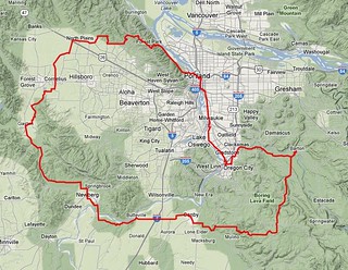
There are only two big climbs here, and they aren’t that big; you climb ~1200 feet up the slopes of an ancient shield volcano, and then, after a long period of ambling through farmlands and wetlands, you climb another 1000 feet up Tualatin Mountain, but then descend back into Portland before you reach another vent(Sylvan Butte) and end up your day with officially 3800 feet of climbing.
As is traditional, the loop starts in Sellwood (in the vicinity of Milwaukie & Bybee – the Marsee Baking shop on Bybee is a good place to start, but it is an open control so you can start anywhere in the vicinity as long as you end in the same place – and heads south. You take 17th Ave south into Milwaukie, then work your way along the river on bicycle paths and side streets until you’re plunked – after a short but kind of steep climb – down onto River Road, which takes you down to the first info control in Oregon City. And from Oregon City, you proceed east along the Clackamas River (with a little bit of dodging into the city to avoid a long-standing construction project at the foot of highway 213) through the town of Carver and across Baker’s Ferry Road all the way to the first timed control in Barton.
Turning back from Barton puts you onto the first climby section as you work your way up to Ridge Road , which you then follow up the slopes of the volcano until you are almost to the main vent complex at Highland Butte. Ridge Road ends here, and so does your climbing, as you turn west and descend towards Canby (a large chunk of the descent is on Buckner Creek Road, which is an insanely steep climb going the other way, but which is a lovely, if somewhat bumpy, descent going east to west) with only one short climb in the middle of the leg (Buckner Creek Road goes all the way down to the bottom of the gorge that Buckner Creek dug out, and then has to climb a couple of hundred feet back up to the top of the Boring Lava; if you’re a keen-eyed trainspotter, you can spot where the Willamette Valley Southern crossed Buckner Creek Road almost 80 years ago) to break the mood.
The route takes you out of the country and crosses through Canby about 50 miles
into the ride. There is no control here, but if you want to stop for a snack and can’t wait another 14 miles to Newberg, there are a few restaurants and stores (including Cutsforth’s Thriftway, which is one block north of the route just west of the SP mainline) that you can stop at. And then, almost before you know it, you’re back out into the country and rolling east towards Newberg.

It’s very very flat here, and the roads are narrow and shoulderless, but you don’t spend much time rolling through the flatlands before you bend north and drop down into Butteville, then work your way – briefly on Butteville Road, and then on a bicycle path – into and through Champoeg State Park, where you can get water and use the bathrooms at the visitor center before jumping back onto Champoeg Road for the last half-dozen miles into Newberg.
Newberg is officially the halfway point (it’s a little more than halfway, but it’s pretty close) and is a good place to stop and have a more substantial meal.
(If you’re fast, it might come a bit early for a meal, but there’s really not much else in the way of sit-down food for another 30 miles past here unless you go a ways off course to find it.)
You head north to get out of Newberg, but the route turns back to the west in ample time to avoid a climb of Bald Peak. You’ll cross a short section of gravel road just west of Newberg, but then you get back onto pavement for the rest of the loop.

The route between Newberg and North Plains travels mainly along farmlands, but it also goes along the historic shoreline of Wapato Lake, which is slowly being reverted back to marshlands. You may not hear them as you go by, but there is a huge population of frogs in the Tualatin River/Wapato Lake wetlands and on spring evenings the sound of them croaking is deafening.
As you head north, the valley tilts slightly upwards as you approach North Plains, but the climbing doesn’t begin in earnest until after you’ve transited North Plains and are heading back east. The fast route back to the east is to take West Union to Germantown Road, but it’s a very heavily trafficked road that doesn’t have much of a shoulder, so you dodge north on Jackson Quarry Road to take secondary roads east to Skyline. The secondary roads have much less traffic, but they pay for that by being considerably more vertical, and you end up doing a lot of climbing as you proceed from the south end of Jackson Quarry Road up to Helvetia Road and then over to Old Cornelius Pass Road via Phillips.
And then there’s Old Cornelius Pass Road, which runs uphill for a considerable distance without relenting, and then spits you out onto Skyline, which also runs uphill for a considerable distance before it relents. And then you’re basically done with the climbing; there are some rollers before you reach Germantown Road, there’s a short ramp up to the St Johns Bridge (which you don’t go over; it’s simply the shortest connection to town instead of turning left and going north down the ramp to highway 30) and then an even shorter one that takes you up and around Montgomery Park, but that’s it.
But first there’s Germantown Road, which drops precipitously off the side of Tualatin Mountain and hairpins its way down to highway 30. And at the bottom of that, you’re on highway 30, which is an unpleasant, but fast, 3 miles to the junction with St Helens Road, which takes you into town for the last half dozen miles of city streets and bicycle paths back to Sellwood, where you can sign off on your cards and be done with it all.
A cuesheet is available here, and if you want to ride this for RUSA credit contact me at orc@pell.portland.or.us.
—orc Tue May 22 16:42:06 2012
May 18, 2012
Dust Mite helps me prepare for tomorrow’s 400
—orc Fri May 18 22:50:57 2012
May 17, 2012
After a considerable period of time of riding, tweaking, riding more and tweaking I finally got the mlcm set up in a position where it is comfortable to ride for long stretches of miles in or out of the drops (almost accidentally; I’d been dropping the stem as I got more flexible until I ran out of removable spacers, so I then had to get a long-setback seatpost and shove the saddle back about a centimeter to increase the virtual drop to the point where I hover above the saddle and bars at speed instead of carrying a load on my hands.)
And then I crashed and destroyed my right shoulder on the very next permanent I rode (the (now elided in favor of the paved but much more terrifying Germandown Road descent) Saltzman Road section of Volcanos-vs-Farmlands) and was knocked
off the bike for an indefinite period of time.
That indefinite period of time pretty rapidly became “six days” because after a few days off the bike I started to go stir-crazy, spent a bunch of time researching whether it was okay to try and ride a bike after this sort of crippling injury (the rider consensus was “sure, go ahead, your shoulder is already irrevocably fucked up so you can’t hurt it any more unless you actually tear it loose”; the medical consensus was much the same, but fenced it with enough caveats to build a large country house out of,) then jumped on for a short city loop while my arm was still in the “I feel like I’m going to fall off now, k?” mode.
Surprisingly, it was really comfortable except when I either rattled over an unpaved section or stood and tried to crank my way up a hill.
Next day I went out for a (much slower) 58 miles, which were also very comfortable except for muscle pain on my pectoral and trapezius muscles.
And the for the next 3-4 days I did 10-25 miles a day, all in a state of
extreme comfort (and maniacal grinning.)
And then I pulled out the Trek, which had fallen off the bandwagon of being
tweaked to fit several months again. And, ow, it was nowhere nearly as
comfortable, even after a couple of small tweaks to the crankset and pedals
(I’m trying out clipless pedals, so I had to replace the MKS Sylvans on the Trek with a pair of eggbeaters.)
So I’m going to need to measure the mlcm and force the trek into fitting that geometry. Oh the joy. But when I go force it, maybe it will be in a good state to take out on brevets again?
—orc Thu May 17 23:07:17 2012
A piece of spam that showed up in the spam bucket yesterday:
Dear Sir/Madam,
I am Mary, the Manager of Weisuventure Ventures
Limited.
We are located in 359. Oknha Peich (St 242) Phnom
Penh, Cambodia.
We saw your product i am in intrested in this
product.
We will await your response with details, prize and
quantity that can be made available immediately.
Thanks
Mary
MD,
Weisuventure Ventures Limited.
“My product”, eh? How wonderfully non-specific.
I’ll be sure to get right back to you on that.
—orc Thu May 17 09:49:39 2012
After a considerable period of looking around for tights that don’t come with a chamois, I found something at REI (REI is expensive, but it has the decided advantage that if things don’t work out you can return them) that has the tight nature but doesn’t have a pad (If I wanted a chamois of some sort, I would find some suitably soft woolen fabric and fabricate my own – I suspect that if I can stand tights I’ll need to do that anyway, because the non-chamoised tights out there are designed for running, not perching on top of a bicycle and pedalling for extended periods of time. I’m not worried that much about me chafing (I can do 300 miles in regular woolen ¾ths johns and my bits are, at least last time I checked, still in working order) but that the fabric will chafe away and leave me aflapping in the breeze. A nylon wear surface on the outside of tights means that there’d be stitching poking through the inside, and I’d want to have some regular fabric there instead of having stitching going scrape-scrape-scrape-scrape against me 80 or 90 times a minute for 18 hours.)
And if this fails, there’s always shopping for XXL womens +4s (there are a lot more clothes-cut womens +4s than mens, and they don’t have the horribly aggressively baggy cut which appears to be the fashion for mens (non-tighted) athletic clothing) so I can have pants that fit around my thighs and hips without being ridiculously too large around my waist (at 51 years old and ~190 pounds, you’d think that mens +4s would fit. But no, the Chrome +4s I’m wearing these days are fine around the hips and legs, but ridiculously huge around the waist. I’ve got about 2 inches of excess waistline on them, and if I use a small enough belt to tighten the waist it pleats, then pouches down between the belt loops.) The only +4s I’ve found that actually fit well were the Swrve “Sprinter Cut” cotton ones, and I went through the seat in a pair of them in only about 5000 miles a couple of years ago (plus they’re cotton, which is just a little too warm on a hot summer day.)
So, running tights it is. Plus a pair of traditional bike shorts so I can experience the full joy of dealing with someone else’s idea of comfort for a short time before screaming in exasperation, yanking them off, and returning them in a state of great indignation (no, I won’t be doing all of this at once, and I certainly won’t be doing the second step in public. There’s a very small subset of humanity that gets to see me flapping in the breeze these days, and that doesn’t overlap with the rando community at all despite my occasional peep about “wouldn’t it be nice if….?”)
Update: I bought the pairs of tights, and they arrived on Saturday. So I tried them on, to universal disapproval at home. And I took a couple of pictures and put them on flickr (not there anymore, sorry) and waited for comment. People looked at them, but did not comment (and those who did – bikey acquantances of mine – disapproved,) and when I wrote notes to other bikey friends about them I got nothing but disapproving silence.
Sigh.
They are much cooler than my traditional layers, and I am (at least theoretically) fast enough now so that temperature regulation is more important than looking foolish, so I guess what I’ll do is save them for solitary brevets, permanents, and other rides that are far enough out in the country so that nobody sees me while I flash along by my lonesome self.
And I also have a second experiment I need to do. Normally I don’t have any sort of padding between my bits and the bicycle (aside from whatever padding a layer of wool and a layer of nylon provides) but I rely on my bike fit and saddle choice to keep my genitals from being tenderised as I ride along. This works most of the time (if I’m tired or injured and ride slowly, I sometimes forget to keep my hips rotated, which has unexpected surprises during undisclosed activities after I’ve gotten off of the stupid bicycle) but that’s with two layers of fabric. The non-bikey tights, since they don’t have a chamois, is only one thin layer of polyester/stretchy thread blend, so it’s basically World Naked Bike Ride every time I go out wearing just them. So what I need to do is go and ride a tighted short loop (60-70 miles) sometime soon and see just what’s left when I’m finished with it.
—orc Thu May 17 09:37:38 2012
May 16, 2012
So I went to an osteopath on monday and had him look at my shoulder. He had another round of xrays taken of the offending shoulder, and, yes, the poor thing is pretty severely separated (the CC ligaments that my normal doctor and the ER people said were just damaged are “just damaged” to the point where I think they’ve either stretched beyond repair or have finally ruptured; during the last couple of days, I can poke at the offending clavicle and feel it depress, which means either no more CC ligaments or they’ve retired from active duty.) but, no, surgery won’t completely fix it.
Apparently not very many people are willing to try and suture AC ligaments together (because they don’t heal?) and the local osteopaths aren’t counted in that “not very many people” category. They can trim and suture the CC ligaments together, which means that the clavicle may drop back to a more conventional position and stop fouling the point of the shoulder (apparently it will also do some stabilization when you’re lifting your arm high above your shoulder, but a lot of that stabilization seems to be because part of the surgery is to resect the end of the clavicle, thus mechanically getting it the hell out of the way of the point of the shoulder.) But the cost of this surgery is, indeed, 4 months of immobility – the doctor I talked to said that for 4 months I couldn’t lift anything weighing more than 8 oz with that arm.
Now that’s a spectacular reduction in usefulness right there. I won’t enumerate exactly everything that this cuts out, but if it’s fun basically I can’t use that side of my torso for it. (And even if it’s not fun – things like climbing into and out of bed or getting a shirt on come to mind – it’s still not doable.) It is worthwhile not having the stupid clavicle leaning on my shoulder getting in the way whenever I do anything with the arm, and it would be worth something cosmetically to not have this horrible little bump (as if I was a pirate who had a giant ichneumon wasp as a familiar instead of a parrot) on my right shoulder, but 4 months offline is a considerable period of time when it happens right before the start of the summer brevet season.
And to add insult to that, apparently the best results for shoulder reconstruction surgery is if you do it within 2 weeks of the injury, which would have put the surgery before the spring 400k – I can wait until later for the surgery, but then I would need to have cadaver ligaments put in to replace the now scarred-into-uselessness ligaments that used to be there.
Given any luck, I can continue randonneuring until my 80s (offer not valid if I die before then, of course; zombie randonneuring might be amusing, but in any case I would not be around for it) which leaves me with 30 or so summers left to ride. Lose this summer and I lose 3% of my summers, and that 3% would be right at the peak of my fitness. I can, I suppose, hunt around for a tadpole and trike it for a summer (but that would require borrowing one, because a new one costs $1200 $3000 (for a racy model) and that’s a lot of money to spend for 4 months) but if I did the surgery now I’d still be in a narcotic haze on saturday, which would not be conducive to finishing a 400k loop, particularly on a new type of hpv.
So defer defer defer. Ride the 400 on Saturday (or DNF trying to ride it) and see how my crippled shoulder feels. There’s not much I need to use that side of my body for much these days, so if I can ride reasonably long distances with it I can make it through until the summer series is over, then decide whether or not it’s worth taking myself offline for 4 months to try and glue that side of my torso back together or not.
On the bright side I’ve got enough strength back I can wrench on my bicycles again – I was able to pull and replace the bottom bracket on my Trek this afternoon without having that side of my body completely explode on me – so I can do some routine maintenance around the house again.
—orc Wed May 16 23:46:34 2012
May 13, 2012
So, I crippled myself last weekend and pretty much trashed my chances of riding in Orrando’s spring 400 (which is about as flat as a 400 can be in Oregon – only two 20%+ ramps, and they’re very short.) Okay, fine, so I’m out of luck there and my project for the year (to do two brevet series – one in workers rides) will need to have some serious schedule tweaks to make it work.
So lets see what 400s are nearby and available.
The Desert River region has one which does not cost an arm and/or a leg. But it’s on 26 May, which falls right on top of the Forest Grove-Vernonia populaire, which not only am I volunteering for but which I volunteered to run the start/finish control. So that’s out.
Seattle has one on 18 Aug, which is conveniently one week before Orrando’s summer 600k (which I’m volunteering for, and might be preriding that week.) And it costs $85, plus the cost of getting to whereever in Washington it starts/ends, plus the cost of hotel rooms.
And if I panic and start looking elsewhere, I run headlong into the detail of nobody really has any summer/fall 400s. SFrando has one in July, but it conflicts with a 3 day tour I’m taking to celebrate a friends birthday, and another of the California regions has a 400 on September 1 (which is doable,
but any California-based 400 would cost a lot of money to get to, hotel at, and enter.)
I’d gone to a lot of trouble to arrange my schedule to make room for a pair of series this year (it’s really hard, because my family, not surprisingly, starts making snarky comments about rando widowhood when I start lunging for the horizon every weekend) and even if I submit and get one of my 400s approved I can’t just ride it because permanents don’t count as the proper secret handshake for a series.
Golly, that’s inconvenient.
After 5 days off the bike I snapped and rode about 12 miles on Friday, 60 miles yesterday, and another 12 miles today and didn’t have any ill effects (aside from reinforcing that it’s really unpleasant to have the distal end of my clavicle rubbing laviciously around on top of the point of my shoulder when it should be tucked under that point providing structural support when I need to punch my way up a ramp or sprint to catch up with the friends who dropped me on the previously mentioned ramp) so it is theoretically possible that I could ride a 400 and then fill in the gaps between then and the 600 with strategically placed 200s, but the failure case (running out of steam/drugs/workable shoulder 190km down the valley, needing to cool my heels for 12 hours in the Eugene Amtrak station before catching train #500 at 5:30am Sunday morning, then hearing “I told you so!” from my supportive family for approximately the next 30 years :-) ) is a little daunting.
Now I’ve not actually seen the xrays of the damage to my shoulder, but it (thanks, I think, to going up to Crown Point yesterday) has gotten a lot better
since the accident (to the point where I’m not wearing the sling and can type with two hands. I still don’t have any strength in my right arm, nor can I reliably lift it above shoulder height) and it might be dimly possible to at least start the 400 and turn back at Silverton if it turns out that 50 miles is about as far as I can go in one go (Silverton is also, coincidentally, where the road first tilts upwards fairly severely and is where I would be dropped by my friends even if I was bolting downvalley at the pace I was going on the 300 – if I couldn’t keep up with them on the valley floor, there’s no way I could keep up with them on the hilly parts between there and the nuclear free summit on Brush Creek Road.)
I’m going to see an osteopath on Monday, so maybe I’ll bring this up and see what expert advice has to say about it, because I’d really hate to not have a 2×SR year this year :-(
—orc Sun May 13 18:03:43 2012
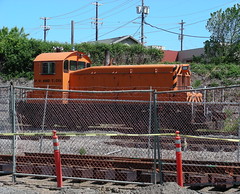
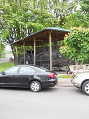
The working Eng! sits in the middle of the construction mess that is becoming the new EPT East Portland yard (the old one is going to have an interurban line built across it, which makes it somewhat less than useful as a yard.)
—orc Sun May 13 16:31:16 2012
May 11, 2012
Dust Mite meets with our robotic overlords.
—orc Fri May 11 20:35:19 2012
May 06, 2012
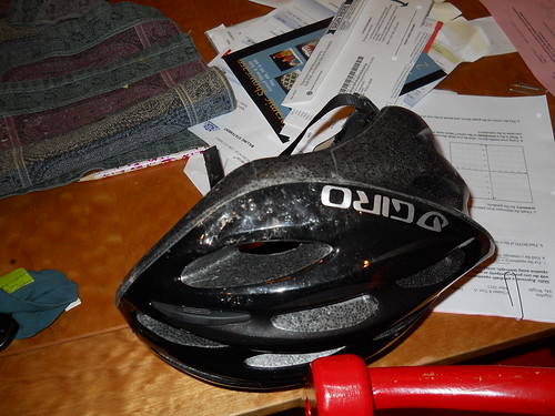
I rode Volcanos vs. Farmland again yesterday, and once again managed to get my bicycle caught in a rut on Saltzman Road. Unfortunately this was a transverse rut (runoff across the road at a hairpin) that didn’t just stop me from steering, but stopped me abruptly, which made me fly elegantly over the handebars, then crash (on my head and right shoulder) somewhat less elegantly on the trail.
Damage to my head? Nil, or close to nil, thanks to the helmet that died the true death protecting me. Damage to my shoulder? Unfortunately I didn’t crack any bones – I instead landed on the point of my shoulder, irrepairably tore apart the ligaments connecting my clavicle to the acromion spur of my scapula, possibly crippling me (it appears that the common treatment here is to just suck it up and live with it, if “live with it” properly describes the incredibly unsettling feeling of one’s right scapula rotating as your right arm becomes two inches longer) and at the very least putting an end to my 2012
rando season.
Hopefully the sports doctor I’m going to see on Thursday will decide that the damage is bad enough to require surgery and that my insurance company will pay for the procedure. Ligament transplants aren’t exactly the quickest healing surgical procedure, but 4 months (and, sigh, another two years of riding to get back to the speed I was going prior to 17:06 Pacific Time on May 5th) off the bike is much better than having to give it up forever.
—orc Sun May 6 12:01:06 2012
May 04, 2012
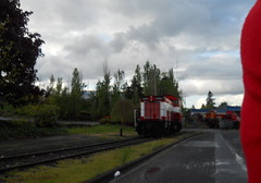
I was riding down McBrod Ave, and it would have been a sin to not take a picture of the Eng!s sitting there.
—orc Fri May 4 19:18:27 2012
Dust Mite is working on the railroad.
—orc Fri May 4 19:14:57 2012
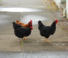
I was walking over to Llewellyn school to pick up Silas when I encountered a couple of chickens scratching in the gutter. When I returned with Silas, they had moved on down the street and were just hanging out on the sidewalk walking up to passersby and asking (or something; they were all murpling to each other and to everyone who passed) for a little something to help stave off the cold rain.
—orc Fri May 4 16:55:11 2012
May 01, 2012
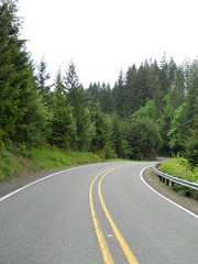
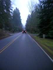
Since I’m volunteering to staff one of the controls on the upcoming Multnomah Falls populaire this means that I don’t get to ride it on the day. But to make up for that I was given the chance to ride it in advance, and that’s what I did on Sunday.
This is not a particularly surprising route for anyone who actually lives in the Portland area; the loop from Portland out the Historic Columbia River Highway to Multnomah Falls is hideously popular with local cyclists, and on any weekend with good weather there are almost as many bicycles as cars winding along the side of the gorge between here and there.
The plan was that the workers would meet at the Jazz Cats coffeehouse in Hollywood at 8:00ish for an 8:30 departure. Well, that was the plan; I got to Jazz Cats at about 8:05 and there was nobody there, so I settled down with some coffee and a muffin to wait. About 10 minutes later, Stasia Honnold showed up – she’d been roped into the preride just the day before – and we sat around and chatted for about 25 minutes before everyone else arrived, and after another 10 minutes of planning we rolled off by a maze of twisty passages northwards to get to Marine Drive, and then east towards the gorge.
There are no surprises on the route inside Portland, aside from the cuesheet going abruptly wrong on milage (when we reached Marine Drive, we were about half a mile up on the cuesheet. Some of that is because the cuesheet was based on a start from Wilshire Park and it needed to be extended down into Hollywood for a Velo Cult start, but some of it was just wrong in the same way the preride for the Bridge of the Gods 200k last year found the milages wrong) and we whisked away to the east at a pretty good pace. In Troutdale, we briefly stopped at Troutdale Community Park to use the facilities and delayer, then hopped across the Sandy River and chugged upgrade towards the info control at Crown Point.
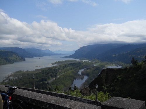
As is traditional, I fell behind on the climb up to Springdale, but as is not traditional, I managed to overhaul them between Springdale and Corbett (after stopping briefly to delayer a little bit more; the day started off cool, but warmed up in a hurry when I needed to hustle upgrade to catch up to everyone) and we rolled up to the Vista House in more-or-less of a group. After a brief pause to use the facilities and pick out an info control question, we plunged back down into the gorge (along the highway; it’s probably faster to go over the cliff, but it would wreck your bicycle and force a DNF) and proceeded past every other waterfall on our way to the turnaround at Multnomah Falls (arriving there approximately 2 miles up on what the cuesheet said. Hmmpf.)
We parked ourselves at Multnomah Falls for a considerable period of time, only prying ourselves away 45 minutes (and one train) later, and then headed back towards Portland. The cuesheet directs you onto I84 to get into Troutdale, but says you can climb up to Crown Point as a slightly longer (3 miles) alternative route. Well, none of us had the slightest interest in riding along I84, so we decided we’d climb back over the hill to get back into civilization.
The climb up to Crown Point is considerably more scenic when you’re not carving around switchbacks at 30 mph, and if you’re like me you’ll get plenty of chances to see the scenery as you creep up the ramp well behind everyone else. But as 700 foot climbs go, it’s really not that bad, and once you’ve climbed around the five switchbacks halfway up the ramp the grades moderate and you can pick up your pace and enjoy the views at a somewhat better speed than you were climbing just a few minutes ago.

Since this is an optional scenic reroute, there’s no need to stop at the Vista House for control purposes, but if it’s not raining it’s always worthwhile to stop for a second or two for the view. And then there’s about a mile of intermittently steep climbing up to the summit at the Women’s Forum (and the road to Larch Mountain, which you DO NOT want to do now unless you brought snowshoes) and then it’s a long pleasant coast all the way back down to the Sandy River(say “hi!” to the Springdale Dragon as you fly past the entrance to the Springdale Job Corps complex just west of downtown Springdale,) then across the river and back into the city of Troutdale.
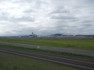
From there you’re back on onto Marine Drive, but on the return you route around the southeast side of the airport. It’s worthwhile to be careful when you go from Marine Drive to the i205 path, because it involves a left turn across Marine Drive and the people driving along there may feel it’s a moral failing to slow down for bicyclists (when I was turning onto the i205 path, I signalled a good long way in advance of any cars, but one of them decided that stopping was wrong and sped up to go around me in the other lane instead of slowing down for a second to wait for me to clear their lane) but after that you’re back on city streets where people are at least used to seeing bicycles on the road.
And then south along 34th, wiggling over the Alameda and dodging back into Hollywood, where the ride finishes at Velo Cult. Velo Cult is a pretty nice bike shop, not only because they’ve got a bar and coffee, but because the owner collects interesting old bicycles and thus has a good collection of rando-style shiny! for people to ogle as they sit around and chat.
(Like we did. For two hours before we got hungry and went to Apex to sit around and chat for another two hours. But that’s not relevant here.)
It took us about 5h30 minutes to do the loop (at a brevet average of 12.7mph/moving average of 15.6mph,) but that included about a hour of sitting around at various controls and the 3 mile scenic reroute over Crown Point. With the reroute, it was 72 miles, which is approximately 4 miles
over what the cuesheet claims, so the cuesheet will no doubt be revised before the ride. And I took some pictures while I was riding, and a few after the ride was finished (because I dropped the camera on Cornfoot Road and needed to test it out after I wedged it back together when the ride was over :-)
—orc Tue May 1 00:47:27 2012
—30—
