A tale of two brevets (part 1)
The school year staggered to an end last Wednesday, which meant that the routine of having my day chopped into many tiny chunks also came to an end. So what came immediately to my mind? Taking the mlcm out on a permanent or two!
I couldn’t do a permanent on Thursday, though, because my front rack had cracked and I needed to braze in a new fork crown mountpoint before I could take it out again (I think I may have cracked it when I crashed on Saltzman last month, and then riding it for another 1000km was probably pressing my luck enough for one year) but I’d had that all done by thursday night and was ready to head out nice and early on Friday morning to do a nice loop.
My original plan was to do a second preride of Portland-Ripplebrook-Portland(As a permanent, not the preride, because there are a couple of in-town routing alternatives I want to ride in a batch to choose between later on this week) on Friday, but my new One Big Hill permanent was approved on Wednesday and I really wanted to do my checkride of that loop before anything else.
I’d designed One Big Hill as a sample route for an acquantance of mine, and the original plan was that we would do the checkride together, but, alas, we had a falling out and aren’t friends anymore. So, instead, I did the loop myself.
And one side-effect of that was that my “leave early in the morning” plan became “leave at 9am”, which meant that I’d have to maintain a fairly aggressive pace just to get back at a reasonable time. And there was one route variation I wanted to test out – Portland Traction’s Oregon City line, now rail-to-trailed as the Trolley Trail, provides a much more easily graded ROW that avoids the steep ramps up to and down from the point of land that Oak Grove sits on.
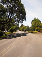
So out the door I went, and southwards I went. The first sign of the Trolley Trail was very encouraging; brand new pavement stretching south and under the P&W bridge, but after clearing the bridge the trail pretty much came to an abrupt end and deposited you into the 99e bike lane (which is better than nothing, but still not very good) for the climb up the ramp to Park Ave, where, thankfully, the Trolley Trail came back to life for the rest of the way south to Gladstone.
I’ve ridden this part of Portland Traction before, back when it was not paved, and lemme tell you it’s a lot nicer now than it used to be. Once the segment from River Road to Park Ave is finished I’m certainly going to reroute all of my permanents from River Road over to the Trolley Trail (even those routes, like Hills to the Yeah!, that involve stupid amounts of climbing.)
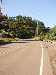
The new routing I’m using to get through Oregon City works out better and worse than I expected; South End Road is a gradual enough climb so that I can get all the way up to the top of the bluff without feeling like I’m going to die during the ascent, but once I reached the top and needed to dodge over to Central Point Road for the rest of the leg into Canby I managed to completely miss the offending (and not very well signed) turn onto Partlow Road, and couldn’t find it even after wandering back and forth along South End Road for a considerable period of time. So instead I continued south along South End Road, which is a lovely road except for the teeny detail that it deposits you onto 99e for half a mile before you can escape back to New Era Road and the published route. (I don’t mind traffic, but that’s not the thing that gets me about 99e. No, the problem with 99e is the narrow debris-and-pothole covered breakdown lane, which meant that I spent a lot of time threading a needle between really fast traffic that had no interest in giving me 3 feet of clearance and things that might want to shred my brand new tires.)
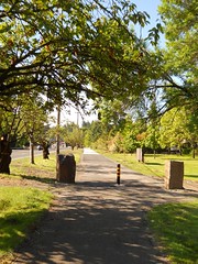
But half a mile, even if it’s slightly uphill, isn’t that long, and I was able to escape back onto the proper route quickly enough, then down into Canby for the first control. This control isn’t strictly necessary, because the route I picked from Portland to Silver Falls State Park is about as direct as possible, but the people at Cutforth’s Thriftway are really nice to wandering cyclists (I’ve staggered in there countless times looking like a rat that drowned in boiling water, and have never once been treated with anything other than the utmost respect) and deserve our custom.
When a friend noticed that the outbound leg was on Barlow Road, he mentioned that he thought it was really busy and unpleasant to ride on. I’d never noticed this in the past, but decided that I would take particular care to watch for traffic.
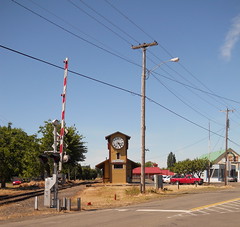
And because I was thinking about watching for traffic, I managed to miss the turn onto Barlow Road and went sailing right past it on Knightsbridge Road, then had to turn back on Arndt Road to get back to the route. And from that point on it was smooth sailing south – there was a lot of traffic on the northern reaches of Barlow Road, but that traffic evaporated at 99e. And even when it was there, it wasn’t that bad; I found that getting over the SP mainline just north of 99e was more problematic than the traffic, because it was just far enough away from 99e so that cars would go shooting over the railroad crossing, then stomp on the brakes for the highway crossing, which made the whole business of trying to cross the railroad without crashing even more interesting.
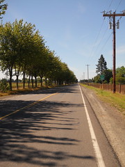
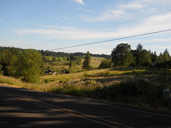
And then south to Silverton and the big hill. There are quite a few roads running north-south through here, so once you get off the primary roads there’s basically no traffic, so you can speed or dawdle along as you wish without worrying about annoying anyone else. And then, almost before I realized it, I was in Silverton, out of the flatlands, and about to do a nice long climb.
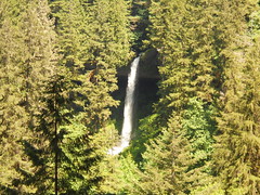
A quick stop to delayer, and then up I went. Last time I’d done this I was riding with a friend, but on a windy day, so the climb seemed to take approximately forever because misery enjoyed the company, but today, since I was doing it by myself (and not for the first time) it felt like I wound my way up the first and then the second ramps in no time at all (“no time at all” was probably around a hour and a half; it’s about 17 miles of climbing, interrupted by about 4 miles of gentle downgrades) and, in what felt like less time than actually elapsed, I found myself rolling into the South Falls day use area to hunt for the hidden control.
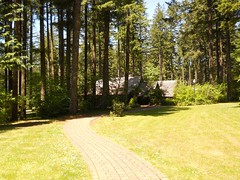
I already knew where the control was (I’d visited South Falls before, both on foot and on the spring 200k this year) but was still pleased to see that the signage had been modified since the spring and it was now a bit easier to follow the signs to the offending lodge.
And since I’d gotten there in 4h30(ish), I decided that this would be a good time to settle in for a nice long lunch, and it was not much less than a hour later when I walked the mlcm back down the ped-only path, then hopped on to ride back into Portland.
Sadly, a hour was long enough for my body to decide that it was done for the day, and I found the return trip to be considerably more of an annoyance than the trip out. It took several miles for me to start warming up, which was just long enough to reach the long descent into Silverton, and by the time I’d reached the bottom of that ramp I had cooled down to the point where I had to warm up again.
I’d tweaked the return route to take me over roads I’d never ridden before. I put a control into Mount Angel (so I could go over the Gallon House Bridge on the way up, and then routed myself over secondary roads back to Meridian, which would then go most of the way up into Canby before I circled southeast and then headed up into Oregon City. But a few of these roads I’d never ridden on, and found myself having to abruptly redo the cuesheet after making turns and realizing I was about to run into a gravel road (my shattered shoulder is discouraging my attempts to explore gravel roads these days.)
But I made my way around these obstacles and worked my way north, stopping periodically at convenience stores (for some unknown reason I’d completely run out of power in Mount Angel, so was stopping every half hour or so to pick up something or another to eat to see if that would kickstart my engines. Something must have worked, because by the time I’d reached Oregon City I was running along at about 75% of normal power.)
The route I’d picked to climb up to Oregon City was one I’d never ridden before – Leland Road, which climbs up the lava about a mile east of Central Point Road. This was a pleasant surprise, because, even though it was steeper than South End Road, it wasn’t that much steeper and I could get up to the top without too much fuss, muss, or stops to coalesce my water bottles into one.
And then it was a nice unfussy 10 miles back to town. I detoured onto the Trolley Trail again (this time it was Boardman->Trolley Trail->Arista->Oak Grove, which got me around the one steep narrow hill on River Road, and then River Road->99e, where I could hop onto the trolley trail and avoid the Wren descent. This first detour is pretty easy, and only adds about .2 miles; the second one still has construction going on so I;m going to put off officially using it until the construction is finished.)
And then back into Sellwood, arriving home 10h28 after I’d left. Not bad for a slow loop, and it was a nice day out, but the whole business of taking long lunches at Silver Falls appears to do horrible things to any hope of a quick return home afterwards.
The gory details for the loop are
- 203.5 km (rerouting, exploration, getting lost)
- 2040 meters climbing
- 9h10 moving time
- 47 pictures