Oh G-d, not another ramp! (summer 400k workers ride)
I am helping staff orrando’s summer 400k (this is basically Michael Wolfe’s Barlow 300 with the Maupin end filed down a bit and a departure from Portland bolted on at the start/finish) next weekend, so I’m obviously not going to be riding it then. So, instead, I went out with most of the volunteers at 5am yesterday morning (leaving home at 3:45am to get up to the vicinity of Hayden Island at a hair before 5am) to ride around the loop to look it over and get our chance for ride credit.
I’d done all the prepwork on the bicycle on thursday (for a change; this gave me the chance to take it out for a couple of short shakedown rides to make sure things wouldn’t fall off, break, or otherwise incapacitate me) and had it all loaded up with food and water (except for perishables) on Friday night, so all I had to do on Saturday morning was shower, get dressed, toss the perishables into my big rando bag, unplug the electronics and store them around the bicycle, then get out the door. This I actually managed to do within 5 minutes of when I wanted to get out the door, which was good because it took me about a hour to get up to the vicinity of Hayden Island and find the correct hotel.
It was still dark when we left (me, Michal Young, Lesli Larson, Susan Otcenas (one of the organizers), and Kevin Brightbill) and worked our way south across the city. We were going faster than I was going on the way down, but not much faster due to annoying things like traffic controls and traffic, but we made it to the Springwater Trail 48 minutes after we pulled out from the starting control. And from there it was south, then east, along the Springwater Trail, stopping only to verify a cue or two and to find an open bathroom that had not been colonised by a homeless person (most of the bathrooms along the Springwater Trail are closed because of this, but we found one unlocked porta-potty that we couldn’t use because someone had sacked out there.)
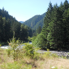
There’s not much to say about the Springwater Trail I haven’t already said. If you’re going directly east to the mountains, it’s a nice low-grade route that takes you 3/5ths of the way to Sandy before you have to dodge onto the public roads and start working with more substantial inclines as you get closer to the big volcanoes.
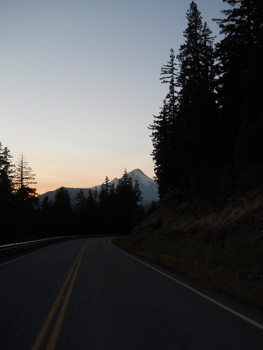
But today we weren’t going directly east. No, we were heading southeast to make the climb up to Timothy Lake (on our way to the town of Maupin on the Deschutes River) so all that taking the Springwater Trail did was to put us on top of a bluff that we didn’t want to be on top of. So after a quick fud+bathroom break in Boring, we aimed south on Amisegger Road, which isn’t anything special except that it drops us down to the Clackamas River Valley before we turned left and climbed up another bluff (via Judd Road, which seems steep and pointless until you reach Van Curen Road, which makes it all worthwhile.)
I was feeling well fed and watered, so I was feeling fast, and I managed to gap everyone climbing up to Kelso Road, gap them further dropping down Amisegger, then climb up Judd faster than anyone else (they’d caught up somewhat when I’d started climbing, because I could hear their voices, but by the time I reached the top of the bluff all way quiet except my gasping for breath.) So I plunged off the top of Van Curen Road all by my lonesome (Van Curen Road is basically a strip of asphalt that was painted on the side of a cliff. It’s gratifyingly steep, and when I was weighing around 200 pounds I could regularly make 50mph freefalling down it) and screamed up towards Estacada in solitude.
In Estacada, I stopped and waited for them, and from that point until Ripplebrook we moved along as a more-or-less bicycley blob of uniform density. It had been cloudy in the early morning, but the clouds started breaking up as we reached the mountains and we headed towards Ripplebrook under bright sunny skies.
I was still feeling in fine form when we reached Ripplebrook, but felt that I needed a little something right then to keep from running out of energy. But, alas, I became distracted there and forgot to get food (I only got coffee and soda, which was not the right choice) so when we left and I lagged behind to get some photos I discovered that I was not able to unlag. So it wasn’t very long before the masses of bicyclists ahead of me vanished into the distance, leaving me to turtle along at a distressingly slow rate up along NFD 57, then over to NFD 5810 and up from there.
I was moving more slowly over time, and it wasn’t long after reaching NFD 5810 when I basically ground to a stop and found myself having to lean the mlcm up against a tree and scrounge through the big rando bag for food that I was willing to eat (a sad side effect of burning all my spare calories is that food just isn’t that appealing, so I had to choose the least unappealing items and cram them into my gullet before they became any less appealing.) Sadly, I ran into the caloric limitation of my digestive system (I can metabolize ~400 kcal/hour if all I eat is nasty sports food, somewhat less if I eat real food,) and I was burning substantially more than that as I stomped my way up the mountain. So this started a race of my ability to constantly eat enough so that my body would burn fat instead of flopping down by the side of the road and giving up. This was not exactly a recipe for speed, except in one or two sprint situations where a piece of fruitcake would suddenly metabolize away and give me a couple of thousand free calories which I would then immediately waste going faster.
But anyway, here I was on the slopes of Mount Hood, with about 1500 feet of climbing left before I topped out and descended towards Timothy Lake. So up I went, but only for a few hundred feet before I realized that I was carrying a distraction in the form of a cellphone with some music on it, and I could plug in some earphones and work my way uphill to the tunes of whatever music I’d put on the thing (I’d thought I’d put the Mekons on this thing, but, no, all I had on the thing was Carly Rae Jepson (Call Me Maybe, which is a terrific crush song, but possibly not so much after the first 30 repetitions), Bonnie Tyler (Total Eclipse of the Heart), Evanescence (Away From Me), Liz Phair (Why can’t I?) and Katy Perry (I Kissed A Girl).)
By the time I reached the water feature on NFD5810, I was singing the lyrics of these songs about half a second before the songs were :-)
… what? You want to know what I mean by “water feature”?
Well, once upon a time NFD5810 was a paved road leading from NFD58 to NFD57 up at Timothy Lake, but then Anvil Creek flooded and washed out a quarter mile of the road, and the Forest Service said “eff it!” and abandoned that part of the road. It’s not accessable by automobile, but you can walk it or carry your bicycle across it. Michael Wolfe arranged this for the Barlow 300 (the alternative options are to either take NF46 to NF42, or take NFD58 all the way up to High Rock, then across to NF42 several miles and about 800 feet above the ranger station (and water) at Clackamas Lake) and the organizers of the summer 400 thought that this was a wonderful plan, so they kept it.
At least the water level was low, so I could totter across on my newly becleated feet without falling over and killing the bicycle or my other shoulder. And then up to the road again and off I went to the east.
An inconvenient routine started developing here. I was riding very slowly compared to everyone else, so the routine at controls is that all the other riders would get there, do their routine, then sit around waiting for me and then bolt out very soon after I got there. If it wasn’t for Kevin Brightbill moderating his pace for a goodly amount of the loop I would have ridden the entire thing by myself, only seeing the other riders briefly at controls. So I rolled into the Timothy Lake control, and soon thereafter rode out after everyone else for the longish climb up to Highway 26. (Here I took advantage of my familiarity with this part of the route to stomp up a couple of short ramps and accelerate down the other side, gapping myself out from about 15 miles before I was inevitably overrun on on highway 216.)
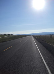
The nice thing about highway 216 is that after a few miles of bouncing into and out of small river valleys it falls off the eastern slope of the volcano and drops precipitously down towards the Deschutes River. It is easy to spend 24 miles doing 30+mph if you’re not suffering from a severe calorie deficit (on the Barlow 300, I did just this on the trek) but even if you are there are still stretches where you look down and you’re coasting along at 30-35mph.
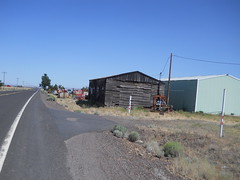
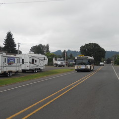
The last 15 or so miles into Maupin, however, are in the middle of the high desert, and today was sunny, hot, and dry. Kevin was dawdling along to keep me company, and the both of us ran short of water halfway across the baking plains and had to stop at a conveniently located store to get more water. And once restocked, we kept going west until we had to turn south, then down, to drop 300 feet down into the Deschutes gorge to reach Maupin, where we met the other riders in the middle of a leisurely stop for lunch.
I finished slightly before everyone else, so said I’d start off first because I was climbing slowly (and we had to climb out of Maupin to get to the next control at Tygh Valley.) The wind was blowing from the north at about 8mph, which was about the top speed I was able to maintain on the long ramp out of town. So for the first quarter of the climb I proceeded in a still hot envelope of air, which only dissipated when I realized that if I just slowed down to 7mph that there’d be a slight breeze. And at the top of the ramp the highway (highway 197) fishhooked around a cliff and aimed north, directly into the teeth of the wind.
Did I mention it was hot and sunny? Normally I regard headwinds as if they were some sort of tapeworm, but today this breeze was doing quick work of evaporating the sweat off my body and cooling me down, so as I got more comfortable I accelerated and was going about 18mph when we fell off the plateau and down into the White River gorge, which is where Tygh Valley is.
A quick resupply at the store there, and then we had to get back home (and over the mountain again) Up we went on Wamic Market Road, which climbed back out of the gorge, then over a low summit, rollered down into the town of Wamic (once upon a time there was a Wamic Market, but it closed in the last couple of years), then tilted up again and made a run for Mount Hood.
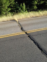
This is a long stretch of road, and it’s all uphill or has features. The most spectacular feature is that a stretch of the road was paved in concrete once upon a time, then tarred over with asphalt. The high desert tends to have fairly wide temperature extremes, so the concrete slabs expand and contract and squash the asphalt between them, leaving deep wide fissures in the road surface.
You enter the National Forest over a cattle guard. About half a mile down the road is another cattle guard, and immediately after that the expansion cracks start up. For five miles. It’s a relief when the road finally tilts uphill in earnest and starts climbing up towards Barlow Pass.
I rode for a while with Susan, and then after a regroup (after being dropped for a while when my right foot cramped up (I still need to adjust the positioning of these Shimano cleats)) I ended up riding the rest of the way with Kevin, who was very patient on the long stretches of climb where I could not for the life of me get above 5mph (the steady state between what I ate and what was being burned to keep me going) as we ground up to the summit before the White River, the second summit before the White River, and then the 9 mile climb up to Barlow Pass.
It was somewhat chilly up in the vicinity of Barlow Pass, so I was impressed when I could make the descent from the White River bridge wearing no top layers except my blue cloud chamber jersey, given that the last time I came through here late at night I ended up hypothermic. The actual descent from Barlow Pass was a little bit longer, and closer to the boreal blasts that come up from the Sandy River gorge, so I eventually had to stop (because I was shivering so much that I couldn’t control the bicycle) and throw on my cheap REI windbreaker.
We met up with everyone else in Government Camp (at the Huckleberry Inn, where Kevin and I bolted down some soup and I inhaled a strawberry malt,) then put on every layer we could find and headed down towards Zigzag and a detour off onto Barlow Road/Marmot Road. Everybody else vanished into the distance just like that, but I proceeded downwards more slowly because I had sat still just long enough to drop my core temperature to normal and was thus freezing as I crept (relatively speaking) down the ramp.
In Zigzag, I met up with everyone else and we headed over to the Barlow Road, and onwards on Marmot. The eastside ramps on Marmot are fairly steep, and the middle one defeated me. I decided to walk up the first section of that ramp, which I did, but I then discovered that the second section was still steep enough to ensure that I couldn’t actually push off and get the bicycle moving fast enough to balance, so I had to walk up that one as well.
Ditto with the Bull Run ramp, which I made it up about 2/3rds, stopped, said “I’m done; I’m going to DNF and go home.” Kevin said that this would not be a fine plan, but asked where I’d be bailing (Hurlbert, because that’s the Only Way Out.) So he rode up to the top of that ramp while I walked, then we continued along until we reached the climb out of Oxbow, which I again just walked because my legs weren’t even going to make the slightest effort. And at the top, he was waiting and pointed out that there was still 2.5 hours until the Troutdale control closed, so why not try to make it up that last ramp to the Corbett info control (and info control that I’ve been past so many times that I usually know exactly what the answer is.) Sure, I said (expecting that I’d end up walking up another hellish grade) but then I discovered that the route up to Corbett is basically nothing and only required going down to my emergency low gear for about 300 feet in the middle.)
And that, after somewhere in the ballpark of 6 kilometers of climbing, was that for the climby parts of the brevet. We dropped down to the Sandy River (taking the Columbia River Highway instead of Bell Road because Bell Road is fairly potholey at its lower stretches and we were both worn down enough so that it did not seem like a fine plan,) went into Troutdale for the control there, then bolted (fsvo “bolted” – we were averaging about 15mph on this stretch) for the vicinity of Hayden Island to finish the loop.
Which we did, in the leisurely (but it didn’t feel that way) time of 25h11 (to go 408 horizontal km, 6.1 vertical km.) During the loop I went through probably 14 waterbottles of water + nasty sports drink pills, another 5-6 sodas, ice tea, or coffee, and about half of the supplies I brought along. I walked into this workers ride weighing about 186 pounds, and finished up at 179.
My original plan was to get home, then head directly out to the coast, but I found that I was so tired that I was falling asleep at the keyboard when uploading photos. So I took a 2 hour nap, and woke up ready to go, only to have the best put her foot down and say that I’d likely die if I went out with this little sleep. So I’m going to take a long nap this evening, then head out bright and early tomorrow morning to take my Nestucca River Road populaire from my door to Pacific City.
Photos are on flickr, and my sanity is somewhere on the road. Now I need to decide whether to hunt for co-riders and try another 600 to make up a series for the year.