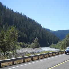
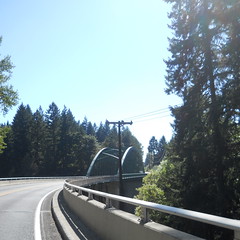
A fairly short description of my latest run up to Ripplebrook
When I left home at 9am on Saturday, the best asked when I was going to get back. I said I’d be back between 5:30 and 6, which committed me to doing the loop in <= 9 hours. A few months ago this would have been an idle boast (though I did do a barely sub-9 P-R-P in June, when I needed to get out and exhaust myself for a while) but I’ve been riding the eff out of the mlcm since the 26th of May and have developed enough horsepower so I could be moderately confident about that loop time.
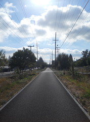
So I needed to move smartly along, but I didn’t want to blow myself up, so I put in one earphone, put the cellphone into “plays music” mode, and settled in to a nice steady pace and went sailing away. I’d made a variant of the route that started in Brooklyn, so I rode north to the start of the Springwater Trail, then rode south and east along the trail at a speed that averaged about 17mph. There were not very many people out on the trail at that time of the morning, and I suspect that part of the reason was that it was pretty cold; the weather forecast was claiming it was 54°F when I went out the door, and it certainly felt cold (it took a considerable amount of time for my body heat to overcome the chill on my lower body, which was only protected by the elements by one layer of fabric) so I didn’t really push myself very hard until I reached Boring (where Telford curves under the old Portland Traction ROW, becomes 272nd, and goes up over the shoulder of one of the many vents in the Boring Lava Field) and had to stand up and shove myself up a few hills.
The hills around Boring used to seem moderately hard to climb, but aren’t anymore, and I was able to climb them at the higher speed I’ve recently developed. And almost before I knew it I’d hit the long ramp down into the Clackamas River Valley and was descending like a bomb towards the turnoff to Judd Road.
Judd Road is still pretty steep, but, in what must be a first for me, this day it was not steep enough to drop me into my alpine gears. Nope, I just geared down to 50×21 and started winching my way up the ramp, dropping further to 50×24 about halfway up, and then going back to 50×21 as I approached the top. This was moderately exhausting, and I staggered along at 13mph for a while before I caught my breath, then went up to my normal cruising speed and I wound upgrade towards highway 211 and the lovely drop on Van Curen Road (alas, I didn’t get very much of a tuck here and only got up to about 46mph) after which I dodged over to Eagle Fern Road and did my usual high-speed run up into Estacada.
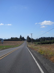
After passing through Estacada and avoiding the big 224 hill by riding on Faraday, I went back onto 224 and discovered that the nasty north wind that had slowed me down on the tail end of the 600 was, apparently, still there, and was helpfully giving me a push as I sailed up towards Ripplebrook. This was very nice, and I settled into a nice 18mph cruising speed which went on for about 10 miles, until I failed to avoid all of a shattered bottle and got a shard of glass poking through a sidewall and putting a nice little hole into the inner tub on my rear tire.
Lemme tell you, it’s fairly disruptive to my routine when I have to pull off on the narrow shoulder/bike lane and change a tube when there’s holidaymaker traffic sailing on by. It took me about 15 minutes (guessing from the number of songs that went by on the cellphone while I was doing the whole tire routine) to change the tube, reinflate the tire, and remount it on the bicycle, and by the time this was all done my routine was in disarray, and it took another 10 miles to get back into my groove, which, conveniently, was just before the last bridge and then the Big Ramp up to the ledge that Ripplebrook sits on.
So up I went. I didn’t know if I could make it all the way up this ramp in my big ring, but what the hell, might as well try it. And, you know something, it worked – I wasn’t going particularly fast up the ramp (though 8mph is approximately twice the speed I’ve climbed it in the past), but I was going up the ramp in my big ring and only went down to 50×28 for the last steep pitch.
And then at the top, a minivan pulled over, flagged me down, and asked for directions to Bagby Hot Springs. And it took about 5 minutes to give them the directions, because their english was not that good (they sounded like Russian tourists who were taking a tour of the northwest) and they’d apparently gotten turned around and were heading north instead of south. But after much “you mean Bagby Hot Springs?” “Yes, yes, hot water from the ground, that’s the place we want” I think they finally understood my directions and we headed off our separate ways.
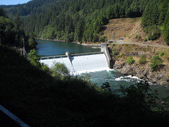
I reached Ripplebrook about 4h20 after I set out from Portland, did the control paperwork (and photography) as quickly as possible, then turned around and headed back north.
Last week the headwind caught me by surprise and stopped me dead at the head of the Ripplebrook ramp. Today I was ready for it, and was already crouching in the drops when I came out of the trees and was greeted with a blast of north wind. It slowed me briefly to about 10mph, but I put my head down and put on the gas to get onto the top of the ramp, and didn’t let up until my speedometer read a comfortable 30mph.
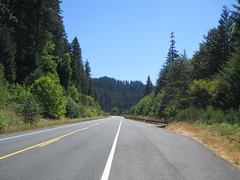
The trip back down the gorge was amusing. In some sections there would be strong headwinds and I’d be struggling to maintain 17mph, and then the road would curve into a sheltered section and my speed would like magic go up to 23-24mph up until the point where the road curved out and my speed would plunge back on down. Fortunately the wind was unable to be quite so aggressive north of Estacada because there was a lot more river valley for it to fill, so it was moving somewhat slower than it had been before.
Down 224 to Barton, then across the Clackamas River on Baker’s Ferry Road to Springwater Road, then up through Carver (where a fairly massive bridge-replacement project appears to be going on) and onto Clackamas River Road, which follows the Clackamas River all the way into Oregon City, and, now that the Jughandle Project has gotten far enough along to through-route Clackamas River Road under 213 to Washington St, no longer needs the detour up to Abernethy to avoid the construction zone.
I looped through downtown Oregon City for the Oregon City control (and to look for water, because my water bottles were basically empty. Alas, the only bubblers I found were disconnected; I had to get water at a little park along the Trolley Trail) and then north towards home. The sewer project that had closed the old Washington St bridge across the Clackamas was now finished, so I got to go back onto the bikepath-bridge-Arlington route that I’d originally set up for P-R-P (and then had to reroute around because no sooner had the route been approved than Oregon City came along and closed the path) and got to avoid the complex crossing of 99e and River Road.
When I reached the Trolley Trail, I’d been riding for 7h45. No chance of a sub-8 finish, but I only had about 12 miles to go and there was a pretty good chance I could do sub-9. I stopped at the Stringfield Family Park to refill the water bottles, then chugged away up the hill. I’d be just sailing along at a casual pace earlier on the loop, but I was moving quite a bit slower now and had to push it a lot to get my speed up to 16-17mph for these last miles. The water helped a lot; I tend to sweat all of my water away when I’m moving moderately quickly, and when I run out of water it’s like I fell off a cliff.
Up the Trolley Trail to Oak Grove, then over to River Road for the descent into Milwaukie. Up 17th into Sellwood, over to the Springwater Trail, up to the info control on Clay Street before looping around OMSI, and then back south towards Brooklyn.
I arrived back where I set off 8h38 after I started the brevet clock. Not quite a sub-8 200k, but it’s getting there.
Pictures are in the usual place; there aren’t very many of them, but after seven runs at this loop this year I’m starting to run out of things to photograph :-)
