Sellwood to Hood & Back, in (most of) one day
A couple of years ago, I did my first R300 by riding most of the Barlow 300, and got stuck with an extreme itch to revisit that route some time soon (but without the 50km ferry move from Sellwood to Sandy.) Last year I drew up an route for a R300 and did a check-ride that was not completely successful thanks to a section of tire-eating gravel road. So I went back and rearranged the loop a little bit (dropping the Buckner Creek rollercoaster in favo(u)r of going along the Clackamas River up to Barton, then climbing up Judd Road (not so bad these days as it was last year; there’s apparently enough traffic through there to flatten down the chipseal, if not the grade,) wandering along backroads into Estacada before joining OR224 for the run up to Ripplebrook, then replacing the route up NFD 5810 (steeeeep) and NFD 5820 (gravel!) with a run up NFD 58 to the foot of High Rock, then across to what I thought was a paved road dropping down to Timothy Lake, and finally (100 km further down the road) getting away from US 26 at Zigzag and taking Barlow Road, Marmot Road, and Lusted Road down to the road to Troutdale.
It was a little more climbing (~1500 feet, I thought?) but the absence of gravel should reduce the chances of flat tire hell. A few friends had expressed interest in riding it with me, but, alas, when the ride date grew nigh one of them had to work, another one had a date, and a third sensibly developed cold feet when he realized that it was going to be within spitting distance of a 200 mile loop, leaving only Ed Groth as a comrade in rando idiocy.
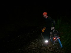
So on Saturday morning, at the somewhat more reasonable hour of ~7am, we dragged ourselves out of Marsee Baking (400 feet from my front door; when I make up a brevet route one of the important considerations is that it start close to my front door) and headed off for Barlow Pass.
River Road is currently the least painful way to efficiently go from Milwaukie to Oregon City; there’s one steepish climb at the start, but it’s only 60 meters or so, and the local DOTs have narrowed River Road by putting in two super-wide bicycle lanes, which means that you can creep up the ramp without having to worry about blocking faster and heavier traffic while you’re doing it. And then once you’re in Oregon City, it’s only a mile or so to get onto Clackamas River Drive, which is a lovely level grade that sees very little traffic and becomes rural almost immediately after ducking into the lower Clackamas River gorge.
Be aware, however, that our tax dollars are being used to completely rebuild the OR213/I205 interchange, so the DOT has put in some nice bike detour signs that direct the uncautious onto OR213 heading south, which is not a good plan.
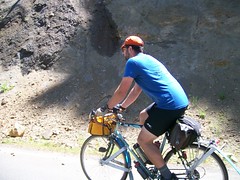
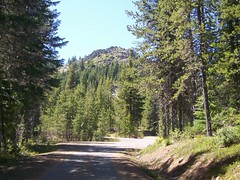
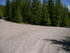
But once we worked that out and turned ourselves around (by travelling along next to the jersey barriers at the edge of a narrow traffic lane on OR213) we got out onto Clackamas River Drive and rolled on east out to Carver, up Springwater to Baker’s Ferry Road, across the Clackamas and up into Barton, then down to Amisegger Road and up onto Judd Road, where, as is traditional, I raced and was dropped by a banana slug that was out for its morning constitutional.
There is, however, a gratifyingly steep descent down off the mountain spur that Judd Road climbs up; you give up 100 meters in about a kilometer, starting with 200 meters at a 14% grade. And then you (eventually) bounce along Eagle Creek Road into Estacada, where the route deposits you right at the local Thriftway for the first (and most important; there are basically no services except for water from Estacada to Government Camp) control. We took what felt like a leisurely break here, but which was only about 15 minutes, then wandered off down OR224 towards Ripplebrook and points up.
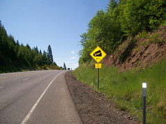
One very sad thing is that Faraday Road, which is a lovely river-level PGE service road, has been closed by landslides. This is sad not just because you lose the views, but that you have to use OR224 to get around this landslide, and OR224 goes up over a spur of the mountain to the tune of an 800 foot climb (at grades up to 9%) which is only partially made up for by the more gradual descent down the other side to river level.
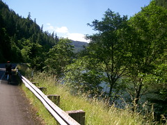
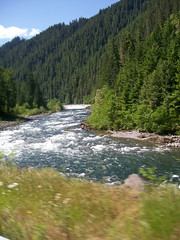
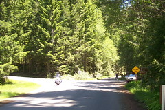
But once you’re done with this, it’s about 20 miles of river-level riding up to Ripplebrook. It’s not flat, of course – you’re riding upstream along a mountain river – but it’s not nearly as hysterically vertical as mountains can be. And the sun was out, and it was nice and warm, so it was about as good a day for just riding around™ as you can imagine. I took many pictures here as we rode up the river, despite the limitations of my horribly damaged CBC.
There is one short ramp just before Ripplebrook (where OR224 climbs away from the Clackamas River before rejoining it along NFD 46) but, as a welcome change from previous excursions, I managed to make it all of the way up without falling over dead once. (I did manage to derail the chain when I went into my alpine ring. Not sure how I did that, but it’s something that’s very easy to correct.) And at Ripplebrook there’s a nice ranger station with water spouts out behind it and cold sodapop inside. Which is just the thing for a second control, because Ripplebrook is only at 1500 feet and the climb doesn’t top out until 4500 feet.
So once again we had a leisurely stop where I got rid of some weight by finishing off a sandwich I’d bought in Estacada, then putting that weight back by filling up my water bottles, and then we started up the ramp towards High Rock.
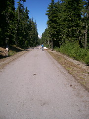
NFD 57 starts out fairly steeply – a mile or so of 5-7% grades – but then levels out and waits for the Oak Grove fork of the Clackamas River to catch up to it. But after 8 miles of this it stops being paved and becomes a gravel road for the next 7 miles up to Timothy Lake. It’s not very steeply graded (there’s only a mile stretch where the grade is steeper than 3%) but it is gravel, so it seems more prudent to just turn onto NFD 58 for the climb up to the base of High Rock for the info control I needed to place there.
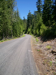
On the Barlow 300, the detour away from the gravel part of NFD57 was to dodge up NFD 58 to NFD 5810, which is paved all the way to Anvil Creek, but which then disappears for a kilometer or so and requires a hike-a-bike and fording Anvil Creek before climbing up an embankment to the other half of the road. And NFD 5810 starts out with a few miles of stompingly steep climb, but then relents and becomes fairly level up until the end of the road (NFD 5820 avoids the hikeabike section at the cost of 5+ miles of tire-eating gravel, so we weren’t going to be going there today.) But NFD 58 starts out with moderate grades (there are a couple of hundred feet of steepish grade, but then it moderates until it gets past the entrance to NFD 5810,) and then gradually begins to pitch up more steeply.
And it doesn’t pitch up continually, either. It pitches up, then moderates, then pitches up a little more, then moderates not quite so much. I spent a large chunk of time climbing here first wondering why I was starting to spin out, then (after correcting to a higher gear) wondering why it was suddenly so difficult to pedal.
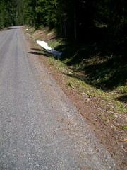
And then, as we climbed, I started to see little patches of snow in the woods along the road, and then patches of snow in the ditches along the road, and by the time we reached the site of the High Rock info control (after a kilometer of 10-14% grades) the little patches had become huge drifts tucked not too far away in the trees.
Ed parked in the shade while I set up some info questions, then we continued east on NFD 58 (NFD 58 has some odd routing around High Rock; the road actually loops around High Rock, but the two lobes of the loop pinch together on a narrow ridge just to the east of the offending rock. We headed east on the upper lobe of NFD 58.
There’d been some traffic along the road as we headed up towards High Rock, but not much. One truck passed us as we reached the control, but we then encountered it again no more than a mile to the east, and as they passed us they warned us that there was snow on the road ahead. We thanked them, but continued onwards, because, June?, and it would be nice to know if this loop was actually ridable in summertime.
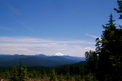
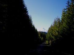
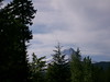
And, anyway, we had more things to occupy our mind. The views here were absolutely spectacular, and I found myself actually starting to stop the bicycle to try and get good photographs of what we saw as we rolled up the line. First, of course, there was High Rock itself (and, yes, I did stop on a 14% grade to get that picture), and then we went around a curve where the forest to the south had been clearcut and saw Mount Jefferson right there across the crest of the Cascades. And, as we continued eastwards, we started to see fragments of Mount Hood peeking through the trees whenever the road curved northish.
And we started to see some other stuff as well. Patches of snow that weren’t obligingly sitting in the ditches or the woods, but which were actually in the road. First they were small patches, but we curved into the lee of a more thickly forested section and the patches got larger and more substantial, and eventually reached a point where it was not really so much a road anymore but was instead a path travelling through the snow.
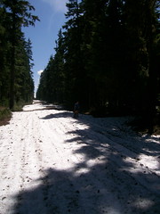
About a mile’s worth of snowy path going through the snow, actually. And it was densely packed wet snow so there wasn’t even the slightest hope of being able to ride my bicycle through it. So I shouldered the thing and cyclocrossed my way through the winter wonderland, stopping occasionally to take more pictures and laugh at the ridiculousness of the whole thing.
If the snowy part of the loop had gone on too far, it would have put a severe crimp into the plan of finishing, but the road was trending downgrade and it dropped below the snowline at ~4300 feet. So back on the bicycles and on we went towards NFD 5860, which I had foolishly thought was paved due to the state of the road closer to Timothy Lake.
I was wrong about the paving. NFD 5860 is a unsigned gravel path descending 1100 steep feet down to Timothy Lake, and it’s not very much shorter than just taking NFD 58 out to Skyline, then backtracking to Clackamas Lake. Ed and I went screaming down this path at full speed (Ed converted to 650B wheels on his rando bike, so he’s got traction to spare; the MLCM, on the other hand, is still using Nashbar Duro tires like last year, so I did more of a slither down this ramp and didn’t really get the chance to take any pictures documenting the atrocities.)
And at Timothy Lake, we were back on a once-again-paved NFD57, which we took up to NFD 42, and then back half a mile west to the Clackamas Lake Ranger Station, which is not just an info control but a water stop, which we took full advantage of during a very leisurely pause to catch our breath.
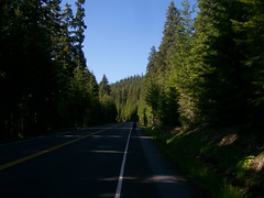
And then up again and to the east. NFD 42 takes you out to US 26, climbing most of the way, and then you give up most of that climb dropping down to NF 43, which rollers along over to the White River Valley giving occasional spectacular views of Mount Hood as well as the quieter but equally lovely ride through pine forests in the late afternoon.
And then down a steep ramp into the White River Valley, which has the last info control on the loop, and then a turn onto NFD 48, which climbs up toward Barlow Pass.
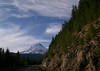
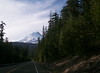
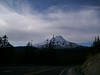
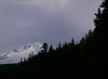
Last time (on the Barlow 300) it was dark by the time I’d reached this point of NFD 48, so the only views I had of Mount Hood were it just shining ghostly white against the night sky. It was impressive then, but ohmygod the views on this loop were so much better. Mount Hood was right there every time we rode around a spur that blocked our view, getting bigger and bigger every time it popped into view. And all this framed against the almost unnatural green forest that comes from a rainy springtime, and the huge uncluttered sky that comes with it being up on the mountain.
NFD 48 pops out onto OR 35 just east of the White River valley (which, up that far, is on a bed of layers and layers of lahars; the DOT is in the throes of building a new taller viaduct across the valley floor. presumably because they’re kind of sick of bulldozing hundreds of tons of ash and gravel off the road every spring) and OR 35 joins up with US 26 a couple of miles east of Government Camp, which we rolled into just before 8pm, and then stopped for a hour to have the dinner that our stomachs had been screaming for for the last hour and a half.
The spectacular part of the loop as pretty much over now; we left the Huckleberry Inn at ~9pm, when the sun was about to go into a terminal plummet towards the horizon, and the evening cold blast was already warming up. So, despite layering up with all of the clothes I had brought along for just this reason, I was shivering enough to make me want to pay most of my attention to the road, which in addition to the cold was in the throes of being rebuilt, which converted the formerly wide bicycle lanes into pretty much nothing at all.
So down we shot towards Zig-zag, Ed pulling a long way ahead on the initial descent but then me catching up when we dropped into a warmer layer down around 3000 feet.
The plan was that we’d ride on US 26 down to Zigzag, the hop over to the Barlow Road and take it, Marmot, and Lusted into the vicinity of Troutdale. But Ed had other plans – his GPS unit has maps that show bicycle trails as well as auto-passable roads, and he’d seen that NF 19 (a discontinued section of the Barlow Road) was still marked as accessable to bicycles from Rhododendron to Zigzag – and suggested a slight route variation that would take us off US 26 a mile or so ahead of the original plan.
Sure, why not?
It did turn out to be basically singletrack instead of a road or even a path (complete with sections where streams had washed out the path and you had to carry your bike around gravelled shooflies) but it did get through in a very bumpy (and I’m sure pretty, but it was too dark for me to verify that) way. I’m not going to put it onto the final R300, though, because not everyone is willing to toss their rando bikes onto mountain biking paths!
And then in Zigzag we finally diverged onto a paved part of the Barlow Road, and charged down towards Troutdale and Portland in the dark. I discovered that the ramps on the east side of Devil’s Backbone are steep enough so that it doesn’t help when you climb them in the dark, but the Lusted Road ramp out of the Sandy River gorge seems much less steep when you don’t have any visual cues about where you are, and the Dodge Park Blvd (ex Mount Hood Railway) ramp seems like it’s almost level when you can’t see anything.
And from Dodge Park Blvd, we dodged south through Pleasant Home to Lusted (again), then west of Lusted to Troutdale Road, and thus down into the last control at Troutdale. And after a brief stop for fud and water at the Plaid Pantry there, we rolled west towards the end of the line at, if not the most sprighty speed possible, at least as a speed that guaranteed finishing the checkride within 20 hours.
Ed split off to head home at 28th Ave, but I finished the route as mapped, arriving home at ~2:20am. The gory details of the loop are:
- 189 miles, including .5 bonus miles
- 9.7 mph brevet average
- 19h32 minutes brevet time, of which 16h was spent moving
- ~15,000 feet of climbing
- 53 pictures published out of 170 taken.
- Approximately 20 hours for rando amnesia to set in :-)
Comments
Well, I didn’t think to ask you about NFD 5860, but it was an amusing test (an 1100 foot descent on gravel on narrow tires? That’s great fun!) But there’s one large difference between NFD 5810 and NFD58, and that’s that NFD 58 actually connects through (and may even be paved) instead of having a half-mile lacuniae at Anvil Creek! (And after the flat tire extravaganza that was NFD 5820, paved is worth the additional 500 or so feet of climbing.)
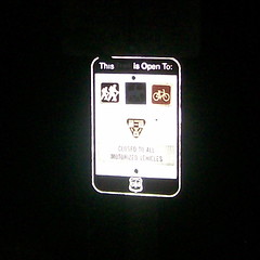
I’ll need to discuss where to put info controls with the permanents coordinator. I have half a dozen places on Judd that are infoable, but routing via Judd/Eagle Creek is not much longer than routing down 211+224, and it avoids major highways (unlike the High Rock info control, which keeps people from cutting about 15 miles out of the loop; the Clackamas Lake info control is primarily there to get riders into the vicinity of potable water, because their water bottles may be empty by that point.
Comments are closed
I’m on record as being skeptical about the surface of NFD 5860. You can’t say you weren’t warned.
And your ploy of going up 58 to High Rock to avoid the steepness of 5810 is akin to jumping in a lake to avoid a rainstorm. 58 is every bit as steep as the steep bit of 5810 by the time you get to the top, and has a lot more redundant grade.
Also, you’ll need an info control on Judd Road if you’re going to make it part of your perm route, because there’s absolutely no reason to detour up there, otherwise.