SEP (Someone Else’s Permanent)
I’d been thinking of riding a permanent today, and my friend Kevin expressed some interest in joining me, but when the day got close he said he’d rather ride something shorter so he could fit work in before the workers ride for the summer 400k (which we’re both doing on Saturday/Saturday night) and he would be happy to ride one of my hilly populaires or his new Greater Boring Area 100k (which takes some of the quiet side roads that crisscross the Boring Lava.) The Greater Boring Area 100k looked intriguing, and it had the advantage of only being 100k (which meant that we could start at the somewhat more reasonable hour of 9am) so we both gravitated to that route.
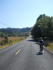
It is nice that the route takes sideroads, but the side-effect of sideroads is that you do bucketloads of climbing, much of it up fairly steep ramps. You don’t climb very high (all of the ramps top out between 100-200 meters) but the topology makes up for it.
This route starts in Brooklyn, proceeds south on 17th, then turns onto Bybee to climb over a shoulder of the Eastmoreland highlands on its way to the Springwater Trail (there’s some climbing here after 27th Ave curves left and becomes Crystal Springs Blvd, but that’s short – the descent from 37th down to the Springwater Trail (super-steep, curvy, terrible sightlines to the east) is more stressful that the climb,) and then works its way east, climbing gradually, until almost the Portland city limits, where it jumps over to Foster Road and proceeds to climb like the dickens for the next 35 miles.
Foster Road diverged from the old interurban line and started climbing more steeply on its way to Damascus, and then Tillstrom Road climbed a whole lot to get over the somewhat taller shoulder of one of the approximately 25 vents that sit just west of Boring. It then relented briefly and ran along the side of the little valley that sits between Gresham and the more urbanised parts of Damascus, but then pitched up again before depositing us on 242nd, which dropped down into the valley briefly before we had to turn onto Sunshine Valley Road, which twisted its way up to an unnamed pass and then fell down towards Boring (this road is a blast going west, because it’s steep and curvy, but generally has good sightlines, so you can spend a lot of the descent just sailing downhill at line speed. Going east is not quite so much of a blast, because it’s not such a steep descent and it’s nowhere nearly as curvy) and eventually (afer a few intermediate turns and a stop at the Boring control) deposited us onto Amisegger Road, which dropped us into the Clackamas River valley and forced us to climb up the other side.
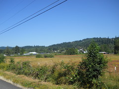
The other side started with a loop along Eaden Road, which goes to almost exactly the same place as Harding Road does, but travels through much more scenic farms and forest before we had to creep up the side of the gorge to reach Springwater Road. And then (after giving most of that elevation dropping down into Fischers Mill) we turned right (instead of going directly ahead onto Ridge Road as I usually do on my permanent that runs through this area) and wound our way up onto the Boring Lava again to get to Redland.
There’s a store in Redland, which is nice to know for my longer brevets, but it wasn’t a control for this ride. Instead we rode right on through downtown Redland (climbing all the way) and turned off onto a sideroad for a trip along to an info control placed south of Redland Road. This part of the route went up gradually for a while, then turned left onto Maplelane Road, which immediately dropped into a deep ravine, and then, oh G-d, climbed all the way out.
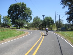
We bounced around on the top of the Lava for a few miles, then, finally, fell back down to Redland Road and proceeded on into Oregon City. But, sadly, we weren’t staying there but instead turned right and onto Forsythe Road, which went all the way back up the Lava in one big steep climb, and then sailed along the edge of the Clackamas River gorge almost all the way to Carver (dropping, I hasten to add, into a series of deep notches with steep walls that had very little earthmoving done to them to lessen the grades.)
And then we fell off the Lava again and dropped down to Carver, and the climbing was basically done for the day; 35 miles of climbing, to the tune of about 3000 feet.
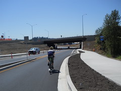
The rest of the loop was the usual uneventful southern gateway to Sellwood and Brooklyn – a quick run up Clackamas River Road (made better by the highway construction project; Highway 213 now goes over Clackamas River Road instead of there being a nasty grade crossing, so nobody needs to do the Forsythe/Apperson dance to get around the traffic and stop signs), then up River Road to the Trolley Trail, then back onto River Road, bike paths, and 17th Ave all the way into Brooklyn and the end of the loop.
5h36 (20 of which was a lengthy stop at a Taco Bell for a little something), and I’m happy to have done it that quickly. I’m obviously going to have to step up my “stupidly climby/stupidly steep” game to build a permanent that’s more horrifying than this one.
pictures are on flickr, of course.