There and back again (part 1)
A couple of weeks ago my mother surprised the family by inviting us all down to Newport for a week at one of the rental cabins that their favorite motel has available. It was short notice, but not so short that we had to just drop everything and head out the door immediately.
No, we had time to prepare, and my preparations included deciding that I would not ride down in a car, but would just take the midlifecrisismobile there and back. So I sat down and built up a route that would get me down there and back with a minimum of fuss, muss, and bother. And then I submitted it as a permanent so the next time we ride down to Newport I’ll be able to snarfle up some RUSA miles in the process.
So last Sunday, after a couple of days of vapourlock trying to schedule a bunch of things (I was planning to preride the summer 300. Nope. I wanted to ride a 200. Nope. But I did manage to pack the handlebar bag before Sunday morning at least) I woke up at 4:30am, ate a little breakfast, and managed to get out onto the road by ~5:20.
At 5 in the morning, there’s basically no traffic on the road, so I was able to cross over to 99W and head south without any fuss, muss, or bother (my now-traditional route up the hill to 99W – LaView->Corbett->Custer – is never congested, but 99W gets fairly busy when people start to wake up) and rode the first 30 or so miles on 99W in fairly short order. 223 was also fairly uneventful, except that as I headed south out of Dayton the promised N/NW wind not only didn’t materialize, but was replaced by a slight, but constant and noticable S/SE wind, just like what happened the last time I rode this route segment. But at least the sun was out, so it was a warm crawl south against the wind through the valley until I reached Perrydale, where, after the obligatory photos of the traction engine I rode into the lee of the hills that separate Perrydale from Dallas and got a hour or so’s worth of riding without a headwind. (Climbing, yes, but no headwind.)
Dallas is basically the end of T-Mobile cellphone territory, so I stopped there for a little snack and a phonecall home, then continued onto Kings Valley Road for the long hilly run out to Blodgett, ice cream, and the turn west onto the Blodgett-Eddyville Highway (aka OR 180, aka Summit Highway.) As is usual, this took longer than I wanted, and included a stretch where the balls of my feet started cramping up on me (I’ve been experimenting with clipless pedals, and started off by trying Eggbeaters, which have not been working out very well) and I had to stop to go ouchouchouchouchouch!!! until they stopped hurting before continuing south and which finished with a 4-mile race against my rapidly emptying water bottles on the climb up to Blodgett on highway 20.
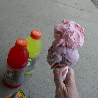
And what’s in Blodgett? The Blodgett Country Store. And what’s in the Blodgett Country Store? Nasty sports drink, of course (I’ve been carrying Nuun nasty sports drink effervescent tablets, but left them on the kitchen counter at home) and real ice cream that I can sit in front of the store and take my own sweet time eating before getting back on my bicycle and heading west.
So that’s what I got, and it was very good. And after a considerable period of time I jumped back onto the bicycle, carefully crossed highway 20 (insanely busy, even at 1:30pm on a Sunday) and proceeded (against, sigh, a headwind) towards Summit and points west.
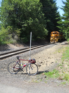
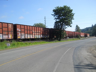
But after riding west for a little while, I started to hear distant mechanical noises like a tractor trailer working its way up a ramp. I didn’t pay much attention at first, but then I started to hear a distant quiet squeaky metal chorus that sounded an awful lot like a train. I stopped, listened carefully for a second, then turned around and sprinted back east for a section of line where I could get off the road and get a picture of what was indeed a train.
Score :-) ‘vantage bicycle commuting!
I got pictures of each locomotive on the train (5 locomotives and one slug), then got back on the bicycle and headed west while the rest of the train rolled eastwards past me. And soon thereafter I reached Summit, then plunged down into the upper Yaquina River valley to Nashville, where I turned right, crossed the railroad again, and headed towards Siletz on Logsden Road.
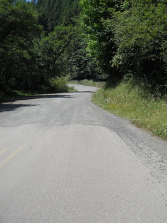
I thought that part of the reason for this annoying two-mile stretch of gravel on Logsden Road was to keep the tourists off it and on the main drag across to the coast, and it was certainly quiet when I came across it at 7 in the morning on the Oregon Coast 600. But it wasn’t quiet last Sunday; while I was walking up the east side of the pass (annoyingly, the loose gravel on that side appears to be a permanent feature, and the combination of it, the Ruffy Tuffy tires I’m using now, and the washboarding on the hairpins meant that when I reached a hairpin the rear wheel would break free and start sliding sideways, which is a fairly disconcerting feeling. My patience for this lasted about 1/3rd of the way up the pass before I dismounted and walked the midlifecrisismobile the rest of the way to the top) a steady stream of pickup trucks, SUVs, family sedans, and regular automobiles hauling camping trailers went past me in both directions. Maybe 30 vehicles in the 10-15 minutes it took me to push the MLCM up half a mile of mountain road, which was pretty amazingly busy for a one lane gravel mountain road. I can’t imagine just how busy this road would be if it was paved the whole distance, but it would most likely be just as bad as highway 20, but with many more accidents.
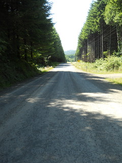
At the top of pass the gravel becomes more hardpacked for the descent down the west side, so I was able to go skittering on down to the end of the gravel section without cramping my arms from too much braking. And then it was merely a matter of going downhill for 17 miles to Siletz (or, as I soon discovered, 10 miles down to the Logsden Store, because my nasty sports drink supplies were running fairly low) which should have been no problem, except that for some bizarre reason it seemed to take forever (the last time I went over this section was from west to east on the Oregon Coast 600, and I was riding with other people, so I wrote that off as not noticing how much time it took because I was too busy chatting, but then when I returned on Friday I rode the same section by myself and it didn’t seem to take all that long) and I was ready to be done by the time I reached Siletz.
But, no, Siletz wasn’t the end of the line. There was still another 22 miles to go; 7 miles on highway 219 south to Toledo, a couple of miles through Toledo, and then 13 miles on Yaquina Bay Blvd from Toledo into Newport. So turn left at the end of Logsden Road, climb out of the Siletz River watershed, then descend back into the Yaquina River watershed again, ending up at Yaquina Bay Road for the last run out into Newport.
The Lincoln County bikemaps, after making dire warnings about highway 20 being completely and absolutely unsafe for any vehicles under about 20,000 gross weight, point to Yaquina Bay Road as a nice bike route because it’s low traffic and has nice bike lanes on it. You’d never guess this from the Toledo end of the road, though; it starts out as a narrow shoulderless road that first runs a little ways along the stub of the old line down to Newport, then pitches steeply uphill along a steep landslidy hillside.
Fortunately, this is a fairly deceptive start; you do climb a ways to a saddle (where a gravel sideroad – Criteser Loop – diverges and runs steeply uphill; I didn’t bother to check it out, because I’d already ridden 128 miles and I wanted to get back into T-Mobile cellphone territory) and then plunge back down to water level, at which point the road goes around the bend and transforms into the promised wide quiet road with good bike lanes.
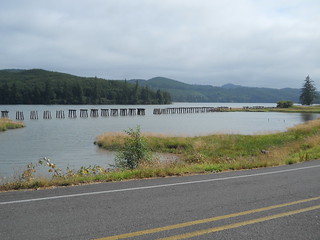
And a headwind, alas (I rode this road back to Toledo a couple of times during the week and was given stiff headwinds both directions both times I rode it) but not so much of a headwind that it would discourage me, because Yaquina Bay Road runs more-or-less along the old railroad line from Toledo to Newport, except in a couple of places where the road swerved inland to avoid a little bay, but the railroad used to go directly across. The railroad is long-gone, but a lot of the old trestlework is not, and it gave me another thing to sightsee as I rolled west towards the ultimate control.
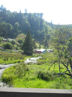
It had been a clear and warm sunny day for the entire ride up until now, but as I approached Newport I rode into the marine layer, which was manifesting itself as a large cloudy 50-degree mass blanketing Newport. So I got colder and colder the last few miles into town, but not so quickly that I wanted to stop and relayer myself. And then, in Newport, Yaquina Bay Road became Bay Blvd, which goes right along the fishing/tourist part of town (so I had to slow way down to navigate around tourists on foot and in cars, as well as local cannery trucks working their way down to the fish processing plants and back) and then a turn up and over the point of land that Newport is founded on before dropping on second street down to the oceanshore and the cottage we had rented for the week.
And then I was done, 11h53, 142 miles, and 9300 feet after leaving home in the morning. A good trip, punctuated by longish stops for trainspotting, food, and doing field editing of the cuesheet to put in cues that bikeroutetoaster had left out. My cloud chamber jersey did the trick for everything other than the last 3 miles (putting armwarmers on would have kept me warm, but at this point I didn’t want to stop for anything aside from my “here I am in cellphone territory, are you here?” (yes; my family got into town about half an hour before I did) call, and I never got particularly tired while I was on the line.
A few things didn’t work. The replacement lug for my front rack had a fork crown mounting point brazed to it, but, alas, it’s a piece of stainless steel tubing and I don’t yet have enough experience brazing stainless steel, as was proven by the mounting point snapping off somewhere along the Kings Valley Highway. Fortunately the rack wraps around the front brake, so when the fork crown mount snapped loose the rack merely slid forward 1/8th inch and was stopped by the brake caliper. I ziptied it back into position for the return and will clean and rebraze the joint sometime this week, and this time I may reinforce the crown mount by running a small bolt through the tubing to hold the mount until I can flow enough bronze into the joint to hold it for good.
The second thing that didn’t work were my Eggbeater petals. They’d started to squeak every pedal stroke, and I discovered that the reason they were squeaking was that the retaining clips were bent concave and were sliding back and forth on the pedal spindles. Grr. Not even 3000 miles and the pedals are trashed; time to take them back to REI and purchase another type of pedal.
The full photoset of my trip down is on flickr.
Comments
Comments are closed
One of the things I found was hurting my feet wasn’t the pedals, as such, but that the stiff plastic part of the cycling shoe sole was giving way and becoming bendy. (In my case, checking the bottom of the insole for the marks of the heads of the screws that hold the cleat on was the give-away…)
If that’s it, and the specific ball-of-the-foot pain makes me think it might be, getting some new, and presumably stiffer, shoes might be in order.
When the cranks show up, I’ll be trying some A530s; hopefully these will be less fangy than the platform side of the M324s. (which are amazingly robust, I’ll give them that. But the steel wrap-around platform part has teeth like a wood rasp, and I keep getting the back of my leg with it any time I have to lug the bike up stairs.)