Better late than never
A few months ago I’d volunteered to man the Vernonia control for the Forest Grove-Vernonia populaire and was planning on doing a preride earlier in the month along with the other volunteers. Unfortunately, things went crash in the day and all of my plans for the month were thrown into disarray.
After the crash, I was assuming that I would be off the bike for the forseeable future, so I changed my volunteering to staff the start and finish of the loop so that someone who could ride a bicycle could go out to Vernonia and man the control there. And finally, a few days before the event, I got mail saying that someone else was going to volunteer for the start and all I needed to do was to volunteer to staff the closing control at Forest Grove.
Sure, and that opened a window of opportunity. You see, the sad thing about type 3 shoulder separations is that they don’t heal, ever, and the only thing that surgery could do was to tie down my clavicle so it wouldn’t just float around in my shoulder causing muscle trauma every time I moved that arm for the rest of my life. And that surgery immobilizes that arm and shoulder for approximately 4 months. I could have had it done right then (and written off the 2012 rando season for certain) and then maybe the CC ligaments would be able to stitch themselves back together, or I could have it done later and use zombie ligaments instead of my own.
And the surgeon said that if I didn’t lift things above my head as a matter of course I would probably be just as well off without the surgery.
Well, perhaps, but no I’m not going to want to have that g-dd-mned clavicle floating around poking up in the air for the rest of my life. But I’d gotten back onto the bicycle 5 days after the crash and had ridden a couple of longish city loops without having my arm fall off, so I was becoming moderately certain that I could survive the summer then turn around and be immobilized for the fall (in the worst case I could resell the mlcm and project bike and get enough money to buy a tadpole to get around for those 4 months, and in the best case once the school session is over I’ll be able to actually have long stretches of the day where I can actually work without being interrupted by having to wake up early, deliver bears to school, retrieve bears from school, or do any of the other million and a half things that chop up my day to the point where I can’t do anything.) Over the next week and a half I’d done a bunch of riding, either short fast loops (without standing or cranking up steep hills, because both of those involve pulling with my arms and that hurt like mad) or stupidly long rando rides (not quite as successful, because my body shifted a lot of the load to my left side, which meant that after a couple of hundred km my left leg would become one huge painful cramp if I went up any sort of ramp in anything other than my dump gear. I took a hour or so longer than I should have taken on that particular loop because of what I was doing to prevent cramping on climbs, and then another 30 minutes longer because near the end of the loop I was just so disgusted with it that I just stopped at a gas station and slowly drank a very large gas station hot chocolate instead of just htfu'ing and wading directly into French Prairie.)
But I was capable of doing long rides, and I had about 90% of the flexibility and 60% of the strength back into that arm when I discovered that I only needed to man the closing control. “You could alway sleep in and come out at noon?” was what the mail said, but I had an even better idea, and that was to wake up at 4am, take a trolley out to Hillsboro, then ride to Forest Grove, get a receipt, and do an absolutely last minute preride which, if I was very fast that day, would get me back to Forest Grove before the actual ride started.
So that’s what I did. Not the “get me back to Forest Grove before the actual ride started” – my climbing has gone back to being as super-sucky as it was last winter – but the preiding part.
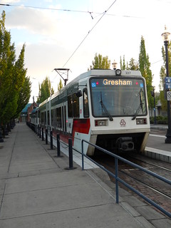
The weather forecast called for a chance of showers/thunderstorms during the day, and it was drizzling a bit when I woke up at 4:05am and pottered around getting a bowl of cereal and getting dressed. So the thoughts I had of just riding directly out to Forest Grove were put aside and I instead rode downtown and caught the first train west to Hillsboro.
It was dark, drizzly, and rainy when I got on the train, but somewhere west of Beaverton Central we rolled out from under the edge of the low-lying rainclouds and into a partially cloudy day with no serious cloud-cover except for the bank of clouds over Tualatin Mountain to the east, and dribs and drabs of cloudcover over the Coast Range to the west. After exiting the train in Hillsboro, I made good time out to Forest Grove, arriving at the Grand Lodge at ~6:30, but then I stepped nextdoor to the local McDonalds to get a cup of coffee and a receipt, and that became a cup of coffee, a receipt, a egg muffin, and the pause that refreshes, so I didn’t start my ride until 6:55.
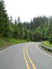
And then westward ho! through Forest Grove, plodding along at 18-20mph towards Gales Creek Road (and only missing one cue; McDonalds coffee is fine, but only one tiny cup is not enough to completely wake me up) and then sailing northwest towards highway 6 and my morning appointment with the Coast Range. Gales Creek Road trends generally upwards, but it doesn’t seem to be trending nearly as much upwards these days as it used to go in the past, and highway 6 works much the same way. I didn’t maintain 20mph for a good section of highway 6, but wound down to something over 17mph, because I’d come into this loop with a collection of mental baggage that needed sorting and could better sort it out if I wasn’t puffing along at my top speed at the same time.
And then Timber Road, which showed up about half a mile before the cuesheet said it did. Hmm, that’s not very good; I knew where I’d started, and I only added about 600 feet when I missed a turn on Gales Creek Road in Forest Grove proper, so I started to keep a close track of the milage in case I had to hunt for the info control locations along course of the loop.
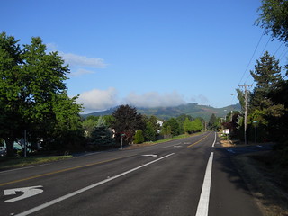
When I turned onto Timber Road, it was bright and sunny, but as I progressed at speed towards the hairpin and climb up the side of the mountain I proceeded under the edge of a layer of clouds which hovered above me for the next 30 miles or so. And then I reached the hairpin, and my thoughts became wonderfully concentrated on just climbing the hill, which, unlike Gales Creek Road and Highway 6, remained just as steep as it had been in previous years. I’d hit the bottom of the hairpin at a brevet average speed of 16mph, but by the time I crested the top of the hill it was down to, um, 13mph.
(It’s probably not very steep if you’re in shape, but I have the lung capacity of a slug, so once I burn off whatever oxygen was stockpiled into my bloodstream my climbing rate drops precipitiously.)
At the top of the ramp the old SP/POTB railway grade runs alongside the road for a while. It was washed out closer to the coast about a decade ago, so it only sees the occasional inspection train, and the rails are thickly coated with fresh red rust. And then the railway line and the road diverge, with the line curving right around a small ridge and the road climbing up to the summit of the ridge, then plunging down the other side to a hairpin (with a railroad crossing) in the little town of Timber.
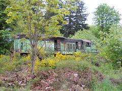
The end of the usable line is marked by the carcass of POTB 6164, which has been sitting there since the POTB decided to abandon the railroad and lease the track along Tillamook Bay to a tourist railroad. The first couple of times I rode through here the 6164 still looked in acceptable shape, but the coastal Oregon weather is taking a cruel toll on the thing, and soon it will be worth nothing except as scrap metal. So I had to stop and take a picture before I continued along. And the down to the Nehalem River, up the other side (there is apparently a ranch with bison here, but I did not see any lifestock except for a pack of farm dogs that ran happily along their side of the fence barking enthusiastically at me) and across to the highway 26 crossing.
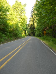
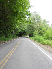
After highway 26, Timber Road runs basically downhill to the junction with Highway 47. There are a couple of climbs, but they’re only a couple of hundred feet and if you’re in shape you could make quick work of them. I’m not, but I was able to make quick enough work of them to not reduce my brevet average through here, and in less time than it seemed (Timber Road is just running along the Nehalem, and it seems to go on a long time. Not Peoria Road long, but still long) I was dumped out onto the highway for a quick jump up to Vernonia and a little brevet average eating pause at the Black Bear Coffee Company (I rolled into the place with my brevet average up to 14.3, I rolled out with it down to 12.9 :-)
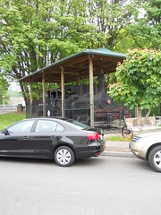
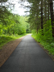
And then, after following the cuesheet out to the Shay, I turned back onto the Banks-Vernonia Trail to get myself back into Forest Grove before the fast boys overran me. It’s an old railroad grade, so it’s a fairly gradual climb (except for the crossing of Highway 47 at Tophill; the old trestle burned, so the state constructed a steep shoofly down to the highway, and a second steep shoofly up to the other half of the trail on the other side) and even if you’re watching for hazards and cuesheet distances (the half-mile glitch in the cuesheet had resolved itself earlier, but I was still unsure about the distances) you can make really good time up the ramp to Tophill. And then it’s 12 miles down to Banks, and ~8 miles back into Forest Grove.
Normally I’d just coast down to the bottom of the hill, but I’d burned enough time in Vernonia that if I’d done that I probably would not have made it back in in <5 hours (if I was not wounded, I’d be pushing for <4 hours, because there’s a 700 coming up in a couple of weeks and if I ride it I have to be moving fast enough to get the eff off the Coast Range before nightfall on Saturday night ) so I ambled downhill at a lazy 20mph, only checking my forward progress to avoid clots of early-morning walkers and the horrid approaches to a couple of trestles where the pavement on either side of them is sinking.
Before I reached the bottom of the hill the clouds had started to burn off, so I took the opportunity to delayer before jumping back onto the public roads for the last leg into Forest Grove. There’s not much to be said about that leg; it’s a bunch of secondary farm roads through villages and farmlands, with only a couple of miles on primary highways, and I just chugged along until I arrived back into Forest Grove at 11:52am for a pathetically slow 4h57 loop time.
But it was still a lovely loop. I’d worked through the mental baggage before I got to Vernonia, so I spent the return leg just enjoying being out on a bicycle by myself (it’s a lot more enjoyable riding by myself when I plan it than when I’ve gotten dropped and have to either DNF or finish the loop by myself) and spent the rest of the afternoon collecting brevet cards from the people who started the ride three hours after I did.
And then I rode back into town with my friend Kevin, who had suggested a scenic detour up Pumpkin Ridge Road (Pumpkin Ridge Road to Smoke Ranch Road to Otto Miller/Dixie Mountain to Rocky Point/Skyline) but who had managed to forget that it’s about 55 miles from Forest Grove to Portland via this route. A lovely loop, particularly the gravel parts (though my current gearing (11-28 cassette, 50/34 chainwheels) is not well suited to steep gravel ramps; there were two ramps that when I stood to crank my way up my rear wheel would start spinning and fishtailing, so I stopped and walked to the top. If I had a -32 or -34 cassette (or a biopace compact double, but, alas,there is no such thing as a 34t 110bcd biopace chainwheel) I could probably smooth out my power output enough to not fishtail, but the last thing I wanted to do on Saturday was to crash and remangle my shoulder up on top of a gravel logging road, so I walked.
When we got close to Skyline, I noticed that the gravel was getting wet, and there was a considerable amount of wet on Skyline proper. We were running late by now, so we ducked down Logie Trail to get to highway 30, and it became obvious that we had missed a hell of a storm when we were out on the west side; Logie Trail was overflowing with water, and there were many small landslides edging their way onto the downhill lane on that scary rutted potholed ramp. Kevin shot ahead, but I crept down so slowly that he was worried that I’d crashed by the time I finally emerged into view at the bottom of the hill. But we made up a lot of this time on Highway 30 – that’s a fast road, and once I was on a gently rolling road I could stomp on the gas and skitter down the road like a cockroach with roller skates and a jetpack.
We arrived back in Portland before 10pm, having ridden somewhere over 200k during the course of the day (but not at brevet speeds, thanks to the long gap at Forest Grove in the middle of the day.)
I took some pictures, but not as many as I wanted (I took no pictures of the return to Portland via Pumpkin Ridge Road, alas) and they’re on flickr. And I did prove to myselfthat I can still climb good distances even with a messed up shoulder (Pumpkin Ridge, et al, is about 3000 feet of climbing over 25 miles, and 15 miles of that is on gravel or dirt) so the 700 actually looks like it might be doable by myself (assuming I don’t miss it; if I wake up at 4am and get on the road by 5am, I’ll get out to Newberg no later than 7:30, which is still before when opening control closes. I’ll ride a climby 200 or 300 next weekend to see how that works first; if it doesn’t, I’ll just finalize my Portland-Bend 600 and try to submit that as a permanent to ride later in the summer.)
