A long nights journey into day (Flèche NW 2011)
I’m riding a lot this spring. I’ve got the mlcm knocked into a nice comfortable shape, I’ve gotten it racked and bagged to my satisfaction, it’s well-lit, and I’ve got the handlebars into a shape where I can ride them for hundreds of miles barehanded without any unhappiness. So there’s not much (aside from the rain, and that doesn’t seem to be enough to drive any sense into me. Cold still drives me away from riding, but that’s mainly a feature of not having found appropriately windproof shoes and/or shoe covers) to keep me from riding.
A few weeks ago, I ran into my friend Ed when he was on his way home from work, and as we wandered around chatting about various things he mentioned that Flèche NW was coming up and was I planning to ride in it? I said I’d like to, but I hadn’t planned anything nor did I have a team, so I’d have to try to graft myself parasitically onto someone else’s team. One thing led to another, and almost before I knew it I’d been asked to be a member of Bill A’s team (Bill, Ed, Theo R, Asta C – all faster than me, but not by very much these days) for an almost-direct run up to Olympia on Friday (the 29th of April) afternoon.
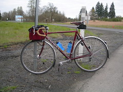
So on Friday, after a day starting at 6:30 (I wake up early so I can get tea into me before getting the bears awake, dressed, and off to school) I baked half a dozen potatoes, packed half a dozen hard boiled eggs (we had 36 easter eggs, and I’m doing my part to make sure they don’t go to waste) into an egg carton, loaded all this plus clothing, camera, alarm clock, Amtrak tickets (I needed to get back from Olympia, and the bike did too) and some science diet into my rando bag, showered, remembered that I was going to deliver a mapcase to Ed, loaded that, remembered that I’d forgotten to load water bottles, loaded them, and rolled out the door at 3:45pm for a scheduled 4pm arrival at Bill’s house (which conveniently was the start of the flèche, but we wanted a hour or so to compare notes and have a little snack before heading north(ish.))
The route out there is pretty simple; it’s the start of the one I use whenever I ride out to Forest Grove for a brevet. I ride down to Tacoma, across the Sellwood bridge (in traffic – there is no bike lane, so you can be guaranteed that I’ll be in the middle of the traffic lane as I zip across the span), dodge north to Taylor’s Ferry, zig onto Laview, wind my way up to Barbur, then ride the Red Electric (aka Bertha + the Beaverton-Hillsdale Highway) out to Beaverton. I arrived there at 4:30, just as Asta arrived (she’d taken the trolley out to Beaverton, but got jammed up in traffic lights; Ed and Theo were already there sensibly taking naps) and settled down for the promised snack and pre-ride planning.
We didn’t get out the door at 5pm; it was closer to 5:20 by the time we hopped on our bicycles and headed south for the Oregon Electric (the Fanno Creek trail, then Multnomah Blvd) for the trip out to Portland Traction’s Bellrose/Gresham line (the Springwater Trail.) There’s not much to be said about this loop; the Fanno Creek trail was put in long enough after the Oregon Electric abandoned their branch from Portland to Beaverton so that the ROW has been gnawed upon by property developments, and thus the path lunges erratically from one side of the ROW to the other instead of sailing stately forward like it does on (most of the) Springwater Trail, and the streets in SW Portland are still a shrine to the Flying Spaghetti Monster. The descent through Riverview Cemetery is awfully nice, as usual, and the cemetery ownership has reshaped the speed bump at the throat of the road so that it’s a little less spectacularly jarring than it was when it was first put in.
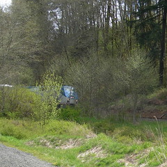
Everyone else spent most of this part of the trip zooming ahead enthusiastically. I, however, stayed at the back and took the opportunity to take some pictures, because even though it was sunny then it was still late in the afternoon, and I was unsure about how the CBC would handle nighttime photography.
After a stop at the Bell Station convenience store (the first control; the Springwater Trail is not overly crowded with stores and if there wasn’t a control there you could short-circuit the loop by half a mile by simply going across the Sellwood Bridge and cutting north to Woodstock) we proceeded north along the i205 path, across the i205 bridge over the Columbia (a nasty crossing as usual; loud, windy, and the path is littered with cracks and debris,) then northish and eastish to the second control in rural Camas (a convenience store where Brunner road turns south and is renamed into one of the millions of numbered streets,avenues,lanes,and whatnots that litter the Vancouver submopolitan area) where night fell with a resounding clank and rendered my camera absolutely useless for the rest of the night.
And then, in the dark, we waded north. Through Battleground, stopping at a safeway for a late evening control and snacks, then east along the Lewis River into Yacolt, arriving at the strike of midnight (where we had to sign our own brevet cards, because nothing is open in Yacolt at 00:00 on a Friday night), then piling on all of our cold-weather gear, turning back west and climbing slowly up the hills that stand east of the Columbia gorge here.
We did a lot of leapfrogging here. Theo spent a goodly portion of this part of the ride up in front of everyone else, and the rest of us drifted back and forth within a ~1 mile window of him. We were all gathered together fairly closely (after a series of short upanddowns that I tried my best to zip up at top speed – I’m fairly fast at short climbs where I can burn short-term energy) when we reached the top of the gorge, but I fell quite a way back during the screaming (and cold) descent down to Woodland where we had yet another control before going back on the road and encountering the first unhappy surprise of the night:
For most of the way between Portland and Olympia, you can travel along secondary roads that hug the river valley and don’t climb steep ramps just because they’re there. True, many bicyclists will cheerfully diverge up to the steep roads for the fun of it, but if you don’t want to climb you can get away without climbing. Except in one place. Just north of Woodland the Old Pacific Highway is absorbed into I5, and if you’re on a bike, you’ve got to ride Green Mountain Road, which has this name because it goes 750 feet or so up the steep side of Green Mountain in one swoop.
Theo hit this ramp and teleported to the top almost too fast to see. Asta followed Theo at almost the same speed, and I put my head down, stomped on the gas, and tried to keep her taillights in sight.
I didn’t lose sight of her taillights (which were at that point looking like they were floating in space 100 feet above where I wished the road would be if it was sanely graded) until I was about 600 feet up from the valley, which is something of an accomplishment. Even more of an accomplishment is that I never got out of breath, and I know this because I was making up imaginative commentary involving sex and chainsaws for much of the increasingly slow creep up the ramp.
When I reached the top of the ramp, Asta was there, but not Theo (he’d dropped down the other side of Green Mountain Road and we regrouped with him there) and the two of us waited for Ed and Bill to arrive before plunging back down into the valley.
I thought that Green Mountain was the last surprise, so I was in pretty good spirits as we wound our way along the valley to Longview. It was about 4:30, and I was starting to feel a little tired, but I knew that sunrise was coming and my tiredness subsided when I started to see the dawn light appearing in the patches of sky between the clouds as we passed through Pleasant Hill, then turned east and crossed over the highway on (Weyerhauser) Headquarters Road.
It’s about a 1000 foot climb up to the top of the bluffs here, but Headquarters Road isn’t that steep (4-5% grade, maybe?) so you’d think that it would be, if not fairly easy, at least not terribly hard. Well, no. It’s 4-5%, but it appears to be evenly graded, so it’s 4-5% all the way up the ramp; Theo, Asta, and I had stopped at the foot of the grade to wait for Bill and Ed, who came screaming by at top speed to make a run at the ramp, and then they (Theo and Asta) redshifted away, and I pretty rapidly ran out of steam and got to watch, as I rolled down to a sustainable climbing gear, the whole lot of them (for it was now dawn, and I could see more of the damned road than I ever wanted to see) advance steadily ahead until they disappeared around a corner never to be seen again (until I reached Silver Lake Road; Theo had run ahead of everybody else and was waiting for them. He congratulated me for dropping them [sfx: high pitched hysterical laughter] until I told him I’d not seen anyone on the way up. It turns out that there’s a sideroad called the Davis Spur that connects Headquarters to Silver Lake Road, and Asta, Ed, and Bill had taken advantage of that instead of the (not quite correct in some places) cuesheet. But neither Theo and I knew this, so we waited around for 10 minutes, then decided to head on into Toutle in the hopes we’d find them at the next control. Imagine our delight when we passed the lower terminus of Davis Spur) until the control at Toutle.
So Theo and I stomped on the gas and went plunging down Silver Lake Road. Theo has a working cellphone, as does Asta, and we were about a quarter of the way down the road when his cellphone got a signal and a voicemail from Asta asking where we were. He called back and left a voicemail asking where they were, and then he got an actual phone call saying that they were at the Toutle convenience store, which by happy coincidence is where we were going.
I was quite hungry by this time. Climbing Headquarters Road took a lot of energy, and I certainly didn’t want to stop to unwrap a potato or egg, so I kept myself running by eating science diet (Clif shot bloks with caffeine, Clif shot goo with caffeine) which may be enough to keep me from collapsing in a sobbing heap by the side of the road but isn’t enough to keep me from wanting to collapse in a sobbing heap by the side of the road. But instead of collapsing in a heap Theo and I spent the 10 miles from Headquarters to Toutle moving as quickly as we could, speeding up as we got closer to our destination, where I had the best horrible convenience store sandwich and hot chocolate I’ve ever had in my life.
The sandwich was actually pretty good. It was certainly calorific enough, because about 30 minutes after I ate it (we stuck around the store for a while after eating, because we weren’t sure if we’d actually finish the flèche in time and were wondering if we should instead continue at a more leisurely pace and decide whether to actually finish at the 22 hour control. I thought we were on time to finish, as did Theo, so we put off any decisions until later) just about the time we’d crested the first small hill on WA-505 (we’d ridden east on WA-504 to the junction with WA-505) I all of a sudden had energy to burn, so when Theo and Asta split off from the rest of the group on a hill I downshifted, spun myself up to 100orso rpm, then upshifted and shot ahead to catch up with them.
But when I reached them I was still accelerating. Uphill. And I rapidly dropped everyone and ended up sailing north(ish)by myself all the way up to Toledo and the next turn onto Jackson Highway, where I ground to a stop, ate the last bits of the sandwich, took a few pictures, and otherwise waited around for something on the order of 10 minutes before they caught up to me.
When I reached Jackson Highway, I’d gotten my trip average speed up to ~10mph, and it had only dropped to 9.8 by the time everyone else reached me. This was comfortably enough to complete the ride; we needed 9.6mph to make up for our late start and this gave us about 25 minutes of breathing room. So we were in pretty good spirits now; it was daytime, the sun was coming out, and the last of the sustained nasty climbs were over; we pacelined down Jackson Highway to Tucker Road, pacelined down Tucker Road to the tiny community (with a convenience store) of Ethel, and then after getting our brevet cards signed we went back to Jackson Highway and headed on towards Centralia and the north.
The section of the trip between Ethel and Tenino was fairly uneventful. Chehalis had a “WTF? WTF-F?!?” moment when the cuesheet pushed us off Jackson Highway onto Washington Ave, which sat at the other side of a 40 foot ramp that must have been 25% at the least, and which deposited us back onto Jackson Highway (which had changed its name going through Chehalis – between Chehalis and Centralia it’s known as Kresky Ave) at the other end of town, and we also had a moment of cuesheet confusion in Centralia because Pearl Street (aka WA-507) was two-way NORTH of our turn, but one-way SOUTH of our turn, and we read the sign and though it meant one-way everywhere.
WA-507 parallels the BN/SF mainline north of Centralia, so I had to stop abruptly to take pictures about a mile north of town when a southbound Coast Starlight (with a Cascades-painted F69 as the second Eng!) shot by, and then I had to take more pictures when a northbound freight thundered by a couple of minutes later. Fortunately everyone else had stopped for a bathroom break so I didn’t have to bolt to catch up here.
In Tenino, we switched over to a rail-trail built over an abandoned BN branchline. But before we got there we were toodling along Crowder Ave (Asta, Ed, and I in front, Theo and Bill in back) when Theo decided he’d make a run for it and shot by us at 22-23 mph.
I watched him go by and did nothing. Ed watched him go by and did nothing. Asta watched him go by and took off like a rocket.
Oh, what the hell. Shift down, spin up, shift up, and I’m off to the races. First catch up to Asta, then dodge around her, spin up some more, and catch up to Theo, who responded to my move by also shifting up and accelerating away. Or trying to accelerate away; I matched his acceleration and we both went screaming down the road at 25(26?) mph until Crowder Road turned sharply left, then deposited us into the town of Tenino, where we had to stop and wait for Asta, Bill, and Ed to catch up.
And then Ed got a flat. So while we were changing it (Ed changed the flat, Theo patched it, I flattened out the old tire, rolled it up, and stuffed it into a protective plastic bag) Bill decided to ride on ahead under the not unreasonable assumption that we’d catch up.
After the tire was fixed, I jokingly said to Theo that we’d need to time-trial to keep up. I should have kept my mouth shut, because he was off like a shot and it didn’t take much more than a mile and a quarter before I had to give up the race. But then Asta and Ed (who had been following along in my slipstream) shot around me and continued the chase, but at a somewhat more relaxed speed (19mph instead of the insanely fast at this point of the day 20mph) which I could sustain, particularly when I was in someone else’s slipstream.
And soon we caught up to Bill and Theo, and were looking at getting into the 22 hour control with a hour of spare time, when suddenly we were surprised by the dreaded™ secret control:
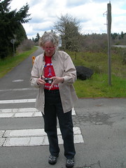

Carol Nussbaum and Amy Piper (both, not surprisingly, SIR members. This flèche is a SIR joint after all) were waiting at a grade crossing to sign our brevet cards and offer us coffee, chocolate coated coffee beans, and other equally healthy fare. We stopped, chatted, had pictures taken, and otherwise burned off time until we finally headed off, now with only about 35 minutes of projected time at the 22 hour control in Yelm.
Which we got to, had a little snack, then headed out at pretty much exactly 3pm for the 30km in to Olympia. We sailed out of Yelm, then down the gradual slopes of the Cascades into the outskirts of Olympia, and then into town where we started to look for the “Woodland Trail” (another abandoned BN branchline; part of it was taken over by the City of Tacoma, and part of it was trailised in an amazingly incompetent fashion.) The cuesheet said “go left, then right and you’ll be on the trail” except that the trail runs, poorly marked, through a roundabout and we ended up going the wrong way for about a mile and a half along this trail, only stopping when the trail ended. And then after turning ourselves around, we found ourselves back at the roundabout where there was a teeny little sign pointing to the other side of the trail, which was cut into handy block-sized chunks for the next mile and change, each block being punctuated by traffic filled streets and bicycle signals that appeared to do nothing other than start a recorded voice saying “crossing traffic may not stop!” (which we could have figured out from context, though at least the crossing traffic did stop. Not that this was guaranteed; the closer we got to Olympia the ruder the traffic got; many many SUVs got their kicks by brushing by us, and several of them actually went out of their way to roll down their windows and yell incomprehensible insults in our directions.)
Eventually the Woodland Trail became an actual trail winding down into the old city of Olympia, and we shot down the hill into the old city. Where we got lost again – the cue sheet recommended that we should turn “toward Deschutes Ave”, which was inconveniently on the other side of a park – so instead we went UP a really steep hill before realizing that we’d gone the wrong way. And then we routed through that city park, first the wrong way for a quarter mile, then back the other way to, finally, Deschutes Ave, and the last turn onto Evergreen Park Drive, which we reached at 16:55. The turn onto Evergreen Park Drive was ½ mile from the end of the loop, and we had five minutes, so no worries, right?
Wrong. The very last surprise on the loop was 200 vertical feet of 15% grade. Which took 4 minutes, leaving us a grand total of a minute to stagger 500 feet over to the ultimate control which we reached just as the clock struck five.
And then, after chatting for a little bit, I got a ride to the Amtrak station and caught the 18:43 Cascades back home (the standard assumption was that the riders would hang around until sunday morning and have a group brunch. I had to bow out of this because it would cost more money than the entry fee for the upcoming 600km loop, plus it would take me out of the house for all weekend two weeks in a row. So I just took the last train home instead.) I’d taken my alarm clock (remember the alarm clock; I put it in my rando bag) under the assumption that I’d fall asleep as soon as I got on the train, but, no, I stayed awake all the way home (except for maybe 10 minutes of napping? I closed my eyes for a little bit south of Woodland, but then a bunch of northbound container freights passed us and attracted my attention) and managed to eat a stack of food, then copy a bunch of pictures to flickr before I finally fell asleep.
24h00, 227 miles, 11000 feet of climbing. It was fun, I’ll have to do it again.
I can hardly wait for the 600k next weekend.