Out climbing
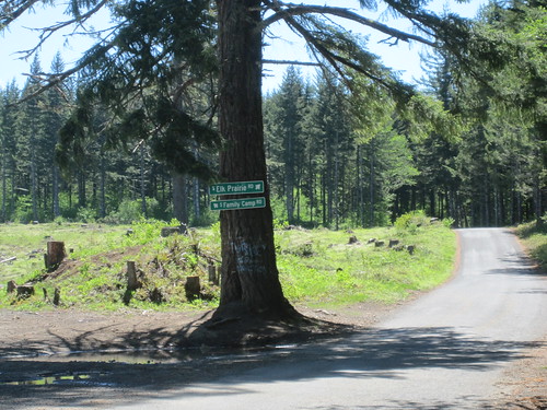
According to signs, this is the southern end of Sawtell Road (at ~2.2k feet; I went right on Elk Prairie Rd and got up to about 2350 feet at the summit before I had to walk down ~1000 feet to the end of the western part of Butte Creek Road – Butte Creek Road connects to Elk Prairie Rd, but theres a 2 mile segment that used to be a quiet path down the side of the ravine containing Butte Creek but which is now a freshly gravelled haul road through a Brand! New! clearcut. Steep descents are fine. Steep descents on fist-sized gravel, even after it’s been compacted by countless logging trucks dragging freshly cut timber up to the ridgeline, are not. So I had a pleasant walk in the middle of my bike ride) even though online maps claim (and, really, who would doubt them just because every map provider shows different routes and names on forest roads) that Family Camp Road is actually Sawtell Road and that it continues south for another 20 miles before looping in a tangle of NF{numbered} roads that connect down to Elkhorn (and, after another 6 miles, to the Opal Creek ancient – and very crowded – wilderness.)
One of these days I need to rope someone into riding with me and then head further south on Family Camp Road, but before I do that I need to get back into shape so that the initial 4 miles of 6% grade at the north end of Sawtell Road is not quite as tiring as it was yesterday (Sawtell Road starts out as a secondary road, so it’s graded to a consistantly steep ramp there; as you get further south the importance of the road decreases and it becomes more of a “paint this road on the hillside”; that part dives into and out of little creek valleys so it’s littered with short sections of what felt like 10+% ramps. Which wouldn’t have been as noticeable if I’d not burned my legs out on that first long ramp!)
Bing maps has street view out this far on Sawtell Road, but what it shows is the Family Camp/Elk Prairie junction in the middle of a mature forest. This is Oregon, so you can guess what happened to that mature forest in the year or so since the Bing cameramobile rolled on through.
And, sadly, I will probably have to redo my Sawtell Road permanent to not drop down to Scotts Mills on Butte Creek Road (at least until I get some satellite imagery that postdates the clearcut along the gravelled part of Butte Creek Road) because even after looking at all of the maps I’ve got I’m still not exactly sure what the arrangement of roads is between 1800asl and 1200asl on that descent. There’s a triple junction in there somewhere that does not appear on the maps (and the lower junction of the two roads does not show up on Bing street view, which is a bit troubling), and I think that’s where Gibboney Road (not sure if an actual name! There’s a Gibboney Lumber Company that operates in that area, and it may just the a convenience name for their haul road) splits off from the not-on-the-maps-but-it-still-exists-because-I-walked-it section of Butte Creek Road. I’m happy to blow my brevet average with a long hike down a steep ramp, but I’m not sure if I can apply enough DANGER, THIS IS REALLY DANGEROUS IF YOU DO SOMETHING STUPID LIKE TRY TO MAKE UP TIME HERE notes to my cuesheet to stop someone from trying to make up that time if it’s the end of a month and they’re trying to keep their 200k run going. Oh well, returning to Maple Grove Road and crossing to Scotts Mills isn’t too much longer, and then people can have the option of sneaking offroute for rural scenic beauty if they ignore the YOU WILL DIE! cue I’ll put in to convince them not to.
Comments
Yup. The bing cameramobile has amazingly good coverage of the forest roads out in that neck of the woods (at least as of about a year and a half ago; I fully expect that many of the more scenic parts of the forest roads have been replaced with clearcuts) I’m going to try to see if I can make it down to Elkhorn first (mainly streetviewed with Google + Bing; there’s a six mile gap from the detour before the Evans Mountain Road landslide to the tangle of forest roads that Sawtell/Family Camp becomes, but aerial photos show – thanks to recent clearcuts – that they actually connect through) if I can find some sucker to ride along with me.
I sketched a route along the Molalla River Road south to Elkhorn, and at the south end of the MRR there’s a long steep ramp that – at least on ridewithgps – climbs 2000 feet in about five miles. That’s a bit past my physical fitness right now, and I’m not going to even think about it until I can crank out one of my 300ks without feeling like I’m going to die 250k into the loop (the first 200k I did this year – Pipeline Road – burned me completely out by the time I reached Ripplebrook, so it was very fortunate that it was generally all downhill to home from there. I was burning pretty low on last weekend’s run, but that was mainly from having pollen rammed into my sinuses from Scotts Mills all the way back north.)
But, man, it’s pretty down there. I made a variant of the Sawtell 200k that doesn’t cross over to Scotts Mills on Butte Creek Road, and if that’s approved it gives me an excuse to make two more runs up Sawtell Road before continuing on with my runthrough of all of my Portland loops.
Looks like you could get down to the Mollala River by way of Family Camp road and Horse Creek road, which could be fun. In the general area there, I’m dying to go up Table Rock road and over the pass to the Collawash River, looping back home via the Clackamas some time this summer.